Last updated 6Nov24

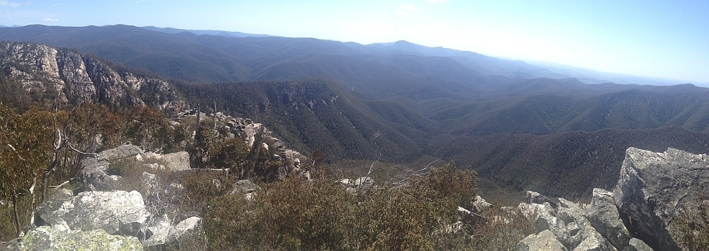
28 Jun 15 | The top of Binnari Pass to Quiltys Mountain, the Budawangs, Morton NP
Text Layer

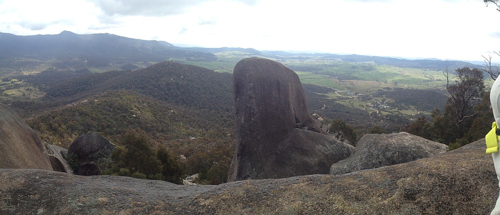
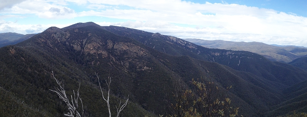
30Jun 15 | Views from north of Currockbilly Mountain over the source of the Yadboro River to Wirritin Basin and beyond to Pigeon House and the ocean, Budawang NP

22 Apr 15 | Morning light on Frenchmans Cap and Lions Head, Tasmania

3 Mar 15 | Eucalyptus 'grass', Nadgigomar NR
7 Feb 15 | Sunrise over Lake Burley Griffin at 6.30am, Canberra
30 Sep 14 | Views down the south arm of Burkes Creek from The Pimple,NNP
13 Sep 14 | Tidbinbilla Ridge, Mt Eliza and the main tor from Gibraltar Peak,TNR
2 Sep 14 | View south to Johns Peak, Tidbinbilla Peak, Tidbinbilla Mountain and The Pimple, TNR and NNP
28 Jun 14 | Gooandra Homestead, KNP
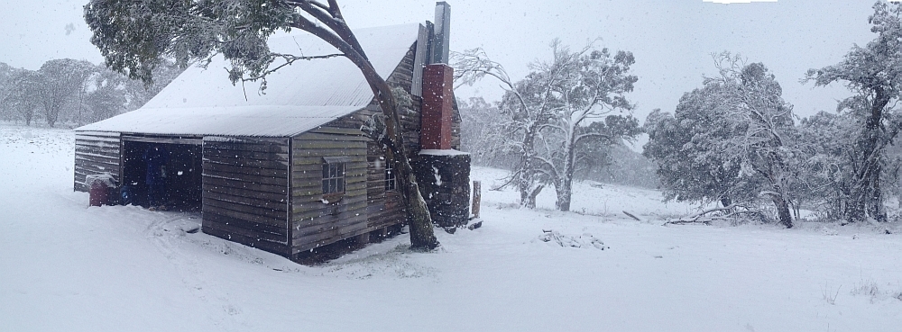
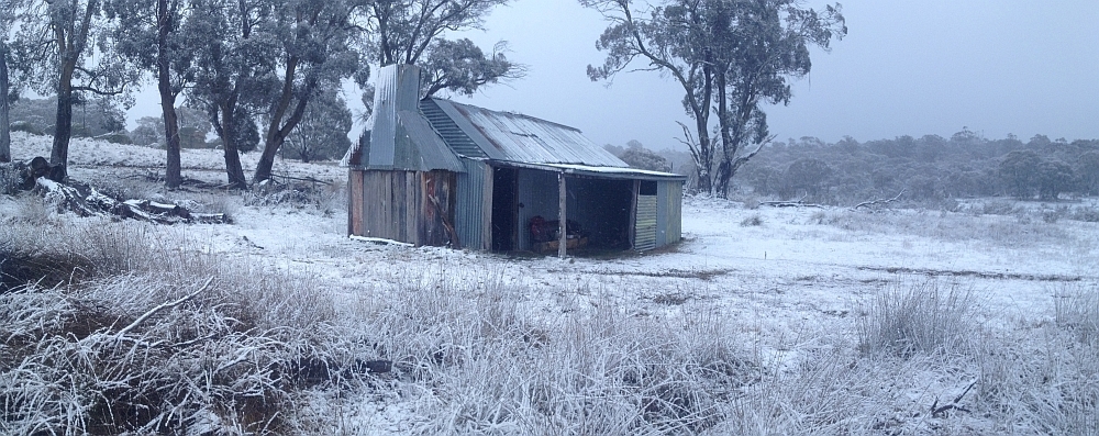
12 Jul 14 | Waterhole Hut, NNP
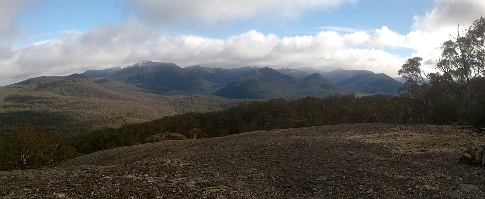
6 Jul 14 | Mt Gudgenby and the high hills of the Namadgi from Boboyan tor lookout, NNP
7 Jun 14 | Blue Gum Hill and the South Buttress of Booroomba Rocks from SH1353, NNP
24 May 14 | Orroral Valley from GC1XAJQ Ridge of Stone geocache, NNP
29 Mar 14 | Googong Dam from Googong Lookout, GF
15 Mar 14 | Mt Namadgi, Rotten Swamp, Mt Burbidge, Bogong Gap, Gudgenby Grasslands and Yankee Hats from Mt Kelly, NNP
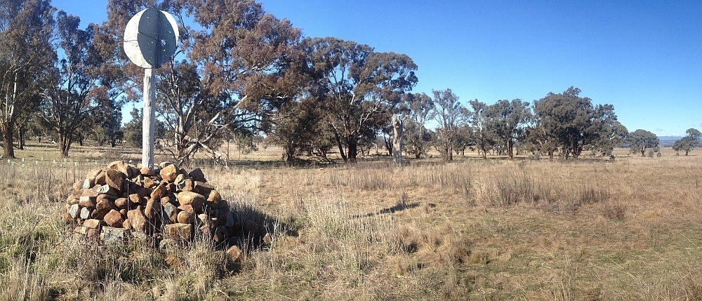
10 Aug 13 | Plains trig, Pri
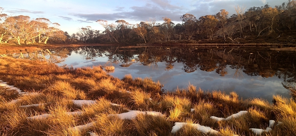
13 Jul 13 | Scabby Tarn at sunset, NNP
25 Jun 13 | Colliers homestead and orchard, Pri
8 June 13 | Webbs Ridge from Mt Coree, BNP
4 Jun 13 | Mt Moollattoo from the Carrialoo plateau, MNP
9 Sep 12 | Mt Gudgenby from granite slabs E of Sentry Box Mountain, NNP
View south from Mt Namadgi
10 Nov 12 | View south from Mt Namadgi, NNP
30 Jun 12 | Snow Gums at Mt Gingera, NNP
31 Jan 12 | Molonglo Ridge from Yarrow Pic, Pri
28 Jun 16 | Lunch on Mt Reedy (photo Barrie R), KF

News:
| 3.5K POI in the ACT available for you to download in gpx format, grouped in the 18 1:25000 topo map areas covering the ACT | Do you use this blog? It costs ~$1K pa to maintain. Happy to receive your small donation to PayID 0417436877 😊 | Do you have gas? | The blog’s SIX Maps page has been updated | Want to try some practical map and compass navigation? | Some thoughts on Trip Planning, Recording and Review using Digital Resources | Check out all the ACT border marker details of surveyors Johnston, Mouat and Sheaffe | Want no-cost OpenStreetMaps on your GPSr? | Looking for a walk in a particular area? Try my Google Maps/Google Earth search, with destinations linked to trip reports, for all trips, or walks in 2022, 2019 and 2018-2014 | Since this blog went to WordPress, it’s had 478,500 views from 217,500 visits | Watch a slideshow of the theme photos from each trip | Try a Google Map/Earth Search |

Coming to you from Ngunnawal Country

You are very welcome to come walking with the Canberra Bushwalking Club. Find a walk that interests you and suits your current capability here.

“A good leader inspires people to have confidence in the leader, a great leader inspires people to have confidence in themselves.” Elanor Rosevelt


Sunday 10 November 2024: Bloody Long Walk Canberra – mito fund raiser 35km. See deets here.

Sunday morning 17 November 2024: Practical Map and Compass Navigation group 9 *. A refresher/introduction to map and compass navigation in a practical setting. Walk several bounds in the open woodland of Callum Brae Nature Reserve, after you’ve worked out required directions and distances. You should come away with renewed navigation skills, or at least an understanding of what it all means if you use a digital navigation device. Prerequisites – know basic map reading (grid references, contours, etc.) and parts of a flatbed compass (direction of travel arrow, orienting lines and arrow, etc.). Brush up by reading Geoscience Australia’s Map Reading Guide here. This activity is designed for new/emerging walk leaders and any member or guest who’d like to try it. Around 7km and 4-5 hours. Activity repeated on subsequent dates for as long as new participants book.
Book on the walk.

Saturday morning 23 November 2024: Basic navigation for Holly and friends, 7am. 5 starters !.

Thursday evening 2 January 2024: William Farrer’s Grave, De Salis Cemetery and picnic tea * – S/E. Visit these two historic sites near the southern suburbs of Canberra – William Farrer’s and Nina’s grave, and the De Salis cemetery. Bring a picnic tea to share on the tables underneath the Tharwa bridge. Around 5km and 50vm. Sunset at 8.22pm. Book on the walk.

Thursday 9 January 2025: Bush Tucker with Aaron Chatfield from Dreamtime Connections ! . A private trip for my extended family.

2024 completed walks – expand accordions below for 2023/21/20/2019/18/17/16 and follow links for older trips

A new way of recording hikes. Time taken by an old codger, plus distance and climb, can be seen in the hike’s map segment in Photos, as part of the start waypoint description.

Map Walk # Date Hike gpx file Distance Climb Grading Photos
1606 3 Nov 24 CBNR: Practical Map and Compass Navigation for Robyn S and friends ! THE LATEST Download here 6.38 145 S/M; E(5)  
1605 27 Oct 24 NNP: Pheasant and Boboyan Hills and beyond Download here 20.18 650 L/M; M(11) Photos
1604 23 Oct 24 RRNR: E-M Wednesday Walk Rob Roy Falls * Download here 12.00 610 M/M; M(10) Photos
1603 19 Oct 24 NNP: Tidbinbilla Mountain via Snowy Corner and the Pimple * Download here 12.12 1030 L/R; H(12) Photos
1602 15 Oct 24 MTNR: Daylight Savings Get Fit – Mt Taylor Download here 4.76 230 S/E; E(4)  
1601 13 Oct 24 NNP: CBC Super Week of Walks #9 – Temple of Doom * Download here 9.51 505 M/R,X; M(11) Photos
1600 10 Oct 24 NNP: CBC Super Week of Walks #5 – Rendezvous Creek and Gudgenby Grasslands * Download here 15.20 385 M/E-M; M(9) Photos
1599 9 Oct 24 KNP: SE of Charlotte Pass Download here 9.23 390 M/M; M(8) Photos
1598 7 Oct 24 NNP: Nursery Swamp and beyond Download here 14.74 405 M/e-M; M(9) Photos
1597 6 Oct 24 NNP: NNP 40th anniversary walk for the public – Granite Tors Walking Track * Download here 9.59 420 M/E-M; E(7) Photos
1596 5 Oct 24 NNP: NNP 40th anniversary walk for the public – Cypress Pine Lookout * Download here 5.50 185 S/E; E(4) Photos
1595 1 Oct 24 TNR: Gibraltar Peak and Mushroom Rock Download here 15.23 665 L/E; M(8) Photos
1594 29 Sep 24 TNR: Snowy Corner and the Shale Knoll ! Download here 7.58 620 M/E-M; M(10) Photos
1593 28 Sep 24 NNP: NNP 40th anniversary walk for the public – Rendezvous Creek and Gudgenby Grasslands * Download here 8.04 120 S/E-M; E(6) Photos
1592 22 Sep 24 NNP: A Weir-d Day in the Brindabellas * Download here 19.22 610 L/E,H; M(11) Photos
1591 21 Sep 24 NNP: Cypress Pine Lookout recce ! Download here 6.05 195 S/E-M; E(7) Photos
1590 15 Sep 24 TNR: Mt Eliza, Gibraltar Peak, Mushroom Rock Download here 12.94 665 M/R; M(11) Photos
1589 14 Sep 24 UHNR: Urambi Hill with SACTCG and Kambah Turns 50 Download here 2.53 115 S/E; E(4) Photos
1588 14 Sep 24 CBNR: Practical Map and Compass Navigation 8 *   6.29 100 S/E-M; E(6)  
1587 11 Sep 24 MRC: Barrer Hill and the arboretum Download here 15.24 320 M/E Photos
1586 9 Sep 24 MTNR: The Source of Village Creek with Tim the Yowie Man ! Download here 3.44 155 S/E-M; E(6) Photos
1585 7 Sep 24 BRNR: ‘Calvary’ and William Farrer’s Grave * Download here 12.86 340 M/M; M(9) Photos
1584 4 Sep 24 ACTF: Dowling trig and Sherwood Daffy-dils * Download here 9.45 305 M/E; E(7) Photos
1583 1 Sep 24 The Real Source of Village Creek ! Download here 3.44 115 S/R,X; E(7) Photos
1582 31 Aug 24 CNP: Southside Saunter – taking in Farrer Hill and Mt Wanniassa Download here 8.04 270 S/E; E(5) Photos
1581 27 Aug 24 ACTF: NE Border of the ACT – Sutton Rd to Kings H’way * Download here 23.05 660 L/E-M; H(12) Photos
1580 26 Aug 24 MTNR: Upper Village Creek ! Download here 2.28 50 S/E,X; E(4) Photos
1579 25 Aug 24 NNP: Mt Tennent Download here 16.12 875 L/E; M(10) Photos
1578 24 Aug 24 GGNR/MGNR: Gungaderra Grasslands and Mulangarri Grasslands NRs including Gubur Dhaura Download here 12.58 185 M/E-M; M(8) Photos
1577 21 Aug 24 CCT: E-M Wednesday Walk Forde to Hall on the CCT Download here 18.80 420 L/E; M(8) Photos
1576 17 Aug 24 MTNR: Mt Taylor Western Views * Download here 6.31 270 S/E-M; E(7) Photos
1575 12 Aug 24 KNP: The Paralyser snowshoe Download here 10.66 530 M/R; M(11) Photos
1574 10 Aug 24 RRNR: Rob Roy NR, Mountain and Falls * Download here 12.26 700 M/M-R,ptX; M(11) Photos
1573 8 Aug 24 MTNR: Mt Taylor Western Lookouts ! Download here 5.87 250 S/E-M; E(6) Photos
1572 5 Aug 24 NNP: Bogong Creek Falls * Download here 17.85 405 L/R,ptX; H(12) Photos
1571 3 Aug 24 RRNR: Rob Roy Creek and Falls ! Download here 6.54 310 S/R,ptX; M(10) Photos
1570 31 Jul 24 NNP: E-M Wednesday Walk – Rendezvous Creek and Gudgenby Ramble * Download here 16.11 315 M/E-M; M(9) Photos
1569 30 Jul 24 MFNR: Geocaching with Marmaduke Rothschild   11.17 140   Photos
1568 29 Jul 24 NNP: Mt Gingera Ridge Snowshoe * Download here 20.55 1120 L/M; H(12) Photos
1567 28 Jul 24 MFNR: Mulligans Flat (R)amble * Download here 16.26 375 M/E-M; M(9) Photos
1566 23 Jul 24 NNR: Nadgigomar Nature Reserve – Durran Durra Section Download here 15.25 430 M/R; M(11) Photos
1565 20 Jul 24 NNP: Orroral Valley Circuit Night Walk * Download here 18.69 400 L/E; M(8) Photos
1564 14 Jul 24 MFNR: Aboriginal Culture at Mulligans Flat   2.71 50 S/E; E(3) Photos
1563 13 Jul 24 CNP: Canberra Centenary Trail (CCT) Stage 1 and a bit * Download here 25.73 770 L/E; M(11) Photos
1562 11 Jul 24 NNP: Rendezvous Creek and Gudgenby Explore * Download here 16.79 305 M/E-M; M(10) Photos
1561 6 Jul 24 NNP: Orroral Valley Explore and Granite Tors Walking Track * Download here 20.48 580 L/E-M; M(11) Photos
1560 2 Jul 24 TPNR/KNR/MoRC: The Pinnacle and Kama NRs Download here 10.90 250 M/E; E(6) Photos
1559 29 Jun 24 GoNR: A walk in the (Goorooyarroo) park Download here 10.73 340 M/E-M; E(7) Photos
    CBC and JBWB get a plug from Ginninderry and Her Canberra          
1558 27 Jun 24 NNP: Gudgenby Saddle recce * Download here 16.59 480 L/E,R; M(11) Photos
1557 23 Jun 24 NNP: Cotter Gap ! Download here 18.36 630 L/E; M(9) Photos
1556 22 Jun 24 MGNR: Molonglo Gorge Nature Reserve Download here 10.06 460 M/E-M; E(7) Photos
1555 16 Jun 24 TNR: Gibraltar Peak Download here 11.43 430 M/E; E(7) Photos
  12 Jun 24 Pri: First Aid Training          
1554 11 Jun 24 TNR: Birrigai Rock Shelter and environs Download here 3.46 75 S/E; VE(3) Photos
1553 9 Jun 24 GCC: Ginninderry Walking Tracks Download here 14.65 335 M/E; E(7) Photos
1552 28 May 24 GCC: Geocaching and Shepherds Lookout Download here 9.62 250 S/E-M; E(7) Photos


Walk # Date Walk Distance Climb Grading Photos
Follow/Like Johnny Boy’s Walkabout Blog FaceBook Page
1551 25 May 24 NNP: Middle Creek Explore * 20.63 410 L/E-R,ptX,W; H(12) Photos
1550 21 May 24 GCC: Opening of Ginninderry Tracks * 7.28 185 S/E,X; E(5) Photos
1549 19 May 24 NNP: Mt Tennent * 14.91 804 L/E-M,ptX; M(10) Photos
1548 16 May 24 MTNR: Mt Taylor Indigenous Walk 3.86 170 S/E; E(4) Photos
1547 12 May 24 CNP/Urban: Urban Worn Boot Bash * 33.81 1035 L/E-M; H(13) Photos
1546 6-7 May 24 KNP: Gentlemen’s Main Range Trip 22.00 915 M/E-M: M(9) Photos
1545 4 May 24 TiNR: Tinderries by fire trail 11.87 665 M/E-M; M(10) Photos
1544 30 Apr 24 RRNR: Rob Roy NR Geocaching 7.52 425 S/M-R; M(9) Photos
1543 29 Apr 24 NNP: Mt Tennent * 14.25 770 L/E; M(9) Photos
1542 27 Apr 24 MNP: Corang Peak 21.49 535 L/E-M; H(12) Photos
1541 25 Apr 24 CNP: Kambah 4 Hills 22.08 640 L/E; M(11) Photos
1540 22 Apr 24 TNR: Tidbinbilla Skyline Southern Section * 12.38 900 L/M-R; H(12) Photos
1539 20 Apr 24 BRNR: South Bullen Range and ‘Calvary’ * 16.26 400 M/E-M; M(10) Photos
1538 15 Apr 24 TNR: Tidbinbilla Skyline Northern Section – Camels Hump, Pierce Hill, Johns Peak, Tidbinbilla Peak * 18.38 1015 L/E-M; H(13) Photos
1537 13 Apr 24 GF: London Bridge to Washpen Crossing 9.60 235 S/E-M; E(7) Photos
1536 8 Apr 24 TBR: Tidbinbilla Mountain * 9.53 745 M/R; M(11) Photos
1535 7 Apr 24 CBNR: Practical Map and Compass Navigation 7 * 6.92 110 S/E; E(7)  
1534 3 Apr 24 TNR/NNP: Awesome Views from both sides of Corin Rd – Mushroom Rock, Gibraltar Peak, SH985 ! 14.64 710 M/E-M,ptXptW; M(11) Photos
1533 30 Mar 24 KF: Kowen Forest Arboreta * 16.09 420 M/E-M,ptX; M(9) Photos
1532 28 Mar 24 NNP: Granite Tors Walking Track Upgrade * 9.47 415 M/E-M; M(8) Photos
1531 25 Mar 24 KNP: Main Range Track ! 23.77 765 L/E; H(12) Photos
1530 24 Mar 24 CBNR: Practical Map and Compass Navigation 6 * 6.2 100 S/E; E(7)  
1529 23 Mar 24 GiNR: Gigerline NR from the South * 9.19 365 M/E-M; M(8) Photos
1528 17 Mar 24 CBNR: Practical Map and Compass Navigation 5 * 6.1 100 S/E; E(7)  
1527 12 Mar 24 BRNR: Bullen Range Geocaching 10.19 410 M/R; M(9) Photos
1526 9 Mar 24 NNP: Under Square Rock and Smokers Trail 15.74 405 M/E-M; M(10) Photos
1525 3 Mar 24 CBNR: Practical Map and Compass Navigation 4 * 6.1 100 S/E; E(7)  
1524 28 Feb 24 TNR: Red Hill at TNR and Cascade Trail * 6.54 310 S/R; M(9) Photos
1523 25 Feb 24 CBNR: Practical Map and Compass Navigation 3 * 6.5 100 S/E; E(7)  
1522 24 Feb 24 FRNR: Footcare and Snake Bite Compression Bandaging Practice 3.74 120 S/E; E(5) Photos
1521 22 Feb 24 CBNR: Callum Brae evening walk gpx file here 4.85 100 S/E; E(4)  
1520 18 Feb 24 NNP: Dick and Lena’s Rendezvous Creek Ramble 14.08 225 M/M; M(8) Photos
1519 15 Feb 24 UHNR: Urambi Hills gpx file here 4.06 180 S/E; E(5)  
1518 11 Feb 24 THNR: Tuggeranong Hill Base Loop gpx file here 6.45 165 S/E; E(5) Photos
1517 11 Feb 24 CBNR: Practical Map and Compass Navigation 2 * 6.43 100 S/E-M; E(7)  
1516 10 Feb 24 NNP: Booroomba Rocks South Buttress and ‘Granite Dome’ 14.64 570 M/R; M(11) Photos
1515 9 Feb 24 Pri/Pub: William Farrer’s Grave and De Salis Cemetery * gpx file here 4.98 50 S/M; E(4) Photos
1514 8 Feb 24 WHNR: Wanniassa Hills Nature Reserve gpx file here 7.47 230 S/E; E(6) Photos
1513 28 Jan 24 CBNR: Practical Map and Compass Navigation 1 * 6.88 110 S/E-M; E(7)  
1512 25 Jan 24 MTNR” Mt Taylor Base Tramp gpx file here 6.24 130 S/E; E(5)  
1511 20 Jan 24 TNR: Billy Billy Rocks 6.15 365 S/R; M(10) Photos
1510 13 Jan 24 NNP: Orroral Ridge of Stone * 14.75 500 M/E-M; M(10) Photos
1509 6 Jan 24 CBNR: Callum Brae Map and Compass Navigation * 6.65 180 S/M,ptX; E(7) Photos


2023 (activate here to view the list of 2023 walks, or to toggle list off)

Walk # Date Walk Distance Climb Grading Photos
1508 31 Dec 23 GoNR: Eastern Hills of Goorooyarroo * 11.04 400 M/E-M; M(9) Photos
1507 30 Dec 23 Pri: Snake Awareness       Photos
1506 21 Dec 23 MRC: Barrer Hill and Misery Point gpx file here 7.98 145 S/E; E(5) Photos
1505 18 Dec 23 CNP: Craig’s recce gpx file here 5.54 102 S/E; E(5)  
1504 16 Dec 23 NNP: Tennent ridge and N Bushfold Flats sites * 19.12 850 L/E-M; M(11) Photos
1503 14 Dec 23 MRC: Point Hut Crossing to Pine Island gpx file here 7.24 125 S/E-M; E(7) Photos
1502 10 Dec 23 BRNR: Bullen Range Spurs 6.32 415 S/M; M(8) Photos
1501 3 Dec 23 IRNR: Isaacs Ridge and Eastern Flank * gpx file here 9.63 270 S/E-M; E(6) Photos
1500 2 Dec 23 NNP: Granite Tors NPA/* 12.52 540 M/E; M(8) Photos
1499 30 Nov 23 MTNR: Mt Taylor gpx file here 5.65 345 S/E; E(6) Photos
1498 23 Nov 23 ACTF: Narrabundah Hill gpx file here 5.31 90 S/E; VE(3)  
1497 18-19 Nov 23 KNP: Seamans Hut 23.08 580 M/M; M(8) Photos
1496 16 Nov 23 KNP: Kiandra to Selwyn 13.84 315 M/E; M(8) Photos
1495 14 Nov 23 TNR: Red Hill Track at TNR ! 4.29 205 S/R,X; M(8) Photos
1494 13 Nov 23 FP: Fairbairn Pine Forest stroll 5.16 125 S/E; E(4) Photos
1493 11 Nov 23 NNP: White Horse Rocks and beyond 10.96 440 M/M-R; M(9) Photos
1492 7 Nov 23 TNR: TNR at 75 ! 15.55 645 M/E; M(8) Photos
1491 4 Nov 23 TNR: Red Hill Track at TNR – eastern leg * 7.33 300 S/R,X; M(10) Photos
1490 2 Nov 23 ABNR: Frost Hollow to Forest Walk 5.24 120 S/E; E(5) Photos
1489 29 Oct 23 NNP: Searching for ‘old’ Fishlock Yards NPA/* 20.80 430 L/E-M; M(10) Photos
1488 26 Oct 23 RRNR: Moonlit Monks * 5.04 300 S/E-M; E(7) Photos
1487 24 Oct 23 Home: Bushwalking NSW introduces Leadership Training Course via Zoom        
1486 15 Oct 23 Pri: Mt Ramsay Trig 8.34 350 M/M; M(8) Photos
1485 14 Oct 23 NNP: Nursery Creek through walk * 11.94 380 M/E,R,ptX; M(11) Photos
1484 11 Oct 23 NNP: E-M Wednesday Walk – Nursery Creek – NS3 and NS1 * 15.45 450 M/E-M; M(9) Photos
1483 9 Oct 23 NNP: Geodetic Dome off-track 5.58 405 S/R; M(9) Photos
1482 7 Oct 23 NNP: Settlers Track and beyond 16.78 360 M/E-M; M(10) Photos
1481 5 Oct 23 BMNR: Black Mountain scorpions 1.58 flat S/E; E(4) Photos
1480 2 Oct 23 MRC: Red Rocks Gorge and ‘The Chasm’ 8.03 150 S/M-R; M(8) Photos
1479 30 Sep 23 TNR: New/Emerging Leaders Training Walk to Tidbinbilla Peak * 13.20 760 M/E-M; M(10) Photos
1478 29 Sep 23 MMNR: Moonlit wander on Mt Majura 9.59 340 M/E; E(6+) Photos
1477 27 Sep 23 CNP: Enchanted Hill 12.40 440 M/M; M(9) Photos
1476 23 Sep 23 NNP: Cotter Hut loop * 36.54 1150 L/E; H(12) Photos
1475 16-17 Sep 23 NNP: CBC Navigation Refresher #4 36.98 790 M/R and L/E-M; M(11) Photos
1474 13 Sep 23 NNP: Nursery Swamp Axe Quarry search ! 13.69 390 M/E-M,ptX; M(9) Photos
1473 9 Sep 23 NNP: A Search for NS1 * 15.09 430 M/E-M,ptX; M(9) Photos
1472 6 Sep 23 Pri: A cameo trig bag with Canberra’s Trig Queen, Lauren O. Download her latest list here. 2.45 75 Doddle Photos
1471 5 Sep 23 MGNR: Molonglo Gorge Nature Reserve 9.86 460 M/E-M; E(7) Photos
1470 3 Sep 23 CuNR: Cuumbeun Nature Reserve 16.29 420 M/E; M(8) Photos
1469 31 Aug 23 UHNR: Supermoon and blue moon from Urambi Hills. 8 walkers took in the view of the rising supermoon * 1.83 125 S/E; E(4) Photos
1468 31 Aug 23 ACTF: Dowling trig and Sherwood Daffodils 9.91 325 M/E; E(7) Photos
1467 26 Aug 23 NNP: Nursery Creek Rock Art and Orroral Valley sites * 12.96 460 M/M-R,ptX: M(10) Photos
1464 21 Aug 23 KNP: Snowshoe from Guthega to SMA0318 9.68 510 M/M; M(9) Photos
1463 19 Aug 23 NNP: Orroral Valley Circuit * 19.36 360 L/E-M; M(9) Photos
1462 13 Aug 23 NNP: Booroomba Rocks 4.92 264 S/M; E(7) Photos
1461 12 Aug 23 NNP: Sites around Yankee Hat car park * 15.72 430 M/E-M; M(8) Photos
1460 9 Aug 23 BRNR: E-M Wednesday Walk Kambah Pool to Tuggeranong Stone Wall and return
gpx file is here
14.71 220 M/E; E(6) Photos
1459 6 Aug 23 TNR: Valley-level Trails at Tidbinbilla Nature Reserve *
gpx file is here
7.18 260 S/E; E(5) Photos
1458 30 Jul 23 CRNR: Cooleman Ridge 9.35 250 S/E; E(5) Photos
1457 22 Jul 23 GF: Bradleys Creek Walk 14.63 550 M/E; M(8) Photos
1456 6 Jul 23 NNP/TNR: SE Rim of TNR from Corin Rd * 8.76 430 M/R,X; M(10+) Photos
1455 1 Jul 23 NNP: Mt Gingera Ridge Snowshoe ! 20.92 1200 L/M-H; H(14) Photos
1454 29 Jun 23 Public: Around Lake Tuggeranong at 6am. Fabulous first time walk leader Sandra. Foggy views       Photos
1453 28 Jun 23 NNP: E-M Wednesday Walk Orroral Valley * 11.28 200 M/M,ptW; M(8) Photos
1452 25 Jun 23 NNP: Horse Gully Hut via Naas Creek 20.20 600 L/R,ptW; H(12) Photos
1451 24 Jun 23 TNR: Tidbinbilla Nature Reserve Trails recce ! 8.59 260 S/E-M,ptX;E(7) Photos
1450 17 Jun 23 NNP: Orroral Valley recce ! 21.74 400 L/M,W; M(11) Photos
1449 15 Jun 23 CNP: Black Mountain by torch light * Ten of us enjoyed tea or Australian sparkling white (aka champers)/soda water (consumption limited by plastic shot glasses LOL). We washed down scones, jam and cream, mini muffins and Tim Tams by candlelight. Great fun! 5.21 220 S/E; E(4) Photos
1448 1,2 12 Jun 23 NNP: Granite Tors and Nursery Swamp Walking Tracks * 18.22 780 L/E,R; H(12) Photos
1447 10 Jun 23 NNP: Split Rock 21.50 900 L/E,R; H(14-) Photos
1446 3 Jun 23 TNR: Eastern Rim of TNR * 14.40 690 M/M-R; M(11) Photos
1445 1 Jun 23 CNP: Mt Taylor * Eleven of us walked on a balmy first night of winter 5.35 270 S/E; E(4)  
1444 29 May 23 NNP: McKeahnie Trig 13.83 460 M/R; M(11) Photos
1443 28 May 23 TNR: Bogong Cave 6.02 300 S/M-R; M(9) Photos
1442 27 May 23 TRNP: Tarlo River National Park 7.01 170 S/M-R; M(8) Photos
1441 24 May 23 TNR: Eastern Rim of TNR recce ! 14.45 695 L/M-R; M(11) Photos
1440 20 May 23 TNR: Tidbinbilla Mountain and beyond * 10.01 810 M/M; M(10) Photos
1439 13 May 23 JW: Jerrabomberra Wetlands and the bird refuge area * 12.51 45 S/E; E(6) Photos
1429 9 May 23 TNR/NNP: Geocaches South of Fishing Gap 12.42 615 M/R; M(11) Photos
1428 6-7 May 23 MNP: Budawangs – Flat Top Mountain 14.18 350 M/M; M(9) Photos
1427 3 May 23 NNP: Wednesday Walk – SW of Booroomba 7.63 335 S/M-R; M(9) Photos
1426 29 Apr 23 BRNR: Bullen Range Spurs * 9.43 660 M/M-R; M(10) Photos
1425 27 Apr 23 DNP: The Big Hole and Marble Arch 12.45 470 M/E; M(8) Photos
1424 26 Apr 23 NNP: part Wednesday Walk – Gorilla Rock. gpx file is here 10.96 309 M/M-R; M(9) Photos
1423 22 Apr 23 NNP/Pri: Blythburn Cottage via Punch Bowl Creek * 16.17 660 L/M; M(11) Photos
1422 15 Apr 23 MNP: Fitzroy Falls to Manandoo Point 13.21 284 M/E-M; M(8) Photos
1421 14 Apr 23 GNR: ArchivesACT-CBC Heritage Festival Walk to Border Marker X4 * 7.49 278 S/E-M: E(6) Photos
1420 12 Apr 23 ABC Radio interview: The historically significant books that mapped the ACT border. Listen here.        
1419 11 Apr 23 NNP: Geocaches above Corin Road with Marmaduke Rothschild 7.08 585 M/R,W; M(10) Photos
1418 10 Apr 23 GNR: Eastern Hills of Goorooyarroo NR * 8.85 443 M/M-R; M(8) Photos
1417 1 Apr 23 TNR: Shale Knolls South of Snowy Corner Cairns 7.28 712 M/M-R; M(10) Photos
1416 29 Mar 23 BRNR: Wednesday Walk – Bullen Range. gpx file is here 9.28 548 M/M; M(9) Photos
1415 27 Mar 23 THNR: Navigation Basics on Tuggeranong Hill !        
1414 24-26 Mar 23 KNP: Mt Morgan 22.27 959 S/R; M(9) Photos
1413 23 Mar 23 ABC Radio interview: Johny Boy’s Walkabout Blog. Listen here.        
1412 18 Mar 23 ACTF: Mt Blundell Adit * 14.07 803 L/E-M; M(11) Photos
1411 15 Mar 23 MFNR/GNR: Mulligans Flat and Goorooyarroo NRs 15.41 509 M/E-M; M(10) Photos
1410 14 Mar 23 RRNR: Big Monks and the Stone Throne at ‘Little Monks’ * 4.81 304 S/M; E(7) Photos
1409 11 Mar 23 CNP: Dunlop and Jarramlee Grasslands NRs * #38, #39 15.63 217 M/E-M; M(8) Photos
1408 7 Mar 23 CNP: Mt Taylor gpx file is here 5.68 258 S/E-M; E(6) Photos
1407 4 Mar 23 KNP: Snowies Alpine Walk – Charlotte Pass to Guthega 9.90 250 M/E; E(5+) Photos
1406 18 Feb 23 CCT: CCT 6 – Duffy to Tuggeranong * 20.39 653 L/E-M; M(10) Photos
1405 14 Feb 23 CNP/Arb: Frost Hollow, Cork Oaks, Arboretum 8.39 185 S/E; E(5) Photos
1404 1,2 11 Feb 23 TNR: Camels Hump, Johns Peak, Tidbinbilla Peak * 15.16 957 L/M; H(12) Photos
1403 7 Feb 23 CNP: Arawang Trig 6.25 161 S/E; E(5) Photos
1402 5 Feb 23 TNR/NNP: Beat’s ‘Cave’ – Cave on NW side of Mt Domain * 15.42 972 L/R,ptX; H(12) Photos
1401 29 Jan 23 TNR: Tidbinbilla Warning Siren       Photos
1400 29 Jan 23 TNR: Rediscovering Red Hill Trail 3.94 196 S/R,X; M(8) Photos
1399 24 Jan 23 CNP: YA90 trig on Isaacs Ridge 3.70 136 S/E; E(4) Photos
1398 21 Jan 23 NNP: Geocaching on Little Ginini Mountain and Mt Gingera * 21.90 1416 L/R; H(14) Photos
1397 17 Jan 23 CNP: Mt Painter and The Pinnacle * #36, #37 8.73 332 S/E; E(6) Photos
1396 13-14 Jan 23 CNP/CCT: Night Walk – Horse Park Drive to Hall (urban fringe Worn Boot Bash) * 31.54 806 L/E-M; H(12) Photos
1395 10 Jan 23 UHNR: Urambi Hills 6.65 208 S/E; E(5) Photos
1394 8 Jan 23 RRNR: Mt Rob Roy and Lanyon Falls * 12.06 777 M/M; M(11) Photos
1393 1 Jan 23 THNR: RU⇧4it T is for Tuggeranong Hill/T is for TG84 trig * 4.83 289 S/E-M; E(5) Photos

2022 (activate here to view the list of 2022 walks, or to toggle list off)


1392 21 Dec 22 CNP: Dunlop Grasslands and Jarramlee-West MacGregor Grasslands NRs ! 17.90 346 L/E-M,ptX; M(10) Photos
1391 20 Dec 22 CNP: Farrer Ridge and Wanniassa Hills NRs * #34, #35 7.71 313 S/E; E(7) Photos
1390 17 Dec 22 TNR: Tidbinbilla Range Skyline, Southern Section – Fishing Gap to Snowy Corner * 12.22 974 L/M-R; H(12) Photos
1389 13 Dec 22 MoRC: Molonglo River to Barrer Hill 7.98 223 S/E; E(5) Photos
1388 10 Dec 22 TNR: Mt Domain * 13.68 817 L/E-M; M(11) Photos
1387 5 Dec 22 GoNR: Hills and Dales of Goorooyarroo Nature Reserve ! 12.73 467 M/E-M,ptX; M(9) Photos
1386 3 Dec 22 NNP: Snowy Flat Creek cascades 15.30 1007 L/E-M; M(11) Photos
1385 30 Nov 22 TNR: Mt Domain and a bit beyond ! 13.92 836 L/E-M; M(11) Photos
1384 29 Nov 22 CNP: Wanniassa Hills Nature Reserve 8.74 259 S/E; E(5) Photos
1383 28 Nov 22 RRNR: Mt Rob Roy and geocaching ! 10.35 621 M/E-M,ptX; M(9) Photos
1382 26 Nov 22 Pri/BHR: Snake Awareness and Eastern Point of the ACT ! 3.7 50 S/E-M,ptX; E(4) Photos
1381 23 Nov 22 RRNR: Rob Roy Nature Reserve wander ! 12.51 786 M/E-M,ptX; M(11) Photos
1380 22 Nov 22 Ranger guided walk and CCT to Hall for coffee * 12.49 404 M/E-M,ptX; M(8) Photos
1379 19 Nov 22 TNR: The Pimple ! 11.54 1042 L/E-M-H,ptX; H(12) Photos
1378 16 Nov 22 TNR: Tidbinbilla Peak and SE exit ! 11.13 829 L/E-M; M(11) Photos
1377 12 Nov 22 Public,CNP: Canberra Centenary Trail Section 5 – Black Mountain to Stromlo Leisure Centre including Black Mountain and Aranda Bushland NRs #32, #33 * 24.04 545 L/E-M,ptX; M(11) Photos
1376 9 Nov 22 TNR: Mt Domain ! 12.65 745 M/E-M; M(10) Photos
1375 6 Nov 22 THNR: Map and Compass Review * 3.0 155 S/E; E(5) Photo
1375 5 Nov 22 CNP: Black Mountain and Aranda Bushland NRs 11.70 494 M/E; E(7) Photos
1374 2 Nov 22 NNP: Booroomba Bakery and Deadmans Donga ! 17.85 835 L/E-M; H(12) Photos
1373 30 Oct 22 TNR: Gibraltar Peak 13.69 512 M/E; M(8) Photos
1372 29 Oct 22 Public,CNP: Canberra Centenary Trail Section 7 – Tuggeranong to Parliament House * 28.01 568 L/E,ptX; M(11) Photos
1371 27 Oct 22 NNP: Booroomba Rocks – elders’ amble/dodderers’ doodle. Haven’t laughed so much for a while. Great friends. 9.2 250 S/E-M; E(6) Photos
1370 26 Oct 22 TNR: Tidbinbilla Mountain via Snowy Corner ! 7.88 760 M/M; M(10) Photos
1369 23 Oct 22 Public,CNP: Canberra Centenary Trail Section 4 – Hall to Black Mountain * 21.97 430 L/E,ptX,W; M(10) Photos
1368 19 Oct 22 NNP: Wednesday Walk – Little Ginini Mountain and Pryors Hut 17.14 1100 L/E-M; H(12) Photos
1367 16 Oct 22 Rail: Good Shepherd Lutheran Church to Tuggeranong Siding and Melrose Trig ! 6.37 139 S/E; E(5) Photos
1366 15 Oct 22 CNP,public: Canberra Centenary Trail Section 1 – Federation Stone to Horse Park Drive * 25.99 819 L/E,ptX; M(11) Photos
1365 12 Oct 22 CNP: Mt Majura and Mt Ainslie Wednesday Walk 15.83 662 L/E; M(9) Photos
1364 8 Oct 22 CNP: Mulligans Flat and Goorooyarroo NRs * #30, #31 22.58 490 L/E-M,ptX; H(12) Photos
1363 3 Oct 22 Open space: Toddlers Toddle – Scrivener Hill 0.4 12    
1362 2 Oct 22 NNP: Pierces Creek Falls 16.16 900 L/R; H(14) Photos
1361 1 Oct 22 CNP: Mt Ainslie and Mt Pleasant NRs * #28, #29 14.86 601 M/E-M,ptX; M(10) Photos
1360 28 Sep 22 BMNR: Around Black Mountain 9.86 475 M/E; E(7) Photos
1359 25 Sep 22 CNP: Mt Majura and Justice Robert Hope Park NRs * #26, #27 10.78 651 M/M-R,ptX; M(10) Photos
1358 22 Sep 22 LCCR,SCNR: Cotter Dam and McDonald’s Lookout Loop; Grasstree Lookout 14.45 484 M/E; E(7) Photos
1357 21 Sep 22 CNP: What, again? Isaacs Ridge and Mt Mugga Mugga NRs 13.76 499 M/E-M; M(9) Photos
1356 17 Sep 22 CNP: Isaacs Ridge and Mt Mugga Mugga NRs * #24, #25 13.6 584 M/E,ptX; M(9) Photos
1355 14 Sep 22 TNR: Tidbinbilla Peak includes a photo of Tidbinbilla Peak trig from Sep 2002, before it was burnt (thanks to Girts O) 13.34 878 L/E; M(11+) Photos
1354 13 Sep 22 Presentation to Belconnen Probus Club        
1353 11 Sep 22 ACTF: Dowling trig and Sherwood Daffodils 9.32 372 M/E; E(7) Photos
1352 7 Sep 22 GCC: Shepherds Walking Track to Shepherd’s Lookout and Molonglo River 10.90 294 M/E; E(6) Photos
1351 4 Sep 22 CNP: Cooleman Ridge, Mt Taylor and Oakey Hill NRs * #21, #22, #23 17.52 720 L/E,ptX; M(11) Photos
1350 31 Aug 22 NNP: Mt Tennent ! 13.99 835 L/E; M(9) Photos
1349 27 Aug 22 CNP: Tuggeranong Hill and Melrose NRs * #19, #20 17.8 838 L/E-M,ptX; H(12-) Photos
1348 24 Aug 22 CRNR: Mt Arawang and Cooleman Ridge 8.9 306 M/E; E(6) Photos
1347 21 Aug 22 CNP: Rob Roy NR * #18 11.8 862 M/M,ptX; M(11) Photos
1346 – 1, 2, 3 14 Aug 22 CNP: Kowen Escarpment and Molonglo Gorge NRs * #16, #17 13.5 755 M/E-M,ptX; M(11) Photos
1346 6 Aug 22 CNP: McQuoids Hill and Urambi Hills NRs * #14, #15 16.4 567 L/E-M,ptX; M(10) Photos
1345 2 Aug 22 NNP: Spot Height 985 above Corin Road ! 5.5 440 S/E-M,X; M(8) Photos
1344 30 Jul 22 CNP: Budjan Galindji Grasslands, Nadjung Mada and Crace Grasslands NRs * #11, #12, #13 13.1 182 M/E-M,ptX; E(7) Photos
1343 29 Jul 22 RRNR: Big Monks, ‘Little Monks’ and the Black and White Mine – different route ! 2.4 256 S/E,X; E(5) Photos
1342 27 Jul 22 RRNR: Lanyon Falls 8.2 506 M/M; M(9) Photos
1341-1,2 23 Jul 22 CNP: Kinlyside and Percival Hill NRs * #9 and #10 11.5 250 M/M,ptX; E(7) Photos
1340 18 Jul 22 NNP: Under Square Rock 9.3 277 M/M; E(7) Photos
1339 16 Jul 22 CNP: Gungaderra Grasslands and Mulanggari Grasslands NRs, including Gubur Dhauri * #7 and #8 12.4 319 M/E-M,ptX; M(8) Photos
1338 12 Jul 22 NNP: Square Rock and Smokers Trail 13.5 369 M/E; E(7) Photos
1337 10 Jul 22 MMNR: Mt Majura and Dry Stone Wall; 4 short recces 6.6 300 S/E-M; E(7) Photos
Photos
1336 2 Jul 22 CNP: Bruce Ridge, Gossan Hill and O’Connor Ridge NRs #4, #5, #6 13.5 410 M/E,ptX; M(8) Photos
1335 29 Jun 22 RRNR: West Flank of Big Monks – yet more technobabble ! 4.2 216 S/M,ptX; E(6) Photos
1334 28 Jun 22 RRNR: Big Monks, Little Monks and around – more technobabble ! 6.3 356 S/E-M,ptX; E(7) Photos
1333 25 Jun 22 CNP: Callum Brae and Jerrabomberra Grasslands NRs * #2 and #3 10.4 203 M/M,ptX; E(7) Photos
1332 24 Jun 22 CNP: Tuggeranong knolls and PeakFinder ! 3.8 167 S/E; E(5) Photos
1331 19 Jun 22 CNP: Farrer Ridge and Wanniassa Hills 12.0 391 M/E; M(8) Photos
1330 13 Jun 22 CNP: Red Hill NR * #1 13.2 410 M/E; M(8) Photos
1329 12 Jun 22 CNP: The Pinnacle and Mt Painter 9.1 343 M/E,ptX; E(7) Photos
1328 24 Apr 22 BRNR: South Bullen Range and Miowera area * 15.5 425 M/E-M,ptX; M(9) Photos
1327 23 Apr 22 TNR: Camels Hump 12.4 660 M/E-M; M(10) Photos
1326 16 Apr 22 TNR: Johns Peak and Camels Hump * 15.5 840 L/E-M; M(11) Photos
1325 12 Apr 22 NNP: Grumpy old man walk – ‘Opera House Cave’ on the Orroral Ridge of Stone ! 10.0 385 M/E-M; M(8) Photos
1324 10 Apr 22 JW: Jerrabomberra Wetlands and bird refuge area * 11.9 109 M/E-M; M(8) Photos
  9 Apr 22 Launch of the CBC 60th Anniversary Photographic Exhibition       Photos
1323 2 Apr 22 NNP: Booroomba Rocks 4.4 238 S/E-M; M(8) Photos
1322 28 Mar 22 TP,Rail: Old Tuggeranong Road and environs geocaching ! 4.1 102 S/E; E(4) Photos
  All All Trip Destinations and Parking via a Google Map/Google Earth
  2022 2022 Trip Destinations and Parking via a Google Map/Google Earth
1321 26 Mar 22 NNP: Mt Ginini, Little Ginini and Mt Gingera 15.5 703 L/M; M(11) Photos
1320 23 Mar 22 MFNR: Mulligans Flat * 13.7 240 M/E-M; E(7) Photos
1319 22 Mar 22 MtANR: Mt Ainslie Quarries and the Labyrinth ! 9.7 332 M/E; M(8-) Photos
1318 20 Mar 22 NNP: Mt Gingera from Corin Dam ! 20.2 1136 L/E; M(11) Photos
1317 19 Mar 22 Rail: The misplaced ACT border marker near Melrose ! 7.6 149 S/E; E(5) Photos
1316 14 Mar 22 TNR: Johns Peak ! – fabulous track! 14.6 755 L/E-M; M(11-) Photos
1315 12 Mar 22 MoRC: Barrer Hill * 9.8 161 S/E; E(6) Photos
1314 9 Mar 22 NNP: Yerrabi Track, Hospital Hill and nowhere near Smiley Face ! 7.0 360 S/R,ptX; M(10) Photos
1313 5 Mar 22 NNP: Smokers Trail and Square Rock 15.1 453 M/E; E(7) Photos
1312 28 Feb 22 MoRC: Misery Point (Barrer Hill) and nearby hills ! 10.8 230 S/E; E(6) Photos
1311 27 Feb 22 UHNR: Around Urambi Hills 5.2 131 S/E; E(5) Photos
1310 23 Feb 22 NArb: National Arboretum #2 7.2 145 S/E; E(5) Photos
1309 21 Feb 22 NNP: Mt Tennent via the new track ! 13.3 783 L/E; M(9) Photos
1308 19 Feb 22 NNP: Rendezvous Creek and Rock Art * 14.6 297 M/M; M(8) Photos
1307 13 Feb 22 NArb: National Arboretum 8.1 224 S/E-M; E(6) Photos
1306 12 Feb 22 MFNR: Scattering of Stan Mark’s ashes 5.3 100 S/E; E(5) Photos
1305 9 Feb 22 GNR: Angle Crossing to Tharwa 11.2 287 M/M; M(8) Photos
1304 8 Feb 22 NNP: Square Rock and Smokers Trail ! 15.3 466 M/E; E(7) Photos
1303 6 Feb 22 MtANR: Around Mt Ainslie 9.9 274 S/E-M; E(6) Photos
1302 5 Feb 22 MFNR: Mulligans Flat * 14.3 248 M/E-M; M(8-) Photos
1301 2 Feb 22 GGNR: Palmerville Heritage Park – Gungaderra Grasslands – Gungahlin Hill Circuit 12.4 246 M/E; E(7) Photos
1300 31 Jan 22 NNP: Drystone Walls above Glendale ! 5.4 350 S/R; M(8+) Photos
1299 25 Jan 22 MFNR: Mulligans Flat Circumnavigation ! 12.7 246 M/E-M: M(8-) Photos
1298 23 Jan 22 MGNR: Molonglo Gorge 7.0 200 S/E; E(5) Photos
1297 22 Jan 22 BB: Bluetts Block * 5.5 176 M/E; E(7-) Photos
1296 20 Jan 22 JW: Jerrabomberra Wetlands ! 11.1 102 M/E; E(6-) Photos
1295 16 Jan 22 GCC: Shepherds Track to Shepherds Lookout * 7.7 195 S/E; E(5) Photos
1294 13 Jan 22 MGNR: Molonglo Gorge to Blue Tiles 7.3 250 S/E; E(5) Photos
1293 – 1,2,3,4 4-7 Jan 22 KNP: Huts and Hills (not for me) on Nungar Plain 44.7 1150 M-L/E; E(6)-M(9) Photos
1292 1 Jan 22 GCC: Shepherds Walking Track to Molonglo River ! 11.5 325 M/E; E(7) Photos

2021 (activate here to view the list of 2021 walks, or to toggle list off)


1291 2021  Cancer Recovery Walks ! various various S/E; E Photos via links in trip reports

2020 (activate here to view the list of 2020 walks, or to toggle list off)


1290 2020 Cancer Recovery Walks ! various various S/E; E Photos via links in trip reports

2019 (activate here to view the list of 2019 walks, or to toggle list off)

  All All Trip Destinations and Parking via a Google Map/Google Earth
  2019 2019 Trip Destinations and Parking via a Google Map/Google Earth
1289 26 Oct 19 LBG: Early morning paddle on Lake Burley Griffin *    5.7 E-M paddle Photos
1288 22-23 Oct 19 MNP: Tallowa Dam Paddle      26.6 M-H paddle Photos
1287 19 Oct 19 NNP: CBC Annual Worn Boot Bash *  33.9 1500 L/E; H(13) Photos
1286 15 Oct 19 TNP: Butmaroo Range 12.3 500 M/R; M(11+) Photos
1285 12 Oct 19 BuNP: Mt Budawang 14.0 550 M/E-M; M(9) Photos
1284 7 Oct 19 NNP: Thunder Bluff 13.0 680 M/R; H(12) Photos
1283 1,2,3 5 Oct 19 NNP: Two Walks in the Brindabellas *   11.8 420 M/M-R; M(10) Photos
1282 1 Oct 19 MNP: Tallowa Gorge Clifftop Walk   14.2 520 M/R; M(11+) Photos
1281 28 Sep 19 NNP: Yankee Hat South 13.8 700 M/M-R; H(12) Photos
1280 16,19,20 Sep 19 Pri: Navigation Refresher #7 – GPSr and PC *
1279 14 Sep 19 NNP: Mt Mavis
17.0 1100 L/R; VH(15) Photos
1278 13 Sep 19 Public: Queanbeyan area caching with Roger and Diana Photos
1277 12 Sep 19 MFNR: Mulligans Flat caching with Shell ! 10.5 200 M/M; E(6) Photos
1276 7-8 Sep 19 NNP: A roam around the southern Namadgi * 39.2 1200 L/M-R; H(12) Photos
1275 6 Sep 19 Public: Burrinjuck caching       Photos
1274 31 Aug 19 NNP: ‘Mt Evans’ * 14.7 750 L/M-R,ptX; H(12) Photos
1273 30 Aug 19 BNP: Brindabella National Park caching 12.9 600 M/E; M(9) Photos
1272 28 Aug 19 KNP: The Paralyser Snowshoe
10.4 440 M/M; M(10) Photos
1271 24 Aug 19 NNP: Orroral Ridge of Stone from Orroral Valley * 13.8 700 L/R; H(12) Photos
1270 22 Aug 19 NNP/TNR: Corin Rd caching again ! 5.7 470 S/R,ptX; M(10) Photos
1269 19 Aug 19 Rail: Railway caching
4.6 100 S/M; E(5) Photos
1268 17 Aug 19 NNP: Mt Orroral 12.2 700 M/R; H(12) Photos
1267 16 Aug 19 KF: Sutton Rd and Poppet Hill geocaching 4.1 130 S/M; E(6) Photos
1266 14 Aug 19 KNP: South Rams Head snowshoe 10.3 650 M/M; M(10+) Photos
1265 10 Aug 19 NNP: Ridge above Nursery Swamp 10.6 590 M/R; H(12+) Photos
1264 1,2,3 4-7 Aug 19 MNP: Byangee Walls and Pigeon House via Longfella Gap 32.6 2125 L/R; H(13) Photos
1263 3 Aug 19 NNP: Square Rock – CBC’s third come-and-try-it Walk * 10.6 350 M/M Photos
1262 31 Jul 19 TNR: Tidbinbilla Mountain to Johns Peak Traverse
12.7 950 L/R; H(13) Photos
1261 1, 2 24 Jul 19 NNP: Caching both sides of Corin Rd *s 9.3 500 M/E-M,X; M(9) Photos
1260 20 Jul 19 NNP: Rendezvous Creek Rock Art * 14.8 350 M/E-M; M(9) Photos
1259 19 Jul 19 BRNR: South Bullen Range Caching and Calvary 17.3 800 L/E-M; H(12) Photos
1258 18 Jul 19 NNP: Mt Gingera Snowshoe from Corin Dam * 20.4 1190 L/M-R; H(13) Photos
1257 13 Jul 19 NNP: Mt Tennent 13.9 780 L/E; M(11) Photos
1256 12 Jul 19 ACTF/Urban: Queanbeyan Caching 6.7 145 S/M; E(7) Photos
1255 9 Jul 19 MNP: Tallowa Gully Clifftop Walk 19.3 680 L/R; H(13-) Photos
1254 6 Jul 19 NNP: Little Ginini Mountain and Mt Ginini 24.2 1300 M/R,ptX; H(14-) Photos
1253 3 Jul 19 WNR: Woodstock Caching 10.1 200 S/E-M; E(7) Photos
1252 1, 2 29 Jun 19 TNR/NNP: (near) Billy Billy Rocks, Bogong Cave and a hill * 8.5 690 M/R,ptX; M(11) Photos
1251 1, 2 27 Jun 19 MRC/SCNR: Cotter Dam Views * 17.0 725 L/E-M; H(12-) Photos
1250 25 Jun 19 MNP: Caoura Ridge Clifftop Walk 14.2 500 M/R; H(12-) Photos
1249 22 Jun 19 NNP: The Spinnaker 6.2 300 S/M-R; M(9) Photos
1248 20 Jun 19 NNP: Uriarra Pine Forest Caching with Roger 20.9 760 L/E,R; H(12) Photos
1247 15 Jun 19 NNP: CBC’s Come-and-try-it Bushwalk Orroral Valley * 6.7 100 S/E-M; E(7) Photos
1246 1, 2 14 Jun 19 ACTF: Cotter Caching with Roger 15.8 800 L/E-M; M(11) Photos
1245 11 Jun 19 NNP: Tallowa Gorge Clifftop Walk 17.9 590 L/R; H(12) Photos
1244 8 Jun 19 NNP: Gorilla Rock 8.7 250 S/E-M; E(7) Photos
1243 6 Jun 19 KF: Kowen Caching 21.5 600 L/E-M; H(12-) Photos
1242 1 Jun 19 NNP: Camels Hump and Nil Desperandum * 14.9 840 L/R,ptX; H(12) Photos
1241 31 May 19 NNP: Nice Namadgi Places       Photos
1240 29 May 19 NNP: Enchanted Hill 13.8 600 M/M; M(10) Photos
1239 27 May 19 NNP: Reconciliation Day Walk to Yankee Hat Rock Art and European Sites 15.5 450 M/E-M; M(9) Photos
1238 25 May 19 CNR: Cuumbeun Nature Reserve * 14.8 800 L/M-R; H(12-) Photos
1237 22 May 19 KNP: Round Mountain 7.9 370 S/M; M(9) Photos
1236 1,2 20 May 19 NNP: Square Rock, Gibraltar Pine Forest, Gibraltar Creek * 15.8 660 M/M-R,ptX; M(10) Photos
1235 1,2 18 May 19 NNP: Rendezvous Creek and Orroral Valley ! 10.6 250 M/E-M; E(7) Photos
1234 13-14 May 19 TD: Tallowa Dam paddleTallowa Dam paddle 27.3   M – paddle Photos
1233 11 May 19 NNP: Booths Hill 20.6 850 L/R; H(14-) Photos
1232 9 May 19 GF: Geocaching with Marmaduke Rothschild 13.4 200 M/E-M; M(8) Photos
1231 5 May 19 KNP/NNP: Bimberi Peak * 22.0 1000 L/E-M; H(13) Photos
1230 22 Apr 19 LMNR: Shepherds Lookout and the Murrumbidgee River 9.1 300 M/E-M; E(7) Photos
1229 19-20 Apr 19 NNP: Clear Range (and beyond) ride and stride * 52.0 2030 L/R,ptX; H(14) Photos
1228 16 Apr 19 NNP: Mt Tennent Lower Scar Geocaching !
6.3 320 S/R; M(10) Photos
1227 13 Apr 19 NNP:   Clear Range via The Forest Trail * 20.9 625 L/E-R; H(12-) Photos
1226 6-7 Apr 19 NNP: Mt Burbidge * 25.9 1040 M/R; H(13) Photos
1225 1,2 3 Apr 19 NNP: Orroral Ridge Rabbit-Ear Rocks and Gudgenby River Geocaching 16.1 740 L/M-R; H(13) Photos
1224 1,2 16 Mar 19 NNP: Brindabella Arboreta, Hills, Border Markers and Caches 11.2 250 M/M-R: M(8) Photos
1223 1,2 12-13 Mar 19 KNP: Kosciuszko Walk, Rams Head Range and Mt Townsend * 39.2 1800 L/M-R; H(14) Photos
1222 5 Mar 19 NNP: A stroll with Tim the Yowie Man ! 6.8 90 S/E; E(5) Photos
1221 2-3 Mar 19 KNP: Pockets Hut, Leura Gap 37 1200 L/E-M; M(11) Photos
1220 22-24 Feb 19 Paddling the Tumut River with Paul and Fi 24.5 -30 L/M paddle Photos
1219 18 Feb 19 Mt Taylor 3.6 200 S/R; E(7)  
1218 16 Feb 19 Mt Ginini, Little Ginini, Pryors Hut, Mt Gingera 15.1 640 L/M; M(11) Photos
1217 1,2 8-10 Feb 19 Glamp Paddling on the Shoalhaven Coast 17 0 M(8) paddle Photos
1216 2-3 Feb 19 KNP: Reclaim Kosci Feral Horse Impact Excursion and Paddle on Talbingo Reservoir       Photos
1215 31 Jan 19 MRC: Tharwa Log Jam, De Salis Cemetery and the Murrumbidgee River 4.3 50 S/E; E(4) Photos
1214 28 Jan 19 LBG: My first Wherigo Geocache 15.1 0 M(8) paddle Photos
1213 1,2 26 Jan 19 NNP: South Orroral Ridge of Stone and Orroral Valley *   8.7 370 M/M-R,ptX; M(9) Photos
1212 22 Jan 19 CNP: Big Monks *
4.1 230 S/E-M; E(6) Photos
1211 19 Jan 19 NNP: Orroral Ridge of Stone 13.5 350 M/R; M(9) Photos
1210 16 Jan 19 LBG: LBG: Paddle to the CBC January Barbeque * 7.9   S/E; E(5) Photos
1209 12 Jan 19 CNP: Orroral Tor 9.7 500 M/R; M(10) Photos
1208 3 Jan 19 CNP: Mugga Circuit 7.1 150 S/E; E(5) Photos

2018 (activate here to view the list of 2018 walks, or to toggle list off)

  All All Trip Destinations and Parking via a Google Map/Google Earth
  2018 2018-2014 Trip Destinations and Parking via a Google Map
1207
1,2,3,4,5,6,7
3-9 Dec 18 KNP: A Week of Day Walks from Thredbo various various various 1,2,3,4,5,6,7
1206 1 Dec 18 NNP: Booroomba Rocks 10.8 500 M/E; M(8) Photos
1205 29 Nov 18 NNP: Ride Smokers Trail 33.1 600 L/E; M(11) ride Photos
1204 17-18 Nov 18 NNP: Mt Namadgi *
31 1030 M/R; H(14) Photos
1203 1 Nov 18 MRC/NNP: Bushwalking with Covenant College !
7.3 220 S/E; E(5) Photos
1202 1,2 30 Oct 18 Rail: Save Kosci recce Bumbalong Road to Bredbo plus Bredbo to Rothlyn Rd – along the railway line 24.4 270 L/E; M(9+) Photos
1201 26 Oct 18 Johnny Boy and Johnny Boy’s Walkabout Blog unboxed – 1Way FM radio interview. Listen now        
1200 18-23 Oct 18 KNP: Snowy River Paddle – Byadbo Wilderness Expedition: ‘Paddling through the Past’ 65 -80 H paddle Photos
1199 13 Oct 18 NNP: Worn Boot Bash Ride 36.4 1240 L/E; M(11) ride Photos
1198 1,2 11 Oct 18 NNP: Geocaches Granite Cascade (below Billy Billy Rocks) and Torrevieja (near AAWT) 10.2 680 M/R; M(11) Photos
1197 29 Sep – 2 Oct 18 MNP: Budawangs – Folly Point, Watson Pass, Munnuldi Falls, Sluice Box Falls 64.1 2050 L/R; H(14) Photos
1196 22 Sep 18 NNP: Billy Billy Rocks and Bogong Cave Circuit 7.1 550 M/M; M(10) Photos
1195 20 Sep 18 CNP: Bushwalking for Covenant College ! 5.4 270 S/E-M; E(5) Photos
1194 19 Sep 18 LBG: Lake Burley Griffin paddle with Max 7.1     Photos
1193 15 Sep 18 YNP: Mt Foxlow 13.0 680 M/M; M(10) Photos
1192 13 Sep 18 Pri: Navigation Refresher #7 – GPSr and PC *        
1191 13 Sep 18 MRC: Bushwalking for Covenant College ! 5.1 150 S/M; E(5) Photos
1190 8 Sep 18 TNR: Camels Hump and Tidbinbilla Peak * 12.7 920 L/R; H(12) Photos
1189 25 Aug 18 BRNR: Bullen Range Crest *
16.5 850 L/E,M,R,ptX; H(12-) >Photos
1188 18 Aug 18 NNP: Tennent Ridge and Bushfold Flats * >19.0 750 L/E; M(11) Photos
1187 16 Aug 18 CNP: Red Hill d’Lights *
4.9 150 S/E; E(4)  
1186 11 Aug 18 TNR: Mt Domain * 12.3 700 M/M; M(11) Photos
1185 9 Aug 18 KNP: The Paralyser Snowshoe 10.0 400 M/M; M(10) Photos
1184 2 Aug 18 KNP: Guthega Snowshoe 13.0 590 M/M; M(10) Photos
1183 28 Jul 18 BSCA: Bungonia Lookouts and Caves 14.9 500 M/M; M(10) Photos
1182 25 Jul 18 Lakes: An additional option – Mirage 532 Featherlight       Photos
1181 15 Jul 18 CNP: Walking with Winners – Mulligans Flat NR with Robyn Hall, Tara Cheyne, Alison Neil and others *s
9.6 200 S/M; E(6) Photos
1180 10 Jul 18 Road: Geocaching Point Hut and Tidbinbilla Rds and Tharwa Drive by bike !
23.3 flat M Photos
1179 3 Jul 18 BRNR: UFO Caching in the Bullen Range Nature Reserve 16.4 500 M/E-M; M(10) Photos
1178 25 Jun 18 CNP/CCT: Mulligans Flat and CCT Geocaching !
16.5 250 M/E-M,ptX; M(8) Photos
1177 1&2,3 23 Jun 18 NNP: Stockyard Creek Waterfall and Corin Caching 8.5 800 M/M-R; M(11+) Photos
1176 21 Jun 18 NNP: Around Orroral on the shortest day of the year *
12.8 650 M/R; H(12) Photos
1175 19 Jun 18 TiNR: Tinderry Nature Reserve Western Slopes 17.2 750 L/M-R; H(12-) Photos
1174 16 Jun 18 NNP: Near Mt Tennent *
16.4 900 L/E; M(11) Photos
1173 14 Jun 18 CNP: Black Mountain Geocaching with Kambahkid
10.5 510 M/M; M(9) Photos
1172 7 Jun 18 GNR/MRC: Gigerline Geocaching with Marmaduke Rothschild 16.3 400 M/M; M(10) Photos
1171 2 Jun 18 Pri: Molonglo Ridge from Mt Molonglo to Yarrow Pic * … with guest blogger Lauren O and guest recorder Stephen M 18.9 700 L/M; H(12-) Photos
1170 29 May 18 NNP: West of Orroral Hill, Granite Tors Walking Track 14.5 950 L/R; H(14) Photos
1169 28 May 18 CNP: The Long Weekend Rocks! (Part 3) – Mt Ainslie Quarry and the Labyrinth 9.2 450 M/M: M(6) >Photos
1168 1,2 26 May 18 Pri/TNR: The Long Weekend Rocks! (Part 1) – Castle Hill and Gibraltar Peak 11.6 620 M/M; M(9) Photos
1167 25 May 18 CNP: Goorooyarroo Geocaching 14.3 490 M/M; M(9) Photos
1166 24 May 18 MtAR: Nattai Gorge and Boxvale Tramway 12.7 350 M/M; M(9) Photos
1165 19 May 18 NNP: The Highs and Lows of Booroomba Rocks (again) * 8.4 730 M/R; M(11) Photos
1164 15 May 18 NNP: Mt Herlt … with guest blogger Terrylea R 19.8 800 L/R; H(14) Photos
1163 5 May 18 NNP: Geocaches above Blue Gum Creek
21.3 1150 L/R; VH(16) Photos
1162 28 Apr 18 NNP: Ridge between Nursery Swamp and Rendezvous Creek
15.5 550 L/R; H(12-) Photos
1161 (22) 23-25 Apr 18 KNP: Rowan’s Roam Round 2100+m Hills 54.0 2460 L/M-R; H(13) Photos
1160 21 Apr 18 NNP: The Highs and Lows of Booroomba Rocks * 7.5 700 >M/R,ptX; M(11) Photos
1159 19 Apr 18 YNR: Queanbeyan River and Spring Creek Gorge 9.8 350 M/M-R; M(9) Photos
1158 17 Apr 18 NNP: Yankee Hat Cliff above Bogong Creek 14.4 700 L/R; H(13+) Photos
1157 16 Apr 18 NNP: Around Lutons with KHA and Rhonda ! 4.2 90 S/E; E(5) Photos
1156 14 Apr 18 MNP: Bundanoon Lookouts and Dimmocks Creek
12.5 350 M/M; M(10) Photos
1155 10 Apr 18 NNP: Mt Mavis
16.7 1050 L/R; VH(15) Photos
1154 7 Apr 18 TNR: TNR Skyline Track south *
11.6 930 M/R; H(13) Photos
1153 5 Apr 18 KNP: Gavells Hut and Gang Gang Mountain 21.3 800 L/M; H(13) Photos
1152 31 Mar 18 KNP/NNP: Bimberi Peak 21.6 950 L/M; H(13) Photos
1151 17 Mar 18 NNP: Naas Valley FT and Clear Range flanks *
19.5 600 L/M; M(11) Photos
1150 6 Mar 18 TiNR: Tinderry Nature Reserve – northern area 22.0 1300 L/R; VH(15) Photos
1149 27 Feb 18 JNP/YSF: Jerrawangala Cliffs and Main Creek 11.5 560 M/R; H(12) Photos
1148 1,2,3&4 22 Feb 18 CbrLakes: Northern pond paddling
6.3 0 S/E,W; E(7) Photos
1147 20 Feb 18 TRNP: Tarlo River NP, southern section 12.6 425 M/R; M(10) Photos
1146 18 Feb 18 NNP: River crossing training     S/R,W;E(4) Photos
1145 17 Feb 18 NNP: Beneath Booroomba’s beautiful butt(resses) *
4.7 500 S/R,ptX; M(10+) Photos
1144 16 Feb 18 GF: Googong island caches 2.5 0 S/E; VE(3) Photos
1143 13 Feb 18 DNP: Big Oaky Creek
17.9 1100 L/R; H(14) Photos
1142 10 Feb 18 RRNR: Caching On the Rocks and Vertigo 10.2 450 M/M; M(8) Photos
1141 6 Feb 18 MoNP: ‘Pooh Corner’ Creek 8.6 530 M/R; M(11+) Photos
1140 3 Feb 18 MNP: Bundanoon Creek 9.7 700 M/M; M(10) Photos
1139 1,2 30 Jan 18 NNP: Geocaching near Stockyard Creek Falls and Billy Billy Rocks *s 12.2 1200 L/R; H(13) Photos
1138 28 Jan18 BRNR: Evening Ramble – Kambah Pool, Forster Hill circuit 4.5 300 S/E-M; E(6) Photos
1137 27 Jan 18 NNP: Dawn Sortie – Booroomba Rocks 10.1 210 M/E-M: E(5) Photos
1136 23 Jan 18 NNP: White Sands Creek and Cotter River 7.5 440 M/R; M(10+) Photos
1135 22 Jan 18 CNP: Mt Mugga Mugga NR 7.0 175 S/E; E(5)  
1134 20-21 Jan 18 NNP: Upper Cotter River * 25.5 1080 M/R,ptX; M(11+) Photos
1133 16 Jan 18 KNP: Wallaces Creek Fire Trail – mountain bike 35.1 450 L/E; M(8) Photos
1132 15 Jan 18 CNP: Isaacs Ridge 7.4 290 S/E; E(6)  
1131 1,2,3 9 Jan 18 NNP: Brindabella Caching – Namadgi Bog, Bendora Dam, fire trails * 7.3 270 S/M-R,ptX; M(8) Photos
1130 8 Jan 18 CNP: Mt Taylor (via ‘cascades’ and western ‘cliffs’) 4.6 200 S/M; E(6)  
1129 6 Jan 18 NNP: Dawn sortie to The Spinnaker 4.4 380 S/R; M(9) Photos

2017 (activate here to view the list of 2017 walks, or to toggle list off)

  All All Trip Destinations and Parking via a Google Map/Google Earth
  2017 2018-2014 Trip Destinations and Parking via a Google Map
1128 31 Dec 17 CNP: Evening ramble – Wanniassa Hills 4.3 180 S/E; E(5)  
1127 16 Dec 17 ACTF/NNP: Bulls Head Range, Brindabellas *
17.5 700 L/E-M; M(11) Photos
1126 1,2 4, 5-10 Dec 17 KNP: Thredbo to Kiandra on the AAWT 114.8 3185 M-L/M; M(10++) Photos
Photos
1125 23 Nov 17 NNP: Long time walkabout to Cotter Hut *
36.3 1100 L/E; H(12) Photos
1124 22 Nov 17 CNP: Southside Stroll in daylight savings – Theodore knolls and aboriginal grinding grooves *
6.4 270 S/E-M,ptX; E(7) Photos
1123 21 Nov 17 NNP: Billy Billy Rocks from the east *
6.2 500 S/M-R,ptX: M(10) Photos
1122 1,2 19 Nov 17 NNP: Corin caching – again ! 7.3 400 S/M,ptX; M(8) Photos
1121 15 Nov 17 Pri: Visit ‘the trig which cannot be named’
20m 1 S/E,X; VE(¼) Photos
1120 10-12 Nov 17 NNP: Corin Cottage weekend *
32.1 2215 S,M-L/E-R; M(11) Photos
1119 7 Nov 17 NNP: White Horse Rocks and Punch Bowl Creek
8.8 490 M/R; M(9) Photos
1118 6 Nov 17 CNP: Southside Stroll in daylight savings – MacArthur Park * 7.0 220 S/E-M; E(6) Photos
1117 2 Nov 17 H&HWT: Micalong Creek 11.7 370 M/E; E(7) Photos
1116 31 Oct 17 NNP: Mt Mouat *s
18.6 900 L/R; H(14+) Photos
1115 28-29 Oct 17 NNP: Split Rock and Coronet Peak *
32.9 1550 L/E,R; H(13) Photos
1114 26 Oct 17 Pri: Navigation refresher #7 GPS and PC software *
       
1113 25 Oct 17 CbrOpenSpace: Southside Stroll in daylight savings – A Lap of Lake Tuggeranong 5.7 30 S/E; VE(3)  
1112 20-21 Oct 17 CCT/MFNR: Long time and night walkabout – Hall to Forde, critter spotting , Forde to Hall *
43.6 1050 L/E-M; H(12) Photos
1111 19 Oct 17 GNR: Southside Stroll in daylight savings – De Salis cemetery and Gudgenby-Murrumbidgee Rivers 3.6 38! S/E; E(4) Photos
1110 17 Oct 17 TNR: 11 hours on the TNR Skyline ‘Track’ 21.4 1260 L/R; VH(15) Photos
1109 14 Oct 17 NNP: Worn Boot Bash to Mt Clear * 28.0 995 L/E-M; H(14) Photos
1108 12 Oct 17 Pri: (Geocaching and) Southside Stroll in daylight savings – William Farrer’s grave * 1.6 40 S/E-M; VE(3) Photos
1107 10 Oct 17 Crown land: Shoalhaven River rock ribs 11 200 M/R,W; M(10+) Photos
1106 7 Oct 17 NNP: ‘Ginger Ale’ 31.0 1260 L/M: H(14) Photos
1105 29-30 Sep 17 NNP: Dutchies Peak, Mt McKeahnie and beyond 32.2 1240 L/R; H(14) Photos
1104 26 Sep 17 KNP: Chimney Rock above Blowering Cliffs and Blowering Cliffs Walk *s 11.4 920 L/M; H(12) Photos
1103 23-24 Sep 17 NNP: Mountain bike riding in the Southern Namadgi 42.5 890 M/M; M(11) Photos
1102 20 Sep 17 CP: 8am Floriade walk ~1 S/E Photos
1101 19 Sep 17 NNP: Mt Gudgenby and beyond 17.4 920 L/R; H(14) Photos
1100 17 Sep 17 NNP: Mt Tennent sunset and Bushfold Flats 20.3 1050 L/E; H(12) Photos
1099 5 Sep 17 TNR/ACTF: Nil Desperandum and beyond 20.9 670 L/E-M; M(10) Photos
1098 29 Aug 17 NNP: Boboyan Trig from Hospital Creek Hut * 15.5 615 L/R: M(11) Photos
1097 26 Aug 17 NNP: McKeahnie Trig *s 13.6 540 M/R; H(12) Photos
1096 1,2 24 Aug 17 NNP: Corin Road caches ! 5.1 455 S/R,X; M(9+) Photos
1095 22 Aug 17 SCNR: Swamp Creek exploratory
6.1 250 S/R; M(9++) Photos
1094 19 Aug 17 TNR: Gibraltar geocaching ! 12.0 675 M/E,R,ptX; M(10) Photos
1093-1,2 15 Aug 17 NNP: Orroral Ridge of Stone revisited and the ‘Forgotten Road’ * 13.3 510 M,M-R: M(11) Photos
1092 8 Aug 17 TRNP: Tarlo River 14.6 500 M/R; M(11) Photos
1091 5 Aug 17 NNP: Booths Hill
10.1 810 M/R; H(12) Photos
1090 29 Jul 17 RRNR: Callaghan Hill * 12.1 795 M/M,ptX; M(11) Photos
1089 25 Jul 17 RRNR: Three Creeks of Rob Roy 9.6 525 M/R; M(11) Photos
1088 22 Jul 17 Urban: Burley Griffin Ramble Part 2 21.1 L/E; E(7+) Photos
1087 15 Jul 17 NNP/BNP/ACTF: Mt Coree and nearby geocaching * 19.7 980 L/E; H(12) Photos
1086 11 Jul 17 NNP: Orroral Ridge of Stone loop *s
12.8 660 M/R,ptX; H(12) Photos
1085 8 Jul 17 TNR: Tidbinbilla (T)romp * 6.4 445 S/E-M; M(9) Photos
1084 1 Jul 17 NNP: Hardy Range geocaching *
12.8 800 M/M-R; H(13) Photos
1083 28 Jun 17 TNR: Tidbinbilla Nature Reserve Skyline Track, middle and northern sections ! 13.6 900 L/R; H(13) Photos
1082 24 Jun 17 TNR: Tidbinbilla Peak via the northern Skyline Track * 13.8 900 L/M-R; H(13) Photos
1081 22 Jun 17 NNP: Apollo Rocks and other places 2.6 345 S/R; M(9++) Photos
1080 21 Jun 17 NNP: Mt Tennent Scar 10.9 800 M/R; H(12) Photos
1079 17 Jun 17 NNP: Nursery Swamp and Rendezvous Creek * 17.1 450 L/E-M; M(10) Photos
1078 14 Jun 17 NNP: Mt Gingera from Corin Dam 20.0 1160 L/E-M; H(13) Photos
1077 8 Jun 17 NNP: Corin Caching ! 8.0 395 M/M; M(8) Photos
1076 6 Jun 17 NNR: Nadgigomar Nature Reserve 19.0 150 L/M; M(9) Photos
1075 3 Jun 17 NNP: High Hills East of Gibraltar Creek 6.2 425 S/R; M(10) Photos
1074 30 May 17 MNP: Coolumburra Cliffs 7.5 350 S/R; M(10++) Photos
1073 27 May 17 TNR: Tidbinbilla Mountain and Tidbinbilla Peak 9.6 780 M/R; M(11) Photos
1072 23 May 17 MNP: Caoura Ridge 19.4 575 L/M-R; H(12) Photos
1071 21 May 17 CNP: Big Monks *s 5.9 375 S/E; E(7) Photos
1070 13 May 17 BNR: Honeysuckle Trail to Brindabella Valley and Bendora Hill *s 19.6 1010 L/E,ptX; H(12-) Photos
1069 7-8 May 17 TNR: Conservation Volunteers at Tidbinbilla Nature Reserve 10 400 S/E; E(5) Photos
1068 22 Apr 17 NNP: Warking in the Brindabellas *s
18.4 400 L/E-M; M(10) Photos
1067 15-17 Apr 17 NNP: Mt Namadgi and Squirrel geocaching
34.1 1150 M/R,ptX; M(11++) Photos
1066 12 Apr 17 NNP: Orca Rock and geocaching 15.2 670 L/R; H(12) Photos
1065 8 Apr 17 NNP: Geocaches on Coronet Peak *s 19.0
+ 11.4
1320 L/R,ptX; H(14) Photos
1064 14 Mar 17 NNP: Blue Gum Hill 15.6 750 L/R; H(13) Photos
1063 7 Mar 17 Tasmania: Mt Field – Tarn Shelf Circuit ; 8 May 17 – Waddamana Power Station photos 15.5 600 M/M; M(10) Photos
1062 6 Mar 17 Tasmania: Mt Field West 19.0 850 L/R; H(12) Photos
1061
1060
5 Mar 17 Tasmania: Mt Field – Lady Barron Falls Circuit and Lake Seal Lookout 5.9
6.7
  S/E; E(7)
S/E; E(6)
Photos
1059 4 Mar 17 Tasmania: Cape Raoul 15.8   M/M; M(10) Photos
1058 28Feb-3Mar 17 Tasmania: Three Capes Walk 45.7
+ 20.5
  S-M/M; M(9) Photos
1057 21 Feb 17 PSF: The secrets of Penrose State Forest
21.2 480 L/R; H(12) Photos
1056 14 Feb 17 GNR: Gigerline trig geocaching 8.3 300 S/M; M(8) Photos
1055 10-12 Feb 17 KNP: Mt Jagungal from Cesjacks Hut 24.4 800 M/R; M(11) Photos
1054 7 Feb 17 CuNR: Cuumbeun Nature Reserve 18.6 640 L/M; M(11) Photos
1053 4 Feb 17 Public/MRC/BRNR: Caching on the west bank (that’s geo and ‘bidgee) with OSM ! 19.2 300 M (ride) Photos
1052 3 Feb 17 Road: Tharwa Engineered Log Jam ! 23 290 E (ride) Photos
1051 31 Jan 17 NNP: Mt Tennent (with Rudy) s*
14.1 830 L/E; M(9) Photos
1050 23 Jan17 BNR: Calvary caching ! 32.1 590 L/E; M(8) Photos
1049 21 Jan 17 NNP: Orroral Tor
10.9 450 M/M-R; M(10) Photos
1048 (13)14-15 Jan 17 KNP: Tabletop Mountain and nearby huts and diggings
32.5 950 M/M; M(10) Photos
1047 10 Jan 17 NNP: McKeahnie Trig and nearby granite from Kangaroo Creek 7.4 530 M/R; M(11+) Photos
1046 3 Jan 17 NNP: The compleat Booroomba Rocks – cliff, top and butt(ress) *
5.6 400 S/M; M(9) Photos
1045 2 Jan 17 GNR: De Salis Cemetery * 3.0 flat S/E; VE(3) Photos

2016 (activate here to view the list of 2016 walks, or to toggle list off)

  All All Trip Destinations and Parking via a Google Map/Google Earth
  2016 2018-2014 Trip Destinations and Parking via a Google Map
1044 10 Dec 16 NNP: Ginini Falls with geocacher Cankid s* 10.7 685 M/R; M(11+++) Photos
1043 29 Nov 16 MoNP: Upper Buckenbowra River 10.4 760 M/R; H(12) Photos
1042 26 Nov 16 NNP: Top end of Corin Dam s* 43.0 1130 L/E,W; H(12) Photos
1041 22 Nov 16 NNP: Booroomba Rocks via Gorilla Rock
10.9 500 M/R; H(12) Photos
1040 21 Nov 16 KNR: Kama NR geocaching ! and CBC evening walk 9.5 220 S/E; E(4) Photos
1039 21 Nov 16 MRC: Point Hut Crossing to Kambah Pool ride with Pat 33.7 480 L/E; M(10) ride Photos
1038 15 Nov 16 CNP: Red Hill Moon Walk * 5.2 220 S/E; E(4) Photos
1037 15 Nov 16 NNP: Forests of Snowy Flat Creek 14.5 1160 L/R; H(13) Photos
1036 14 Nov 16 CNP: Red Hill 5.5 250 S/E; E(4) Photos
1035 6-7 Nov 16 NNP: Bimberi Peak from Orroral 51.2 2060 L/E; H(12) Photos
1034 5 Nov 16 NNP: Mt Gingera 20.1 1160 L/E-M; H(13) Photos
1033 3 Nov 16 NNP: Cypress Pine Lookout and the cascades 4.5 100 S/E; E(4) Photos
1032 2 Nov 16 NNP: Pipeline Rd ride with Pat !
21.9 1190 L/E; H(12) ride Photos
1031 29 Oct 16 CNP: Red Hill 10.6 365 M/E; E(7) Photos
1030 26 Oct 16 NNP: Thunder Bluff 13.1 620 M/R; H(12) Photos
1029 16-17 Oct 16 NNP: Bimberi Peak with joy Joy !
64.0 2120 L/E-M; VH(16) Photos
1028 13 Oct 16 MNP: Wave Cave via ‘Skinny Woman Pass’ * 5.6 285 S/R; M(9+) Photos
1027 12 Oct 16 Pri: Navigation Refresher #7: Use of PC with GPSr *        
1026 10 Oct 16 NNP: Mt Tennent Scar * 12.1 760 M/R; H(12) Photos
1025 8 Oct 16 NNP: Mt Orroral * 11.2 690 M/R; M(11) Photos
1024 1 Oct 16 NNP: Greens Peak (SH1409) 8.0 640 M/R; M(11+) Photos
1023 24 Sep 16 NNP: Naas Creek and Sentry Box geocaching * 38.2 1000 L/R; H(14) Photos
1022 20 Sep 16 TNR: Tidbinbilla Traverse – Snowy Corner to Fishing Gap
16.1 1040 L/R; H(14) Photos
1021 13 Sep 16 NNP/LCC: More Brindabella geocaching ride/walk ! 27.6 600 L/M,ptX; M(11) Photos
1020 11 Sep 16 MRC: Murrumbidgee River stroll ! 10.7 120 M/E,X; E(5) Photos
1019 6 Sep 16 CC: Back of Cotter Dam geocaching ride and walk 24.5 720 L/M; H(12) ride Photos
1018 3 Sep 16 CNP: Mulligans Flat Nature Reserve 9.8 140 S/E; E(5) Photos
1017 30 Aug 16 NNP: Brandy Flat geocaching ! 14.2 490 M/M; M(10) ride Photos
1016 27 Aug 16 NNP: Potters Hill wander * 9.2 380 M/M,ptX;M(8) Photos
1015 22 Aug 16 NNP: Booroomba’s Southern Butt and Deadmans Hill s* 12.6 710 M/R,ptX; H(12) Photos
1014 16 Aug 16 CNP: Night Walk on Black Mountain 5.2 265 S/E; E(5) Photos
1013 16 Aug 16 ACTF/NNP: Blue Ridge geocaching 15.8 980 L/M: H(13) Photos
1012 13 Aug 16 TNR: Mt Domain
12.9 675 M/R; M(11) Photos
1011 10 Aug 16 YNR: Queanbeyan River and Spring Creek Gorge
10.6 380 M/M-R; M(10) Photos
1010 4 Aug 16 NNP: (A walk for Lindsay) Head butting at Booroomba s* 9.7 500 M/R,ptX; M(11) Photos
1009 2 Aug 16 NaNP: (Near) Bonum Pic 14.4 300 M/M; M(10) Photos
1008 30 Jul 16 NNP: Geocaches above the Cotter Hut Rd s* (aka ‘Wretched Ridge’) 24.0 780 L/E&R,ptX; H(14) Photos
1007 26 Jul 16 NNP: Spinnaker Rock
7.6 430 S/M; M(10) Photos
1006 19 Jul 16 MNP: Headwaters of Ettrema Creek
8.7 150 S/R; M(9+) Photos
1005 16 Jul 16 TNR: Mt Domain
13.2 830 L/R; H(12) Photos
1004 14 Jul 16 NNP: Mt Tennent and Bushfold Flats ! 19.7 950 L/E; M(11) Photos
1003 9-10 Jul 16 NNP: Sub 24 hour camping #5: Pryors Hut and Mt Gingera 24.5 1350 M/M; M(10) Photos
1002 2 Jul 16 CNP/CCT: Northern Geocaching ! 34.0 500 L/E; M(11) ride Photos
1001 28 Jun 16 KPF: Creeks of Kowen Forest 8.5 305 S/R; M(9) Photos
1000 25 Jun 16 NNP: A Weir-d day in the Brindabellas *s 18.5 850 L/E-M; H(12) Photos
999 13 Jun 16 CNP: Geocaching off-track in the deep south (suburbs) of the ACT ! 2.9 250 S/M,X; E(6) Photos
998 8 Jun 16 TSF: Mt Minor from the west 5.8 360 S/R; M(9) Photos
997 24 May 16 NNP: Mt Tennent scar again !
13.6 950 L/E,R; H(12) Photos
996 17 May 16 NNP: Tennent geocaching 7.0 435 M/R; M(10) Photos
995 14 May 16 NNP: Billy Billy Rocks from Fishing Gap fire trail 8.9 650 M/R; M(11) Photos
994 11 May 16 BNP: Wave Cave and beyond
6.1 315 S/R; M(10) Photos
993 6 May 16 CNP: Mt Ainslie Quarry ! 2.1 180 S/M,X; E(6) Photos
992 19 Apr 16 KSCA: Mt Pleasant and Kybeyan River gorge 11.2 560 M/R; M(10) Photos
991 16 Apr 16 NNP: Split Rock * 23.1 750 L/E&R; H(12) Photos
990 13 Apr 16 NNP: Geocaching McKeahnie in the Middle
15.4 645 L/R; H(12+) Photos
989 12 Apr 16 TiNR: The Onion and Tinderry granite 14.0 585 L/R; H(12) Photos
988 5 Apr 16 ACTF: Two Sticks Hill and Mt Dowling 21.3 890 L/E&R; H(13) Photos
987 3 Apr 16 NNP: Mt Gudgenby 16.8 880 L/R; H(14) Photos
986 28 Mar 16 TNR: Mt Domain 12.3 700 M/R; H(13) Photos
985 26 Mar 16 NNP: Middle Creek 20.0 530 L/E-R; M(11) Photos
984 22 Mar 16 BMNP: Parliament Hill, Blue Mountains National Park 17.3 860 L/R; H(13) Photos
983 16 Mar 16 TNR: Mt Domain * 12.5 700 M/R; H(13) Photos
982 12 Mar 16 CNP: Rob Roy via the gully 11.5 585 M/R; M(11) Photos
981 5-6 Mar 16 CNP/CCT/Urban: Cbr100Challenge 100km route for Beryl Women’s Shelter * 101.7 2095 L/E; H(13++) Photos
980 1 Mar 16 TNR: Camels Hump and beyond 18.6 965 L/E-M; H(13-) Photos
979 27 Feb 16 CCT: Night Walking on the northern Canberra Centenary Trail *s 19.8 465 L/E; M(8+) Photos
978 23 Feb 16 CNP/CCT: Majura Stone Walls and the Cbr100 route *s 21.9 735 L/E; M(11) Photos
977 20 Feb 16 CNP/CCT: Cbr100 Training Gold Creek to Watson 39.3 770 L/E; M(11+) Photos
976 16 Feb 16 NNP: Ridge West of Bushfold Flats 13.2 700 L/R; H(12) Photos
975 13 Feb 16 NNP: Mt Coree 19.2 825 L/E; M(11) Photos
974 8-10 Feb 16 KNP: Kidmans Hut and the Great Dividing Range
46.8 1395 L/R,X; H(12) Photos
973 6 Feb 16 TNR: Gibraltar Peak 7.3 370 S/E; E(6) Photos
972 2 Feb 16 NNP: More Headwaters of Honeysuckle Creek 13.7 625 M/R; H(12) Photos
971 31 Jan 16 Presentation to Artists Society of CanberraA brush with the Border !       Photos
970 30 Jan 16 Urban/CCT: Cbr100 Training for Beryl Womens Shelter !
46.6 860 L/E; M(11+) Photos
969 28 Jan 16 TNR: Chinese tour group to Tidbinbilla Nature Reserve !
4.7 180 S/E; E(4) Photos
968 1,2,3,4 26 Jan 16 NNP/Rural: Orroral Adventures *s
17.5 870 L/E,M,R,ptX; H(13) Photos
967 23 Jan 16 Urban: Lap of Lake Burley Griffin *s
30.8 150 L/E; M(8) Photos
966 21 Jan 16 CNP: Aranda Bushland, Kiers Trig and Frost Hollow 5.6 140 S/E; E(4) Photos
965 17 Jan 16 NNP: High Range and near SH1409 12.2 580 M/R; H(12) Photos
964 16 Jan 16 NNP: Blatant Brindabella Geocaching *s 18.6 920 L/E,M,R; H(13-) Photos
963 12 Jan 16 MRC/CCT: Murrumbidgee Walking Track (CCT) from Pine Island to Kambah Pool
and return !
22.0 540 L/E-M; M(11+) Photos
962 11 Jan 16 CNP: Farrer Ridge and Wanniassa Hills NRs 7.7 340 S/E; E(7) Photos
961 9 Jan 16 NNP: Cbr100 training – Mt Tennent *s
15.6 890 L/E; M(9) Photos
960 8 Jan 16 MNP: Bainbrig Creek and Wave Cave 9.9 365 M/R,X; M(10) Photos
959 2 Jan 16 Urban: Cbr100 training – 25km route *s
29.9 720 L/E; H(12-) Photos

2015
2014
2013
2012
2011
2010
2009
2008
2007
2006
2005
2004
2003
2002
2001
1998

Access the Other Resources menu for a wealth of supporting information including Points of Interest, navigation and bushcraft.