
Tracks pass through pleasant woodland
Saturday 2 July 2022: Bruce Ridge, Gossan Hill and O’Connor Ridge Nature Reserves * – M/E. Canberra Nature Park – a breath of fresh air for busy walkers. There are 39 Nature Reserves in the Canberra Nature Park. How many can we walk in? These are numbers 4, 5 and 6.
Wander the tracks of these reserves. Check out the geological sites at Gossan Hill and the nearby College Street cutting. Around 12km and 260vm climb. Should be finished by around lunch time. A few geocaches for those interested. ACT Heritage Listing of Gossan Hill.
LIKE WHAT YOU SEE? WHY NOT SUBSCRIBE TO GET EMAIL NOTIFICATION WHENEVER A NEW TRIP REPORT IS POSTED
Summary
From Garmin Connect – Distance: 13.49km | Climb: 410m | Time: 3hrs 50mins including stops | Grading: M/E,ptX; M(8).
Photographs
Photographs are available here.
gpx File
The gpx file is available here.
If you’ve previously got any security warnings downloading gpx files from this blog, my silly fault. I have an SSL Certificate (https://…), but had left http:// in the gpx file link until I realised what was going on recently.
Track Notes
I was last in the Bruce Ridge and O’Connor Ridge Nature Reserves on 27 Jun 09, doing a recce for a fund raising walk to send supplies to Uganda. And last in Gossan Hill Nature Reserve on 19 Oct 13, doing the Worn Boot Bash.
Today those of us who walked ‘carp-ed the diem’. 17 were booked and 6 walked. So those who didn’t can “suffer in your jocks” – my favourite saying from the good old Aussie film The Castle and meaning “tough luck, you missed out”. I must admit that the weather forecast was rather threatening, but in the end five misting raindrops that didn’t require a coat. And because it was cloudy the temperature was moderate, a little cooler in the breeze.
There are a multitude of management tracks, MTB tracks and footpads in these reserves and the lesson I learned today was not to over plan. Better to have a more distant aiming point/waypoint and just wend along any track to each destination. So navigation at the start was a bit wonky.
Plenty of construction fences protecting trees at first and we discovered the reason why.
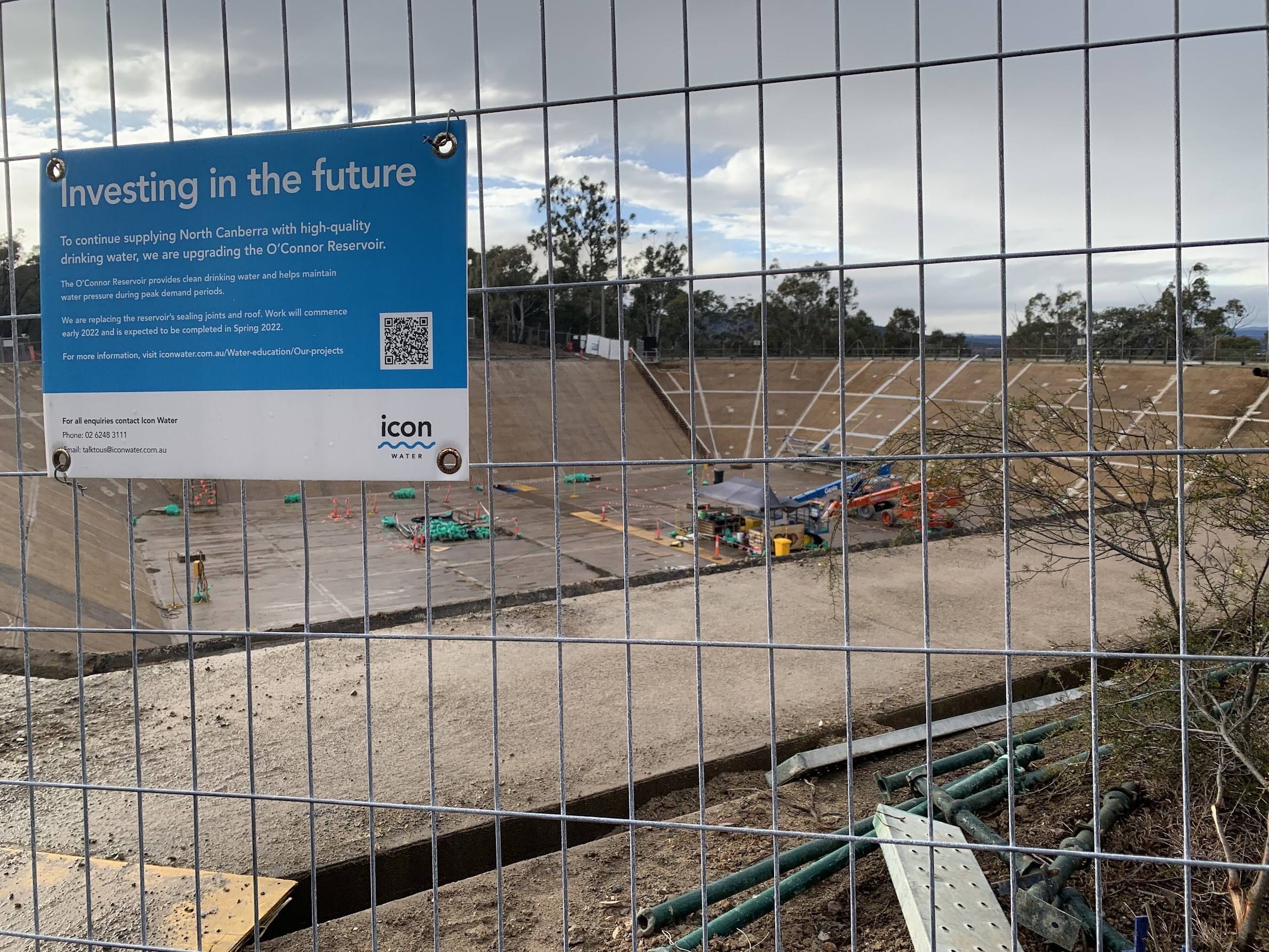
Upgrading the O’Connor reservoir
An easy geocache, GC8NDGB Mythological Monsters #10 – Troll (you won’t see anything via the link unless you are a premium member geocacher), on the way to the second reservoir which showed what they normally look like.

The second one in going order
We wended our way on tracks through pleasant woodland (see photo at top) to cross under Gungahlin Drive.

Gungahlin Drive underpass for critters too
Four different opportunities, if you count the one for humans.
We then skirted around Calvary Hospital, some signage on the Calvary Veterans Track.

Several signs on the Calvary Veterans Track
Generally north-west to leave the Bruce Ridge NR. Some early wattles blooming.

Blooming wattle
We passed a couple of noisy galahs attacking a tree. Never seen a vertical galah before and this view from the iPhone cranked up to x8 is a bit grainy.

Vertical galah
Crossed Haydon Drive and entered the Gossan Hill NR. The main feature of the area is not as I remember it. I remember a great heap of stones, perhaps somewhere near the top (maybe at SH667). We did see some Pilbara-coloured orange-red gossan rocks. Gossan Hill (SH669) itself is an insignificant knoll.

Gossan Hill
There is an outcrop of a gossan, containing haematite, goethite and opaline silica. (Gossan, a Cornish word meaning ‘iron hat’, is a surface outcrop of mainly oxides of iron leached by hot ground water from surrounding rocks. The heat probably resulted from the nearby igneous intrusions.) Over the past 65 million years, the exposed area of the gossan has weathered, impregnating the surrounding soil with coloured ochres. The gossan outcrops were listed on the Register of National Estate (now phased out as a statutory list by the Commonwealth Government). A road-cut on College Street reveals sedimentary rock of the Ordovician Pittman Formation (about 445 million years old) consisting of folded, thin-bedded fine sandstone and shale with minor chert. A quartz porphyry (igneous rock with large quartz crystals of presumed Silurian age around 430–415 million years) intrudes into the Pittman Formation at both the eastern and western ends of the road cutting. (Geological Society of Australia 2013).
A quick find of geocache GC90YY4 Hillclimb kept me happy as we headed north-ish. A local pointed us up a ridge to some signage.

Gossan Hill signage
Back down, we overlooked the College Street cutting.

College Street cut
15 minute stop for morning tea up the back of Radford College, then across Haydon Drive again. A second tunnel, very much like the first, took us back under Gungahlin Drive. Heading generally east, we came to some MTB signage.

The MTB tracks of Bruce Ridge
A bit further and we were in the last Nature Reserve, O’Connor Ridge. It was a NE-SW loop. At its extent we looked across Ginninderra Drive to the southern end of the Lyneham Ridge Eucalypt Plantation. Turning around, I tried to find the old O’Connor tip site. Is this it?

Is this the old O’Connor tip?
Another 1km and we were back at the cars, well exercised and dry.
Nature Reserves #4, #5 and #6 ticked off. Read all about them in the 2021 Management Plan.
Track Map
I’ve been fiddling with various maps recently, spurred on by Peter C’s series of Smartphone Navigation for Bushwalkers recent tutorials. I’ve even added HandyGPS to my (iOS) arsenal on my iPhone. Back at my possibly clunky OziExplorer desktop option, I downloaded the SIX e-Topo Geo PDF maps for Canberra and Hall, converted them to tif format (sadly can’t calibrate pdf maps in OziExplorer) and popped them into Ozi. But, of course, the walk was on parts of the two maps. So to get one complete map snip of the trip, back to TopoView2006 – which has no Gungahlin Drive!

Track Bruce Ridge, Gossan Hill and O’Connor Ridge NRs
Another view, but without a bushwalker’s beloved contour lines, is as follows. Gungahlin Drive yes, contours no.

Track Bruce Ridge, Gossan Hill and O’Connor Ridge NRs on Google satellite view via OziExplorer
Of course, the gpx file can always be downloaded from here and popped into Google Earth.
Finally, here’s the track in AllTrails, where you can pan and zoom.
Party
6 walkers – Bobbie, Hellen, Lesley, Marianne, Phillip, me.
Further Research
From here, “The northern end of O’Connor Ridge was used as a rubbish dump up to the 1970’s. Trees planted on the ridge were meant to hide it. On the north Lyneham Ridge a trial eucalypt plantation for firewood was planted but was not regarded as commercially viable and has been left as open forest.”
So I looked on my old 1966 edition Hall 1:24000 digital map from TopoView2006 and see:

O’Connor tip site on 1966 edition Hall 1:25000 map
You can see the quarry symbol, so we were right on it.
I also contacted the Lyneham/O’Connor Community Group and received the following reply from Trevor Vickers: “I’m told by Gordon McAllister that the tip occupied the area indicated in the attached map.”

O’Connor tip site from Trevor Vickers Lyneham/O’Connor Community Group
Technobabble
Warning, technobabble ahead!
Since I started using a Garmin MAP66i GPSr in early April, it’s taken me three months to understand the relationship between the device and Garmin services such as Garmin Connect and Explore mobile apps and websites, and Garmin’s terminology. I’m not alone. There are many web references to Garmin’s confusing terminology (such as Track Summary, Track, Activity), perhaps caused by the integration of original Delorme inReach into the Garmin universe, or application of data collected from different devices (eg. sports watches). The interrelationship between the data as viewed across the mobile apps and websites is tricky, too.
But I can’t explain the differences in trip metrics such as distance and climb. The track point sampling is exactly the same, as the gpx file is unaltered. As for height, maybe different Digital Elevation Models (DEMs) are being used, but that’s a big difference.
From Garmin services (Connect and Explore mobile apps and websites). Distance = 13.49km, Total ascent = 410m.
Export the unchanged gpx file to my desktop and open it in OziExplorer. Distance = 12.99km.
Create a new AllTrails map and upload the unchanged gpx file. Distance = 13.01km, Elevation gain = 318m.
As I hear you say, who cares!