
Great work – muggle Ali finds Beat’s geocache
Sunday 5 February 2023: Cave on NW side of Mt Domain * – L/R,ptX. On 17 Dec 22, walkers on the Tidbinbilla skyline saw what we thought could be a cave a little to the west of Mt Domain. Let’s see if we can find it. Fire trail and footpad to the Mt Domain cairn, then bush-bashing searching. Success not guaranteed; could be frustrating and fruitless, but a find would be a ripper! Around 15km and 800vm climb and descent. Qualifies for RU⇧4it with a D. PS. Tough bush-bashing member Beat O has found the cave! Thanks for sharing the location Beat. So we’ll be sure to experience it and bag Beat’s geocache.
Summary
From Garmin Connect – Distance: 15.42km | Climb: 972m | Time: 3:58 moving + 4:14 of stops = 8:12 | Grading: L/R,ptX; H(12).
Photographs Photographs are available here.
gpx File The gpx file is available here.
Track Notes
On 17 Dec 22, we looked back towards Mt Domain on our trip to Snowy Corner and saw what we thought was a cave opening. Plans were made to try to find the location. Beat O was also up on the crest that day and saw the dark location too. Since then, the irrepressible and tough off-track walker Beat has visited the cave and placed a geocache there. Beat kindly shared the location with me (and it’s also available via GCA3WPR Mt Domain Cave I).
So I reckon the naming rights should be reserved and henceforth the feature known locally as “Beat’s ‘Cave'”!
The original trip description had a limit of 8 walkers, as I wanted to maintain party cohesion whilst we searched (ie. didn’t want to lose anyone). But once the location was known, 300-400m from the route we previously took along the crest, the party size was increased. We were delighted to have two Tidbinbilla Nature Reserve Rangers with us.
A bit of mucking around to meet our Ranger friends, entirely my fault, involving a couple of U-turns on the Tidbinbilla Road just past the entrance gates. Lesson learned by me – always stick to pre-made arrangements.
Set of from Fishing Gap car park at 7.50am. Whilst I could on the flat, I tried the ‘ask short question expecting long answer’ technique on Ali in an attempt to slow her down and get the latest goss on TNR. No luck on the first. I arrived a long last at Fishing Gap, where my companions were champing at the bit to get on.

Regrouping at Fishing Gap
Letting the front runners have their head again, I assigned myself the roll of tail end Charle. We regrouped at the start of the steep ascent, the nose of the SH1402 ridge and at the bottom of the final ascent to Mt Domain.

At waypoint ‘Cairn in open’, contemplating the final ascent to Mt Domain
As you can see, a perfect blue-sky day, max 27°C in town, so a few degrees cooler up here (temperature reduces by around 0.6°C for every 100vm).
The usual photo of the Mt Domain cairn. I don’t know why I’m collecting them.

Mt Domain cairn
A generous time for smoko at the open area a few tens of metres further north.
Lena did her Ukranian flag ceremony in solidarity with its people. If you want to know more, go on a walk with Lena and ask her. Suffice to say, she’s cumulatively climbed Mt Everest and is on her way down.

Flying the Ukranian flag in solidarity with its people
I began earning my money as the walk leader, but immediately went too low through the scree descent. Ranger Sam showed us an old track alignment through this area coming back, direct and steep but to the east of the scree.
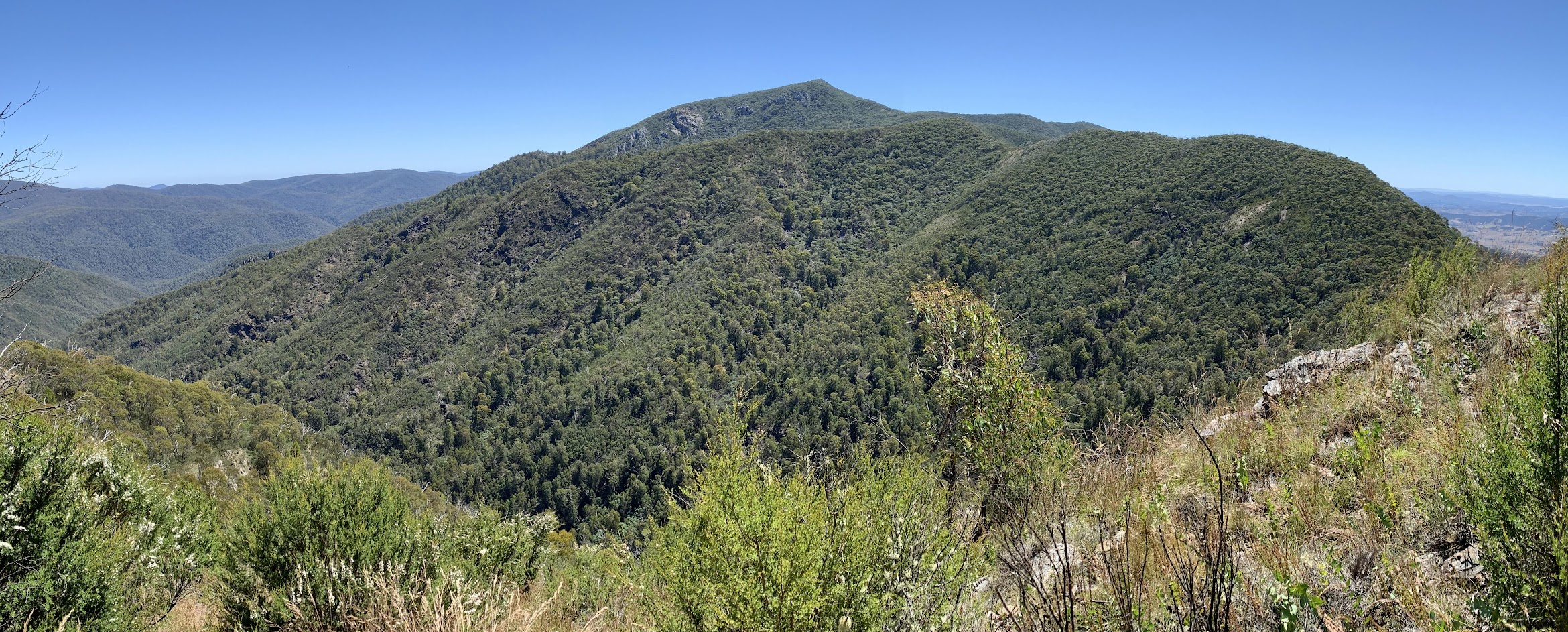
We navigated the boutique little knolls on this part of the Tidbinbilla Range crest, sometimes over, sometimes around. Passed through my favourite ‘Root and rock’ waypoint.

‘Root and rock’ waypoint, without the root in the photo
A further 150m across the ground took us to our turnoff point at the beginning of the crest descent into the Cow Flat Creek-Ashbrook Creek saddle. We wanted to take the NW spur.
Not good route selection here by me. I could say that I got a sniff of the geocache and headed straight for it, but in reality I slipped off the crest of the spur. We were only around 30m off the crest but, coming out, realised that it made quite a difference. Anyway, it was a bit of a scrubby descent.

A scrubby, direct route descent to Beat’s geocache
We did pop out of the scrub at the SE end of the cliff line where Beat’s cache was located. A bit of searching, but muggle (= non-geocacher) Ali found it (see photo above)! Geocache GCA3WPR Mt Domain Cave I. Currently rated Terrain 3/5, I reckon you could make it 4/5 Beat.
The ‘cave’ can be variously described as an overhang, shale cliff, cliff-ette. Its alignment causes a large shadow and that’s exactly what we saw in late December.

Beat’s ‘Cave’
Note: Ever the consummate navigator, I got my East and West mixed up. We came in at the South-East end of the cliff line and exited at the North-West end.

Beat’s ‘Cave’
It was warm with no breeze and shade, so we pressed on looking for a lunch spot. Roger led us NW down along the base of the cliff. An interesting area.

Moving NW along the base of the cliff

Moving NW further along the base of the cliff
Wonderful views over the upper reaches of Cow Flat Creek to Tidbinbilla Mountain.

View directly N to Tidbinbilla Mountain as we turn up from the cliff face
The height of the cliff line eventually diminished and we were able to climb out from the base and up to the top.

Climbing out the W end of the cliff
More views to the north.
View to Tidbinbilla Mountain and the Tidders crest from below lunch
Some shade was found in the scrubby trees. No view, but the shelter from the sun was welcome. Again, I needed a long break.
Lunch finished, I decided to be a proper navigator (and follow Beat’s well documented route) and exit via the crest of the spur. Great views.

The crest of the Tidbinbilla Range from above lunch
From approximately above Beat’s Cave, a view to the saddle on the Tidders Range crest.

Cow Flat Creek – Ashbrook Creek saddle from above Beat’s Cave
The going on the crest of the spur from here was still a little challenging, but different to the going around 30m away on our inward leg. For the outward leg, a little less dense and mainly wattle regrowth.

The going on the crest of the exit spur
Popping out up at the main Tidders crest, we met a party walking through to Tidbinbilla Mountain. I’m sure they knew, but we emphasised not to follow the spur we’d just come up.
Back to Mt Domain, including the little route Sam showed us.
To my cries of “take me home”, Stephen expertly led us back to Fishing Gap.
An unsuccessful attempt to find Tankengine’s GC9ZTBX Fishinggap Frippery, then down to the cars.
This was quite a hard trip for me, but not so for some others. Laeli had been down in Bundanoon Creek and Ming up on Mt Gingera the day before. Hard walking ladies.
Thanks all for your company and contributions. Another bush mystery visited. And thanks again to hard walking Beat.
Relive the trip
Pardon the straight line from home 🙁
Track Maps
Here’s where we went.

Track overview Beat’s ‘Cave’

Track detail Beat’s ‘Cave’
The AllTrails map is here, where you can pan and zoom.
Party
11 walkers – Sam B, Roger E, Laeli H, Richard H, Stephen J, Ming L, Richard M, Ali M, Lauren O, Lena O, me.
Johnny Boy’s Walkabout Blog FaceBook Page
I’ve started up a FaceBook page. Each trip report posts to it. So it’s another way to get some info to get out and breathe a bit of fresh air. Why not pop over and Follow the page, or give a post a Like.
Barrie
6 February , 2023 9:29 pmVery well done! I have often noticed the cave from below and have wanted to go and look for it. On walks I have mentioned to others that it would be worth exploring, but could never raise any interest. So well done all. I enjoyed the blog and the photos.
Johnny Boy
7 February , 2023 10:27 amYuma Barrie. Nice to hear from you. Gosh, if you’ve seen it from below you were down in the headwaters of Cow Flat Creek. That’s tough country. Yarra. john