
Walkers on the shale knoll
Saturday 17 December 2022: Tidbinbilla Range Skyline, Southern Section – Fishing Gap to Snowy Corner * – L/R. Walk the southern section of the Tidbinbilla Range skyline, north from Fishing Gap to Snowy Corner. Awesome views down the western fall to the Cotter River and up to the Brindabella Range, and east down to Tidbinbilla Nature Reserve. Fire trail and rough footpad from Fishing Gap car park to Mt Domain. Then an off-track leg along the skyline of around 3km which will probably take 3 hours. Descend from Snowy Corner via footpad to join the Lyrebird Track and so to Mountain Creek car park. Around 12km and 900vm climb, 7 hours of walking at my moderate pace ?. Steep climbs and descents. Car shuttle required. Limit 8.
Summary
From Garmin Connect – Distance: 12.22km | Climb: 974m | Time: 3:55 moving + 3:17 of stops = 7:12 | Grading: L/M-R; H(12).
Photographs Photographs are available here.
gpx File The gpx file is available here.
A couple of videos.
Track Notes
I was last on Mt Domain on 10 Dec 22. Today was my 21st trip there in 18 years, and I think we’ll have to go back to find a cave on the western side. I last did today’s trip in reverse, from Snowy Corner to Mt Domain, as part of a longer traverse, on 17 Oct 17. Terrylea and I, with others, last did Snowy Corner to Mt Domain on 20 Sep 16. I did Mt Domain to Snowy Corner on 28 Aug 12. Richard M and I, with others, did Snowy Corner to Mt Domain, as part of a longer traverse, on 29 Mar 08. A lot of it seemed new to me – old age, deteriorating memory.
We were waiting at the TNR gates when the early Ranger came through at 7.20am. Beat O was there too, and we ran into him at various times during the day. Put the car shuttle in place and were walking at 7.50am.
It was a lonely walk for this poor old sick and slow pensioner on the leg from Fishing Gap car park to Fishing Gap. But I knew I’d catch my companions at Fishing Gap. I did, but they had arrived at least 10 minutes earlier.
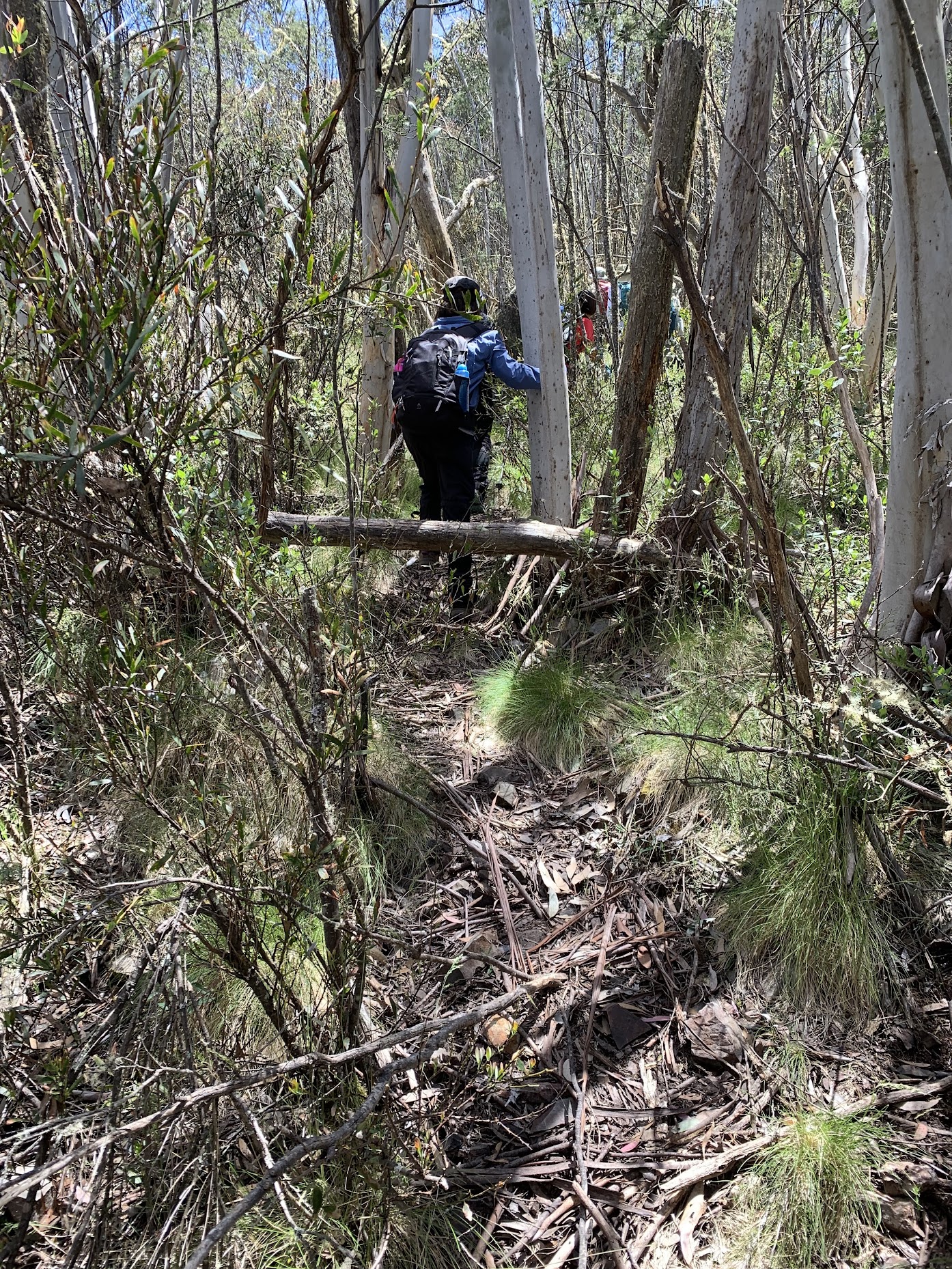
I tried a different approach to keep at the back today. Lam took up my invitation to lead us up to the nose of the SH1402 ridge.
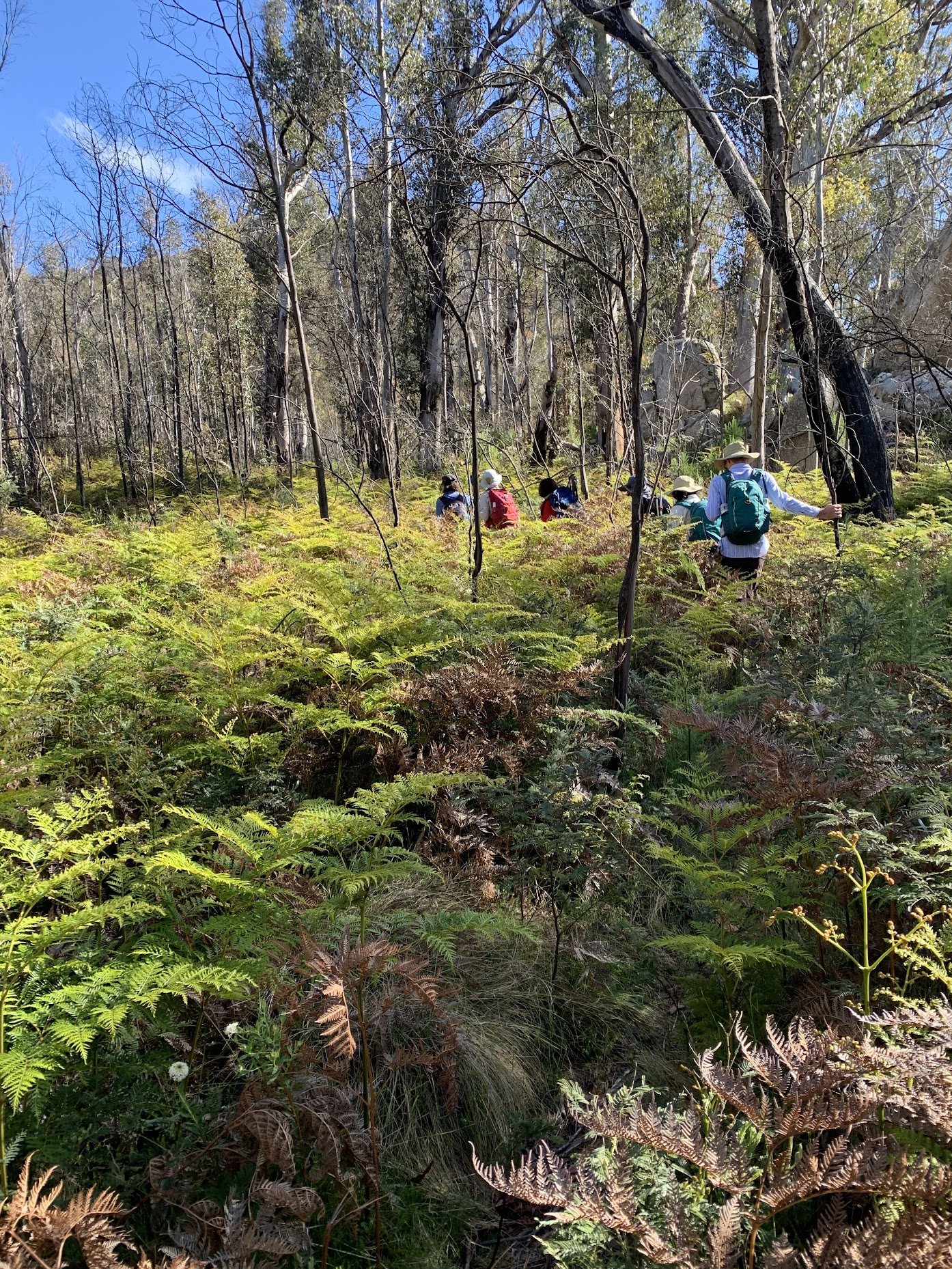
Lam leads the way through the bracken fern up from Fishing Gap
She did a fabulous job, measured pace and waited several times for the old fellow at the rear to catch up.
Lots of Dianella coming into flower now.

Dianella near the nose of the SH1402 ridge
I took the lead for the flat bit. Joanne rose to the challenge of leading us on the final climb to Mt Domain. Another fantastic job. I trailed into the cairn at 10.15am. The obligatory shot.
Mt Domain cairn
On a little distance for smoko. A couple of minutes later Beat arrived, having bashed the bush straight up from Fishing Gap car park! I dips me lid to this guy – he is one tough off-track walker. He snapped a group photo for us.
Morning tea on Mt Domain | photo Ming L’s camera, Beat O snapper
We saw him again at various times during the trip.
We began out northern trek at 10.32am. I was surprised and delighted when TL the hikergirl asked if she could lead along the crest. Of course I acquiesced and looked forward to a tibmin rest of the trip.

The way ahead from Mt Domain to Snowy Corner
The first task was to carefully descend the scree.

Descending the scree from Mt Domain
Then it was across the couple of boutique knolls to the start of the descent to the saddle.

Near the top of the descent to the half way saddle
There’d been a vague pad to here. The descent involved maybe 50 or so metres of pretty rough regrowth which would be hard going without the help of the pad through it. This was the most difficult going of this southern part of the skyline route.

Tight going at the 1380m contour descending to the saddle
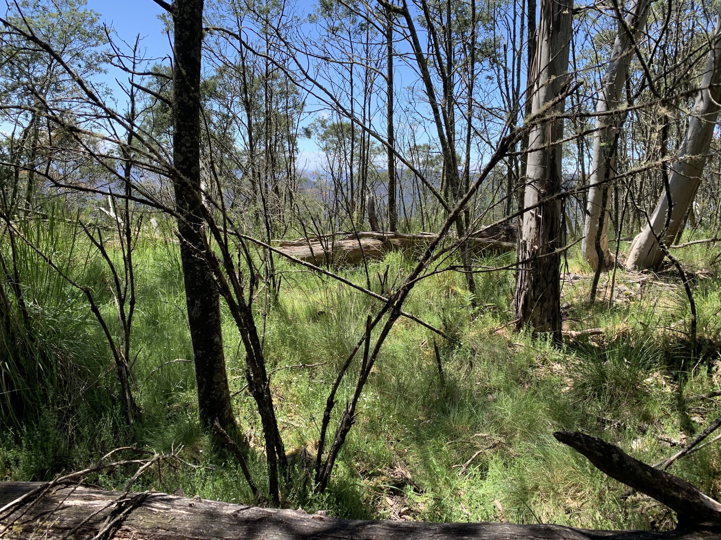
It did ease, with an open area providing views down to TNR.

An open area at 1330m contour with views down to TNR
We broke into the grassy saddle at 10.30am.
View E from saddle
Continuing north, there was a 100vm climb through more pleasant going. A view back south revealing a cave? on the western flank of Mt Domain.

Zoom view back from 1320m contour to cave west of Mt Domain
The pad route more defined in places …
Pleasant climbing up out of the saddle at 1365m
… and not in others,

The going a little tighter at 1395m
There’s a geocache at the top of the 1400+m knoll and my plan for this trip was to have sufficient muggles to find it for me. Not disappointed. Beat and I logged GC9HEBM Loki’s Kennel.

Joanne finds geocache GC9HEBM Loki’s Kennel
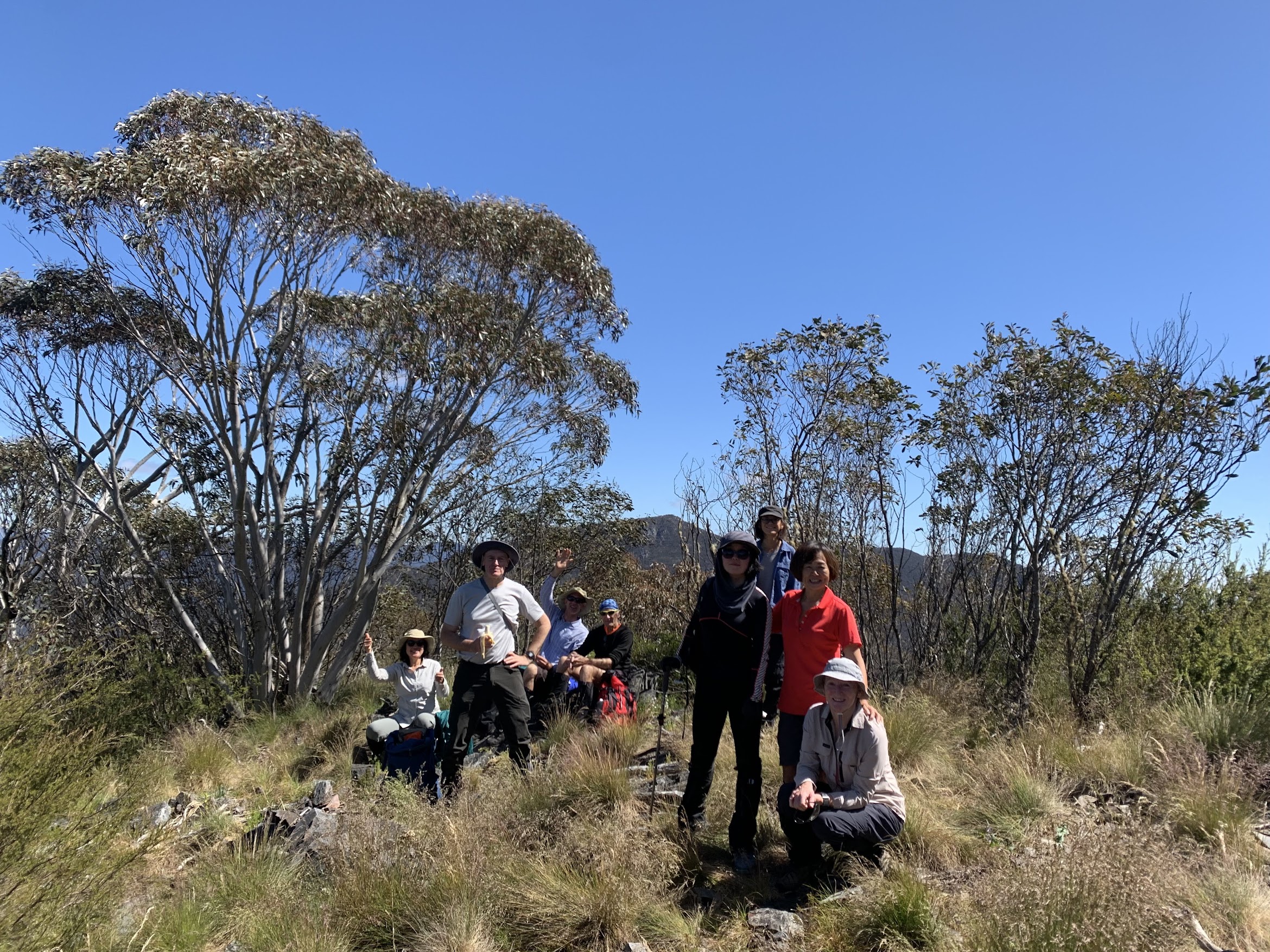
From here, there was a short descent and shorter climb up to a shale knoll, the second virtual stage of the earth cache GC9W5VY Tidbinbilla Shale. Earth caches are great – there’s no physical cache. Although I might have to negotiate with the cache owner (good friend Brigitte) to ensure Beat’s and my answers pass.
This would have to be the most wonderful place on the Tidbinbilla crest (well, so are the views from The Pimple and other great locations). It made an excellent spot for a long lunch.
A photo required by the cache owner.
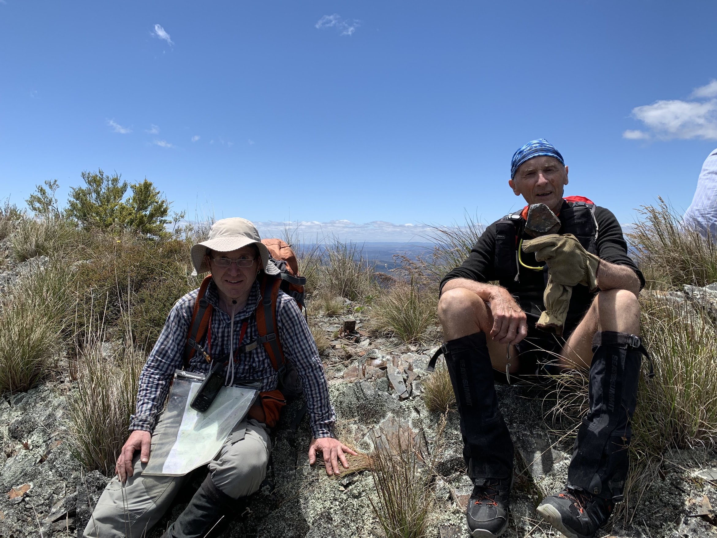
Beat and John on the shale knoll | snapper TL
Huge views all round.

View S from lunch

View SW from lunch

View W from lunch

Canberra from lunch
We left lunch a couple of minutes before 1pm and headed down to the first virtual point for the cache. Much humming and harring to answer the questions.

Shale at GC9W5VY Tidbinbilla Shale (Earth cache)
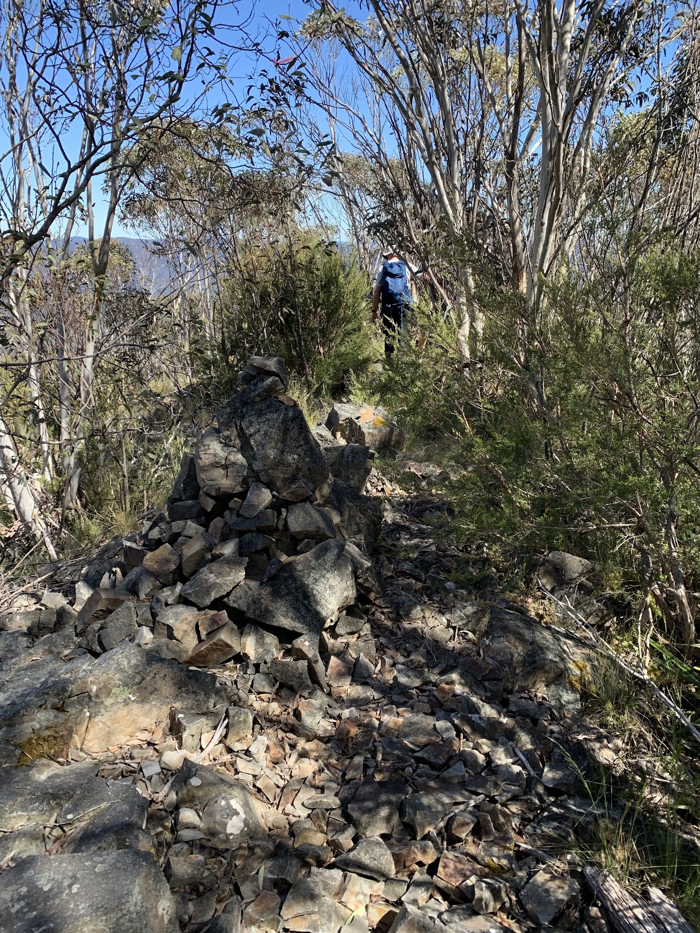
Another nice climb up to SH1431. A couple of cairns on the way. A few more photos of cairns and the going in the photo album.
For this last bit, my route planning and/or the regrowth was a bit off. I’d missed the alignment of the so-called ‘Loki’ track on OSM (eg. via AllTrails) and this caused a bit of fluffing around in the scrub. Arrived at the Snowy Corner cairns at 1.45pm.
The descent from here to the Mountain Creek car park was 2.5km taking 1:15.
We retrieved the cars from Fishing Gap car park, had a little debrief and headed for town. All walkers and cars retrieved.
A wonderful day for me, achieving a trip to boost my confidence. But I should have done a bit more leading! Thanks friends, great party.
Relive the Trip
Track Maps
Here’s where we went. On Tidbinbilla 1:25000 map © BKK Enterprises Pty Ltd, Mona Vale NSW 2103 www.gpsoz.com.au Used with permission.

Track overview Tidbinbilla Range Skyline, Southern Section – Fishing Gap to Snowy Corner

Track 1 Tidbinbilla Range Skyline, Southern Section – Fishing Gap to Snowy Corner

Track 2 Tidbinbilla Range Skyline, Southern Section – Fishing Gap to Snowy Corner
The AllTrails map is here, where you can pan and zoom.
Route Card
| From | To | Distance (km) | Climb (m) | Time (h:mm) | Going |
| Fishing Gap car park | Fishing Gap | 3.7 | 295 | 0:58 | Management trail |
| Fishing Gap | Mt Domain | 2.3 | 389 | 1:28 | Footpad route, a couple of steep climbs |
| Morning tea | Saddle | 1.2 | -214 | 0:58 | Vague footpad route, across scree and through vigorous regrowth in places |
| Saddle | Lunch | 0.9 | 119 | 0:53 | Footpad route, shale knoll |
| Lunch | Snowy Corner cairns | 0.8 | 49 | 0:48 | Footpad route, scrubby out from Snowy Corner cairns |
| Snowy Corner cairns | Mountain Creek car park | 2.5 | -536 | 1:15 | Steep descent on footpad |
(Metrics from OziExplorer Σ)
Party
8 walkers – Richard H, Ming L, Joanne L, Richard M, Terrylea R, Lam S, Tilly T, me.
Johnny Boy’s Walkabout Blog FaceBook Page
I’ve started up a FaceBook page. Each trip report posts to it. So it’s another way to get some info to get out and breathe a bit of fresh air. Why not pop over and Follow the page, or give a post a Like.
Beat Oppikofer
18 December , 2022 9:52 amit was great yesterday, i thought, i didn’t catch you yesterday, when i was doing my new route to Mt Domain (all off-track from Fishing Gap car park), it was good i could go in front from Mt Domain onwards; so i could improve my fitness again, getting my Leg muscles back bush-bashing, as they were in October 2022 (on 1st November 2022 i had Covid19 virus), up-hill i am not there yet as my walking speed was in October 2022, but still it was possible to opening up a gap between your group when i was walking on the front ……
Johnny Boy
18 December , 2022 10:22 amYou certainly are a tough off-track walker! Cheers. john