
Evening view down to the Molonglo River island
Tuesday 13 December 2022: Evening walk – Molonglo River to Barrer Hill. From the pond next to the RSPCA, we will cross the Molonglo River and follow trails up to Barrer Hill. Then a pleasant walk to Misery Point. Return over Southwell Crossing.
Summary
From Garmin Connect – Distance: 7.98km | Climb: 223m | Time: 1:43 moving + 0:15 of stops = 1:58 | Grading: S/E; E(5).
Photographs Photographs are available here.
gpx File The gpx file is available here.
Track Notes
I was last in this area on 12 Mar 22.
Signage says “In 2014, Barrer Hill was named in honour of the late Canberra-based ecologist and environmental advocate, Dr Peter Maling Barrer (1942-1997).”
We wandered down across the bridge over Weston Creek, then over Clos Bridge which spans the Molonglo River.

Molonglo River from Clos Bridge
Fire trails took us to the base of the hill and we climbed up to the top for views from the eastern lookout.
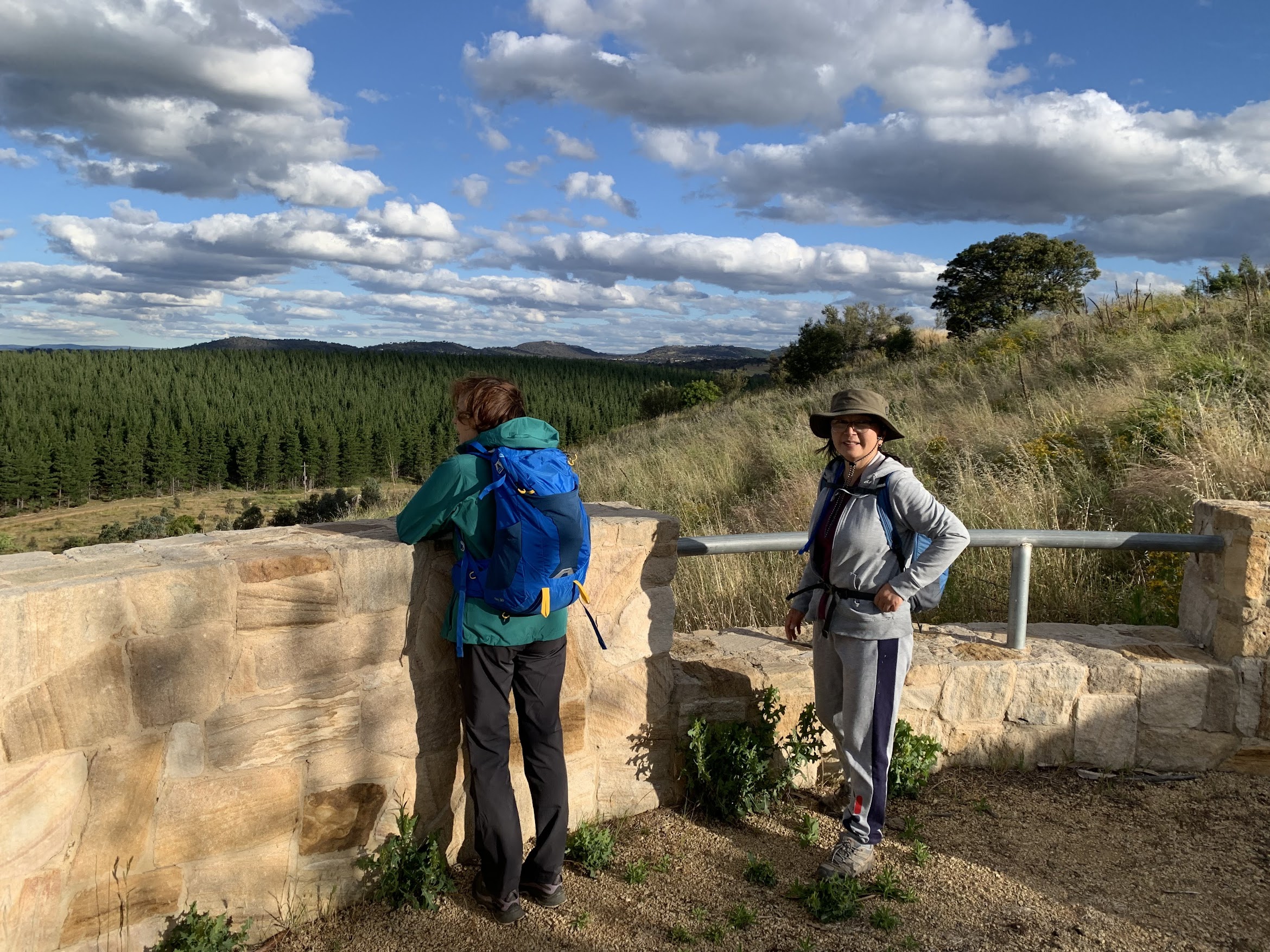
Barrer Hill lookout
Back down the hill, we continued our anti-clockwise walk, passing various nesting boxes. Signage says “A novel restoration technique has been trialled here involving the relocation and resurrection of ten vertical habitat structures (five intact trees and five utility poles). These structures are designed to mimic some of the important habitat functions of mature trees, providing benefits to wildlife in the short term. All structures have been safely secured in underground concrete pads and have been enriched with cross perches, artificial hollows and artificial bark.”

Nesting boxes in dead tree and pole
At the western flank of Barrer Hill we took the track towards Misery Point. Not a very encouraging name, so it’s now called the Barrer Track. Arrived at the fabulous ‘Life Support’ sculpture.

‘Life Support’ sculpture
Wandered down to the river.

Molonglo River at Misery Point
As every good leader should, Ana went home and turned up some research on the naming of Misery Point. See here for a CT article by Ian Warden in Feb 2014. The source of the tale, Tales and Legends of Canberra Pioneers by Samuel Shumack, is here. There’s another mention in an Ian Warden CT column in Jan 2014 here.
We returned up-river, scattering kangaroos. Signage said Southwell Crossing was closed until September 2020, so we pressed on over it.

Crossing Southwell Crossing
Some big timber had come down the Molonglo in recent rains.

Flood debris against Southwell Crossing
Returned to our cars, finishing at 8:05pm.
A nice evening stroll with nice friends. Well led by Ana. Do book and come along next Tuesday evening, although the leader will not be as gracious.
Track Map
Here’s where we went on Canberra 1:25000 topo. Copyright 2003, so a few suburbs missing.

Track Molonglo River to Barrer Hill
The AllTrails map is here, where you can pan and zoom.
Party
5 walkers – Jeff B, Laeli H, Sandra T, Ana V (Leader), me.
Johnny Boy’s Walkabout Blog FaceBook Page
I’ve started up a FaceBook page. Each trip report posts to it, plus there are some extra posts. It’s another way to get some info to get out and breathe a bit of fresh air. Why not pop over and Follow the page, or give a post a Like.