
The quartz ridge of geocache GC7ZYPB Quirky Quartz
Friday 19 July: Caching on the South Bullen Range – L/E. Including a visit to Calvary. Leader: Roger E.
Summary
Distance: 17.3km | Climb: 800m | Time: 7.45am – 1.25pm (5hrs 40mins), including 20 mins of breaks plus caching time | Grading: L/E-M; H(12)
Photographs
Photographs are available, where you can start a large sized slideshow.
Waypoint and Track Files
Download the gpx file for this trip (if your browser does not automatically download the file, it will open the gpx file in a new window and you can then save it). To use in Google Earth, do File, Open… and select Gps or All files as the File Type.
Track Notes
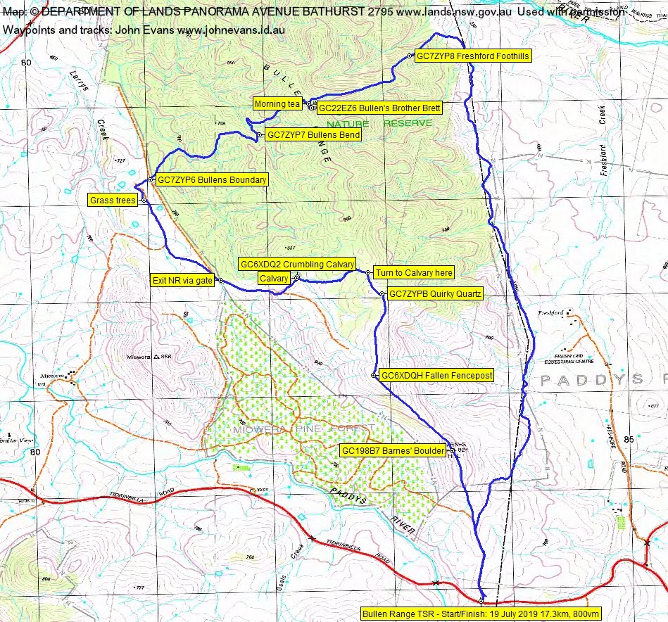
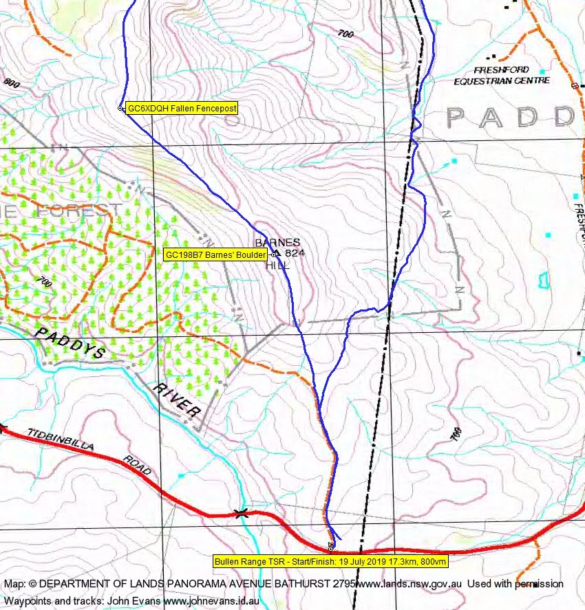
We met at my old folks home and motored the short distance out Point Hut Rd and Brindabella Rd to park at the entrance to the Travelling Stock Route.
We walked north along the fire trail, then up the crest to Barnes Hill for a cache, GC198B7 Barnes’ Boulder, for Shell. Then down and more up to the next knoll and another cache, GC6XDQH Fallen Fencepost. Great views west to the Tidbinbilla Range.

Tidbinbilla Range from the knoll NW of Barnes Hill
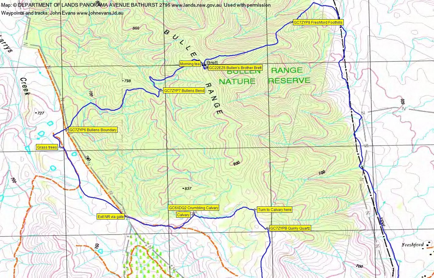
Down to rejoin the fire trail and further north, we found and logged GC7ZYPB Quirky Quartz on a lovely quartz ridge outcrop.
A few hundred metres further on we turned west and down through the shrubby regrowth to Calvary.

Calvary site
A nice poke about and another cache, GC6XDQ2 Crumbling Calvary.

Crockery fragments at Calvary site
We exited by far the easiest way, following the old fence line and contouring across to the nearby fire trail. This descends to a gate at the Bullen Range Nature Reserve boundary.
Previous times here I thought we were on private property (maybe we were then), but now heading down to the north-west into the top of Larrys Creek we found ourselves passing through a couple of ACT government marked gates. The last one we passed through was labelled Grass Trees walk and, indeed, we came across several of said trees, all fenced, probably transplanted there. Remarkable.

Grass trees
Our time in the open landscape was short. We turned back to the NE and reentered the NR, finding and logging GC7ZYP6 Bullens Boundary.
What followed was a steep, nearly 200vm climb (on fire trail, thank goodness) to the crest of the Bullen Range. Pretty rugged country. Around two thirds of the way up we found and logged GC7ZYP7 Bullens Bend.

The creek line at geocache GC7ZYP7 Bullens Bend
A final huff and puff to the top for morning tea at Brett trig.

View down the fire trail from Brett trig
Another cache for our new caching partner, GC22EZ6 Bullen’s Brother Brett.
It was then down the other side of the Range, again thankfully on fire trail, but a steep nearly 300vm descent. Geocache GC7ZYP8 Freshford Foothills was duly found and logged.
Not wanting to climb back up, we exited along the eastern boundary of the NR.
A pile of 10 cent refundable cans and bottle was collected for the Weston Scouts.
Always fun, thanks Roger.
Track Maps
Track overview
Track 1
Track 2
Party
3 walkers – Shell D (Kiteslayer), Roger E (Marmaduke Rothschild) (leader), me (JohnnyBoyACT).