
6am Camp site up behind Lutons Crutching Shed
Saturday-Sunday 16-17 September 2023: Navigation #4 – M/R. Tag along on Navigation #4 – A weekend pack walk navigating off track in the Namadgi NP in the region around Sentry Box Mtn.
Summary
From Garmin Connect (MAP66i) – Distance: 13.28 + 23.70km | Climb: 410 + 380vm (Elev Corrections Enabled) | Time: 2 days | Grading: M/R + L/E-M; M(11) + M(11).
Photographs
View photographs here. There are heaps more than in the trip report.
gpx file (day 2 only)
Download the gpx file here.
Track Map (day 2 only)
Here’s where I went.

Track

Some detail from e-topo Yaouk
Track Notes
I first did this trip on 3-4 Jul 04. I got sucked straight in to bushwalking and have done the walk as a ‘tag along’ many times since. The last time was 30-31 Aug 14.
Much to be thankful for – Great company; a new Tarptent Moment DW and Therm-a-rest Neoair sleeping mat (don’t tell anyone I took a Flextail inflator and chair); wonderful weather and nighttime stars. I revisited some old friends of sites.
A bit to grumble about – I am getting old and slow; I can’t walk off-track with only one arm (it took 15 minutes to button up my shirt using my non-dominant hand) and two cramping legs; spurious entries on the whiteboard containing the words of Peter Doyle’s shearers’ strike poem in Lutons; OSM now naming Sams Creek Fire trail as ‘Stevensons Trail’!
Day 1 Walk
I won’t say much about this, as it would be exposing the fun next year’s budding navigators will have.
There were some difficulties in navigators obtaining maps. Jenny brought along a supply of segments covering the area to be walked. Paper maps are getting hard to find, are printed on thin paper that does not wear at all well, and are no longer produced by the NSW Mapping Authority which covers the ACT at 1:25,000 scale. The best thing, if you have the relevant map, is to tuck it away in your pack in case of emergency. Carry a segment of the relevant e-topo map if you can print it out. This can be annotated with waypoints as you navigate. My procedure to do this is here, at section 15 ‘Printing correct scale NSW SIX e-topo maps.

Which way do we go – navigators decide
One of Jenny’s requirements was “no digital devices” and it was actually a pleasure to get back to simple map and compass navigation. I cheated a little, looking at it once to turn on and once to turn off.
Needless to say, it was all off-track to lunch at Waterhole Hut. A warm day, so the break was appreciated.

Lunch at Waterhole Hut
We exited via the Waterhole Hut Horse Holding Yards site. There’s been some restoration work at the nearby Waterhole Stockyards since I was last there.

Waterhole stockyards
The exercise continued, Jenny asking navigators in turn to take the lead to the next map stop.

A map stop between Waterhole Hut and Lone Pine Homestead site
The day was getting on, so a bit of fire trail was used. A brief look at the Lone Pine Homestead site.

Lone Pine Homestead site
A spot was found to cross Sheep Station Creek (near some fork fencing) and we came in the back of Lutons at the lovely camping area. Thanks to Stephen for helping me set up my tent, or else I would have been under the stars.
A mild and quite windy night. Very quick turnaround on inReach texts to my dear wife, and even quicker when I remembered that the MAP66i can be bluetooth-paired to the Garmin Messenger app on my mobile for easier typing. Around 5 minutes from my send to receiving her reply.
Recharged both phone and GPSr from around 70% to 100% using about half of a 6600mAh power bank.
Day 2 Walk
I won the battle of the bladder and didn’t have to get up till 6am.
I’d already decided that I couldn’t manage the climb to Sentry Box Mountain, but did start with the group.
Quite tight going up to the first map stop at SH1282 through rampant regrowth following the 2020 fires. A little easier going down to the next saddle so I kept up. I said my good-byes there and took a look at the objective, after Jenny checked that I had an SOS device.

Closest I got to Sentry Box Mountain this year
A lovely open descent from the saddle to the Naas valley floor.

Easy going from the saddle down to the Naas Creek valley
My plan was to visit some of my favourite spots in the Naas Creek valley. First was a little further NW along Sams Creek Fire Trail to Richard Brayshaws Hut site.

Richard Brayshaws Hut site
Then down to see the Naas Creek Fork Fencing.
Back up on Sams Creek FT there was the happy sound of frogs.
Further SE, just off Sams Creek FT is the Crawford Homestead (Old Station) site and orchard.

Crawford Homestead (Old Station) orchard and site remains
Returning to Lutons, a snake was skirted.
Lutons Crutching Shed is a favourite haunt of mine.

Lutons Crutching Shed
There are several photos for the sake of nostalgia.
A good friend, Bob Salijevic, was KHA HMO for Namadgi when he restored the fencing at the site. It’s weathered in nicely.

Restored fencing at Lutons Crutching Shed
I flicked through the log book, but the best entry was carved into some structural timber.

‘TOO PISSED TO DIE TOUR OCTOBER 1987’
Back through the camp site, I wandered down to cross Sheep Station Creek at the usual spot at the Fork Fencing on Sheep Station Creek. Completely gone, burnt I guess. There is some left, a few hundred metres up the creek where we crossed it yesterday.
Next onto Alexander Brayshaws Hut site. The tree that was lying down in 2013 has nearly rotted away. Strange that!

Fallen tree at Alexander Brayshaws hut site
I returned to camp via the fire trail, which changes names a couple of times around here.

A plethora of FT signage
Had lunch. Must have taken over an hour to pack up left-handed. Most frustrating.
On the way out I popped down to the Naas Creek ford.
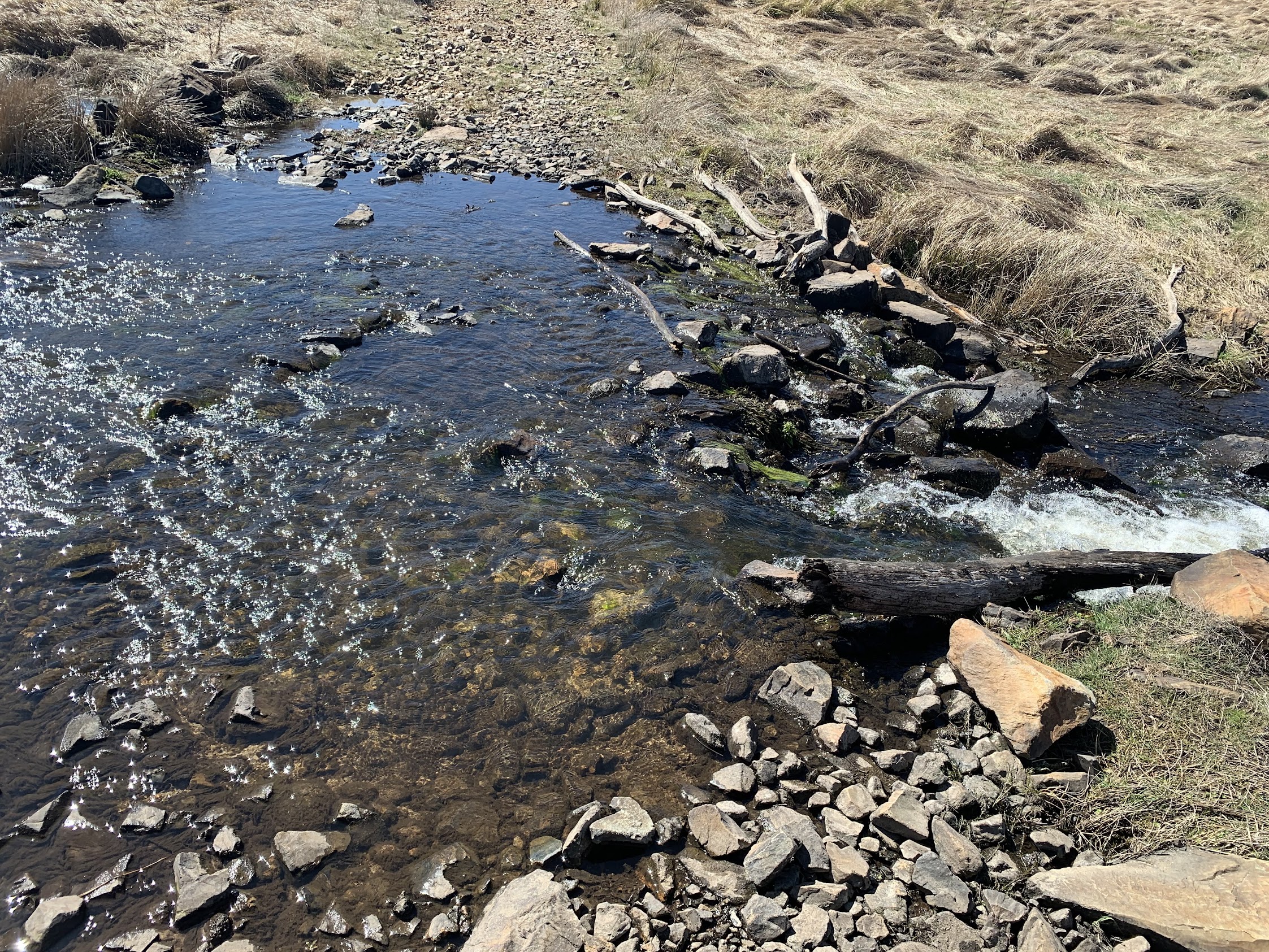
Naas Creek ford on Old Boboyan Road
Next stop was the Boboyan Homestead site. A rich and interesting site.

Boboyan Homestead chimney and flagstones
Went down to visit the dam and walk around the orchard.

Dam at Boboyan Homestead
David Brayshaws cairn is just off the Old Boboyan Road (South) and clearly visible when the grass is down.

David Brayshaws cairn
I arrived back at the cars at 2.40pm and was looking to quite a wait for the rest of the party, if they got back to camp at the estimated 3pm. So I took a little wander to James Brayshaws Hut site. There’s the usual fruit tree orchard and pile of granite from the hearth.

James Brayshaws Hut site
Back at the cars, waiting was boring, so I took a stroll to meet the returning party. They’d only reached SH1319 because of the slow going, so I didn’t feel so bad about wimping out.
So pleased to walk with friends who are great map and compass navigators and, I hope, future CBC walk leaders!
Party
9 walkers – Marlene E, Paula F, Jenny H (leader), Ron K, Craig L, Stephen M, Beat O, Jay S, me.
AllTrails
The AllTrails map is here, where you can pan and zoom.
Johnny Boy’s Walkabout Blog FaceBook Page
I’ve started up a FaceBook page. Each trip report posts to it. It’s another way to get some info to get out and breathe a bit of fresh air. Why not pop over and Follow the page, or give a post a Like.