
Cotter Hut under Coronet Peak
Saturday 23 September 2023: Cotter Hut loop * – L/E. Who cares if the days are short or long, we can walk at night. A ‘day’ walk. Visit sites (and sights) such as Cotter Gap with views to Split Rock, pass by Coronet Peak (see activity photo), ford Cotter River to Cotter Hut, see where Mt Franklin Rd ends, views from Cotter Hut Road to Black Sallee Flat. The route circles ‘De Salis’ Knobs’ and uses the Australian Alps Walking Track and Cotter Hut Road. Around 37km and 1100vm of ascent. At an old codger’s pace, so up to 15 hours walking. Some of the return would be at night by torchlight.
Summary
From Garmin Connect (MAP66i) – Distance: 36.54km | Climb: 1150vm | Time: 8:07 moving + 1:35 of stops = 9:42 | Grading: L/E; H(12).
Photographs
View photographs here.
gpx file
Download the gpx file here.
Track Map
Here’s where we went.

Track Cotter Hut loop
Track Notes
I last did this trip on 3 Oct 05, in 7:45. A bit older and slower today, although not quite as slow as the advertised time. Good walking weather, clear sky, around 20° and no breeze.
Walking by 8.45am along the Cotter Hut Road, up the 140vm climb out of the Orroral Valley and regrouped at the Australian Alps Walking Track junction. Ran into a solo hiker there and a large snake.
In along the AAWT I had a look around the largest granite boulder in the area I could see on Google Earth, continuing the search for old Fishlock Yards. No joy.
Crossed Sawpit Creek where no one needed water and climbed up to Cotter Gap. Climbs test me. Views to Split Rock.

Split Rock from Cotter Gap
We regrouped again and walked the AAWT down the Pond Creek cut. A while since I’ve been here. It was 11.50am when we crossed the Pond Creek feeder, so stopped for morning tea and to water up.

Brunch at the Pond Creek feeder
A look around.
Not much sign of the short entry pad into the nearby campsite due to fire damage.
Back on our feet, we passed the turnoff to the route to Little Creamy Flats and the beginning of the route to Coronet Peak. This was a very old road alignment. Not much sign of it now.

The way to Coronet Peak from the AAWT
At least the anthill on the opposite side of the AAWT marking the turnoff is still there.
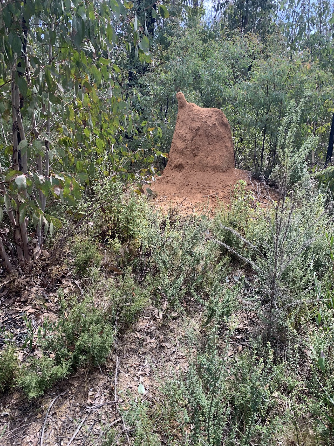
Anthill on the other side of the AAWT marks turnoff to Coronet Peak
We walked on towards the Cotter River, views to Coronet Peak opening up.

Coronet Peak from the AAWT
Cotter Rocks were prominent back behind us.
Some nice track side colour.

AAWT trackside colour
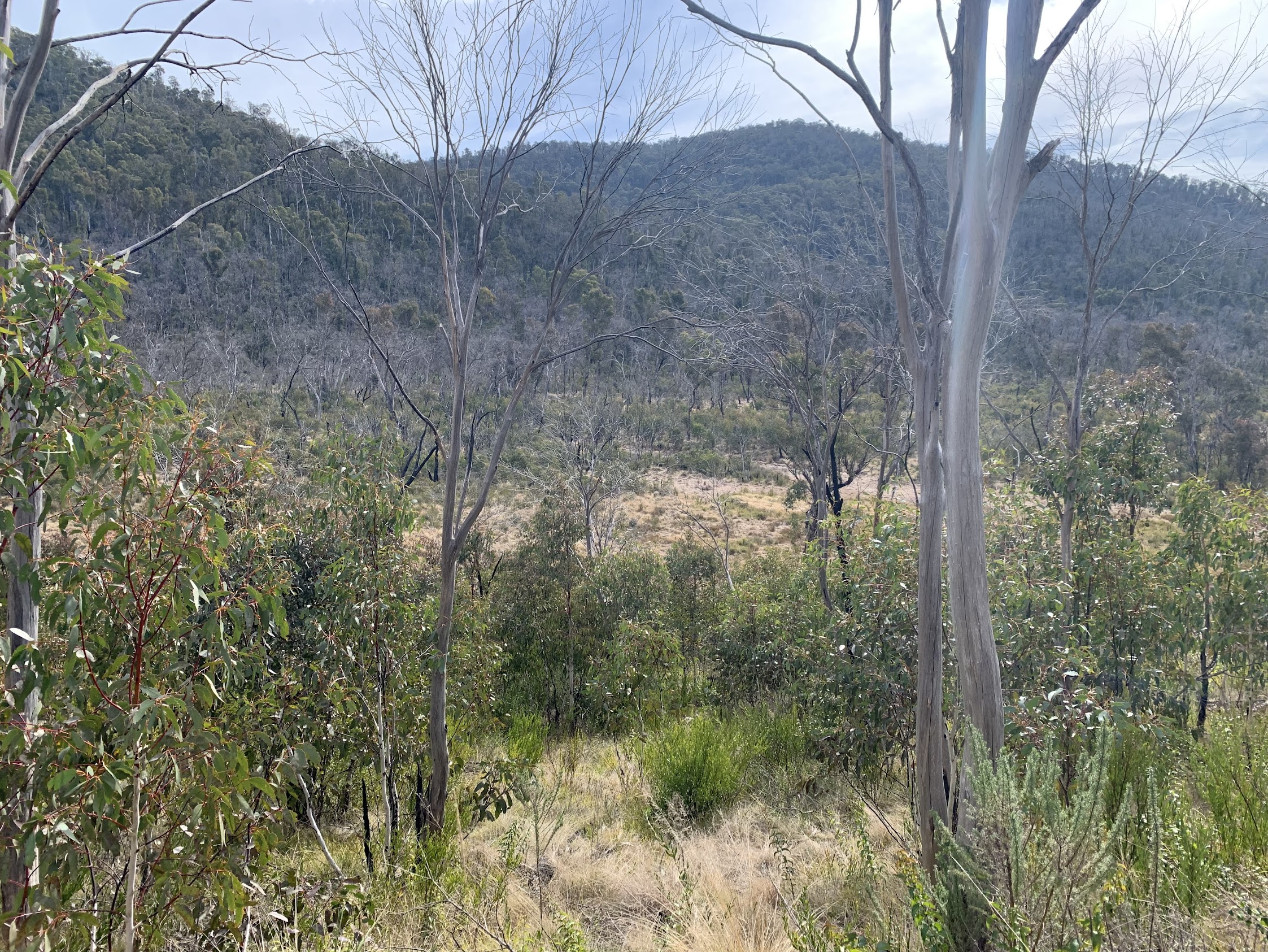
We regrouped overlooking Cotter Flats.

Overlooking Cotter Flats under Bimberi Peak
Martin left us here to log a geocache that had been reestablished after the 2019/20 fires and the rest of us took a shortcut down through the Oldfields Homestead site.

Bedhead at the poplar at Oldfields Homestead site
There were many styles employed to cross the Cotter River.

Many different crossing styles
We walked up to Cotter Hut for lunch on the steps.

Walking into Cotter Hut
Left Cotter Hut at 1.40pm and passed the end of the Mt Franklin Rd.

End of Mt Franklin Rd – only 24km to Ginini carpark
Then down to the Cotter Hut bridge to pick up Martin (he’d been caching the true right side of the river) and water up for the last time.
A leg north along the Cotter Hut Rd above Black Sallee Flat.
Black Sallee Flat from Cotter Hut Rd
From the junction with Lick Hole Rd, the Cotter Hut Road climbs relatively gently ~200vm up beside De Salis Creek. I marked a water access spot close to the road, but we didn’t need it.

Water in De Salis Creek immediately beside Cotter Hut Rd
By just after 5pm we were back at the Cotter Hut Rd/AAWT junction. A short break. Shadow on the Orroral Ridge of Stone.

Shadow line creeps up the Orroral Ridge of Stone at 5.20pm
A last bit of colour.

Indigofera
Back at the cars at 6.30pm, just as the light was fading and it was starting to get cold.
Many thanks to fine friends for humouring an old codger. Great little trip.
What did I learn?
I’m still a bit quicker (except on hills) that I’d allowed. Done and dusted in 9:42 rather than the advertised up to 15:00. Thanks to Laeli, I must start using Courses on my watch! No leg cramps – drank 2l of electrolyte and only sat down at lunchtime on the Cotter Hut steps.
Party
9 walkers – Chris D, Martin E, Kirsty G, Laeli H, Stephen J, Ming L, Lauren O, Michael Z, me.
AllTrails
The AllTrails map is here, where you can pan and zoom.
Relive
Johnny Boy’s Walkabout Blog FaceBook Page
I’ve started up a FaceBook page. Each trip report posts to it. It’s another way to get some info to get out and breathe a bit of fresh air. Why not pop over and Follow the page, or give a post a Like.
Greg Hutchison
24 September , 2023 4:19 pmHi Johnno. Thats a bloody long hike for one day. Thought you said somewhere you were an old bloke struggling to keep up with the young pups. I bet there were a few of them cursing you near the end.
Haven’t done that route myself although I once went from from the valley where you started along the AAWT to Cotter Hut and back in one day. I think about 2005 just after the 2003 fires which made it walkable. Tripped over a couple of pigs near Sawpitt Ck and saw a bunch of Red Necked walllabies are 5PM getting back to the valley.
Johnny Boy
24 September , 2023 4:29 pmYou should’ve seen me crawling up the hills, Greg. Cheers. john
George Fieg
25 September , 2023 7:16 pmGood effort John and co.
Johnny Boy
25 September , 2023 8:33 pmThanks George. Wish I could still do what you two get up to. Cheers. john