
Climbing the eastern end of Billy Billy Rocks
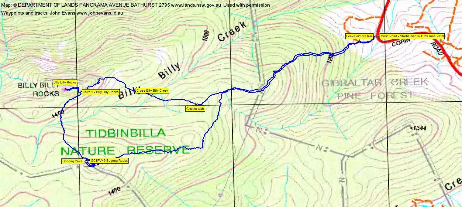
Saturday 29 June: Bogong Cave – M/R,ptX. Use the cairned footpad from Corin Road to gain the Billy Billy Rocks area. Climb up for views if conditions are suitable. However, the main objective for this trip is Bogong Cave, around 500m south of Billy Billy Rocks and across the creek. Return east down the spur then north-east to regain the footpad and so back to Corin Rd. Around 7km and 500m climb. If time and inclination, climb a 1000+m knoll SE of Corin Rd for a geocache. An additional around 3km and 200m climb, all off-track. Map: Corin Dam. Leader: John Evans 0417 436 877 john@johnevans.id.au . Transport: ~$10.
Further Information
Wanted: Billy Billy Rocks guide – I couldn’t find the way for the last 30 or so metres today :-(. My last trips here (all led by others) 12 Jan 08, 30 Jan 10, 26 Jul 14, 14 May 16, 21 Nov 17, 22 Sep 18.
Summary
Walk 1: Distance: 6.2km | Climb: 400m | Time: 8.10am – 12.35pm (4hrs 25mins), including 25 mins of breaks and lots of unproductive rock scrambling
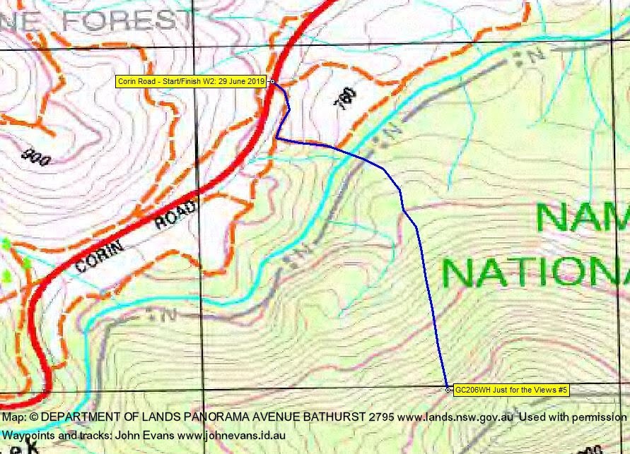
Walk 2: Distance: 2.5km | Climb: 290m | Time: 12.50pm – 2.45pm (1hrs 55mins), including 20 mins of breaks
Total Grading: M/R; M(11)
Photographs
Photographs are available, where you can start a large sized slideshow.
Waypoint and Track Files
Download the gpx file for this trip (if your browser does not automatically download the file, it will open the gpx file in a new window and you can then save it). To use in Google Earth, do File, Open… and select Gps or All files as the File Type.
Track Notes
Walk 1
We met opposite my old folks home and motored via Woodcock Drive, Point Hut Rd, Tidbinbilla Rd and Corin Rd to park on the verge at the take off corner.
An uneventful trip in, following the cairned footpad up the spur. A bit of puffing from me.

Climbing at 1340m contour
Along to cross the granite slab.

The footpad just before the granite slab
Then down across Billy Billy Creek and up and along the east end of the area. We then scrambled over the crest to the southern side to Cairn 1, the usual start.
Climbing the eastern end of Billy Billy Rocks
A large party made the scrambling slow and my indecisive navigation added extra time. Having reviewed the photos from my last trip here, I’m sure I made all the correct points until just before the summit. Much frustration and disappointment, as for me it’s the destination more than the trip.
We retreated back to Cairn 1 and took a B-line to Billy Billy Rocks. Morning tea and Roger found GC1PVH9 Bogong Rocks, so he was happy.

In Bogong Cave
We exited via the spur to the east (the Rob and Jen route) to make a round of it and bash a bit more scrub, coming in at the Granite slab.

Returning to the granite slab
Back down the pad to the cars.
Walk 2
We drove back down Corin Rd to a convenient parking verge for the second walk, one needed to revive my spirits with a cache bag.
Down and across Gibraltar Creek.

Crossing Gibraltar Creek
The shrubs were thick each side of the creek, but the grueling climb up the hill was made doable by sparse vegetation in the poor soil. Lunch 200m from the cache because I was whacked.
Then the last little climb to find and log GC206WH Just for the Views #5.

View down to Corin Rd from geocache GC206WH Just for the Views #5
Back down and up to the cars.
Thanks all. So sorry we didn’t hit the top of Billy Billy Rocks. Go with a better leader next time.
Track Maps
Track Walk 1
Track Walk 2
Party
10 walkers – Dane A, Meghan B, Roger E, Kirsty G, Tim H, Braham H, Stephen M, Georgina P, Steve T, me.