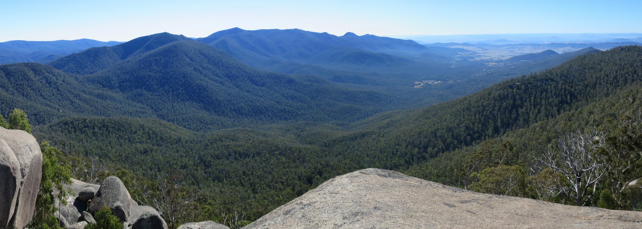
Tidbinbilla views from Billy Billy Rocks
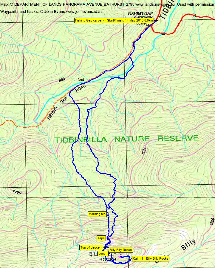
Saturday 14 May: Billy Billy Rocks – M/R. Up and back from Fishing Gap fire trail. About 3 km each way and 600 m climb. Maps: Corin Dam, Tidbinbilla. Leaders: Jenny and Rob H. Transport: ∼$40 per car.
8 of us drove in 2 vehicles to the Fishing Gap car park in TNR.
Summary
Distance: 8.9km | Climb: 650m (GE)/∼600m contour interval | Time: 8.50am-5.00pm (8hrs 10mins), including 45mins of breaks + rubber necking time on Billy Billy Rocks
| Grading: M/R; M(11)
Photographs
Photographs are available, where you can start a large sized slideshow.
Video
Waypoint and Track Files
Download the .gpx file. (Right click, Save Link As…, Save – if you want to use it.)
To use in Google Earth, do File, Open… and select Gps or All files as the File Type.
Track Notes
A great autumn day where we were – blue sky, mild temperature, a gentle breeze at times.
Up Fishing Gap fire trail for 1.3km in 20mins, then into the bush. A great route up. The going to morning tea was through light scrub under forest cover, although it was probably made better by the fact that I drifted towards the back of the pack. A few grass trees in the early stages. We passed a granite wall that had intrusions of sedimentary rock in it. From the fire trail to morning tea was 1.8km in 1hr 20mins, climbing nearly 300 vertical metres.
The next part of the ascent to near the crest was a bit steeper and a little scrubbier. We covered 500m in 40mins, climbing 200 vertical metres. Great views opened up to the Tidbinbilla Range and valley.
We next circled the western end of the Rocks to a cairn on the southern side, towards the east. This leg was 560m in 35mins.
From here the scramble up through the boulders began. A good route in a northerly direction, then turning up to the west. Took 25mins.
Absolutely fabulous views! Check out the video!
We retraced our steps back down to the cairn, then around to the west and a little north for lunch. A lovely spot on rocks in the sun, sheltered from the breeze.
The descent back down to the road was 3.5km and took 3hrs 10mins. Our route was a little to the east of our ascent and a deal scrubbier. So the better way is our ascent route.
A great day with huge views, thanks Rob and Jen and all.
Track Map
Track
Profile
Party
8 walkers – Mark B, Jenny H, Rob H(leader), Bev O’S, Rhonda S, David W, Tim W, me.
Guy Morrison
17 May , 2016 10:18 amI thought of this one too to avoid floundering in the scrub from Smokers gap ascent and a longer climb (this does wonders for fitness and health). I thought I’d get lost trying to find a way to the summit viewpoint. Looks like a great walk. Whilst on the topic of fitness workouts, we did the Mt Tennent firetrail walk recently. I was surprised at how beautiful the various stages of bush were on this walk on a rainy day. Liked it more than the official Namadgi track up the north side.