Tidbinbilla valley from Billy Billy Rocks

Saturday 26 July: Day trips in the Namadgi #5 – Tidbinbilla–Smokers Gap crossover – M/R. Meet on top of Billy Billy Rocks for lunch. Maps: Corin Dam, Tidbinbilla. Leaders: Jenny and Rob H. Transport: ~$32 per car.
15 of us met at Kambah, picking up the 16th down Tuggers way. We split into 2 groups of 8 and drivers swapped cars and keys. I got a very nice Prado 4l turbo diesel! I was in the party that drove to Smokers Gap/Square Rock car park and walked to Fishing Gap car park.
Summary
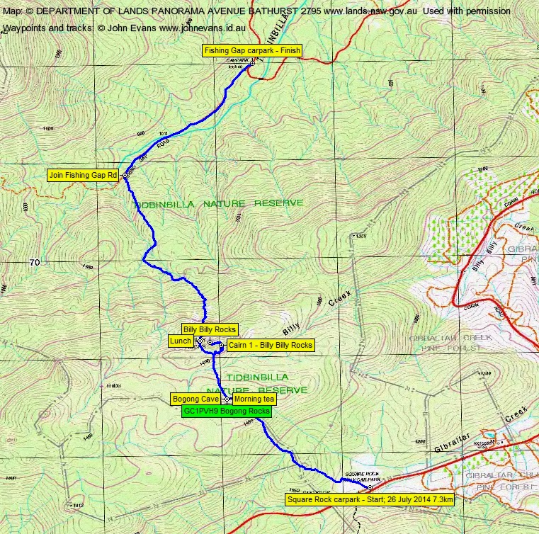
Distance: 7.3km | Climb: 325m | Time: 8.50am-4.10pm (7hrs 20mins), with 50 mins of breaks | Grading: S/R; M(10+) (However, the other party had to climb 715m)
Track Maps
Track overview
Track 1

Track 2
Photographs
Photographs are available, where you can start a large sized slide show.
Google Earth
Download the Google Earth .kmz file here.
Track Notes
Foggy as we left Canberra, but we got above it driving up Corin Rd.
It’s always a slow and scrubby leg in from Smokers Gap car park over the first knoll to the NW. Great to see thickets of Alpine Ash growing in amongst their stark grey burnt and dead parents. Down the other side and we ran into a few patches of snow as we crossed the headwaters of Kangaroo Creek. More snow and regenerating Alpine Ash as we climbed slowly towards Bogong Cave. It’s only as you come up to the knoll behind the cave that the going starts to ease. Around the N of the knoll we stopped at the cave entrance for morning tea. 1.8km in 2hrs.
A good 20 minutes for morning tea as Rob waited for the time of his first walkie-talkie call with Jenny. I was glad, as I searched without joy around the coordinates for GC1PVH9 Bogong Rocks. No joy. Finally looking at the spoiler pics on my phone and with help from BlackLotusEater, muggle Cynthia and my torch, we made the find.
Easier going down the north facing slope to cross Billy Billy Creek. Views to a bit of snow up on the south facing slope towards Billy Billy Rocks. We climbed to the 1400m contour. From morning tea at Bogong Cave, this leg was 500m in 20mins.
The final ascent was only 300m in distance, but it took 45 minutes. We first sidled NE looking for the marker cairns. Finding the first, we began climbing up and to the N. A couple more cairns and the climbing gave way to scrambling. We eventually reached the top. Good views down the Tidbinbilla valley, but the weather was closing in. We were within 100m of the cache GC1A7XY William Totally Rocks!, but no time to reach it.
Intermittent showers began as we reversed down to 1400m, then headed W and NW, with Rob calling “day-o”. Soon we heard the other party and we met where they were lunching at an overhang on the western end of the Billy Billy Rocks area. Swapped car keys! We had our lunch.
With three cheers from each party for the other, we continued our crossover journeys. A nice exit off the Rocks down to the North, fewer boulders than I expected around the top. Again, close to the cache GC1PVHC Granite Cascade, but not appropriate to ask for a detour. Aptly named, as my photos of the area show.
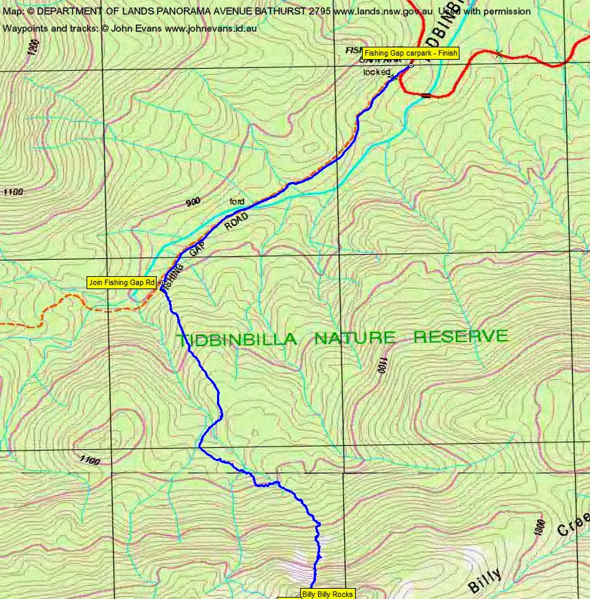
A slow and scrubby descent, through a little creek junction system and finally down to join Fishing Gap Road. 2.4km in 2hrs 20mins.
1.7km down the fire trail in 20mins to Fishing Gap car park.
A good trip.
Party
8 walkers – Mark C, Cynthia C, Rob H (leader), Quentin M, Llewellyn S-P, Venugopal T, Alan V, me.
8 walkers in the other party – Mark B, Jenny H (leader), Brendan K, Gabriela S, Jenny T, Lorraine T, Barb V, Edwina Y.