
Lookout on Shepherds Walking Track
Saturday 1 January: Shepherds Walking Track to Molonglo River – M/E. Walk the new Shepherds Walking Track from The Link in Ginninderry to join the Shepherds Lookout Track. Then take the Molonglo Crossing Track to the Molonglo River footbridge. Return the same, taking any loop/side tracks available.
Summary
Distance: 11.5km | Climb: 325m | Time: Starting 7.15am 3hrs moving time | Grading: M/E; E(7)
Photographs
Photographs are available here
Waypoint and Track Files/gpx File
Download the gpx file for this trip recorded on a GPSr here.
Download the gpx file recorded via AllTrails here (activate …, Download Route, Select a file format, OK).
Track Notes
Faffed around a bit to find the start of the track as it currently has no signage – except for a sign saying it has no signage. Circumnavigated The Link building and was rewarded by a lovely pond on the route to Strathnairn.

Pond behind The Link
Completed the circumnavigation and found that the track started right beside where I parked my car. Through an open construction fence and along an old vehicle track to the start proper of the track.

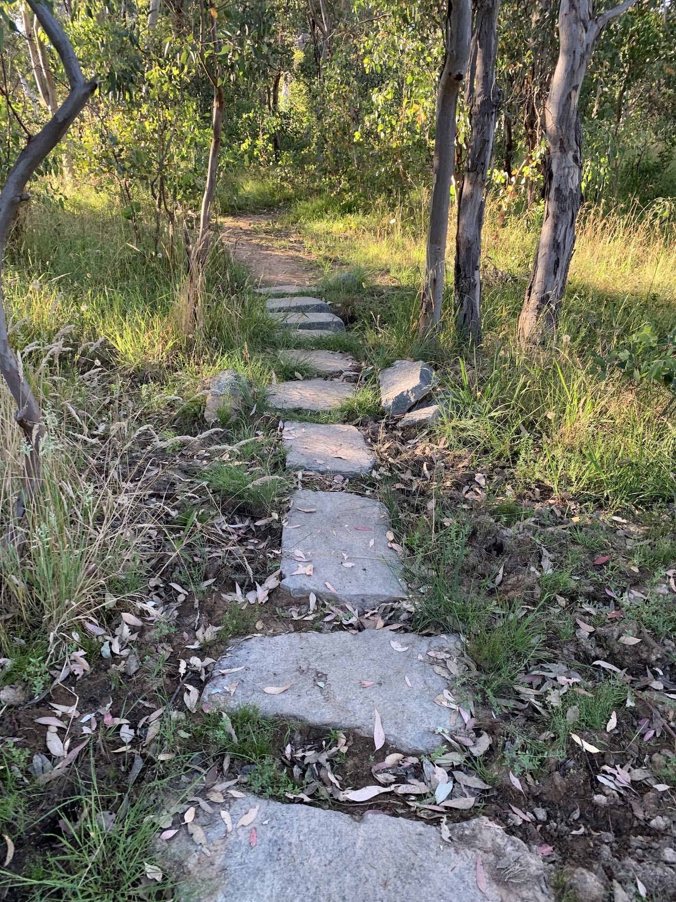
Signage at the start of Shepherds Walking Track
A delightful track of 3.4km passing through a range of vegetation. Here’s a couple of photos – check out the rest here.


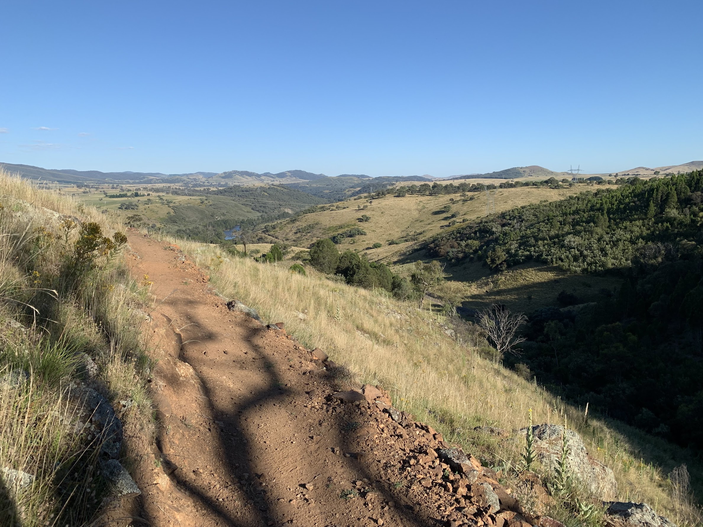
Eventually intersected with the familiar Shepherds Lookout Track. The usual spectacular Murrumbidgee River views.

Murrumbidgee River from Shepherds Lookout
From here, took the 3km return Molonglo Crossing Track down to the river. Poo-side views.

Lower Molonglo Water Quality Control Centre
Stopped at the Molonglo River as it was getting warm and I knew I’d have to walk back up what I’d walked down.
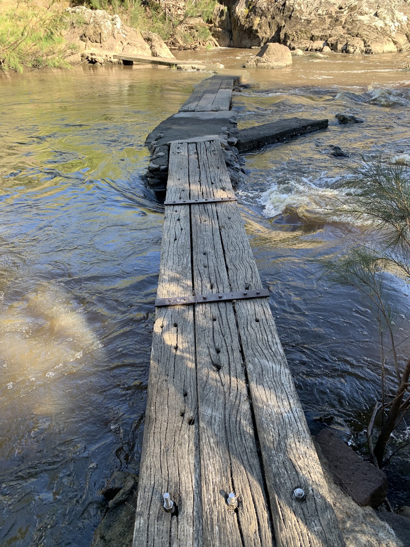
Molonglo River footbridge
The return trip was back the same, except for a short detour along the Shepherds Lookout Loop and a couple of opportunities to visit lookouts off the Shepherds Walking Track.
The first provided solid seating and great views.

Rock seat at lookout
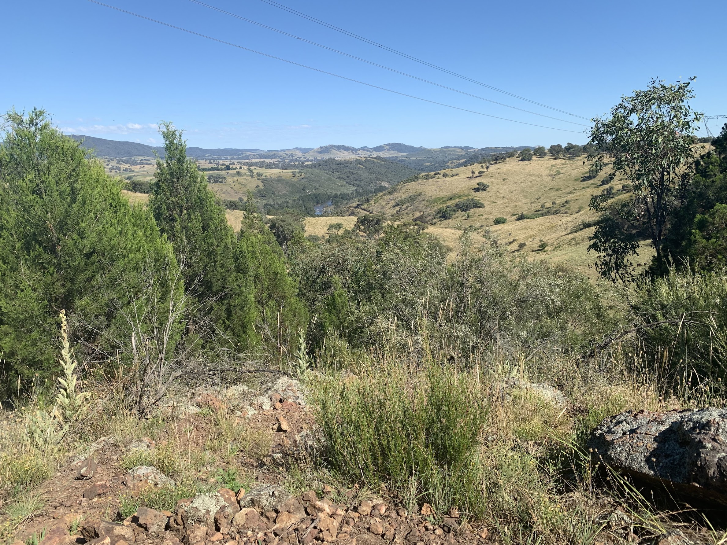
View from lookout
The next lookout was at a short detour to a magnificent eucalypt.

The grand old tree
A short parallel loop in the walking track provided more rock seats and views.

View from third lookout, Pig Hill in the distance
All in all, a great little track!
Track Map
The best track map is available via AllTrails.
From my GPSr recording on my old 2006 TopoView maps via OziExplorer you see:

Track map
Party
A recce, so just moi.
Louise Mackin
1 January , 2022 4:54 pmGreat to see you out walking again John! Was there a part of the footbridge still under water at the river?
Johnny Boy
1 January , 2022 4:56 pmHi Louise. Thanks for the encouragement although I’m a shadow of my former walking self. No, the footbridge was all above water. In the photo, the dip is a damp bit, but still above the water. Cheers. john
John hall
1 January , 2022 5:18 pmHi John, so glad that you tackled this fabulous walk today, with significant ups and downs and mileage. It looks as though you were rewarded with some great views and memories and obviously your fitness is continuing to head in the right direction. Take care my friend.
Johnny Boy
1 January , 2022 5:27 pmHi John. Thanks for your encouragement, in both word and deed. Cheers. john
Helen Cross
1 January , 2022 10:31 pmThanks for sharing – love the big old eucalypt!
Johnny Boy
1 January , 2022 10:34 pmHi Helen. It’s a beauty! The photo doesn’t do it justice. Well worth a walk in to see it. Cheers. john
Ming
2 January , 2022 2:19 amI definitely would have joined you if I knew you are doing this walk. I end up doing part of the Murrumbidgee discovery from pine island.
Will continue from Pine island to Kambah pool today. ( 2 jan 22)
Johnny Boy
2 January , 2022 9:09 amHi Ming. Sorry, it was a last minute decision to do this walk. Enjoy the Murrumbidgee track today! Cheers. john
Kath Hicks
2 January , 2022 1:09 pmGreat to see your blog pop up and looks like a lovely walk to take. Thanks again John 🙂
Johnny Boy
2 January , 2022 1:27 pmHi Kath. My geocaching map is looking decidedly green, rather than yellow! Cheers. john
Rob Taggart
5 January , 2022 8:42 pmGreat to see you back walking and posting on your blog John. Lovely to see the green tinge in the countryside
Johnny Boy
7 January , 2022 1:15 pmThanks for your encouragement Rob. Yes, the countryside is so green. Just back from the Nungar Plain, where I certainly learned my current limitations. Cheers. john