Johnny Boy's Walkabout Blog
... bushwalking in the ACT and nearby NSW
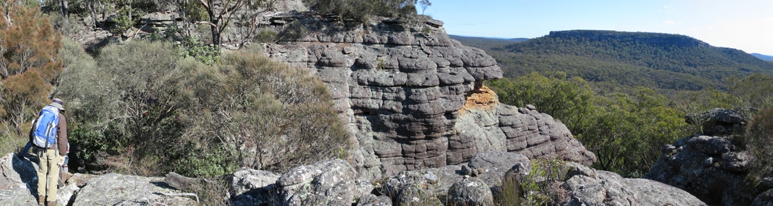
28 Jun 15 | The top of Binnari Pass to Quiltys Mountain, the Budawangs, Morton NP
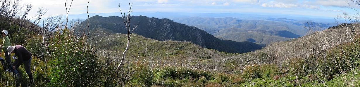
30Jun 15 | Views from north of Currockbilly Mountain over the source of the Yadboro River to Wirritin Basin and beyond to Pigeon House and the ocean, Budawang NP
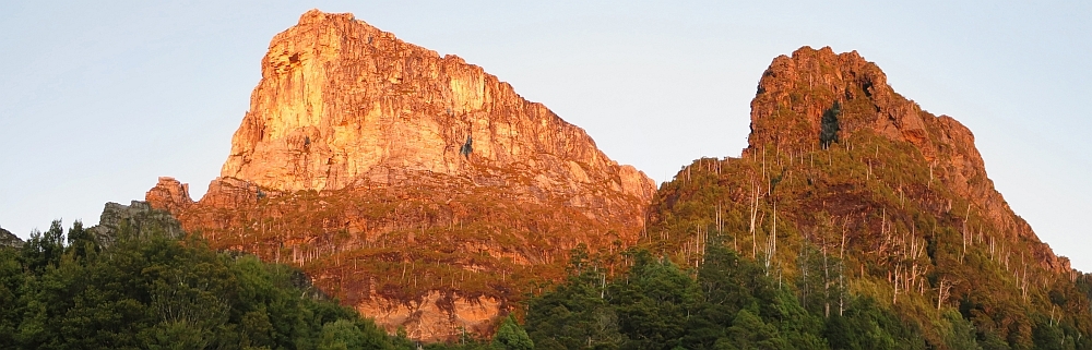
22 Apr 15 | Morning light on Frenchmans Cap and Lions Head, Tasmania
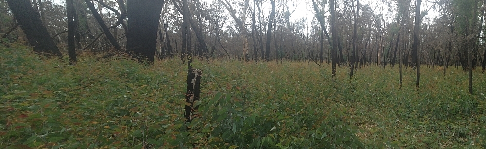
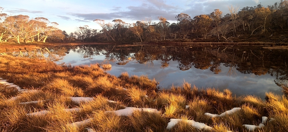
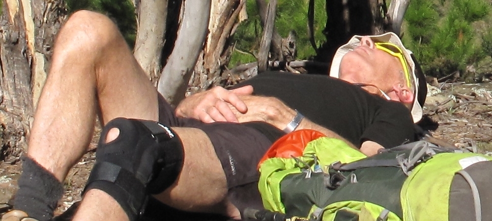
3 Mar 15 | Eucalyptus 'grass', Nadgigomar NR
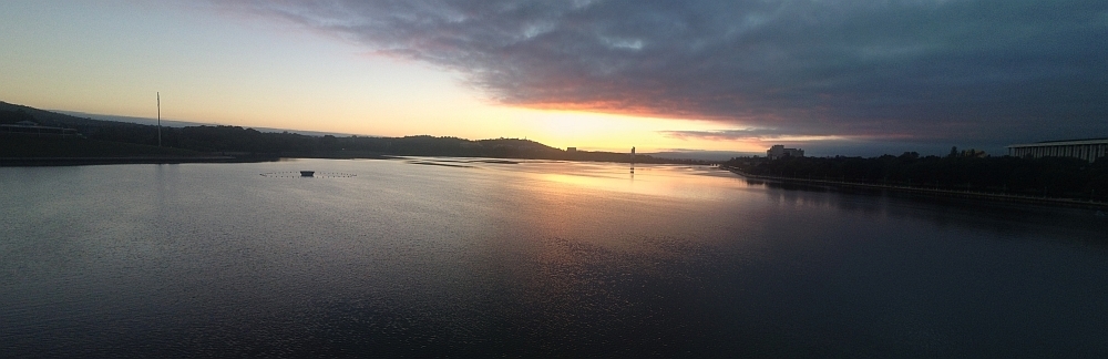
7 Feb 15 | Sunrise over Lake Burley Griffin at 6.30am, Canberra
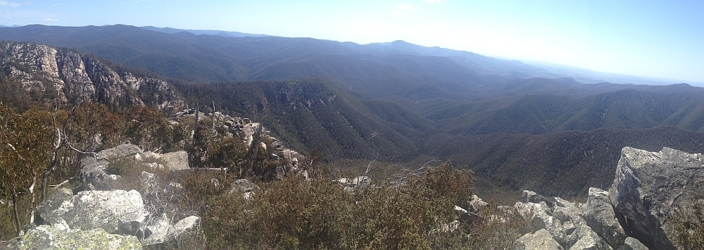
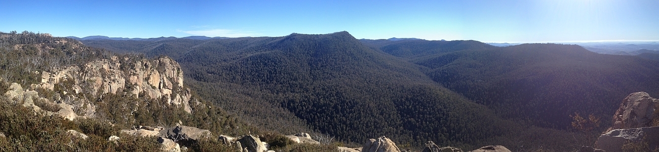
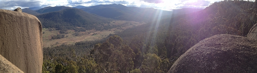
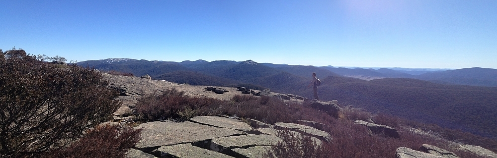
30 Sep 14 | Views down the south arm of Burkes Creek from The Pimple,NNP
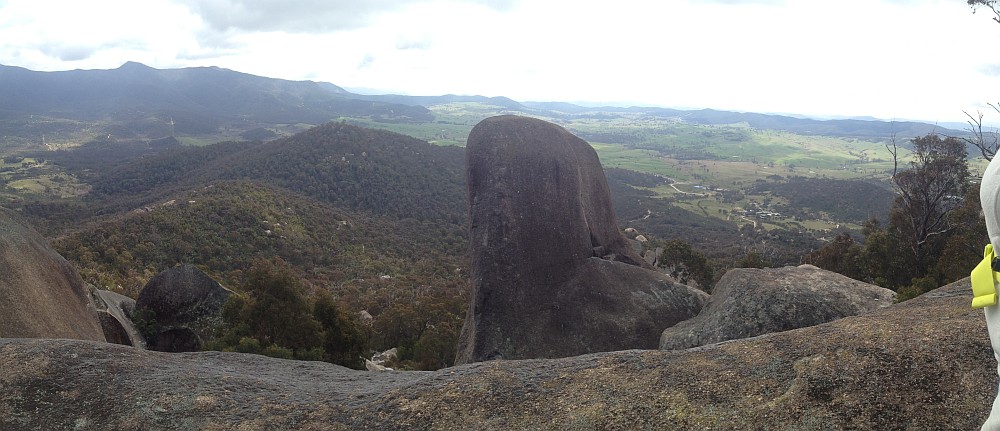
13 Sep 14 | Tidbinbilla Ridge, Mt Eliza and the main tor from Gibraltar Peak,TNR
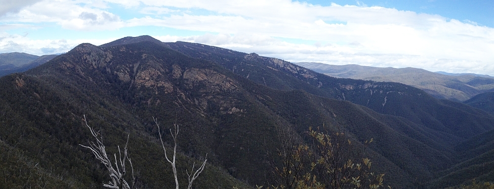
2 Sep 14 | View south to Johns Peak, Tidbinbilla Peak, Tidbinbilla Mountain and The Pimple, TNR and NNP
28 Jun 14 | Gooandra Homestead, KNP
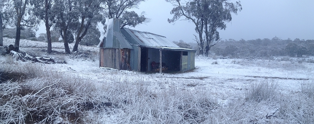
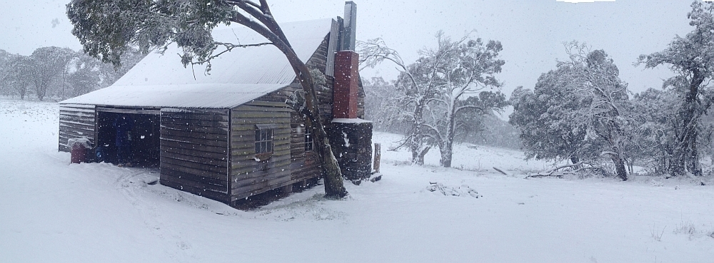
12 Jul 14 | Waterhole Hut, NNP
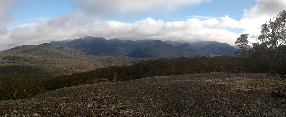
6 Jul 14 | Mt Gudgenby and the high hills of the Namadgi from Boboyan tor lookout, NNP
7 Jun 14 | Blue Gum Hill and the South Buttress of Booroomba Rocks from SH1353, NNP
24 May 14 | Orroral Valley from GC1XAJQ Ridge of Stone geocache, NNP
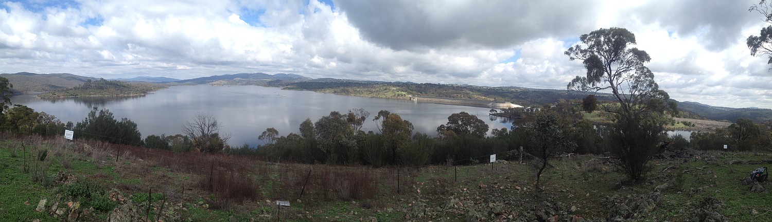
29 Mar 14 | Googong Dam from Googong Lookout, GF
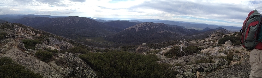
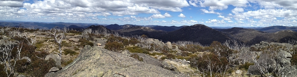
15 Mar 14 | Mt Namadgi, Rotten Swamp, Mt Burbidge, Bogong Gap, Gudgenby Grasslands and Yankee Hats from Mt Kelly, NNP
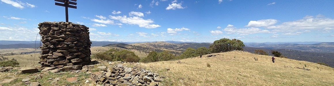
10 Aug 13 | Plains trig, Pri
13 Jul 13 | Scabby Tarn at sunset, NNP
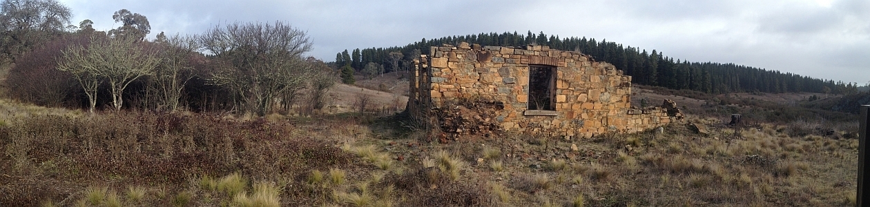
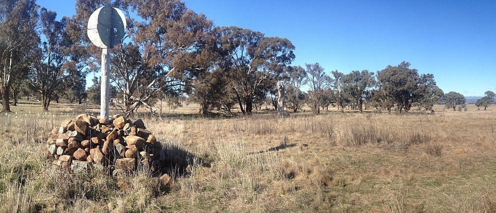
25 Jun 13 | Colliers homestead and orchard, Pri
8 June 13 | Webbs Ridge from Mt Coree, BNP
4 Jun 13 | Mt Moollattoo from the Carrialoo plateau, MNP
9 Sep 12 | Mt Gudgenby from granite slabs E of Sentry Box Mountain, NNP
10 Nov 12 | View south from Mt Namadgi, NNP
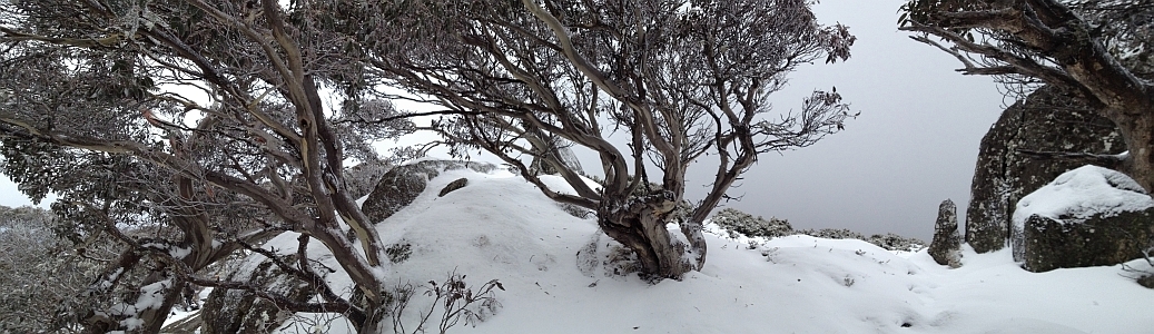
30 Jun 12 | Snow Gums at Mt Gingera, NNP
31 Jan 12 | Molonglo Ridge from Yarrow Pic, Pri
28 Jun 16 | Lunch on Mt Reedy (photo Barrie R), KF
| 205 | 27 Dec 07 | NNP: Mt Tennent | 13.0 | 780 | L/E; M(9) | Photos |
| 204 | 24 Dec 07 | ACTF: Dairy Famers Hill and Misery Point ! |
15.4 | 200 | M/E,X; E(6) | Photos |
| 203 | 18 Dec 07 | NNP: Burkes Creek and Pipeline Roads, Bendora Dam and Bendora Hut * |
22.9 | 600 | L/E,X; M(9) | Photos |
| 202 | 15 Dec 07 | NNP: Mt Kelly | 22.0 | 850 | L/R; H(14) | Photos |
| 201 | 11 Dec 07 | BNP: Brindabella Fire Trails | 25.5 | 1150 | L/E, H(13) | Photos |
| 200 | 4 Dec 07 | LMRCNR: Coppins Crossing to Uriarra Crossing * | 15.2 | 150 | M/M,X; E(7) | Photos |
| 199 | 27 Nov 07 | TiNR: North Tinderry region around SH1325 | 15.2 | 950 | L/R; H(13) | Photos |
| 198 | 24 Nov 07 | NNP: White Horse Rocks, Orroral Valley Lookout and Square Rock |
14.0 | 450 | M/M; M(9) | Photos |
| 197 | 20 Nov 07 | NNP: Dry Stone Walls above Glendale Crossing * | 9.1 | 550 | M/M-R,X; M(9) | Photos |
| 196 | 13 Nov 07 | NNP: Rock Flats | 18.6 | 900 | L/R,X; H(13) | Photos |
| 195 | 10 Nov 07 | NNP: Mt Namadgi via Middle Creek * |
24.0 | 850 | L/R,X; H(14) | Photos |
| 194 | 6 Nov 07 | NNP: Mt Franklin to Cotter River * | 13.0 | 1050 | L/R,X; H(14) | Photos |
| 193 | 4 Nov 07 | GNR: Parkway Ramble – De Salis Cemetery and William Farrer’s Grave ! | 4.5 | 50 | S/E; VE(3) | Picture |
| 192 | 30 Oct 07 | NNP: Coronet Peak | 28.1 | 1200 | L/R; H(14) | Photos |
| 191 | 27 Oct 07 | TNR/NNP: Bendora – Camels Hump Crossover * |
14.7 | 850 | L/R,X; H(12) | Photos |
| 190 | 14 Oct 07 | CNP: Parkway Ramble – Arawang Trig ! | 3.2 | 125 | S/E; E(4) | Photos |
| 189 | 13 Oct 07 | NNP: Tidbinbilla Western Slopes – Cow Flat Creek Cliffs |
7.4 | 500 | S/R; M(11) | Photos |
| 188 | 9 Oct 07 | TNR/NNP: Fishing Gap – Mt Domain – near Snowy Corner |
14.4 | 850 | L/M-R; H(12) | Photos |
| 187 | 14 Aug 07 | NNP: Lower Mavis Ridge * |
18.8 | 850 | L/R,X; H(14) | Photos |
| 186 | 11 Aug 07 | NNP: Hardy Range, Pierces Creek Falls and Pipeline Road ! | 22.9 | 950 | L/R,X; H(14) | Photos |
| 185 | 7 Aug 07 | NNP: Blue Gum Creek area |
13.5 | 800 | L/R; H(12) | Photos |
| 184 | 4 Aug 07 | BRNP: A guided tour to Calvary ! | 9.4 | 200 | S/E; E(6) | Photos |
| 183 | 31 Jul 07 | GPS Workshop * | ||||
| 182 | 31 Jul 07 | NNP: Mt Tennent and Tennent Homestead * | 12.3 | 850 | L/M-R,X; H(12) | Photos |
| 181 | 21-22 Jul 07 | NNP: Mt Kelly |
28.5 | 1050 | M/R; M(11) | Photos |
| 180 | 17 Jul 07 | Pri/NNP: Blythburn Cottage * |
23.3 | 750 | L/E-M,X; M(11) | Photos |
| 179 | 14 Jul 07 | BRNP: (Still looking for) Calvary site ! | 12.1 | 400 | M/E; M(8) | Photos |
| 178 | 3 Jul 07 | NNP: The Banks (Max and Bert’s) Hut * |
23.5 | 600 | L/E-M,X; M(11) | Photos |
| 177 | 30 Jun 07 | BRNP: South Bullen Range ! |
12.4 | 400 | M/M,X; M(8) | Photos |
| 176 | 26 Jun 07 | NNP: Stockyard Spur |
3.8 | 550 | S/M; E(6) | Photos |
| 175 | 23 Jun 07 | NNP: Emu Flat | 11.3 | 200 | M/M; M(8) | Photos |
| 174 | 13 Jun 07 | NNP: Square Rock ! |
8.2 | 250 | S/E; E(5) | Photos |
| 173 | 12 Jun 07 | NNP: Fire Trails in Uriarra Forest ! |
17.7 | 400 | L/E,X; M(8) | Photos |
| 172 | 5 Jun 07 | TNR/NNP: Cotter River from Fishing Gap * |
16.1 | 1100 | L/R,X; H(13) | Photos |
| 171 | 22 May 07 | GNR: Onyong Track and De Salis Cemetery at Tharwa * | 3.5 | 50 | S/E,X; VE(3) | Photos |
| 170 | 22 May 07 | NNP: The Bog Hut (Oldfields) * |
9.1 | 600 | M/M-R,X; M(9) | Photos |
| 169 | 15 May 07 | NNP: Cotter River below Corin Dam | 14.9 | 1000 | L/R,W,X: H(14) | Photos |
| 168 | 8 May 07 | NNP: South Namadgi Huts and Ruins * | 20.6 | 350 | L/E-M,X; M(10) | Photos |
| 167 | 1 May 07 | NNP: SE Rim of Tidbinbilla Nature Reserve ! | 15.9 | 900 | L/M-R,X; H(12) | Photos |
| 166 | 25 Apr 07 | NNP: Boboyan Trig Circuit | 12.0 | 400 | M/M-R; M(9) | Photos |
| 165 | 24 Apr 07 | NNP: 4 Peaks SE of Corin Dam Road from Woods Reserve ! | 12.4 | 800 | L/R,X; H(12) | Photos |
| 164 | 17 Apr 07 | NNP: Ginini Falls from Mt Franklin loop | 13.8 | 950 | L/R,X; H(13 | Photos |
| 163 | 10 Apr 07 | NNP: Mavis Ridge – Big and Little Creamy Flats – near Coronet Peak – AAWT * | 30.6 | 1350 | L/R,X; VH(15) | Photos |
| 162 | 7 Apr 07 | NNP: De Salis Knobs * | 23.8 | 800 | L/M-R; H(12) | Photos |
| 161 | 3 Apr 07 | NNP/TNR: W to E across Tidbinbilla Ridge | 14.3 | 950 | L/R,X; H(13) | Photos |
| 160 | 27 Mar 07 | NNP: Rock Flats * | 17.6 | 800 | L/R,X; H(13) | Photos |
| 159 | 17-19 Mar 07 | KNP: Cave Creek Canyon and Dead Horse Gap | 41.7 | 1050 | L/R; M(10) | Photos |
| 158 | 13 Mar 07 | NNP: SE Namadgi Huts * | 16.0 | 350 | M/M; M(10) | Photos |
| 157 | 10 Mar 07 | TNR/NNP: Fishing Gap – Smokers Gap crossover | 9.7 | 850 | M/R; M(11) | Photos |
| 156 | 6 Mar 07 | NNP: E of Smokers Trail, including SH1452 | 10.5 | 300 | M/M; M(8) | Photos |
| 155 | 10-18 Feb 07 | Tasmania: Eastern Arthurs and (for me, near) Federation Peak | ~67 | huge | S/R; H(14) | Photos |
| 154 | 6 Feb 07 | NNP: Hanging Flat from Stockyard Spur | 19.4 | 1200 | L/M-R; H(13) | Photos |
| 153 | 1 Feb 07 | CNP: Between Mt Majura and Mt Ainslie | 5.5 | 150 | S/E; E(4) | Photos |
| 152 | 30 Jan 07 | BSRA: Bungonia – Trestle Track, Tolong Chimneys and Blockup Gorge * | 9.1 | 350 | M/M; E(7) | Photos |
| 151 | 23 Jan 07 | TiNR: Gulwan Heights and a search for The Onion | 14.8 | 900 | L/R,X; H(13) | Photos |
| 150 | 18 Jan 07 | CNP: Mulligans Flat | 9.0 | 100 | S/E; E(5) | Photos |
| 149 | 16 Jan 07 | NNP: Billy Range and Brandy Flat Hut * | 14.9 | 600 | L/E-M,X; M(10) | Photos |
| 148 | 9 Jan 07 | NNP: Emu Flat and upper Blue Gum Creek from Smokers Trail ! Pri: William Farrer’s Grave ! | 12.61.5 | 50050 | M/M,X; M(10)S/E; VE(3) | Photos |
| 147 | 6 Jan 07 | NNP: Square Rock, Orroral Valley Lookout, McKeahnie Trig and Smokers Trail ! | 19.5 | 850 | L/E-M-R; H(12) | Photos |
| 146 | 4 Jan 07 | ACTF: Kowen Forest | 9.7 | 250 | M/E; E(5) | Photos |
| 145 | 2 Jan 07 | NNP: The Ridge of Stone * | 5.2 | 150 | S/E; E(5) | Photos |