
Happy walkers on NmC105
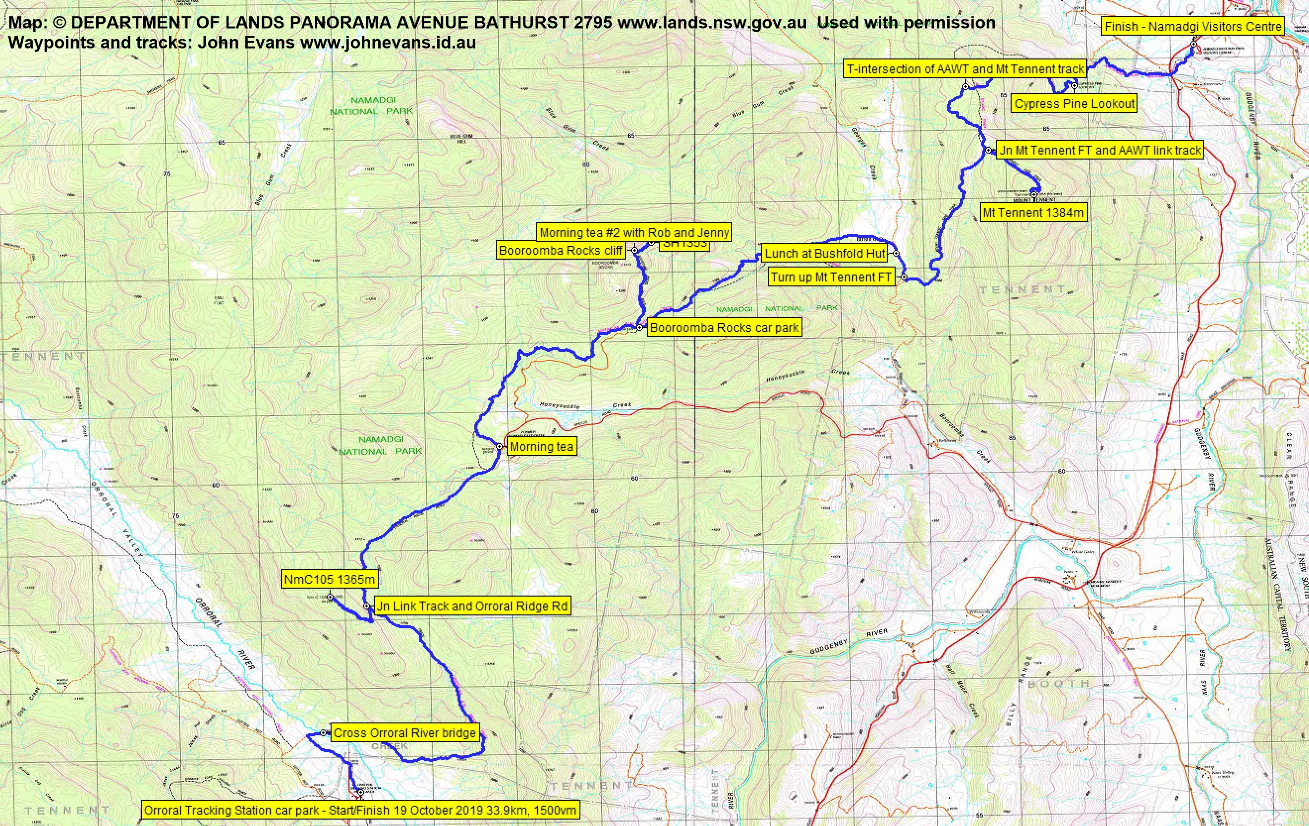
Saturday 19 October: CBC Annual Worn Boot Bash – L/E. The annual Worn Boot Bash has a history extending back to 2002. It is defined by “around 30km and a few hills”, so don’t be fooled by the E(asy) terrain rating. This year we will walk the last long day of the Australian Alps Walking Track, from Orroral Valley to Namadgi Visitors Centre. Hills include NmC105 at the collimation tower site on the Ridge of Stone, SH1353 above the Booroomba Rocks cliffs and Mt Tennent. An early start! Around 33km and 1500m climb. Maps: Corin Dam and Williamsdale. Leader: John Evans 0417 436 877 john@johnevans.id.au . Transport: ~$20 (multiple vehicles for long car shuttle).
Further Information
The history of CBC’s annual Worn Boot Bash is here.
Summary
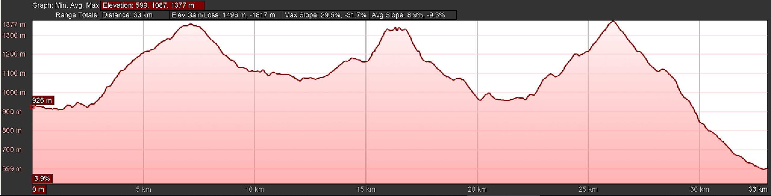
Distance: 33.9km | Climb: 1500m | Time: 7.00am – 5.10pm (10hrs 10mins), including 55 mins of breaks | Grading: L/E; H(13)
Photographs
Photographs are available, where you can start a large sized slideshow.
Waypoint and Track Files
Download the gpx file for this trip (if your browser does not automatically download the file, it will open the gpx file in a new window and you can then save it). To use in Google Earth, do File, Open… and select Gps or All files as the File Type.
Track Notes
Rob and Jen stayed out at Orroral on Friday night and got an early start. Unlike previous years, we did manage to catch them during the day!
My transport arrangement held up well until after we finished, when I realised I had one car too many at the Namadgi Visitors Centre to ferry walkers back to Canberra – but I guess better than one car shy.
The forecast for the day was a maximum of 19°C, perfect for walking. But very strong winds, which made it difficult to keep out feet on the ground at the high points.
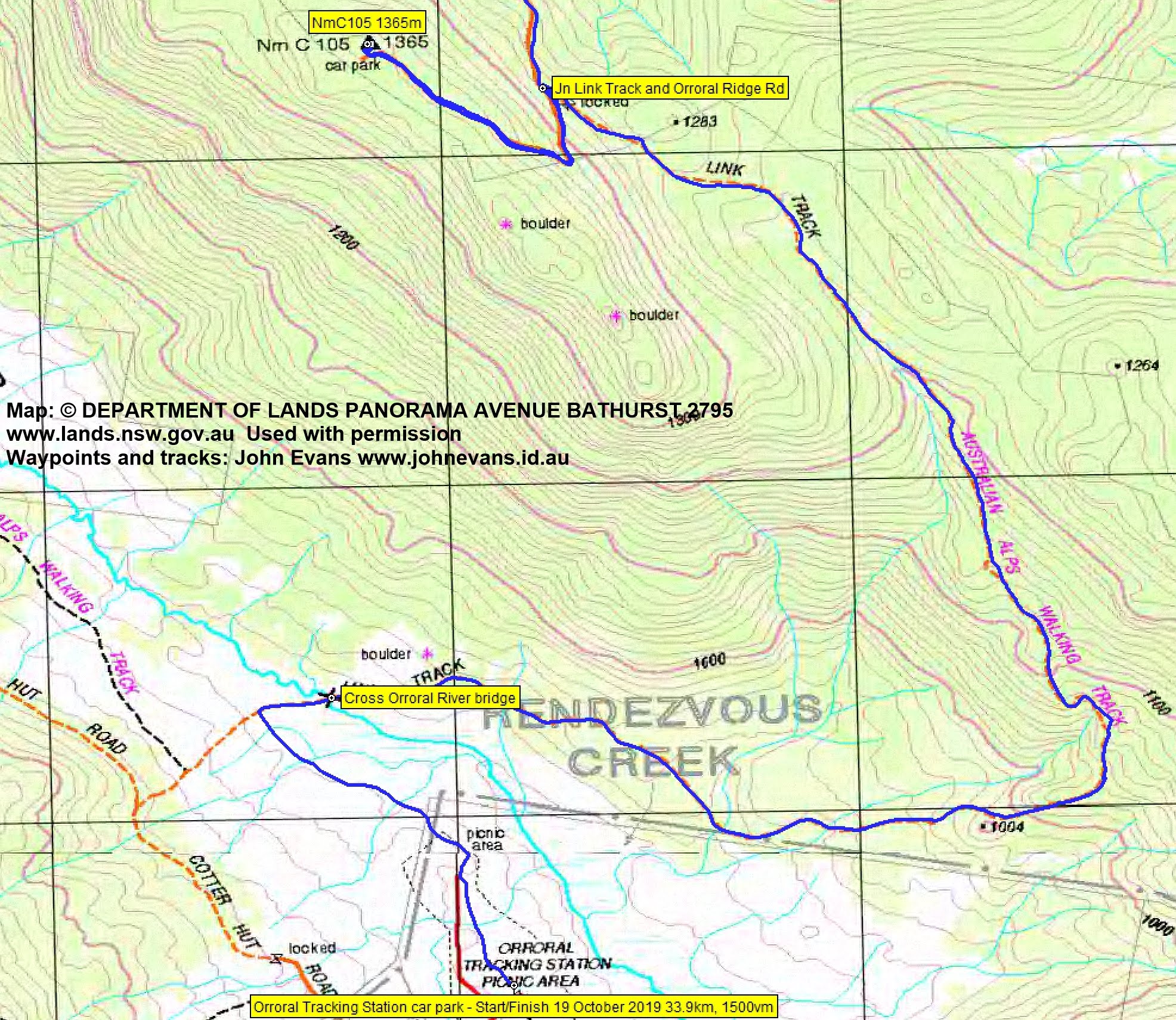
Away from Orroral at 7.00am. Over to the Orroral River bridge, then the steep climb up the Link Track and so on to the Orroral Ridge of Stone car park and the nearby NmC105. 7.3km in 1hr 45mins.
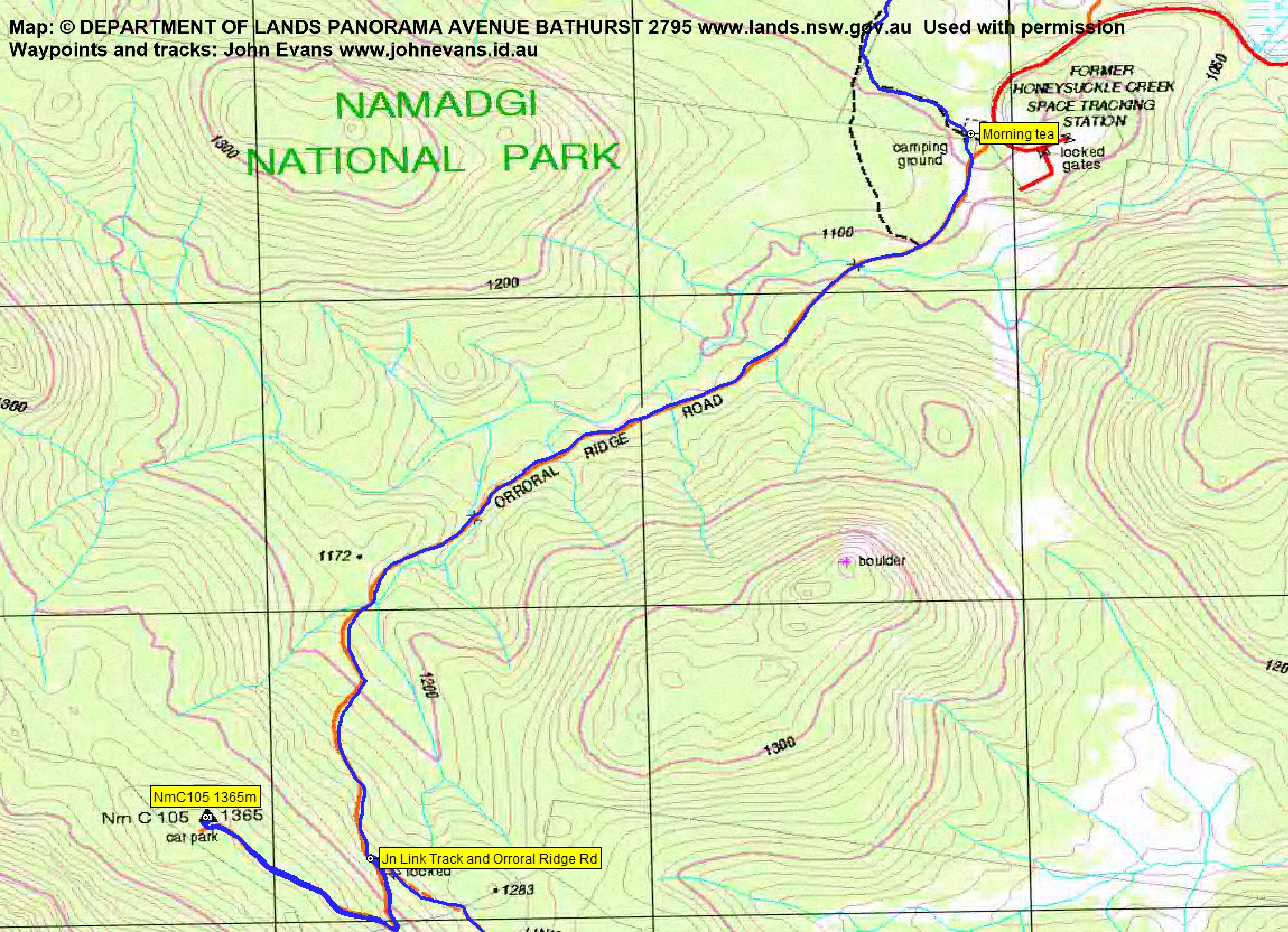
From there, a downhill section of 4.1km in 50mins to morning tea at Honeysuckle Creek camp ground.
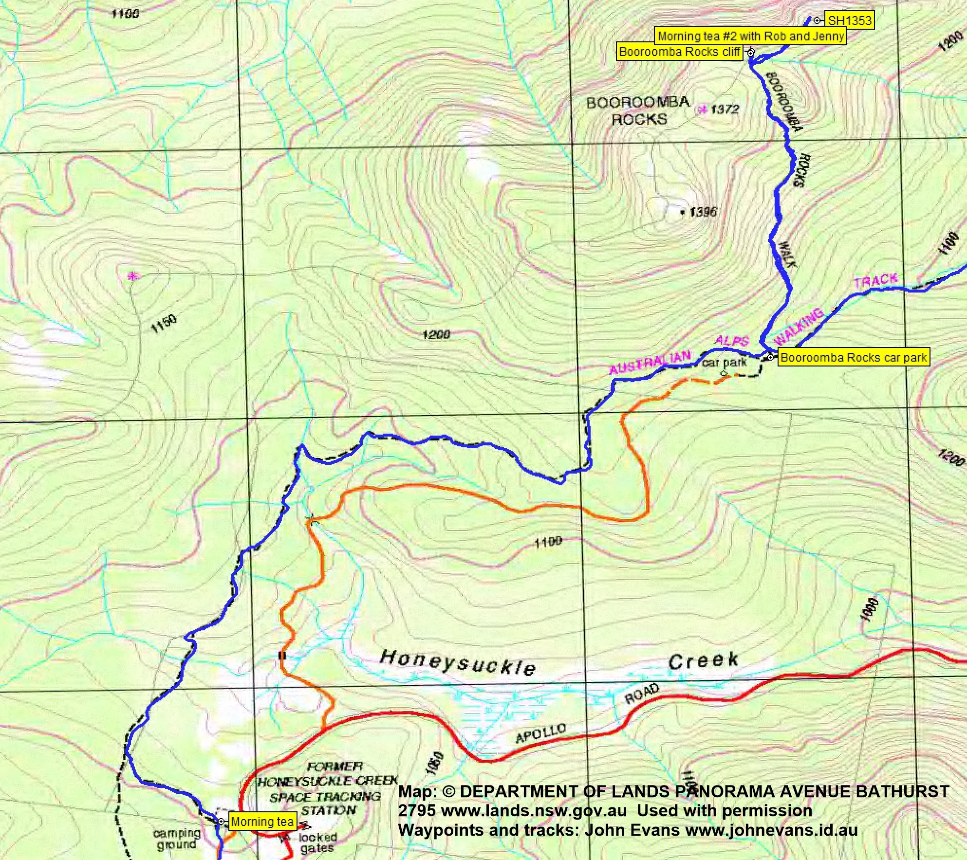
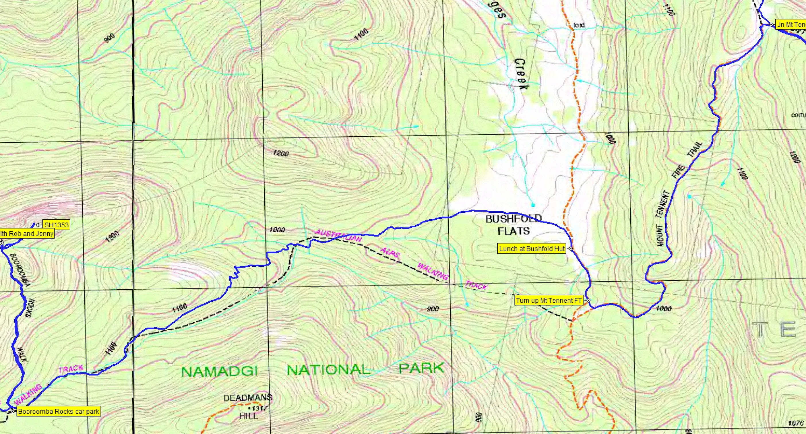
Next, a flat-ish section along the AAWT to Booroomba Rocks car park, then up to the Booroomba Rocks cliff. 5km in 1hr 25mins. Here we met Rob and Jen having morning tea, so we did a morning tea #2.
From here, we ascended SH1353 for a second hill. Nearly got blown off!

Heading up to the wind ravaged SH1353 above Booroomba Rocks
Nearly got blown off!
Then back down to the car park. 1,8km in 50mins. Some nice grevillea beside the narrow pads down from SH1353.

Grevillea beside the footpad coming down from SH1353
We continued to enjoy the down to lunch at Bushfold Hut. 4km in 55mins.

Lunch at Bushfold Hut
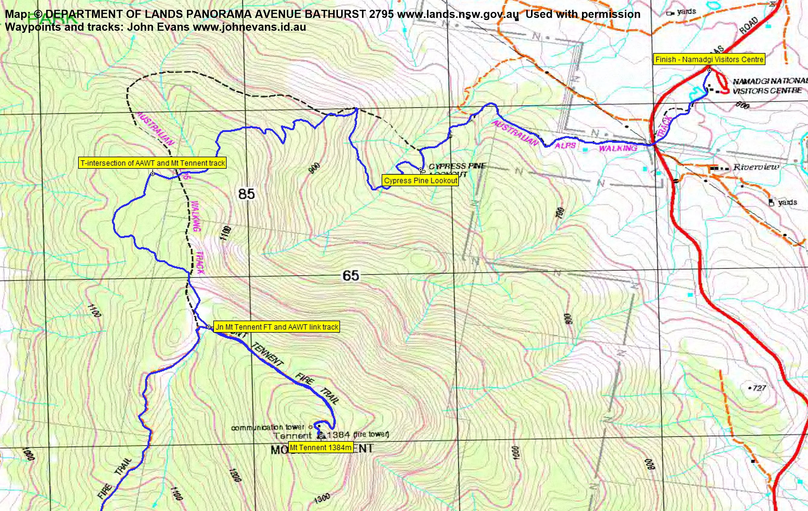
We could see our final hill up above and those who had previously walked the Mt Tennent Fire Trail whimpered (at least I did). From lunch to the top was 4.4km in 1hr 30mins. A windswept stop.

Still happy at Mt Tennent
Always great views.

View SW from Mt Tennent
All over bar the shouting now, except for the run down the hill. 7.1km in 2hrs 15mins.
An echidna was spotted.

Echidna beside the Mt Tennent Walking Track | photo Lucy
And some nice track side colour.

Colour beside the Mt Tennent Walking Track
Great company and conversation. Well done all!
Track Maps
Track overview
Track 1
Track 2
Track 3
Track 4
Track 5
Profile
Party
11 walkers – Cynthia B, Lucy E, Kirsty G, Roger H, Jenny H, Rob H, Ming L, George P, Llewellyn S, Ian W, me.
Kirsty
20 October , 2019 9:08 pmBest walk yet John!! Thanks so again. You are patient & tolerant & your encouragement & company spurred me on. Catch you out there again soon !
Johnny Boy
21 October , 2019 7:59 am🙂