
Taking a photo of someone taking a photo from the Mt Orroral top marker | photo Shell D
Saturday 17 August 2019: Orroral Hill – M/R. Walk the Granite Tors track to the Geodetic Observatory, then off track to Orroral Hill (1609m) through scrub and tors as big as houses. If conditions allow, a visit to cache GCT0D4 and the alpine garden. A steep, challenging walk. Leader: Shell D.
Further Information
Orroral Hill (Mt Orroral) at 1609m is the 15th highest named hill in the ACT. Last time for me up here was 8 Oct 16.
Summary
Distance: 12.2km | Climb: 700m | Time: 7.45am – 2.50pm (7hrs 5mins), including 75 mins of breaks, views and unsuccessful caching | Grading: M/R; H(12)
Photographs
Photographs are available, where you can start a large sized slideshow.
Video
Waypoint and Track Files
Download the gpx file for this trip (if your browser does not automatically download the file, it will open the gpx file in a new window and you can then save it). To use in Google Earth, do File, Open… and select Gps or All files as the File Type.
Track Notes
We met at 7am opposite my old folks home. Not a bad sunrise/moon set.

Sunrise at the meeting place
Motored to the Orroral Valley Tracking Station car park. Walking by 7.45am. A bit chillier than in town.
Wandered up the Granite Tors Walking Track. Interested to see a lot of track maintenance has been done – new surfacing. A stop overlooking James Creek to appreciate the sound of running water and the view down.

Looking down into James Creek from the Granite Tors Walking Track
A bit of snow on the upper parts of the track.

Junction of the new and old Granite Tors Walking Track
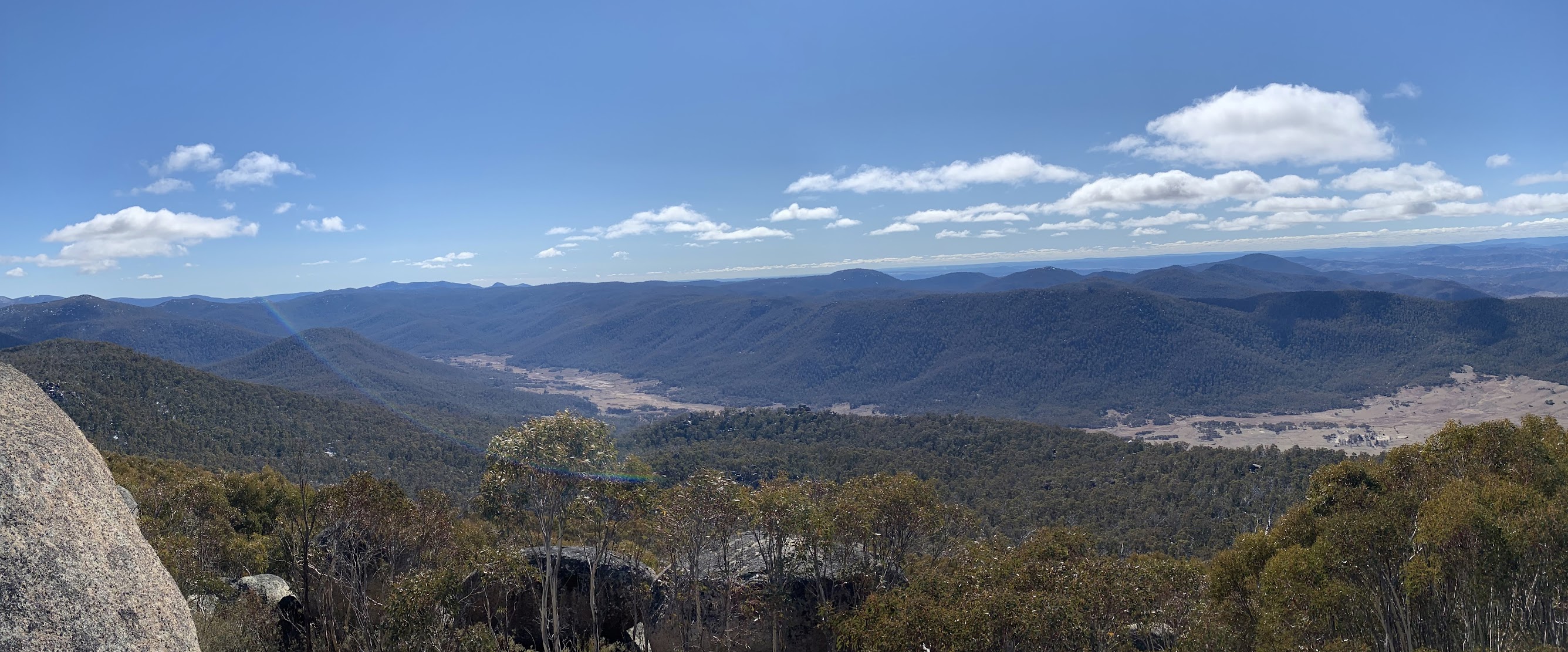
Arriving at the Geodetic Observatory, we had a look around inside, then morning tea next to it with views over the Orroral Valley.

Inside the Geodetic Observatory

View over Orroral Valley
We then climbed up to Mt Orroral, passing through some snow on the way.

Climbing towards Mt Orroral at 1340m

Climbing towards Mt Orroral at 1420m

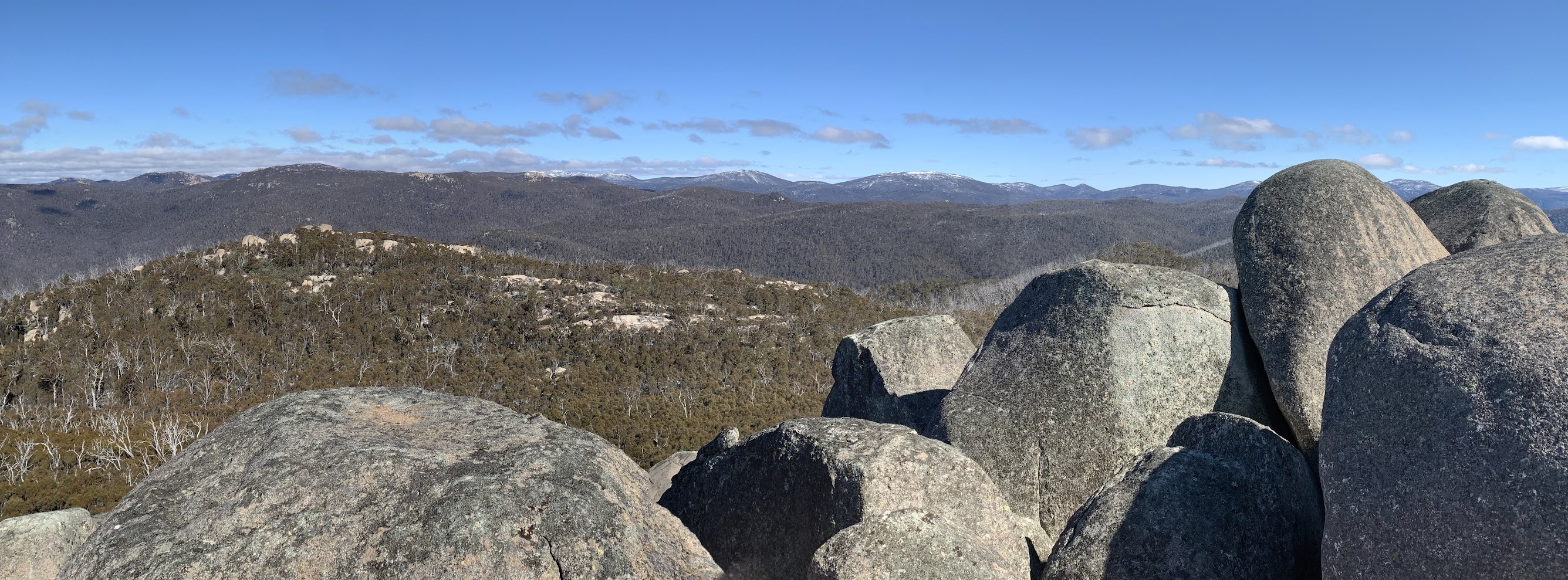
A slab with a view at 1580m
We climbed onto the slabs and battled through the saplings on the crest. Round on the west side, we then scrambled through the cavern and up onto the top marker pipe.

Walking through the cavern near the top of Mt Orroral | photo Nicole B
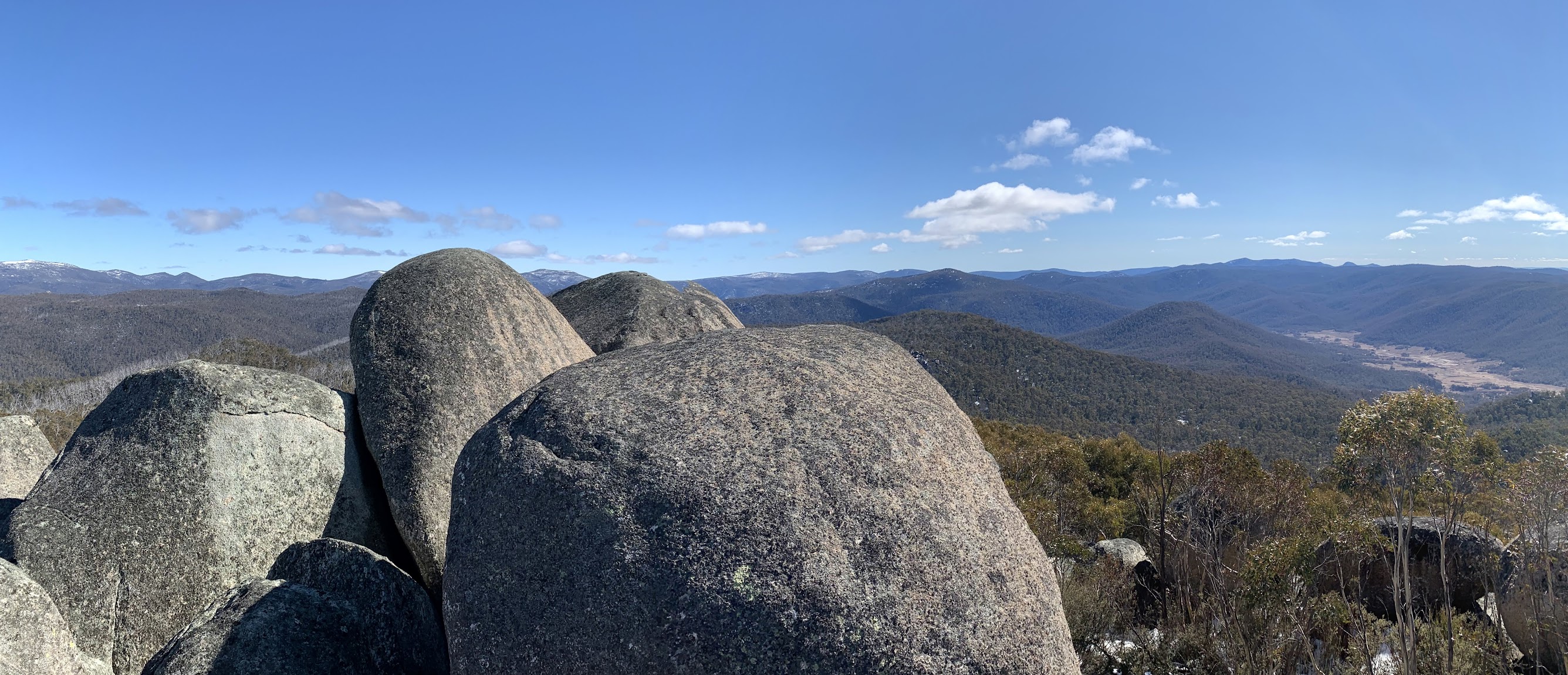
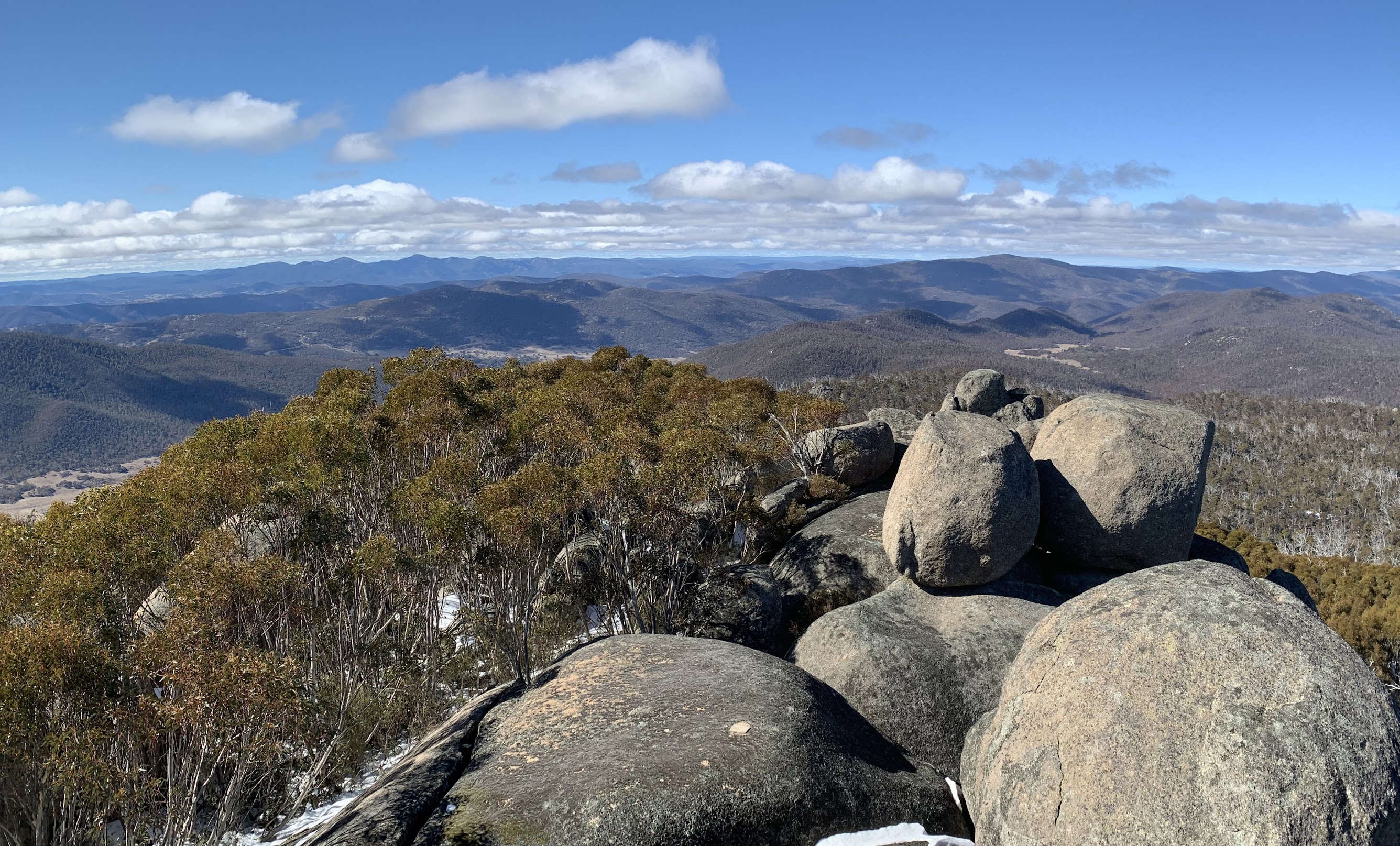
Wonderful views all round.
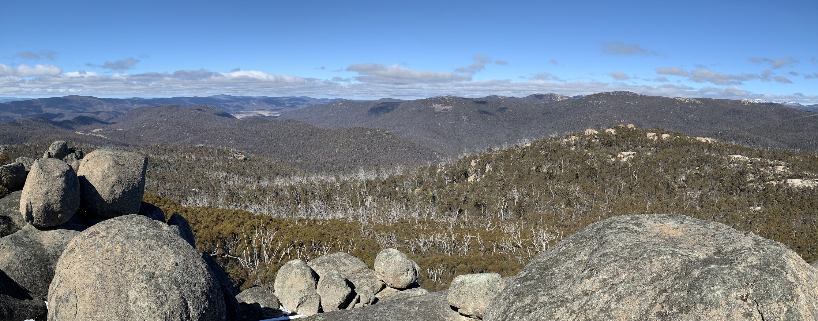

Most scrambled up for the views.

Clambering up to the Mt Orroral top marker

Mt Morgan, Mt Murray and Little Bimberi from Mt Orroral
We spent a long time looking for the geocache GCT0D4 Between a rock and a high place (which I’d logged in 2016), but not found today.
Lunch, then the return down the hill.
A quick break at the Geodetic Observatory, then along the new part of the Granite Tops Walking Track.

The new part of the Granite Tors Walking Track
A log of geocache GC8C11C Geodetic Granite.
Then further along through the great tors.

Tors above the new part of the Granite Tors Walking Track
Down to rejoin the original track which, as I said, has been resurfaced.

New surfacing on the old part of the Granite Tors Walking Track
A great day, thanks Shell and all.
Track Map
Track

Party
8 walkers – Meghan B, Nicole B, Luisa D M, Shell D (leader), Beat O, Justin S, Diana T, me.