
The weir
Friday 16 August: Sutton Rd and Poppet Hill geocaching – S/M. Drive-by geocaching and a little stroll into Poppet Hill. Leader: Roger E.
Further Information
I wasn’t going to publish this little ditty, but then thought someone may be interested in our approach to Poppet Hill.
Summary
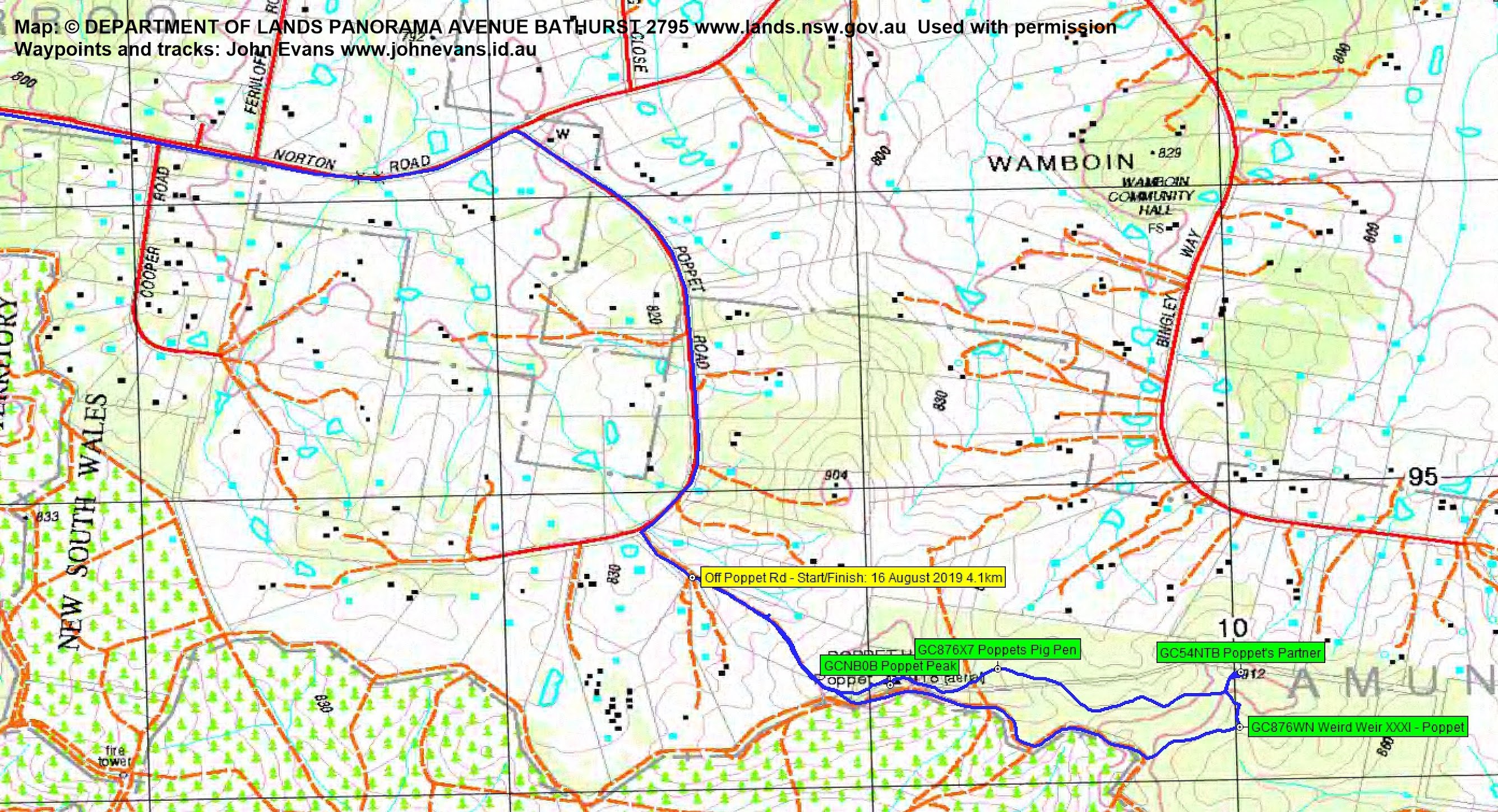
Distance: 4.1km | Climb: 130m | Time: 11.00am – 12.35pm (1hrs 35mins), including 20 mins of breaks | Grading: S/M; E(6)
Photographs
Photographs are available, where you can start a large sized slideshow.
Waypoint and Track Files
Download the gpx file for this trip (if your browser does not automatically download the file, it will open the gpx file in a new window and you can then save it). To use in Google Earth, do File, Open… and select Gps or All files as the File Type.
Track Notes
The day yielded 59 geocaches for me. My contribution was to drive, whilst the others jumped in and out to log the caches.
The only area of real interest was the Poppet Hill area with its 4 caches. We drove in off the Sutton Rd on Norton Rd, then along Poppet Rd and off it. Here, next to a house we found an unlocked gate, no private property sign, most likely a power line access track. We walked up it to Poppet Hill.
4 great caches, including one at a weir!! Now I have an interest in the Brindabella weirs, but who would have thought this structure was up here? Obviously Tankengine, the cache owner, did!

Markings on weir
(BTW, if anyone thinks our access was via private land, let me know and I’ll remove this.)
Lots of carefully edged walking tracks around the Hill; could be a place to revisit.
Track Map
Track
Party
3 walkers – Roger E (Marmaduke Rothschild) (leader), Diana T (contesta), me (JohnnyBoyACT).