Enjoying the view from the top of The Spinnaker
Saturday 22 June: Winter solstice on the Spinnaker – M/M/X. Welcome the turning of the year on the Spinnaker and its ridge. From Honeysuckle camp ground explore the open space ~2km to the south and then climb the Spinnaker ridge and head north to the rock itself. Return via the AAWT track to the cars. some rough patches of scrub and boulders, plus nice woodland. Map: Corin Dam. Leaders: Rob and Jenny H.
Further Information
CBC has a bit of a (good) problem at the moment – increasing membership, lots of people booking on walks, not enough walks!
Summary
Distance: 6.2km | Climb: 300m | Time: 9.00am – 1.25pm (4hrs 25mins), including 45 mins of breaks | Grading: S/M-R; M(9)
Photographs
Photographs are available, where you can start a large sized slideshow.
Waypoint and Track Files
Download the gpx file for this trip (if your browser does not automatically download the file, it will open the gpx file in a new window and you can then save it). To use in Google Earth, do File, Open… and select Gps or All files as the File Type.
Track Notes
A meet in Kambah and Lanyon, then motored to the Honeysuckle Camping Ground.
After a trip briefing, away across the back of the shelter to join the Orroral Ridge Rd, along it for a few hundred metres, then onto the fire trail that rises to the tanks. At the appropriate spot we turned onto the well developed footpad that goes up to the saddle to the east of The Spinnaker.

Walking the footpad from the fire trail to the saddle below The Spinnaker
‘Sun dial rock’ was pointed out.

‘Sun dial rock’ in the saddle below The Spinnaker
A great surprise to me (because I hadn’t read the walk description carefully) as we continued over the saddle and down the gully to the south for a while.

Walking south from the saddle
Then it was a climb to the north of west up towards the ridge-y top that contains the top of The Spinnaker.

Climbing at 1280m contour just before morning tea
Morning tea around 10.30am on the way.

Morning tea
We finished the climb and came to the back of the tors that guard the entrance to the top of our objective. We entered via a bit of a cavern.

Scrambling through the guardian tors at the back of The Spinnaker
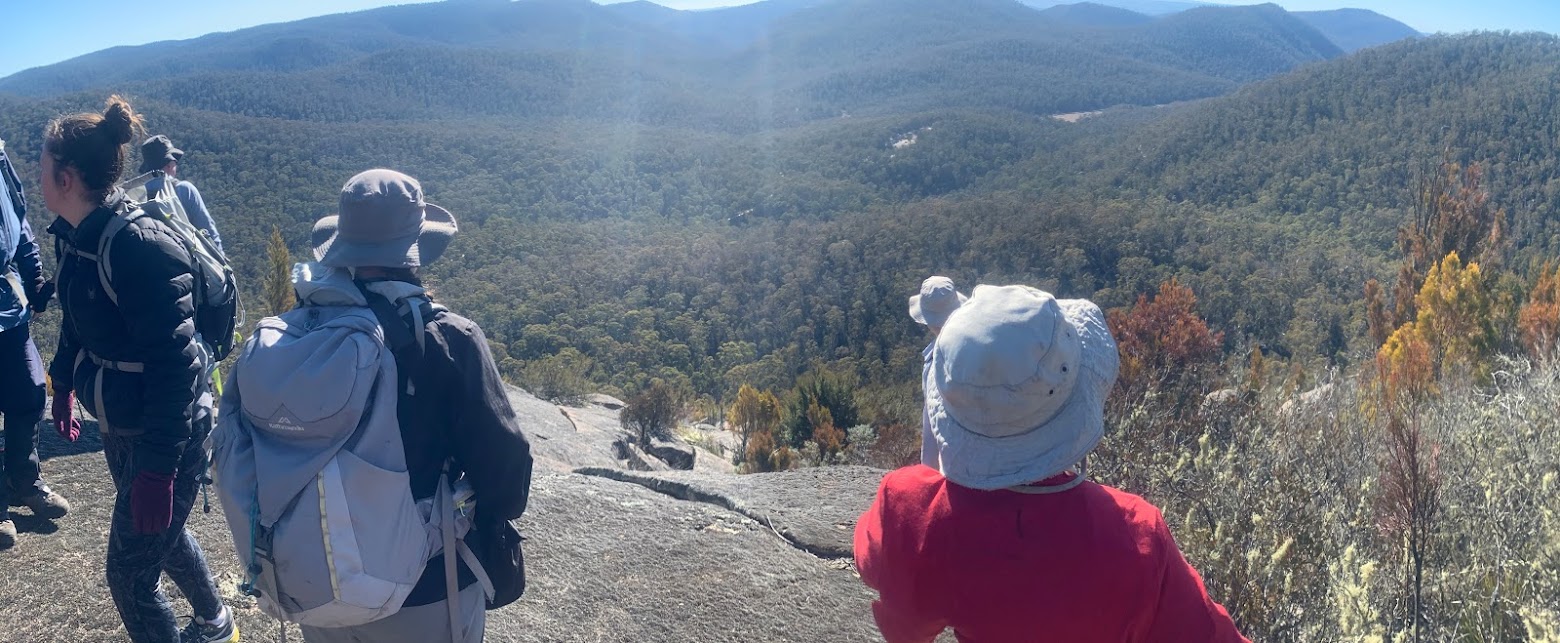
Out to the great view. So good, in fact, that we sat in the sun and had an early lunch. Di found a geocache.
Again, the descent was a surprise to me and a way I’ve never been before. Rob backed out a little and found the top of a clear (ie. not cliffs, tors or boulders) descent to the NW. After a few hundred metres there were some tapes leading us down through boulders.

Tapes
They bent off to the right and we went below them for a while.

More tapes, but we went below them for a while
But we struck them again and followed the taped, developing footpad down to come out on Orroral Ridge Rd.

Back on the taped route, developing into a footpad
The point was marked with a rock stack.

Rock stack marking the pad joining Orroral Ridge Rd
A stroll back along the road to the cars, with views back up to The Spinnaker.

The Spinnaker from Orroral Ridge Rd
Di picking up another cache. I think she’s hooked!
Lovely little trip, thanks Rob and Jen. And a great party.
Track Maps
Track

Tapes

Party
16 walkers.