
View over the Gudgenby grasslands from near geocache GCA66CK Gudgenby Tor
Saturday 25 May 2024: Middle Creek Explore * – M/R,ptW. Let’s explore the beginning of the route to Mt Namadgi. From the Yankee Hat car park, walk the track to the burnt bridge over Bogong Creek. A couple of hundred metres downstream there’s a crossing point near the confluence with Middle Creek. Walk the Gudgenby grasslands and cross Middle Creek at the indigenous rock shelter. Handrail up the creek through regenerating scrub as far as we want/have time to go. Return the same way. Around 16km and 350vm.
Summary
From Garmin Connect (recorded on MAP66i) – Distance: 20.63km | Climb: 410vm | Time: 5:48 moving +2:30 of stops = 8:18 | Grading: L/E-R,ptX,W; H(12).
Photographs
View photographs here.
gpx file
Download the gpx file here.
Track Map
Here’s where we went.

Track Middle Creek Explore on TopoView 2006

New tracks on 8626-1S Rendezvous Creek from SIX
Trip Report
It’s been nearly 6 years since I went up Middle Creek to Mt Namadgi on 17-18 Nov 18. It was so good to get back off-track walking in the Namadgi for nearly half the day!
Today was the first day this part of NNP was reopened after feral animal control. We were prepared for a long walk in if the gate just off Bobeyan Road was still locked. Huge thanks to the Ranger who must have been out prior to 7am to open the gate! We were able to start as planned from Yankee Hat car park.
Away at 7.55am, chasing a CBC party on a 3-day pack walk to Mt Namadgi who were 30 minutes ahead of us. We saw them in the distance on the Gudgenby grasslands and exchanged a couple of inReach messages to report on progress during the day.

High hills from Yankee Hat car park 7.50am
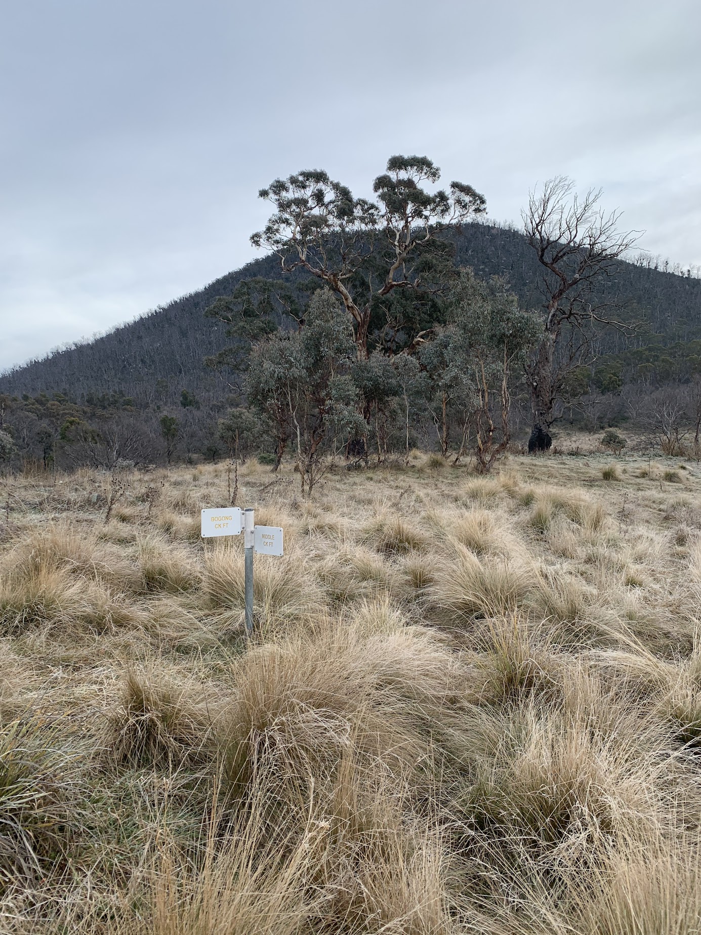
No bridge across Bogong Creek, burnt in 2020.

Bogong Creek bridge site
We followed the footpad downstream to just before the confluence of Middle Creek and Bogong Creek (which forms the beginning of the Gudgenby River), looking for the crossing plank. Is it gone? A couple of wet steps and we were out on the Gudgenby grasslands.
We joined the old vehicle track that runs into the mouth of Middle Creek.
Track junction below the S end of the Mavis Ridge
The vehicle track provides a quick entrance up Middle Creek.

The old vehicle track into the mouth of Middle Creek
It peters out on the other side of Middle Creek from the indigenous rock shelter. We crossed the creek on stones, so dry feet, and popped round the corner of the shelter.
I’ve gotten into so much trouble posting photos and locations of indigenous sites, so here’s my photo.

Signage at the Middle Creek rock shelter
We stopped for a water break and to shed some layers. 5km in 1:10 to here.
From here, I was living my dreams. A bit up from the creek, we handrailed it up for another 3.4km in 2:00. Relatively easy walking with a plethora of animal tracks to choose from. The going a little tighter as we crossed the side feeder creeks. The hills beckoned, but I know I will never walk up further again.

Burbidge and Mt Namadgi from S of Cross side creek 2
The chosen ‘Lovely Spot’ was not quite as good as I remembered. I think I waypointed this on a previous return trip from Mt Namadgi – when indeed it was lovely relief. Smoko was called here at 11.05am.
Our return was generally higher and seemed a little more scrubby. We had a ‘Nice Spot’ provided by Dick and Lena on the creek. Indeed it was.

Middle Creek at DM-LO Nice Spot
The creek gurgled away.
Back down to the indigenous shelter for a well deserved lunch, arriving at 1.40pm. So we had around 7.2km in 4 hours 30 minutes in my beloved Namadgi scrub. Sweet!
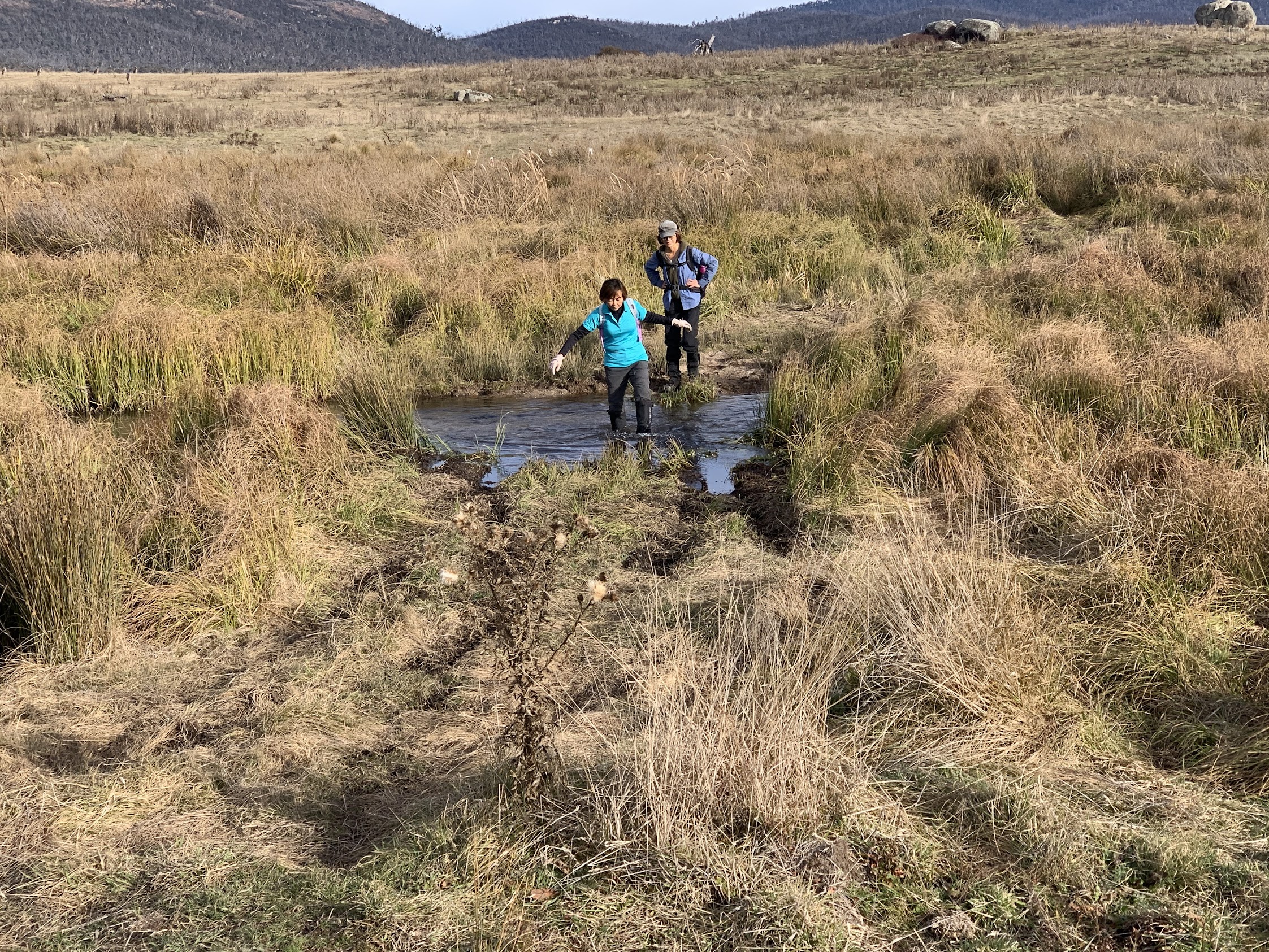
The final 7.7km of the trip took us back across Middle Creek and out the track.

Lam crossing Middle Creek just after lunch
We passed Jack Rustin’s hut site and possible grave.

J Rustin’s hut site and possible grave
On down the Middle Creek Track and across the concrete ford.

Concrete ford over Middle Creek
Another ford is needed across the secondary branch of the creek!
Middle Creek needs another ford near the concrete one
On up a rise to find and log geocache GCA66CK Gudgenby Tor.
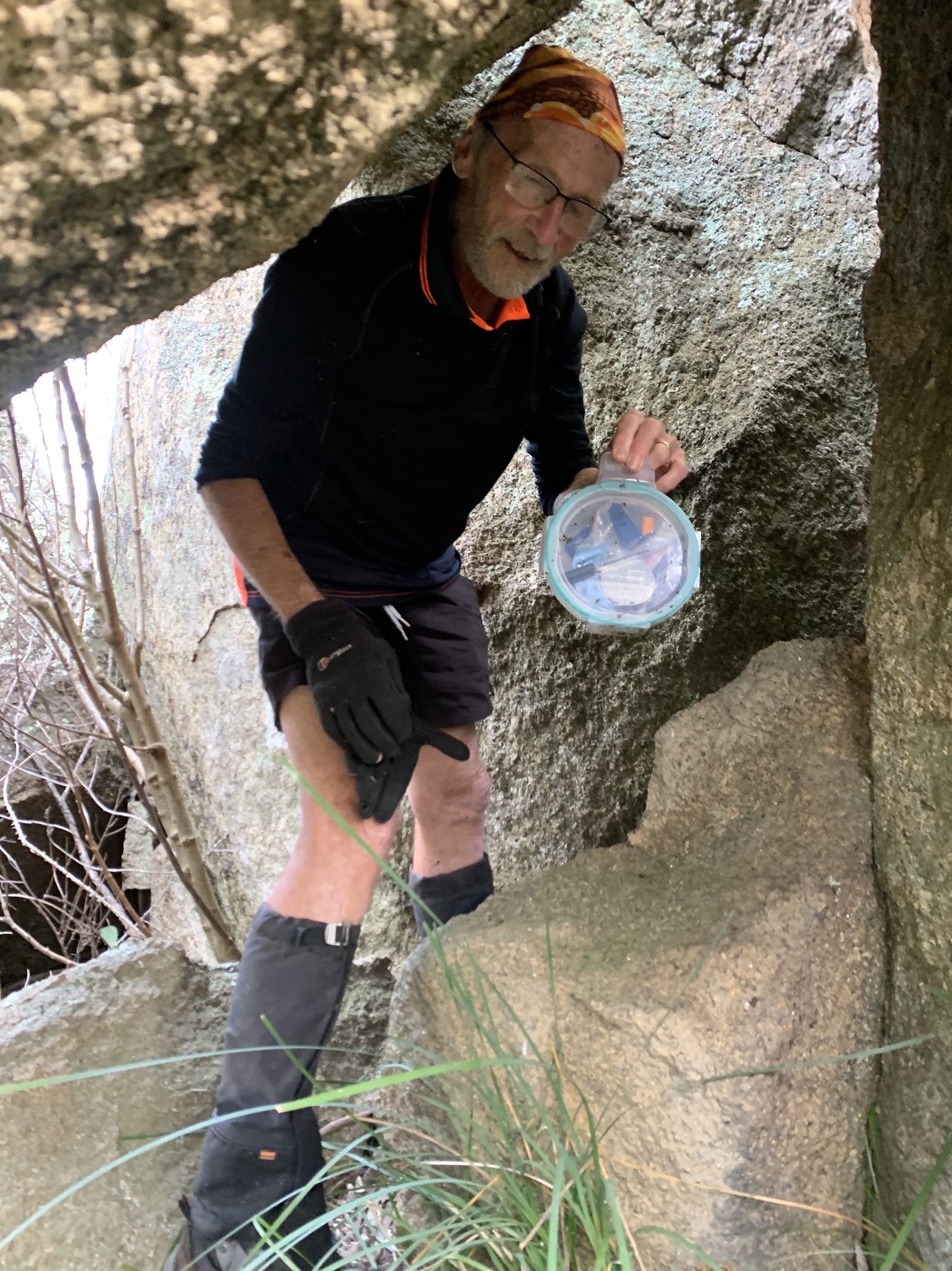
Found it | photo Ming L
Next stop was Gudgenby Homestead.

Gudgenby Homestead
We crossed the river via the footbridge.

Bridge over Gudgenby River between Gudgenby Homestead and Ready-cut Cottage
Passed the Ready-cut Cottage.

Ready-cut Cottage
A final road bash back to the car, including wet feet again at the two fords of Hospital Creek.

Crossing the eastern ford of Hospital Creek
Nostalgic trip up Middle Creek, the closest I’ll ever again get to Mt Namadgi. That’s until young hiker friends deliver my ashes up there.
Trust you enjoyed it ladies.
Party
4 walkers – SF Lam, Ming L, Wahyu S, me.
AllTrails
The AllTrails map is here, where you can pan and zoom. Includes the Shepherds Lookout track which we didn’t walk today.
Johnny Boy’s Walkabout Blog FaceBook Page
I’ve started up a FaceBook page. Each trip report posts to it. It’s another way to get some info to get out and breathe a bit of fresh air. Why not pop over and Follow the page, or give a post a Like.