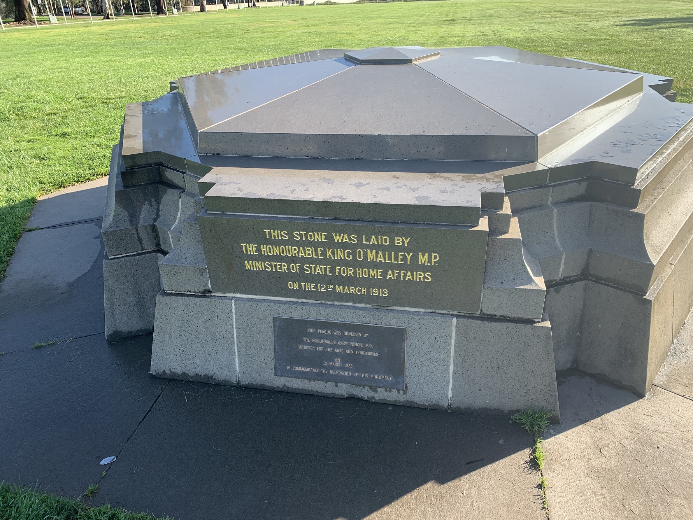
Federation Stone
Saturday 15 October 2022: Canberra Centenary Trail – Section 1 – Federation Stone to Horse Park Drive * – L/E,ptX: Walk past buildings of national significance and across Kings Avenue bridge. At Blundells cottage turn up Anzac Parade. Visit the indigenous war memorial on the way up the main path to Mt Ainslie. North to Mt Majura via the Casuarina Trail. From the Federal Highway, whatever is the current route to the car park on Horse Park Drive. Around 24km and 600vm climb. Limit 12. Early morning assistance required from one (or more, depending on number of walkers) driver/s to set up car shuttle, prior to start of walk.
Summary
From Garmin Connect – Distance: 25.99km | Climb: 819m | Time: 5:22 moving + 1:00 of stops = 6:22 | Grading: L/E,ptX; M(11).
My confidence in the total ascent recorded on my MAP66i was increased today. Here’s some stats accessed via Garmin Connect after today’s trip was synced:

Some of the stats from Garmin Connect
You can see that the Maximum Elevation recorded was 890.6m. Mt Majura, according to Survey Control Marks on ACTmapi, is at elevation 890.378m.
A recently acquired Garmin HRM-Pro heart rate monitor tells me that my maximum heart rate whilst climbing to Mt Ainslie was 124bpm and to Mt Majura was 135bpm.
Photographs are available here.
gpx File
The gpx file is available here.
Track Notes
I last did this section of the Canberra Centenary Trail on 23 Jun 12.
A nice sunny day in between a few days of rain.
Two cars drove to the east-most entrance to Goorooyarroo Nature Reserve on Horse Park Drive (nearest to the Federal Highway/Horse Park Drive-Majura Parkway interchange). We left one there and drove back to the Surveyor’s Hut car park, just off State Circle. Good timing and we were walking by 7.58am.
The first leg took us up made paths on the NW side of Parliament House, round to the front and to the Federation Stone.

Lawns of Parliament House are nearly as nice as mine, haha
Then down Federation Mall, calling in to the Senate Gardens beside Old Parliament House.

Wisteria in Senate Gardens
Down past the front of OPH we passed the Aboriginal Tent Embassy.

Aboriginal Tent Embassy
The Federation Centenary Fountains continue to be in a terrible state. There’s a 2018 Canberra Times article saying that the fountains haven’t operated for a decade.

Federation Centenary Fountains in front of Old Parliament House
Continued on to walk past Questacon and through Reconciliation Place.

Companions in Reconciliation Place
A great market set up at the edge of the lake.
Turning right, we walked past the High Court of Australia and the sculpture garden at the back of the National Art Gallery. I do like this leg from the Federation Stone, passing all those buildings and places of national significance.

The Angel of the North model – National Gallery sculpture garden
Under Bowen Place, across Kings Avenue bridge and along the side of Lake Burley Griffin past the Carillon.

Carillon on Aspen (Queen Elizabeth II) Island
At Blundells Cottage we winkled our way to Anzac Parade, then up it to skirt the Australian War Memorial.

Army vehicles on the NW side of Australian War Memorial
The front of the vehicle on the left is a Bushmaster, the vehicle type Australia has provided to Ukraine.
A pause at the bottom of the track up Mt Ainslie to remove layers. A little way up the track we called in at the Aboriginal Memorial.

Aboriginal memorial behind the Australian War Memorial
We discussed the inclusion of aboriginal people in Australian society. Sadly, they were only given the option to enrol and vote in Federal elections in 1962 (and required to do so, like other voters, in 1984). Even worse, they weren’t recognised as Australian citizens until 1967. Yet so many aboriginal men fought in Australian wars prior to those dates.
Back on the Kokoda Track (the Mt Ainslie summit track) I said good-bye to my companions. I puffed up the hill and meet them again, lazing about whilst waiting for me.
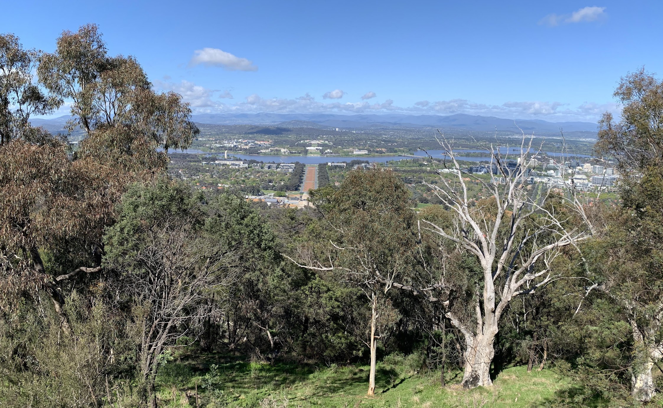
View from Mt Ainslie
Not many more photos after this, as I seem to have spent my recent life in the Mt Ainslie – Mt Majura area, on 12 Oct 22, 1 Oct 22 and 25 Sep 22.
A little navigational whoopsie between the two hills, which Terrylea thankfully corrected for me. A stop on the side of the track for morning tea.
As a pedant I was a little concerned as we began the climb to Mt Majura – I missed a bit of the CCT and had to footpad back to it. Again, at the sheep camp junction, I said good-bye to the ladies and rejoined them at the top, several minutes after they had arrived. A drink break.

Orchid near Mt Majura
Back down off the hill the same way we ascended. There are many more interesting ways, but a pedant must walk the official CCT. For both Mt Ainslie and Mt Majura, there are both bike routes round the flanks of the hills and walking routes that include the summits.
Along the west flank of Majura, with a lunch stop just down from the blaze tree.
The final leg from here was a little eXploratory for me. I’d previously been to near the road interchange overlooking Majura Parkway, but never on the official route. The CCT here goes E on the S side of Majura Parkway, under, W-ish to the Hughie Edwards VC Rest Area, N on the E side of the Federal Highway, under, SW on the W side of the Federal Highway, W along the S flank of Gecko Hills, out through the extended Goorooyarroo predator-proof fence Baray Gate and Mandawari Gate.

Majura Parkway underpass

Federal Highway underpass
We could smell the delicious Brazilian Barbeque that sets up in the car park.
Drove back to the start, pleased that the car shuttle had worked and no walkers or vehicles were left over.
Track Maps
Here’s where we went.

Track overview CCT 1

Track detail 1 CCT 1

Track detail 2 CCT 1

Track detail 3 CCT 1 (on Topoview 2006 map, so no Horse Park Drive then)
Party
4 walkers. Ming L, Terrylea R, Tilly T, me.
Information Bit(e)s
I’ve had a lot of assistance from walking friends recently. By way of paying a bit back, I’ll publish a few bites of information that may help someone. The second is ‘2 What’s a map Datum?‘