LIKE WHAT YOU SEE? WHY NOT SUBSCRIBE TO GET EMAIL NOTIFICATION WHENEVER A NEW TRIP REPORT IS POSTED

PeakFinder to Mt Evans
Friday 24 June: Trying out PeakFinder from Tuggeranong Hill Nature Reserve knolls – S/E !. A quick stroll on my local hills to try the PeakFinder mobile app.
Summary
Distance: 3.8km | Climb: 167m | Time: 1hr 15mins with a couple of stops | Grading: S/E; E(5).
Photographs
Photographs are available here.
gpx File
The gpx file is available here.
Notes …
I became interested in the hills to the west of Canberra last century. I used to walk home to Duffy from work in Woden over Oakey Hill. I’d gaze out to the west and wonder what was there and what those hills were called. Of course I was looking to the Tidbinbilla Range, with Camels Hump prominent. That got me started on bushwalking.
I made a few attempts at labelling photos of hills with a picture editor, but they were pretty elementary.

2012 View N through E to SW from Bimberi Peak – Corin Dam to Yaouk – named
I can often answer the “what is that hill called?” question from party members at vantage points in the ACT, but some still fool me.
These days I follow a couple of Facebook groups posting about walking around Canberra. On one, A.C.T Hikers, I’d often admired photos of hills, all neatly labelled with names and heights. A recent post gave me the answer (thanks Russel H and Brendan B). PeakFinder!
PeakFinder
For the princely one-off sum of $7.99, one can download the PeakFinder mobile app. It has access to hundreds of thousands of peaks worldwide. And plenty in our local area.
As well as the mobile app there’s a website at www.peakfinder.org . Plenty of helpful doco on the website and in the app.
I was wondering how the peaks are populated. It seems that they come from OpenStreetMaps. An entry in the PeakFinder web support page includes:
“PeakFinder uses the peak data mainly from openstreetmap.org (OSM). Openstreetmap.org is the Wikipedia of online maps. Everyone can add missing data this this project. If you like you can add the missing peak by yourself. This way also many other great projects benefit from your work. Here is an explanation: https://www.youtube.com/watch?v=tk6qMcusWEs.
The data will be available in PeakFinder 24 hours later (open the PeakFinder Menu an select Settings->Update).”
A GREAT APP!
… back to Notes
So you could have knocked me over with a feather when I pointed PeakFinder/camera to the SW from near the summit of one of the Tuggeranong Hill NR knolls. Up pops Mt Evans 1008 (see pic above). I went there on 31 Aug 19 and conquered it. It’s an insignificant knoll labelled SH1008 on the Williamsdale 8726-4N 1:25000 topographic map.

Conquering ‘Mt Evans’
Knowing what I do now, I suspect who recorded ‘Mt Evans’, but I won’t embarrass him or me!
Track Map
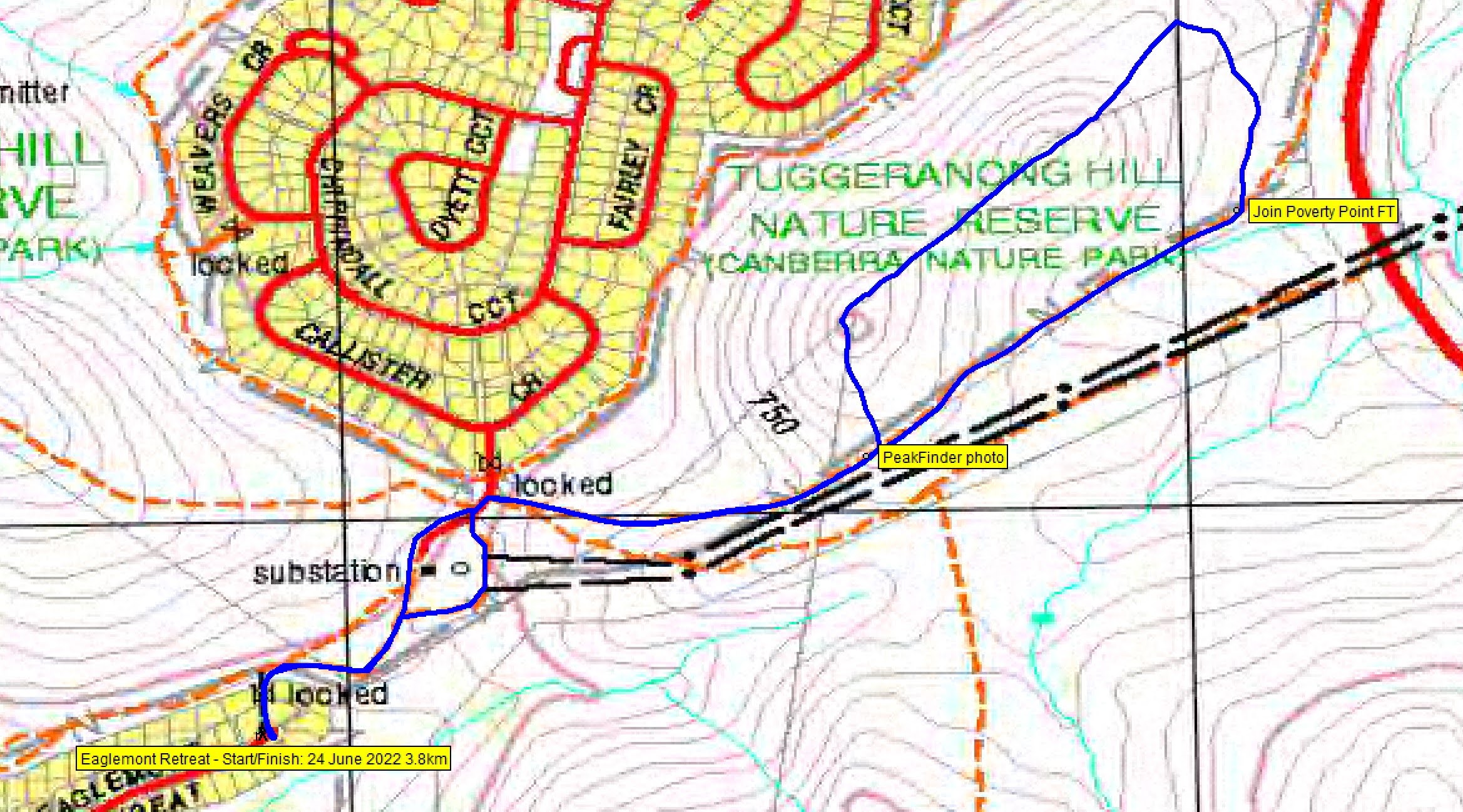
Track Tuggeranong knolls and PeakFinder
Party
Just moi and PeakFinder.
Beat Oppikofer
25 June , 2022 9:54 amthanks to my updating on “open street Map”, i have added there Mt Evans on 12 February 2022, when i was on top of Mt Evans ……
Johnny Boy
25 June , 2022 12:48 pmYuma Beat. Yes, I thought it would have been you! You certainly contribute lots to the ACT based bushwalking community. Keep exploring and walking! Yarra. john