
Mt Gudgenby from the top of the Yankee Hat cliff
Tuesday 17 April: Yankee Hat Cliff, Namadgi National Park – M/R/X. From the Yankee Hat car park, we’ll walk a few kilometres up Bogong Creek, then ascend the steep and scrubby southwest flank of Yankee Hat South to investigate a large cliff. We shall return on a similar route. Minimum distance: 13 km with 500 metres ascent. Map: Yaouk. Leader: Ian W. Transport: 110 km return. Limit: 8.
Quotes of the day
Linda: “I’m having so much fun, but I don’t know why.”
Ian (‘the granite hunter’): “I didn’t expect so many rocks, that’s for sure”
Summary
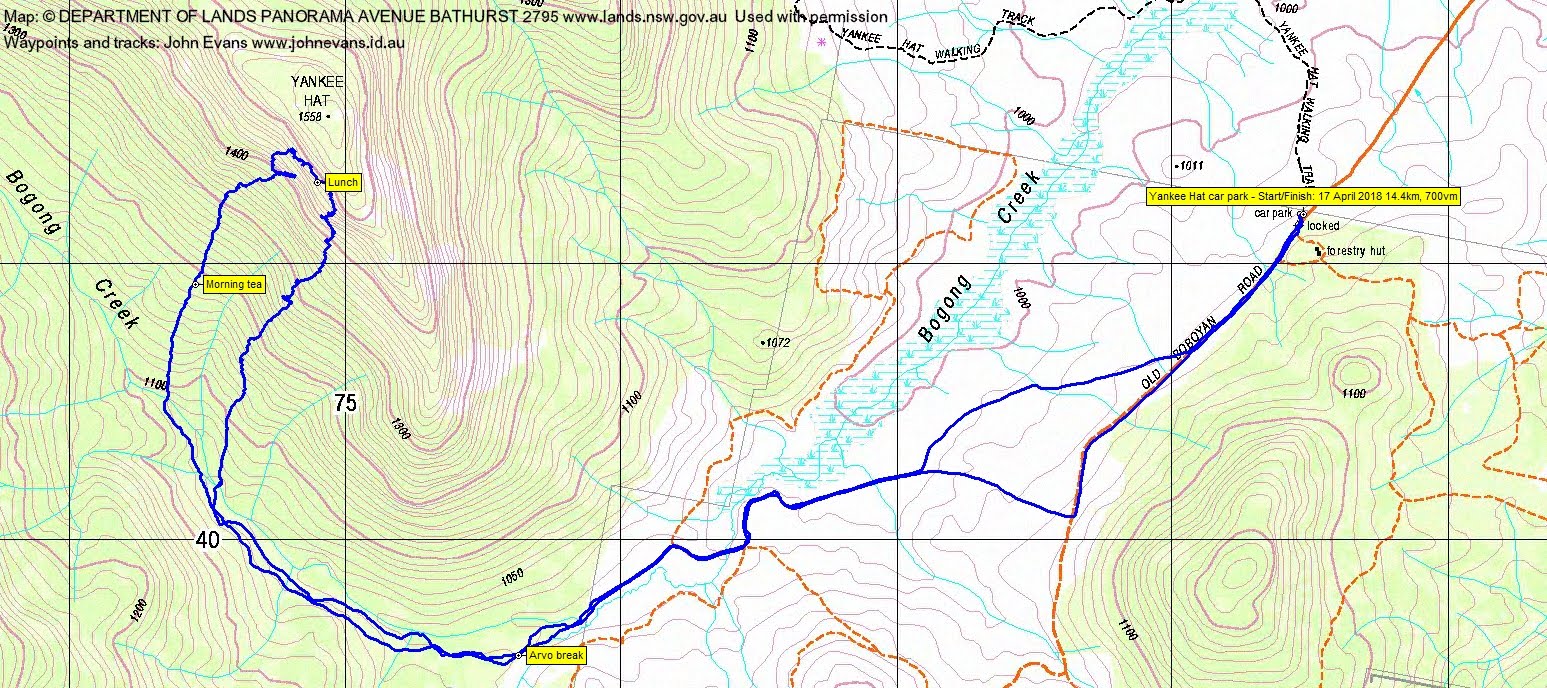
Distance: 14.4km | Climb: 700m | Time: 8.05am – 3.55pm (7hrs 50mins), including 60 mins of breaks | Grading: L/R; H(13+)
Photographs
Photographs are available, where you can start a large sized slideshow.
Video
Waypoint and Track Files
Download the .gpx file. (Right click, Save Link As…, Save – if you want to use it.)
To use in Google Earth, do File, Open… and select Gps or All files as the File Type.
Track Notes
A perfect walking day. Dappled shade most of the time during the climb and descent, lovely and sunny out on the fire trails walking in and out. This was a demanding walk, giving us plenty of exercise via a good total body workout.
Ian had been wanting to visit this cliff, ever since we saw it on our descent from Mt Gudgenby on 19 Sep 17:

Zoom to granite on Yankee Hat South, above Bogong Creek
So that was today’s objective. Walking at 8.05am and we dispatched the 3.6km of Old Boboyan Rd, fire trail, causeway and into the timbered part of Bogong Creek in 45mins.
We walked the true right bank of Bogong Creek, 2.2km in 50mins, through mainly open woodland with a bit of scrub down at the creek when we crossed.
From here, at the 1080m contour, the climb began. An unrelenting 400 vertical metres over 1.8km, taking 2hrs 25mins. That included 15mins of morning tea and an abortive trip in under the cliff. Coming out, we set the climbing ladies (Linda and Monika) to finding us a way up, but it was not possible. So we backed out further, then climbed the final 100 vertical metres.
Mt Gudgenby was a constant companion, as you’ll see from the photos:

Sentry Box Mountain and Rock, Mt Gudgenby and ‘Mt Mouat’ from the top of the Yankee Hat cliff
Lunch was enjoyed on the top of the cliff, with social media connection, thank you Ian 😆 .
We started the descent at 12.40pm, heading a little further SE along the top until we found a way down. Plenty of granite tors and blocks to winkle through as we headed down, steeply in places. 1.8km in 1hr 55mins for the descent. A well deserved drink break at Bogong Creek.
Pleasant walking out Bogong Creek and along the fire trails (plus a little cross country) to get us back to the cars. 5.1km in 1hr 20mins.
A grand destination. Thanks Ian and all.
Track Maps


Party
7 walkers – Monika B, Linda G, Meredith H, Erick McP, Lorraine T, Ian W (leader), me.