
Xenolite
19 May 2024: Mt Tennent * – L/E. A stroll to the top on the track which is still open. And some geocaches.
Summary
From Garmin Connect (recorded on MAP66i) – Distance: 14.91km | Climb: 804vm | Time: 4:26 moving +2:33 of stops = 6:59 | Grading: L/E-M,ptX; M(10).
Photographs
View photographs here.
gpx file
Download the gpx file here.
Track Map
Here’s where we went.

Track Mt Tennent
Trip Report
I was last on Mt Tennent on 29 Apr 24.
Every man and woman and their dog (so as to speak) on Mt Tennent today because of the Namadgi National Park closures. Walkers, trail runners, even a mountain biker! Ran into Diana K on the new track.
The standard trip, with some successful and unsuccessful geocaching.
A beaut earth cache, GC9WKKA Tennent Features, with stages up the track. The first stage was a small quartz dyke on the track.

GC9WKKA Virtual stage 1 Dyke
Second cache was GC9KFMN Basil’s Tennent Temptation Mk 2, within cooee of Cypress Pine Lookout. I even found it myself!
Next stop was the second stage of the earth cache, where we all learned a lot about Xenolite (see GC9WKKA Tennent Features for the good oil). Once we knew what they were (no, not bird droppings) we could see them everywhere. Forgot to collect the cache data, but did so on the way back.
GC9WKKA Virtual stage 2 Xenolite
Next stop was third stage of the earth cache. Now I’ve walked over this probably 100 times, but never realised …

GC9WKKA Virtual stage 3 Map of Australia rock
At the crest we turned onto the new Tennent trail. Two in our party had not walked it before.
Next stop, just off the track, was geocache GC9WZRF Mt Tennent Letterbox. 2.5/5 difficulty and, again, I found it myself.
That was the end of finding traditional caches. The next two we search for, near the vantage points on the new track, alluded me and some helpers.
The first of these, GC9NRQ5 Tennent Track II – 1, even had a spoiler photo which I had with me. Still couldn’t find it.
The second, GC9NRQ8 Tennent Track II – 2, was around 35m off the track and with terrain of 3.5/5 I obviously got something wrong! The two Stephens came with me on a bit of a hairy circumnavigation of the cache location. The down via horrible scrub then a bum contact descent of the rock face, the up via a more horrible scrub bash very steeply up.

Beginning the exit from a hairy circumnavigation of GC9NRQ8 Tennent Track II – 2
My saving grace was that I was third in line, the other guys forcing a line though the scrub.

Looking for GC9NRQ8 Tennent Track II – 2
Rejoined the others for a consoling smoko.
We reached the top at 11.50am and had lunch.
Can’t beat that view to the west.
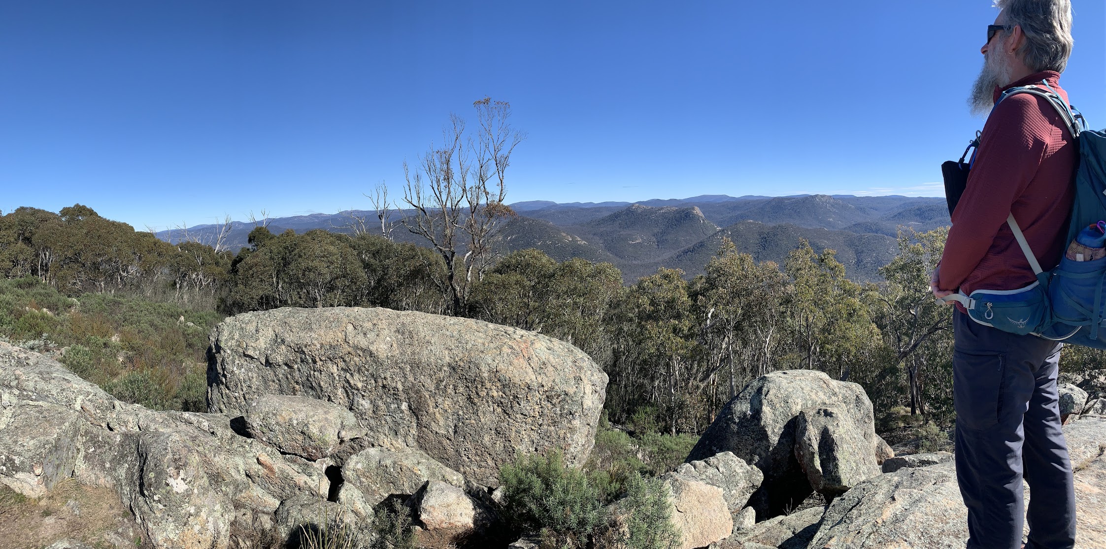
View west from Mt Tennent
The fourth stage of the earth cache was here and I set my companions to work gathering the data.

Measuring GC9WKKA Virtual stage 4 Slab fractures
We returned down the Mt Tennent Fire Trail, across the link track via Tongs Sheep Yard site and on to join the AAWT a couple of hundred metres up from where the new track leaves.
Popped in to visit the creek line below Cypress Pine Lookout.

A detour to the drainage line below Cypress Pine lookout
Back down near the Visitors Centre in the Woodland Walk area, we had a look at the scar tree signage …

Scar tree signage in the Woodland Walk at NVC
… and the tree.

Scar tree
On to The Mouat Tree. If anyone is interested in seeing several hundred photos of the ACT border markers and photos of the few extant blaze trees, access them via here.
Thanks folks for your company. Trust you enjoyed the beautiful weather and the day.
Party
5 walkers – Maureen G, Stephen J, Trevor L, Stephen M, me.
AllTrails
The AllTrails map is here, where you can pan and zoom.
Johnny Boy’s Walkabout Blog FaceBook Page
I’ve started up a FaceBook page. Each trip report posts to it. It’s another way to get some info to get out and breathe a bit of fresh air. Why not pop over and Follow the page, or give a post a Like.