Turpentine tree against Jerrawangala Cliffs

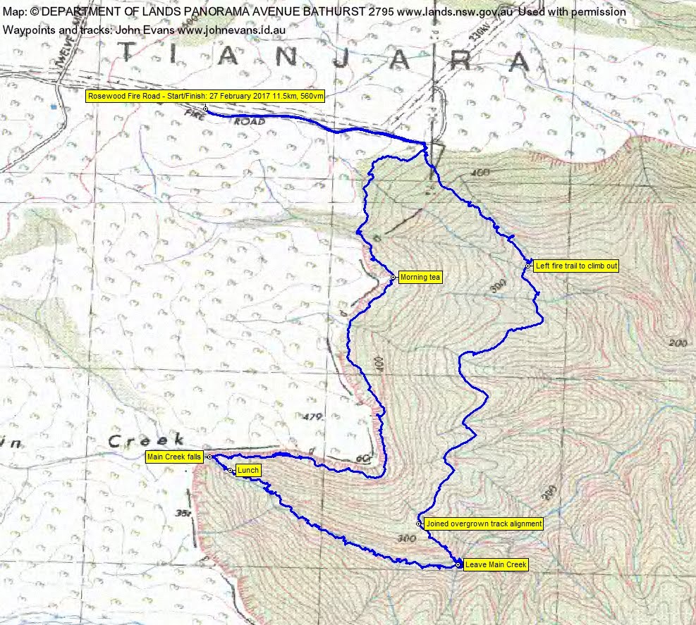
Tuesday 27 February: Jerrawangala Cliffs – M/R/Partly X. Leader: Linda G. A circuit to explore the wonderful cliff-base scenery of Jerrawangala National Park and Yerriyong State Forest. We will start above the cliffline, at the right angle bend on the Hawthorn Fire Trail, where there is a straightforward pass through the cliffline into magnificent turpentine forest with a semi-open understorey. Then south along the cliff base, past giant mossy boulders and through rain forest, to meet Main Creek and, if possible, follow it down for about 1 km. We’ll return north on a fire trail, initially overgrown, later clear, with more cliff base scenery if time. A shady, scenic, strenuous walk. Leader: Linda G.
Summary
Distance: 11.5km | Climb: 560m | Time: 9.30am – 5.35pm (8hrs 5mins), including 50 mins of breaks | Grading: M/R; H(12)
Photographs
Photographs are available, where you can start a large sized slideshow.
Videos
Waypoint and Track Files
Download the .gpx file. (Right click, Save Link As…, Save – if you want to use it.)
To use in Google Earth, do File, Open… and select Gps or All files as the File Type.
Track Notes
This would have to be the best cliff walk I’ve been on. Yet again, hats off to Linda for a wonderful location!!
A long drive (even longer and dirtier for 2 cars which went via Braidwood and sloppy road works, rather than by Oallen Ford) of a bit over 2 hours from Queanbeyan. But worth every km of it. The final Twelve Mile Road and Rosewood Fire Road were pretty second rate too and would not have been handled by 2WD vehicles. So a 13+ hour day, door-to-door from my old folks home in north Cooma (Gordon).
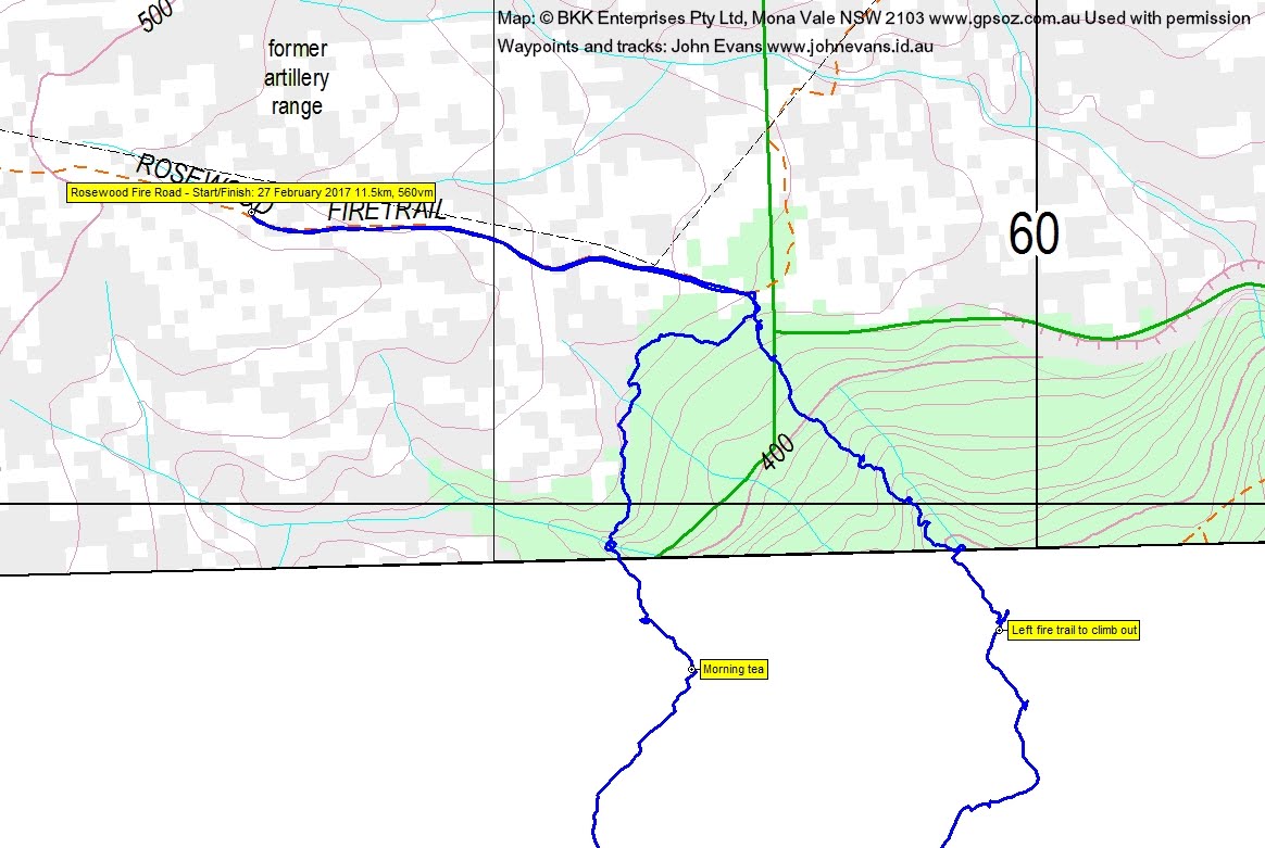
Walking by 9.30am along the Rosewood Fire Road which, here, was a running stream. Max enjoyed the transmission line pylons.
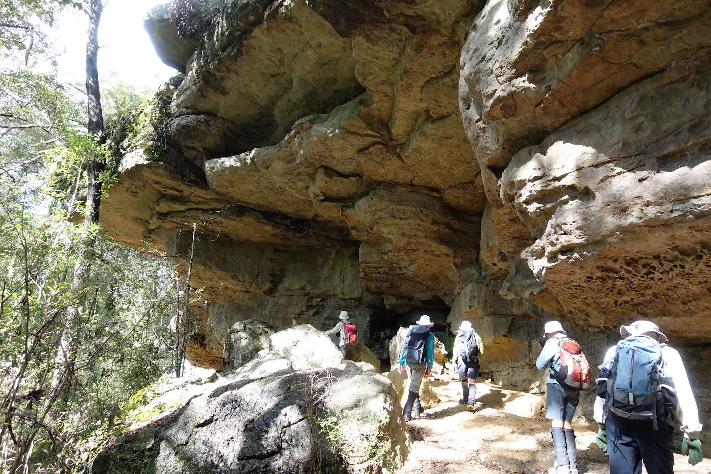
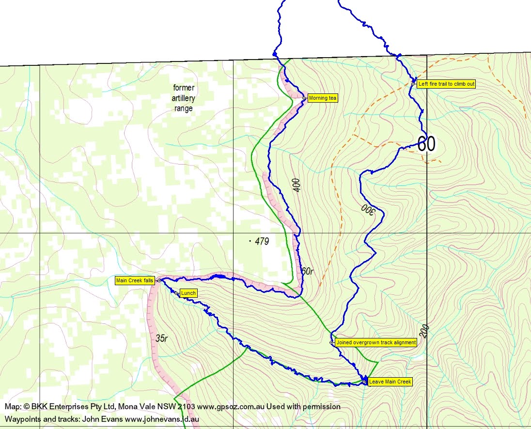
Immediately on leaving the fire trail/transmission line maintenance track, we descended through a gentle pass in the cliff line and began a 3.4km wander along the base of the cliffs which, in places rose 60m above us. The leg took 2 hours 30 minutes (including 15mins of morning tea).
Facts over, this was incredible – Turpentine trees, cliff lines with caves, cascading streams, rain forest ferns and palms. Do check out the photos! Here’s part of the cliff line:
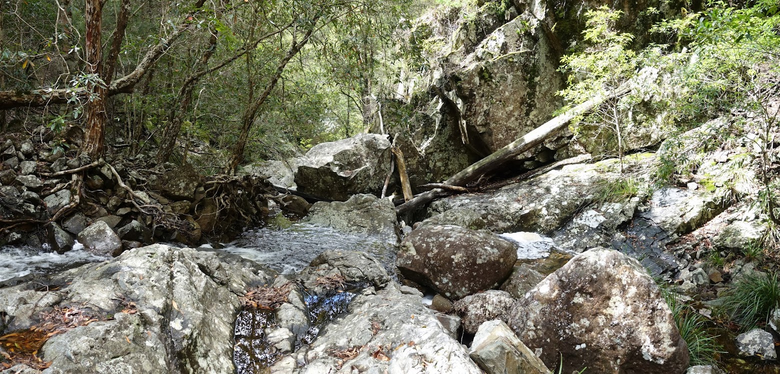
a tumbling stream:

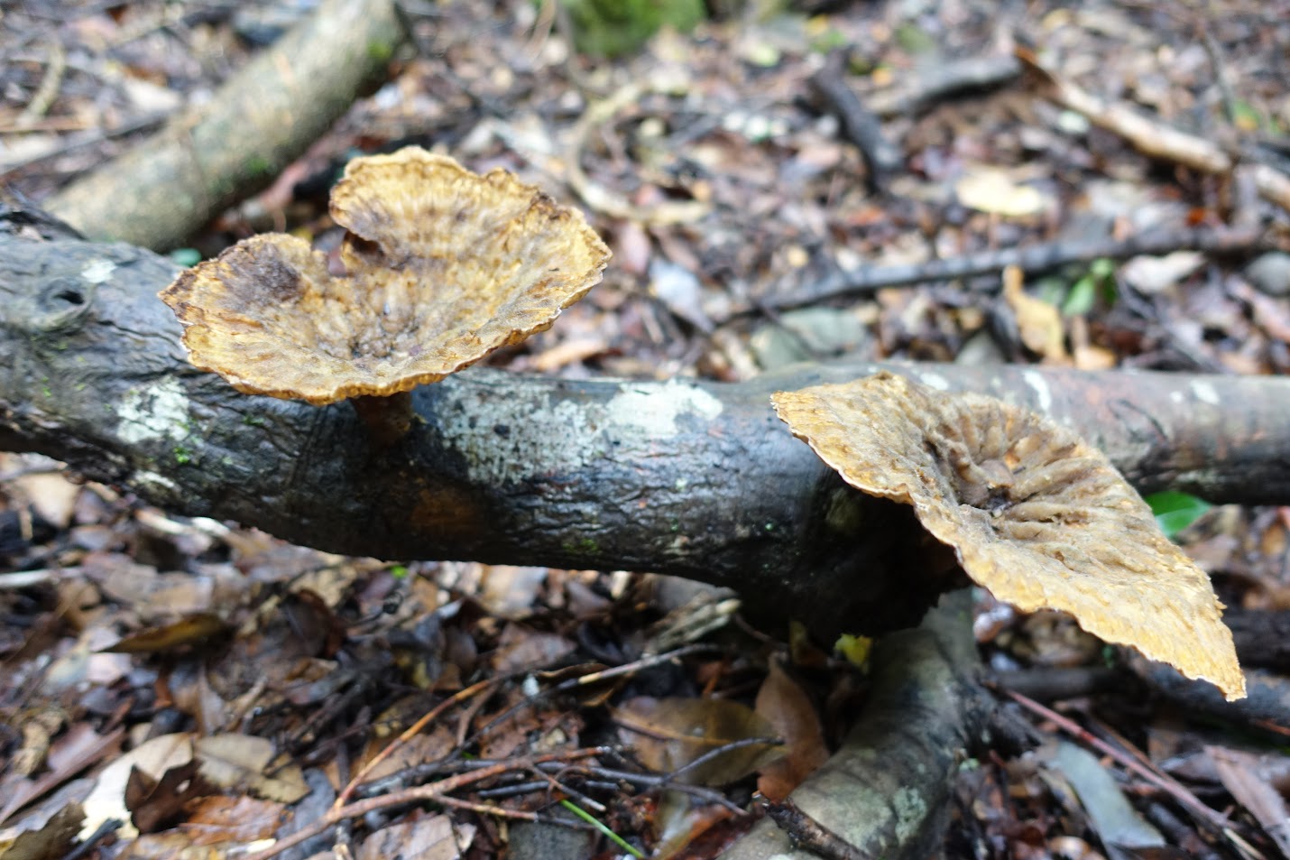
rain forest growth:
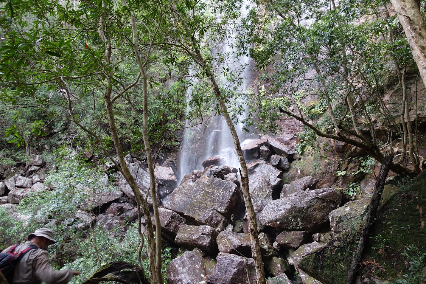
Morning tea was below the first nose of the cliff line. Rounding the second nose, we turned west to where Main Creek tumbled over the cliff top 35m above. Spectacular!
This is where we left the cliff line and enjoyed the second huge attraction of the day. We descended along the side of Main Creek for 15 minutes and stopped among the boulders and ferns (and hopefully no leeches) for lunch.
Our leg down Main Creek for 2km took 2hours (including 25mins for lunch). Lots of foam in the creek, surrounded by rain forest plants. Again check out the photos!
With time ticking away. we stocked up on water and left the creek above where it began a serious plunge.
A 90vm climb up a handy spur took us to a very overgrown fire trail (not marked on the map). Then a 2km leg in 1hr 20mins along the benched route, pushing through light vegetation which had reclaimed it.
We popped out onto a well made fire trail, but immediately left it to climb 170vm over 1.1km in 1hr to the Rosewood Fire Road. A little slow, as one of the party suffered cramps.
A long drive back,but this time we all went via Oallen ford.
What a fabulous trip! Thanks so much Linda and all.
Track Maps
Party
11 walkers – Mark B, Monika B, Melinda B, Linda G (leader), Meredith H, Muhammed, Ian H, Max S, VT, Ian W, me.