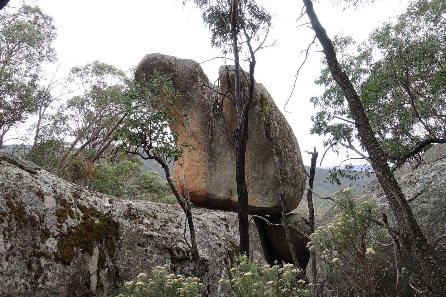
Granite feature 3 – upper molar
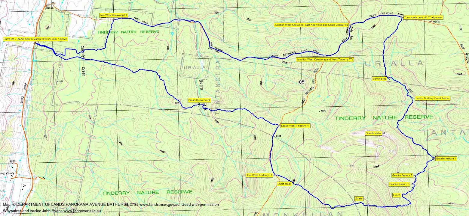
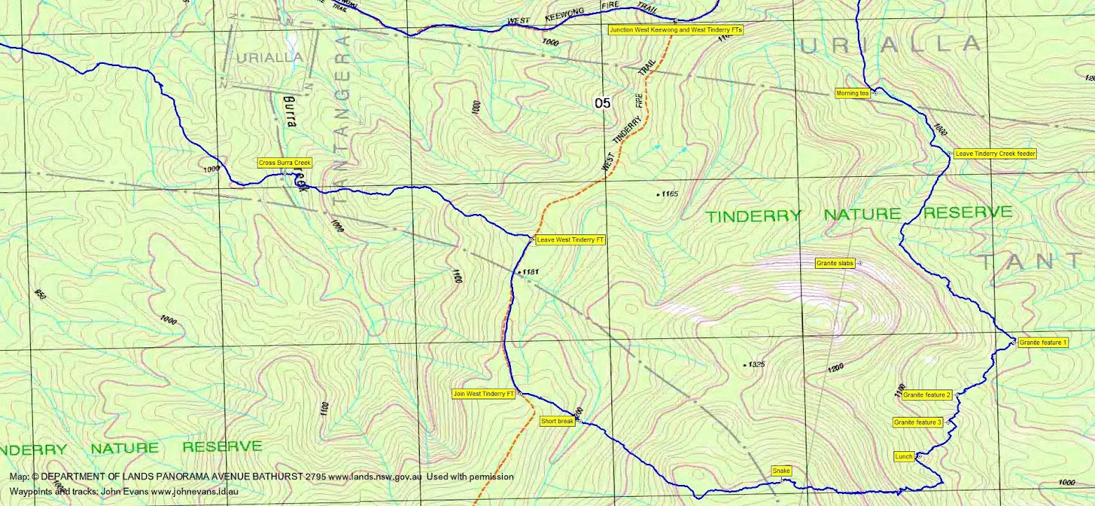
Tuesday 6 March: Tinderry Nature Reserve, Eastern Side – L/R/ part X. A long walk in the north of the Tinderry Nature Reserve. Start on Burra Rd, then: West Keewong Firetrail – North Branch of Tinderry Creek – eastern slopes for 5 km – back to western side of range. The eastern section is exploratory and links up granite outcrops in dense forests. Some rock scrambling required. Off-track: 10 km; Fire-trails: 9km. Minimum distance: 19 km with 1200metres ascent. Maps: Williamsdale, Captains Flat, Michelago, Tinderry. Leader: Ian W. Transport: 112 km return. Limit: 8.
Summary
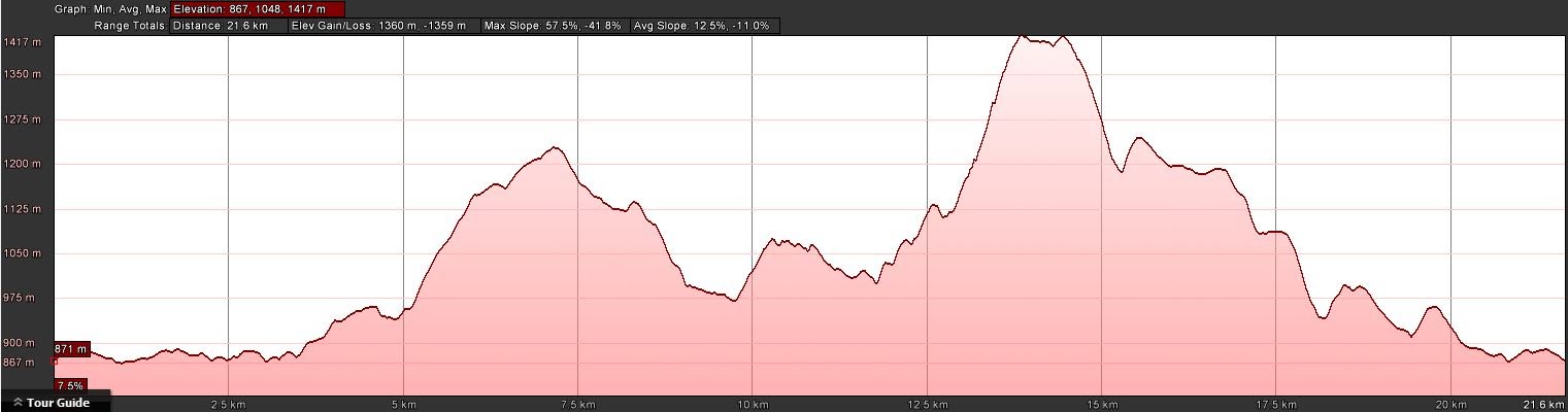
Distance: 22.0km | Climb: 1300m | Time: 7.35am – 5.25pm (9hrs 50mins), including 45 mins of breaks | Grading: L/R; VH(15)
Photographs
Video
Waypoint and Track Files
Download the .gpx file. (Right click, Save Link As…, Save – if you want to use it.)
To use in Google Earth, do File, Open… and select Gps or All files as the File Type.
Track Notes
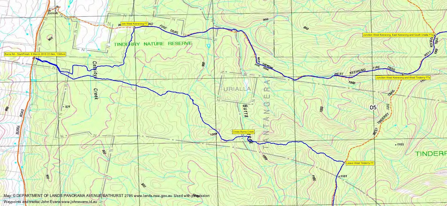
Drove via Monaro Highway, Williamsdale Rd and Burra Rd to park at the Tinderry Nature Park entrance just south of the West Keewong Fire Trail.
Walking by 7.25am on a series of track which link onto the West Keewong Fire Trail. A cool morning, needing the walking to warm up. The walk in starts at the 870m contour and climbs to 1230m, with a particularly steep incline of 200 vertical metres in 1.2km. We were warm by the time we reached the top.
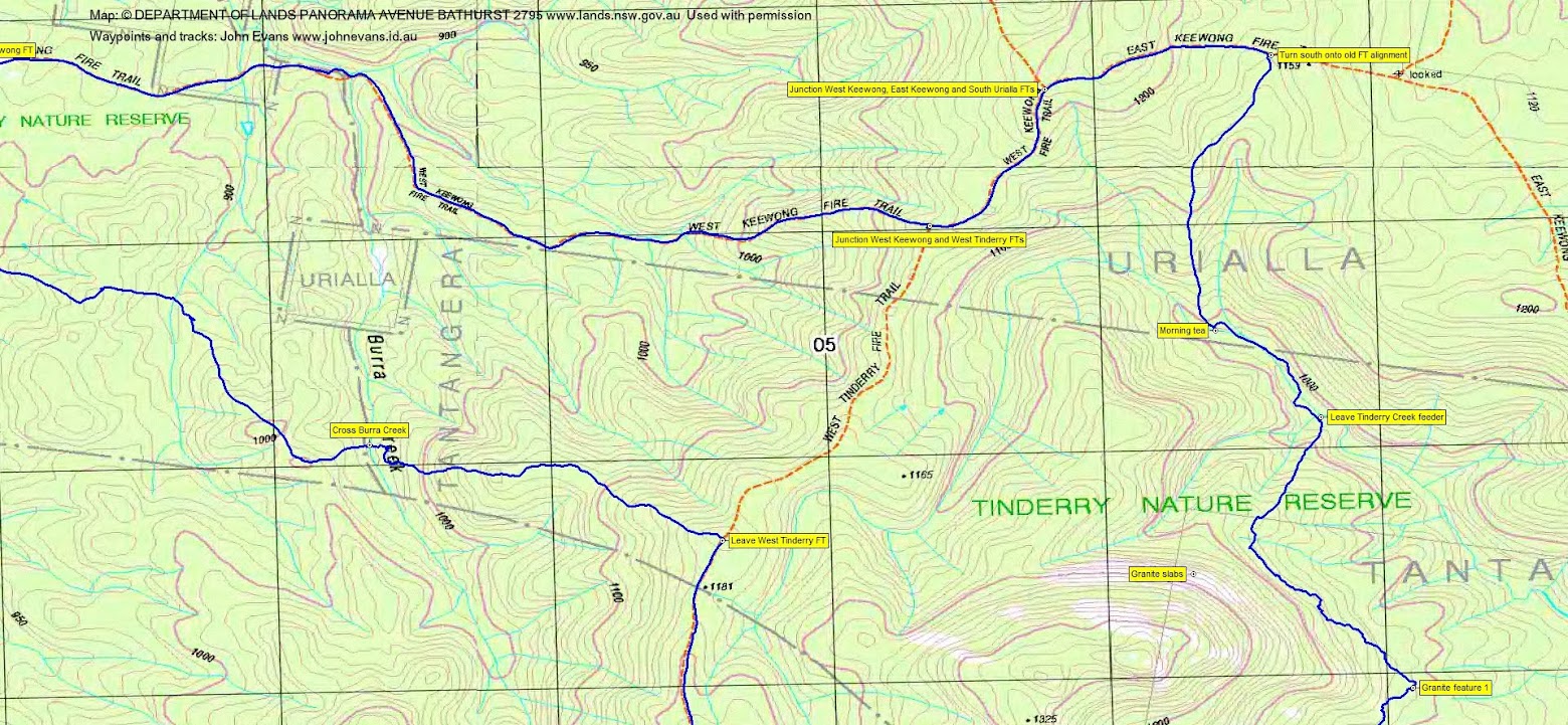
Near SH1159, Ian had spied a disused fire trail heading south and this made for easy walking to morning tea beside a feeder creek to TInderry Creek at 9.50am.
Following the break, we handrailed down the creek for 650m, then turned SW to climb towards some granite slabs which were in view. We then generally contoured SE then SW along the east side of the northern Tinderry Range. I remember lots of Bursaria (common name Blackthorn) – very thorny. We wended our way through three granite features and a couple of bonus features. Although not spectacular, this was new country which always deserves at least one look.
Lunch was taken on granite platforms with easterly views.
After lunch, we turned west and enjoyed (?) a 300 vertical metre climb to the crest of the Tinderry Range. A curled snake greeted us at the top. Westerly views from the top. Snow Gums and plenty of large fallen timber on the crest, as it’s a while since this area has been burnt.
2.15pm, so time to continue heading back. We descended to the West Tinderry Fire Trail, walked it north for a kilometre, then struck off down a spur to cross Burra Creek and climb up the other side. Afternoon memories are of Cassinia coughing.
The walking finally became easier, the scrub cleared. We crossed Cassidys Creek and picked up fire trails and footpads back to the cars.
A long and tough day, but a new area to explore. Thanks Ian and all.
Track Maps
Party
7 walkers – Monika B, Melinda B, Meredith H, Trevor L, VT, Ian W (leader), me.
Next Tuesday
Tuesday 13 March: Corang Circuit – Wog Wog, Corang Peak and Arch, Canowie Brook, Corang River, Goodsell Creek and return – L/M. A lollypop circuit of some Budawang icons. Around 25km and 600m climb on good to rough tracks. Map: Corang. Leader: John Evans 0417 436 877 john@johnevans.id.au. Transport: ~$25 per person, 1hour 40 minute drive from Queanbeyan. Limit: 8.