Lunch at ‘forgotten views’
Saturday 17 March: Naas River Valley and the flanks of the Clear Range – L/M. From Caloola Farm, walk the Naas Valley fire trail, crossing the Naas River 16 times on our return journey. We climb 200m onto the flank of the Clear range via The Forest Trail. The walk is all on fire trails, except for short forays into the bush and over the river for geocaches. Around 25km and 700m climb. Map: Michelago. Leader: John Evans john@johnevans.id.au . Transport: ∼$12 per person. Book by: 15 March.
GC5H751 Six Streams, GC2BZHF Clear to Caloola: GORGEous?, GC2J5HD Forgotten Gate, GC2J5HC Forgotten Views
Further Information
Arrangements for entry to the Namadgi National Park via Caloola Farm have changed. Access to the NNP boundary via the public-access Naas Valley Fire Trail is unencumbered, but if you have to park at Caloola (eg. the Naas River ford just east of the complex is not drivable), do ring the Namadgi Visitors Centre to obtain contact details for Caloola and discuss your options.
Summary
Distance: 19.5km | Climb: 600m | Time: 8.25am – 2.20pm (5hrs 55mins), including 45 mins of breaks | Grading: L/M; M(11)
Photographs
Photographs are available, where you can start a large sized slideshow.
Waypoint and Track Files
Download the .gpx file. (Right click, Save Link As…, Save – if you want to use it.)
To use in Google Earth, do File, Open… and select Gps or All files as the File Type.
Track Notes
Well, I thought this little walk would be boring, except for Roger and me (4 Namadgi caches is a reasonable day’s haul). So I was surprised that there were so many starters. Once again, the synergy between bushwalking and geocaching is proven – bushwalkers get new destinations and geocachers have the assistance of additional muggle eyes!
After sorting out the conditions of entry via Caloola Farm with the owner and Namadgi Visitors Centre staff, we scored a bonus of being able to drive the initial (dry) concrete ford and into the boundary of NNP. That saved us nearly 5km of walking.
The early morning was nice, but the temperature warmed up during the day (34ºC for Canberra). The Naas River was hardly flowing at any of the crossings and the pools of water looked pretty uninviting. I carried 2+ litres of water. As part of the pre-walk briefing, I recounted my day of disgrace near here on 18 Feb 06.
What can one say about a fire trail tromp? Plenty of conversation as the numerous river crossings passed by.
After the sixth, we wandered up a little knoll just off the FT to nab GC5H751 Six Streams.
Another nearly 1km further south, most of us endured the only really off-track part of the day. A steep descent to cross the Naas River, followed by a very scratchy ascent to find and log GC2BZHF Clear to Caloola: GORGEous?. Thank goodness I had the spoiler photo with me. From the vantage point, a more judicious return was spied out. Another very steep descent, but more direct. Still, the detour knocked the stuffing out of me and we all enjoyed our morning tea break.
Next followed a slog up The Forest Trail. On the way a log of GC2J5HD Forgotten Gate and finally we stopped on the fire trail near the final cache.
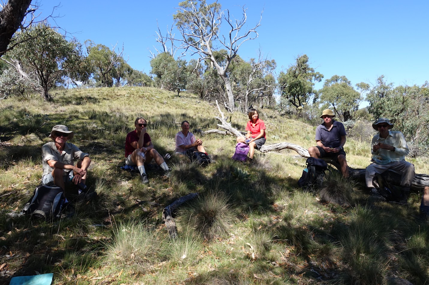
Options were given for lunch. The cache was called ‘Forgotten Views’ so we all decided to wander up the knoll to see if the naming was apt. Indeed it was and, after a log of GC2J5HC Forgotten Views, we had a near perfect lunch spot with views, shade, breeze and good company. I moved a little after a bull ant bit me on the hand.
The 9.3km trip out took 2hrs 5mins.
We stopped at the Tharwa General Store on the way back and enjoyed a drink/icecream on the front verandah.
Thanks all; hope you enjoyed it.
Track Maps


Party
8 walkers – Michele B, Mark C, Sandra D, Roger E, Richard H, Ming L, James V, me.