The Paralyser as we turn down
Wednesday 28 August: Snowshoe from Guthega to The Paralyser. Leader: Mike B.
Further Information
Similar to 9 Aug 18.
Summary
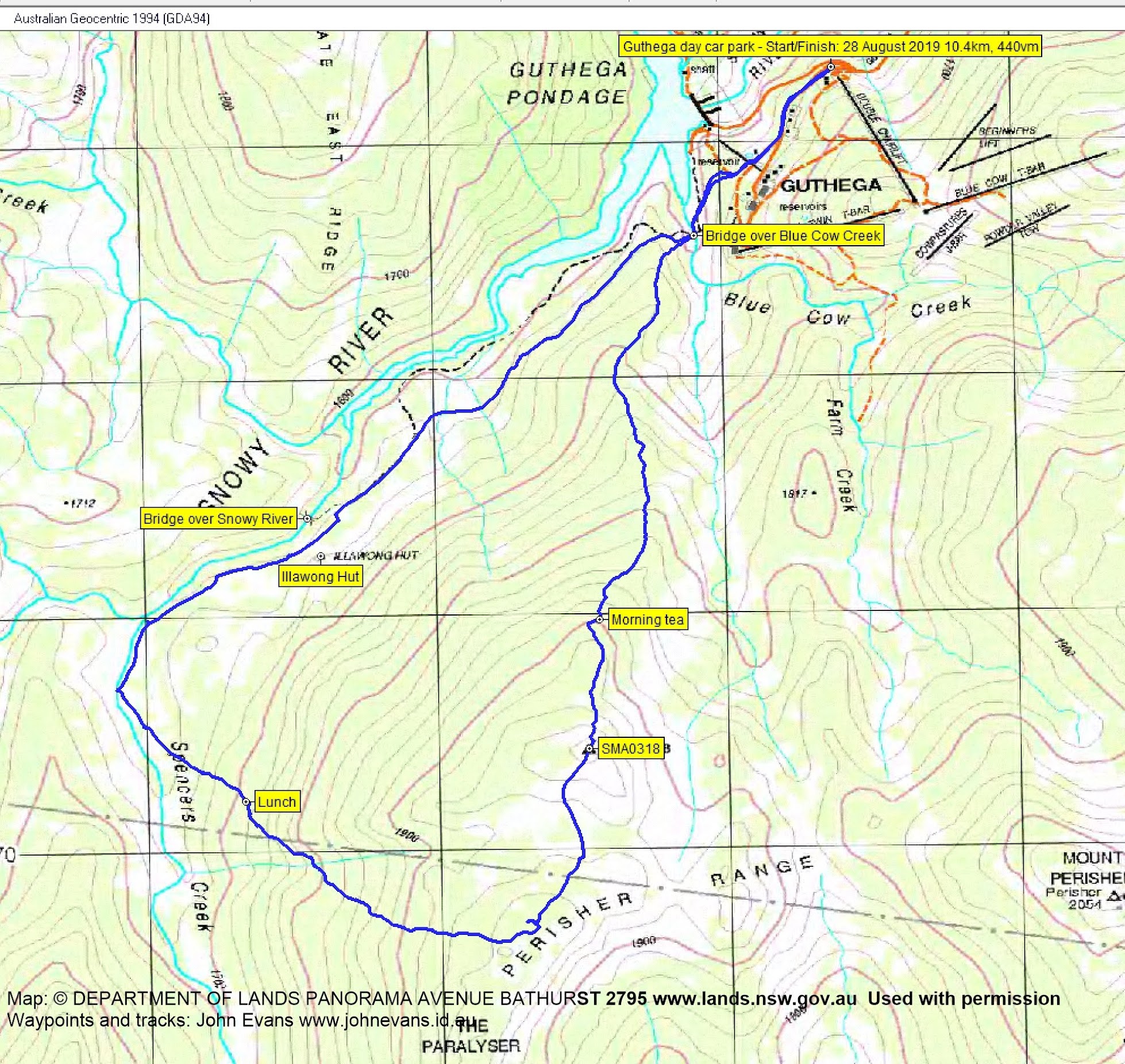
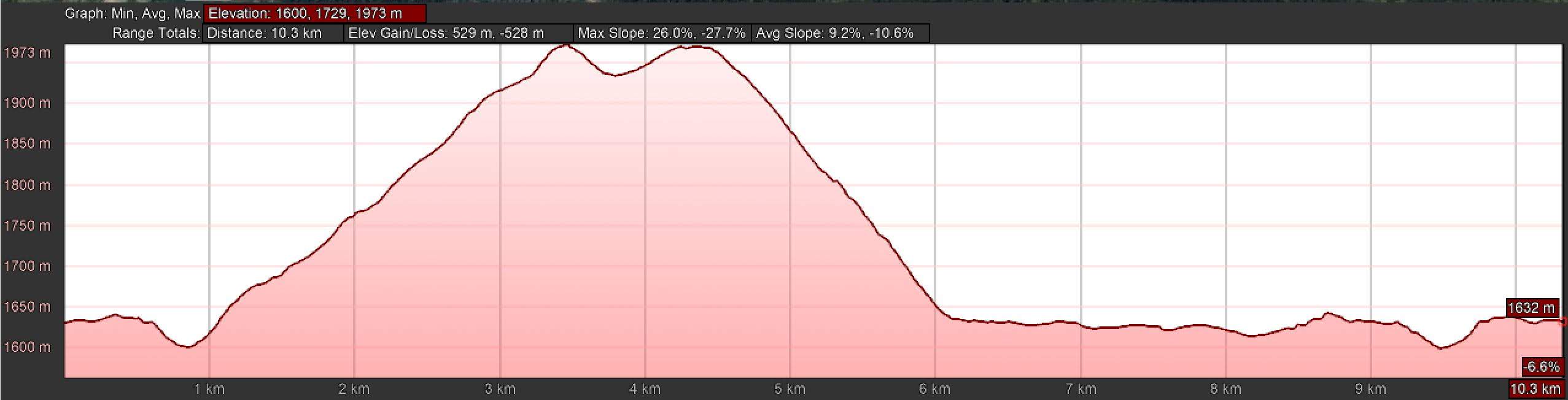
Distance: 10.4km | Climb: 440m | Time: 9.05am – 2.10pm (5hrs 5mins), including 45 mins of breaks | Grading: M/M; M(10)
Photographs
Photographs are available, where you can start a large sized slideshow.
Videos
Waypoint and Track Files
Download the gpx file for this trip (if your browser does not automatically download the file, it will open the gpx file in a new window and you can then save it). To use in Google Earth, do File, Open… and select Gps or All files as the File Type.
Track Notes
A 6.30am meet and I whisked my passengers via Cooma, Berridale and Jindabyne to Guthega. Roads all clear and a very nice day – mainly blue sky. The day car park was only around half full.
Shoes on and we began at the Illawaong Walk.

Heading out from Guthega
Down over Blue Cow Creek.

Crossing Blue Cow Creek
Then the initial steep climb up the spur towards SMA0318.

A steep climb up the spur to SMA0318
Huge views to the west and the east, with Mt Twynam identifiable.

View east as we climb the spur

Mt Twynam

View west from 1840m
The long haul continued, even after SMA0318 came into view.
Climbing towards SMA0318
So did the impressive views.

Surveying the scene to the west from just north of SMA0318
At last we reached the trig.

SMA0318
The lovely vistas to the south and SW continued.

View south to The Paralyser and SW to the Main Range
Once again, the map-marked The Paralyser eluded us as we began to turn away from it and begin the descent to Spencers Creek.

Beginning of the descent to Spencers Creek
Beautiful Snow Gums as we descended towards lunch, the snow firmer than last year.

Snow Gum on the descent to Spencers Creek
We stopped for lunch at 12noon. Although the wind had come up and it was cold at the exposed location, the view could not be missed.

Lunch views to the West and NW
We broke out of the tree line and descended closer towards Spencers Creek than the last trip.

Down to Spencers Creek
Walking beside Spencers Creek was the highlight of the day. It was absolutely stunning!

Beside Spencers Creek

Spencers Creek

Spencers Creek
We came to the confluence of Spencers Creek and the Snowy River, barely recognisable with the chilly water flowing under the snow.

Confluence of Snowy River and Spencers Creek
We then handrailed the Snowy River for a while.

Snowy River bridge
At last we were back at the outskirts of Guthega, not much parking here today.

Above Guthega Pondage
True to the forecast, the clouds started to roll in, with Consett Stephen Pass covered.
Yet another great snowshoe trip, thanks Mike for organising it and for your company Margaret.
Track Map
Track
Profile
Party
3 walkers – Mike B (leader), Margaret P, me.