
Entrance to the ACT Bushfire Memorial
Saturday 12 November 2022: CBC Canberra Centenary Trail Section 5 – Black Mountain to Stromlo Forest Park, including Black Mountain and Aranda Bushland Nature Reserves * – L/E-M,ptX. Begin with a walk around ‘Little Black Mountain’. On through a detour in the Aranda Bushland NR, the Cork Oaks and National Arboretum. Call in to the Wide Brown Land sculpture and Dairy Farmers Hill. Down to the edge of Lake Burley Griffin and a side trip to the National Rock Garden. Over Scrivener Dam and a bit of bike path to the North Weston Ponds and Stromlo Cottage. Through the Holder Wetlands, the Bushfire Memorial to finish at Stromlo Forest Park. Around 25km and 600vm climb. Limit 12. Early morning assistance required from one (or more, depending on number of walkers) driver/s to set up car shuttle, prior to start of walk.
Canberra Nature Park – a breath of fresh air for busy walkers. There are 39 Nature Reserves in the Canberra Nature Park. How many can we walk in? These are numbers 32 and 33.
Summary
From Garmin Connect – Distance: 24.04km | Climb: 545m | Time: 4:40 moving + 0:57 of stops = 5:37 | Grading: L/E-M,ptX; M(11).
Photographs Photographs are available here.
gpx File The gpx file is available here.
Track Notes
I last did this section of the Canberra Centenary Trail on 19 Oct 13. That day it was the 2013 Worn Boot Bash (‘around 30km and a few hills’), so we had to do from Hall to Duffy, around 40km. If I have any friends in another 10 years, we can do it again.
I’m getting a bit smarter with my list ticking. Today we did two more Canberra Nature Park Nature Reserves and a stage of the Canberra Centenary Trail.
Only 4 of us walked. Two late withdrawals – one flying in from Europe yesterday and the other returning from a wet Mt Jagungal trip. Reasonable excuses.
We put the car shuttle in place and started walking from Frith Road at 7.54am. A warm day which only got warmer. One notices it more at the time of change from cool and wet to proper late Spring temperatures.
Fire trail and footpad to Little Black Mountain, then north off the side to rejoin the circumnavigating fire trail. I forget whether this is CCT; we just did it so there was a semblance of valid claim to have walked the Black Mountain Nature Reserve. Another wiggle and a SW leg to the underpass under Caswell Drive. Using the OSM names from AllTrails, we used bits of the Up and Over Track, a footpad to the top, off-track down to join the Around Little Black Mountain Track, footpad to cut the corner and join the Curruthers Fire Trail and SW down Finnerans Road to the Caswell Drive underpass.
Similarly, we had to cover a few detours through the Aranda Bushland Nature Reserve to tick it off. We tracked up the west side of Caswell Drive, a little whoopsie (thanks for the correction, Jenny), SW on the Powerline Track, another whoopsie as I turned by mistake onto the Ridge Walk (but it was quite pleasant), veered right onto the Frost Hollow to Forest Walk, onto the Power Line Link Track, doubled back on Finnerans Road and so to the first of the merciless shared path (bike path), the C5 south along Bindubi Street. Followed the C5 beside William Hovell Drive, under it and into the softer going of the Cork Oak forest. That’s reasonable to tick off the Aranda Bushland Nature Reserve.
Quite soft going amongst the trees, a couple of detours in place. A water break stop.

Richard at water stop in the Cork Oaks
Through the Cork Oaks, we walked the contoured bends of the footpad up to the Himalayan Cedars and the central area.

In the Himalayan Cedars forest
Popped out the top to views over our next bound.

View to Dairy Farmers Hill from near ‘Wide Brown Land’
The fabulous sculpture was about the only brown in the green landscape.

‘Wide Brown Land’
A few steps further on, we stopped for smoko at 10.00am.
The Arboretum was the highlight of this stage of the CCT. We winkled our way around using a combination of tracks, footpads and off-track through the shortest of the long grass we could find.
Here’s the shortest grass.

National Arboretum Events terrace and lawn
The lookout on Dairy Farmers Hill had some great views. The nearby eagle nest sculpture is the best.

Eagle nest sculpture on Dairy Farmers Hill
We could see our next bound to the Arboretum exit, but there was plenty of long grass between it and us. A few bits of footpad, one taking us past the Wollemi Pines.

Wollemi Pine
We exited the Arboretum and went down to the National Rock Garden.
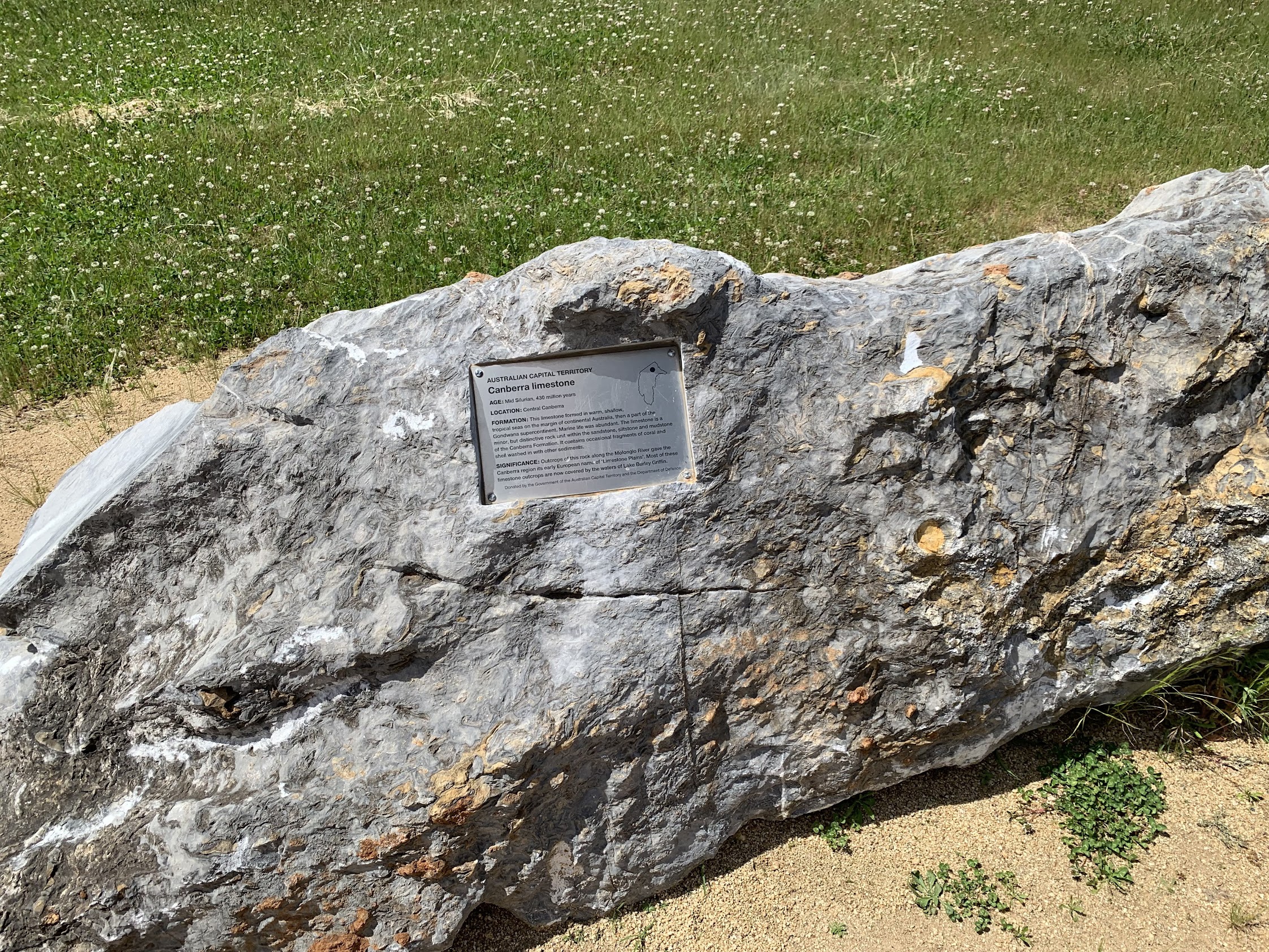
Canberra limestone exhibit in National Rock Garden
A few protesters there. Can anyone remember what they’re protesting?
Bike path to Scrivener Dam. A water stop in the shade. It was warm.

Scrivener Dam spouting the Molonglo River
A 3km in 33mins leg on bike path followed. I remember saying “it’s a lot quicker to ride this than walk it”. Spawning carp near the beginning.
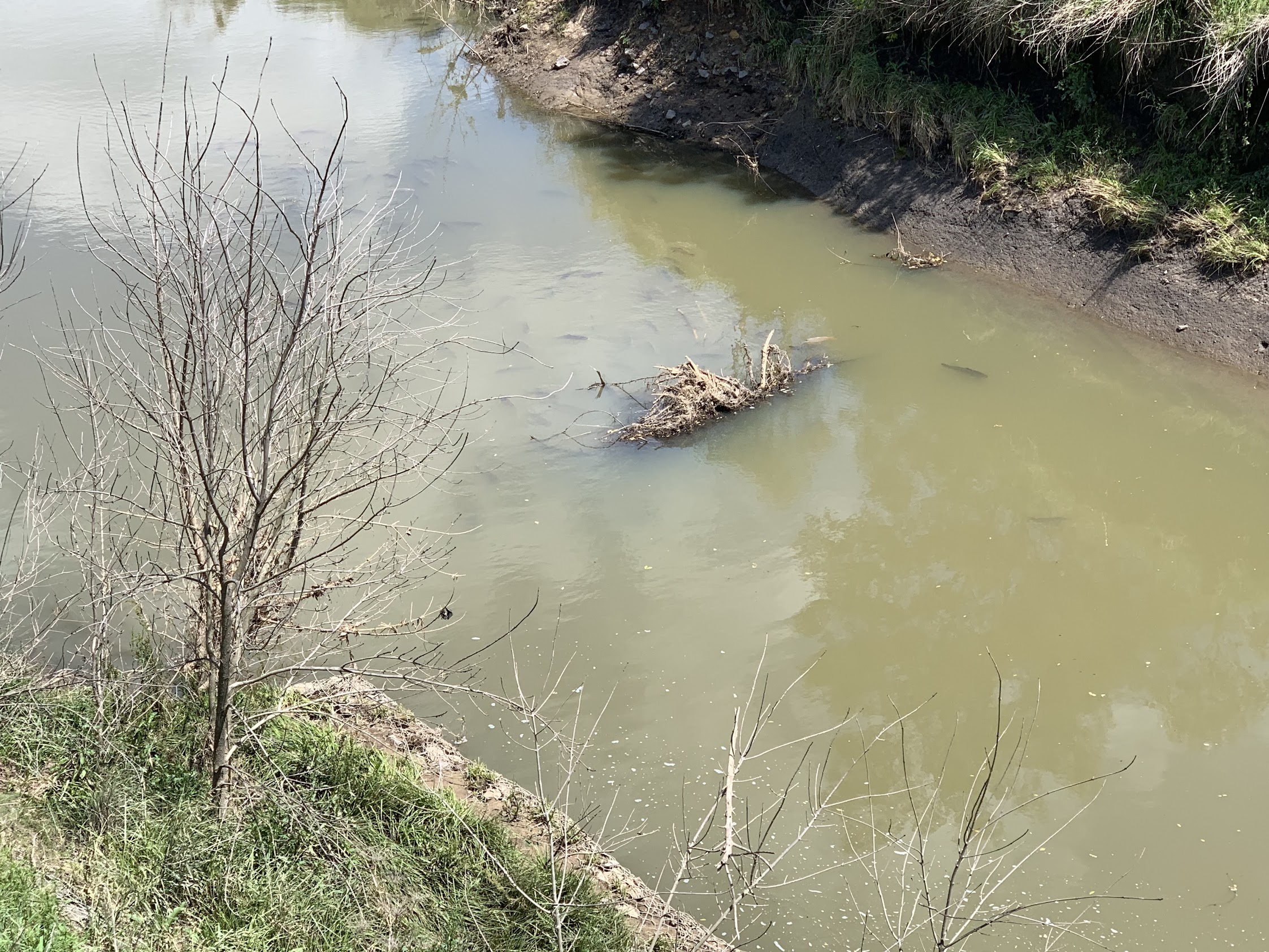
Spawning carp at the confluence of Yarralumla Creek and Molonglo River
I wonder what they’re putting in next to the Tuggeranong Parkway bridge over the Molonglo? The road is coming south out of the Arboretum. A turnaround and lookout?

What’s this going to be?
At last we were off the hard bike path. We walked up through the North Weston Ponds towards Stromlo Cottage. Negotiated the Weston Creek concrete, as we were on the wrong side. 20 minute lunch beside the Cottage fence in the shade.

Through the fence to Stromlo Cottage
We left at 12.30pm and could nearly smell the finish. South along the remaining pond and under John Gorton Drive. I wanted to visit the Holder Wetlands, so probably boo booed here by continuing to Dixon Drive. Closer to JGD would probably have revealed more of the wetlands. All we saw was

About all we saw of the Holder Wetlands
Continued west along the north side of ‘new’ Duffy. We were actually on the CCT. Crossed Cotter Road and took the footpad entry to the Bushfire Memorial, remembering the losses of 2003.

ACT Bushfire (2003) Memorial
The entrance is quite spectacular, and sobering. I lived in Duffy at the time.

Entrance to the ACT Bushfire Memorial
We walked up to the end. The shallow pond that feeds a stream running back down through the area is empty and looking a bit sad. Back down to the entrance.
Bike path to Stromlo Forest Park, through the car parks and up to our cars.
4th section of the CCT ticked off, CNP NRs 32 and 33 finished. 6 to go.
Relive the Trip
Track Maps
Here’s where we went. On Topoview2006 map © DEPARTMENT OF LANDS PANORAMA AVENUE BATHURST 2795 www.lands.nsw.gov.au Used with permission. A few roads and the entire Arboretum missing!

Track overview CCT 5

Track 1 CCT 5

Track 2 CCT 5

Track 3 CCT 5
The AllTrails map is here, where you can pan and zoom.
Party
4 walkers – Jenny A, Helen B, Richard H, me.
Information Bit(e)s
I’ve had a lot of assistance from walking friends recently. By way of paying a bit back, I’ll publish a few bites of information that may help someone. Today’s is ‘8 Plot a compass bearing on a map – what’s that hill over there?‘.