
Walkers on top of Billy Billy Rocks | photo Michael C
Saturday 20 January 2024: A dawn sortie up Billy Billy Rocks – S/R. We’ll be making an early start to drive out along the Corin Dam Rd and parking at the base of the rock climbers track up the Rocks. The old track was burnt in 2019 but the going is reasonable. Late breakfast/ morning tea greeting the morning looking out at the mountains.
Summary
From Garmin Connect (MAP66i) – Distance: 6.15km | Climb: 365vm (Elev Corrections Enabled) | Time: 2:06 moving + 2:52 of stops = 4:58 | Grading: S/R; M(10).
Photographs
View photographs here.
gpx file
Download the gpx file here.
Track Map
Here’s where we went.

Track overview Billy Billy Rocks

Track detail Billy Billy Rocks
Trip Report
I was last on Billy Billy Rocks on 29 Jun 19. That’s not to say that I got to the top then. The times I’ve been to the top have been led by others, on 22 Sep 18, 21 Nov 17 (with help from Jenny H), 14 May 16, 26 Jul 14, 30 Jan 10 (not to the top), 12 Jan 08.
Both Dick and I suffer from the same problem – we can’t get to the top without someone else showing us the way. So Rob H kindly put this trip on. Dick has a great follow on – he’ll pop back soon to review the route, then put on a CBC trip himself. Me? I’m getting too old for this, so will probably book on Dick’s trip!
Today Rob didn’t bring his handy rope ladder (but he did have a rope in his pack, just in case). We were to try a slightly different route from the bottom of the Rocks, Peter Conroy’s ‘crawls’.
Walking from the verge of Corin Road at 7.15am. A bit up the washed-out old fire trail, then left onto the rock climbers’ route.

Bottom of route to Billy Billy Rocks, just after turning off the old fire trail
The route/pad has worn back in again nicely. It’s also well marked with cairns and tapes.
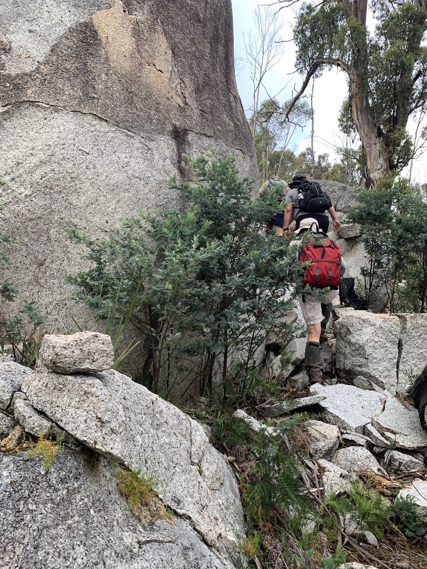
Easy to follow pad at 1310m
A water break at a slab. The tree trunk made a handy seat coming out.

A quick break on a somewhat horizontal slab
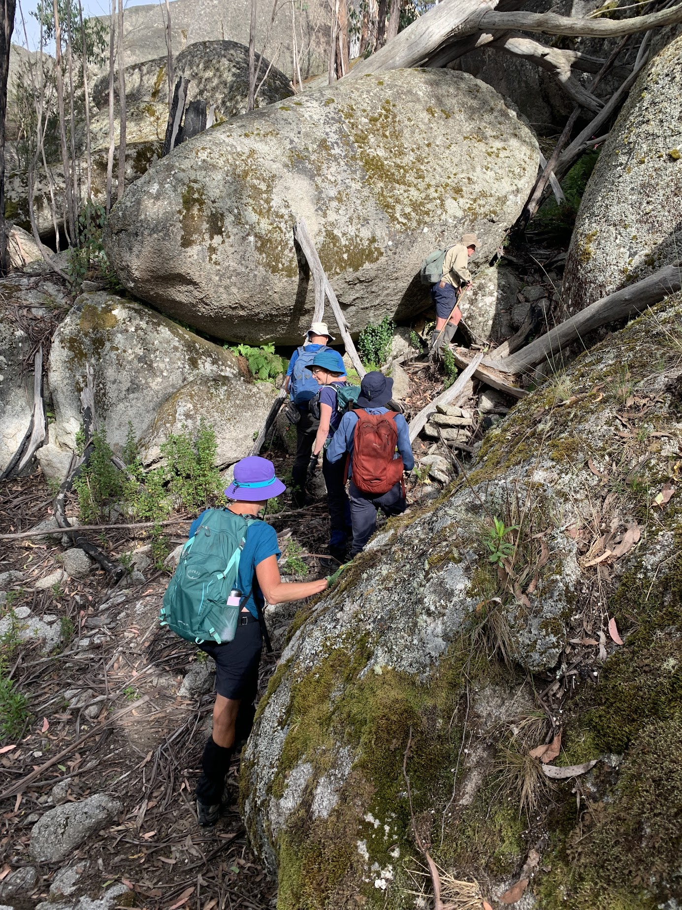
Plenty of tapes, at least up to Billy Billy Creek.
Plenty of tapes
Another brief stop at a granite slab, which makes a good map spot when doing this walk as a round coming back down the spur from Bogong Cave.

A pause at the granite slab | photo Lena O
The pad drops down to Billy Billy Creek.

Dropping down to Billy Billy Creek
An expansive patch of wildflowers in the sphagnum by the creek, kindly identified by Ciaran via NatureMapr as Geranium neglectum (Red-stemmed Cranesbill). Great service!

Delicate flowers in the sphagnum at Billy Billy Creek, Geranium neglectum (Red-stemmed Cranesbill)
Billy Billy Creek was running freely.
Billy Billy Creek
The tapes were few and far between climbing out the NW (true left) side of the creek and the fine footpad changed to one a little more difficult to follow in the grassy ground cover. But the tapes were reestablished closer to the top of the climb.
We reached the Bily Billy Rocks area at the 1400m contour and followed the route to the SW along the base. Arrived at waypoint ‘Cairn 1 – Billy Billy Rocks’ at 8.50am.
Bottom of the final approach at ‘Cairn 1 – Billy Billy Rocks’
As noted above, a slightly different route to the top was used today, involving a couple of crawls.

Michael negotiates a crawl | photo Lena O
We winkled our way up through the tors.

Some old fella out of his depth | photo Lena O
The second crawl was a bit tighter.

Old fella crawl | photo Lena O
Blue sky opened up as we got closer to the top.

Getting closer to the top | photo Lena O
The final crawl had us out on the bottom of the final run up to the top.

Exit of the final crawl
A scurry up and we were there.

Dick on the final run to the top
What a great place!

Top of the final run | photo Lena O
We enjoyed morning tea and the views.

Rob surveys the view to Mts Namadgi and Kelly from Billy Billy Rocks
Still a little cloud over the Tidbinbilla Range.

Tidbinbilla Range in cloud | photo Lena O
At last Rob had to say “mush, mush” and we began the reverse down.
But Dick and Lena had a surprise for us when we got down from the very top tors.

Cairn and clearing where we turned left to R&L’s slot
It was a lovely squeezy passageway.

Entrance to the slot | photo Lena O
We dropped our packs and sidled through as far as we could. It was definitely one-way traffic towards the end.

In the slot
There’s several more photos in the album, if you want a further idea of what it was like.
We backed out, backed down, and returned most satisfied to the Corin Road.
Thanks heaps, Rob and Jen. Everyone had a grand time!
Party
8 walkers – Michael C, Jenny and Rob H, Mon H, Dick M, Lena O, Sandra T, me.
AllTrails
The AllTrails map is here, where you can pan and zoom.
Johnny Boy’s Walkabout Blog FaceBook Page
I’ve started up a FaceBook page. Each trip report posts to it. It’s another way to get some info to get out and breathe a bit of fresh air. Why not pop over and Follow the page, or give a post a Like.
Garry
22 January , 2024 7:57 amUnable to down load your post. The last 2 posts I’ve been unable to see. Nothing changed at my end so don’t know what’s happened.
Cheers Garry
Johnny Boy
22 January , 2024 11:19 amHi Garry. How come you were able to post this comment then? Things check out this end and 70+ people have accessed this trip report so far. Cheers. john