Johnny Boy's Walkabout Blog
... bushwalking in the ACT and nearby NSW
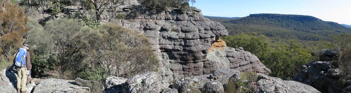
28 Jun 15 | The top of Binnari Pass to Quiltys Mountain, the Budawangs, Morton NP
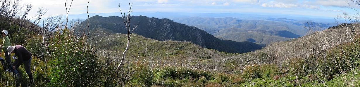
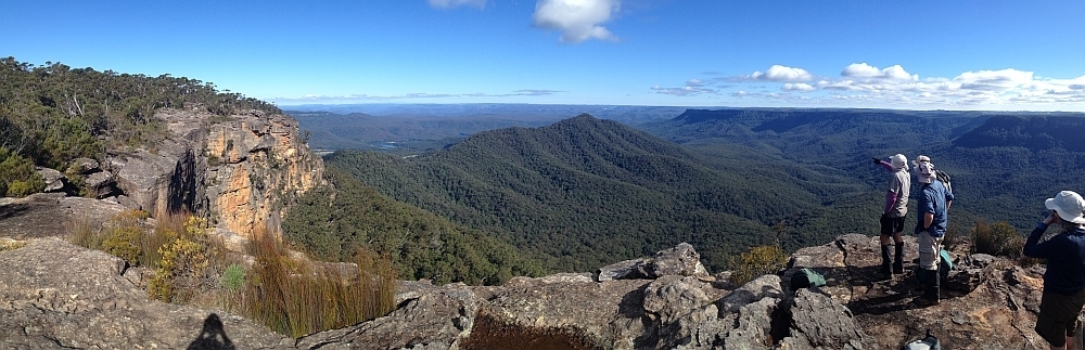
30Jun 15 | Views from north of Currockbilly Mountain over the source of the Yadboro River to Wirritin Basin and beyond to Pigeon House and the ocean, Budawang NP
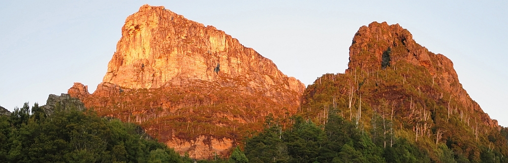
22 Apr 15 | Morning light on Frenchmans Cap and Lions Head, Tasmania
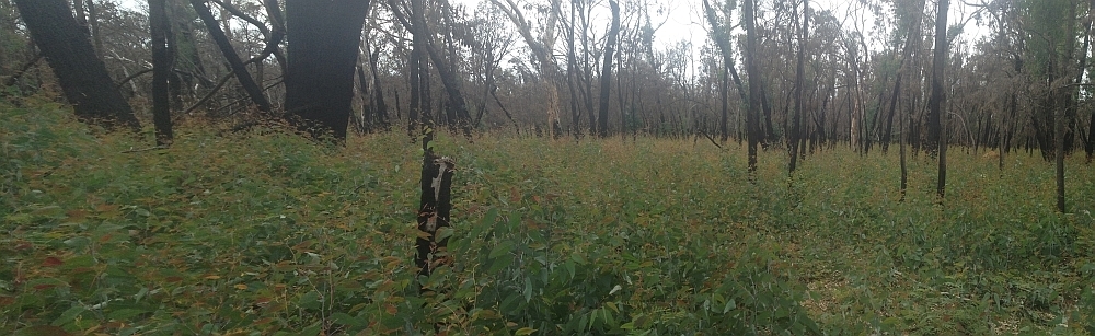
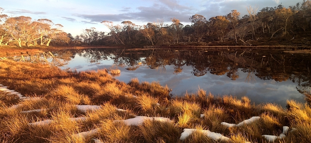
3 Mar 15 | Eucalyptus 'grass', Nadgigomar NR
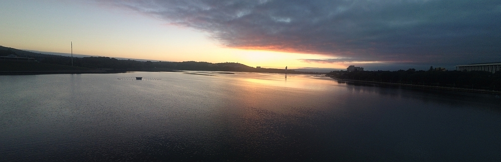
7 Feb 15 | Sunrise over Lake Burley Griffin at 6.30am, Canberra
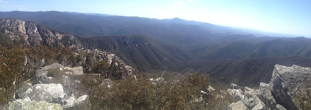
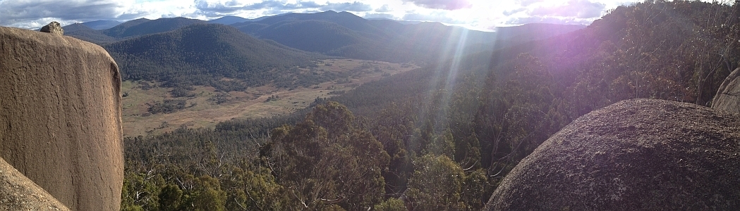
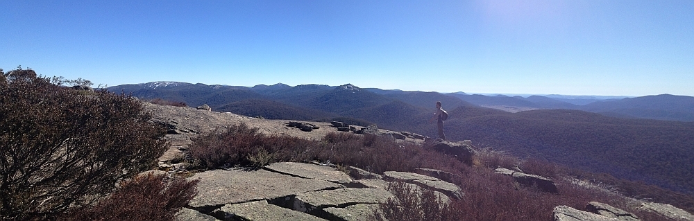
30 Sep 14 | Views down the south arm of Burkes Creek from The Pimple,NNP
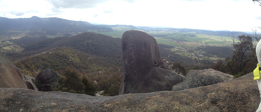
13 Sep 14 | Tidbinbilla Ridge, Mt Eliza and the main tor from Gibraltar Peak,TNR
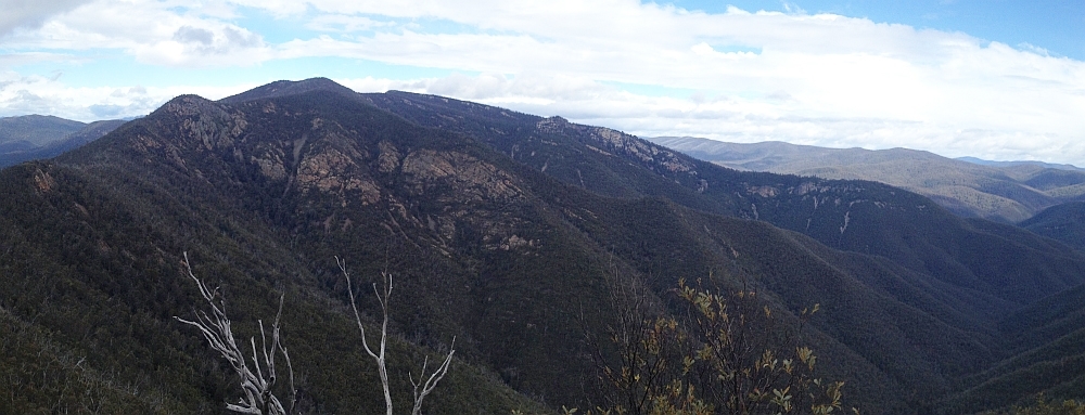
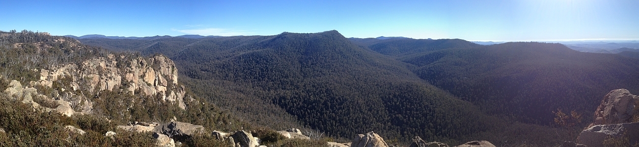
2 Sep 14 | View south to Johns Peak, Tidbinbilla Peak, Tidbinbilla Mountain and The Pimple, TNR and NNP
28 Jun 14 | Gooandra Homestead, KNP
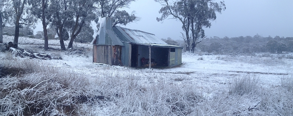
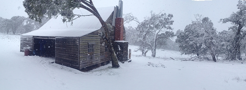
12 Jul 14 | Waterhole Hut, NNP
6 Jul 14 | Mt Gudgenby and the high hills of the Namadgi from Boboyan tor lookout, NNP
7 Jun 14 | Blue Gum Hill and the South Buttress of Booroomba Rocks from SH1353, NNP
24 May 14 | Orroral Valley from GC1XAJQ Ridge of Stone geocache, NNP
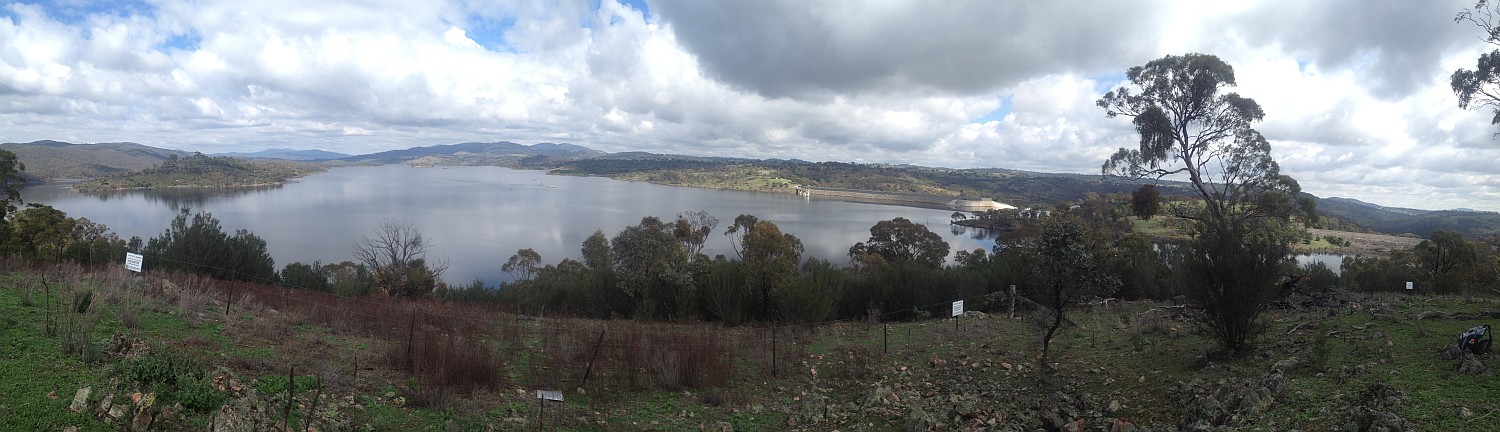
29 Mar 14 | Googong Dam from Googong Lookout, GF
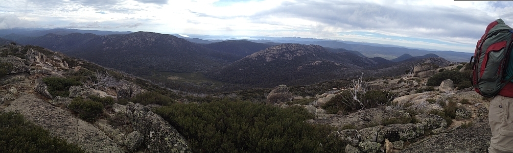
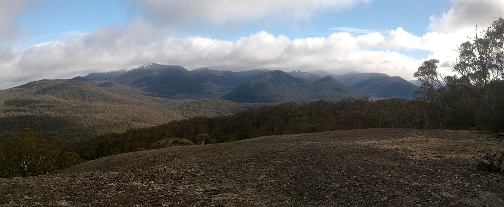
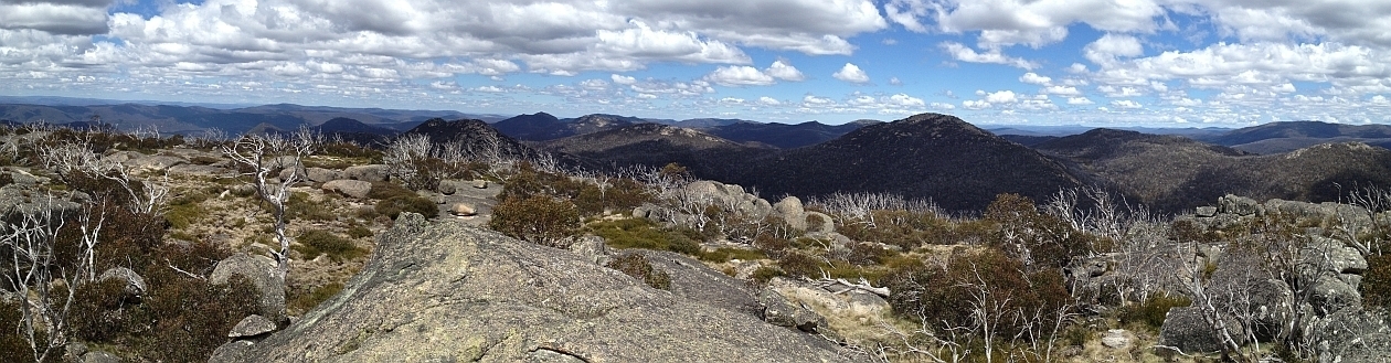
15 Mar 14 | Mt Namadgi, Rotten Swamp, Mt Burbidge, Bogong Gap, Gudgenby Grasslands and Yankee Hats from Mt Kelly, NNP
10 Aug 13 | Plains trig, Pri
13 Jul 13 | Scabby Tarn at sunset, NNP
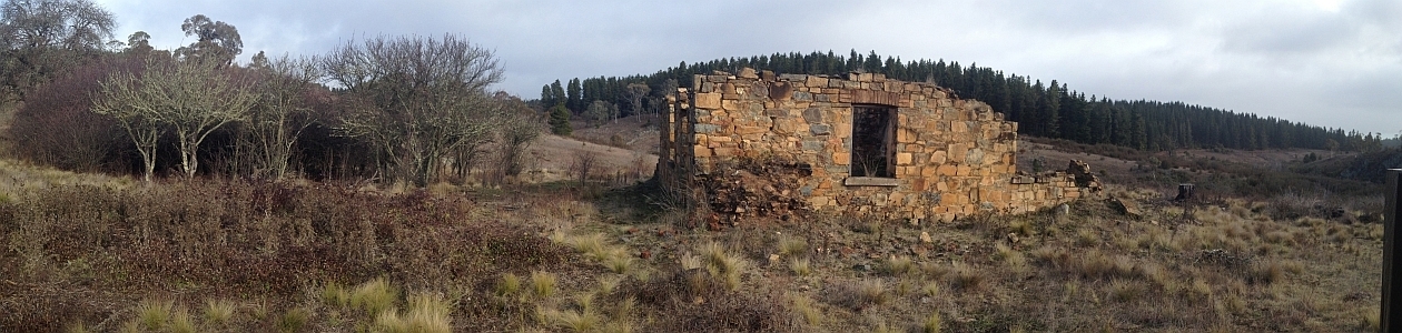
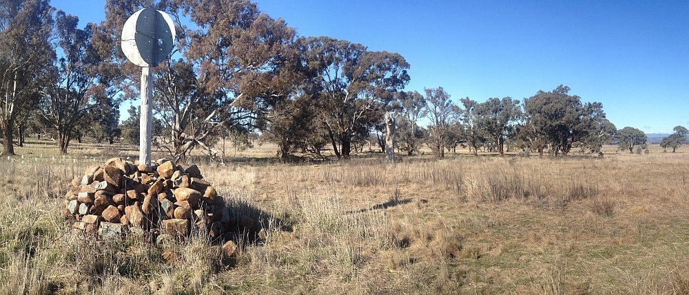
25 Jun 13 | Colliers homestead and orchard, Pri
8 June 13 | Webbs Ridge from Mt Coree, BNP
4 Jun 13 | Mt Moollattoo from the Carrialoo plateau, MNP
9 Sep 12 | Mt Gudgenby from granite slabs E of Sentry Box Mountain, NNP
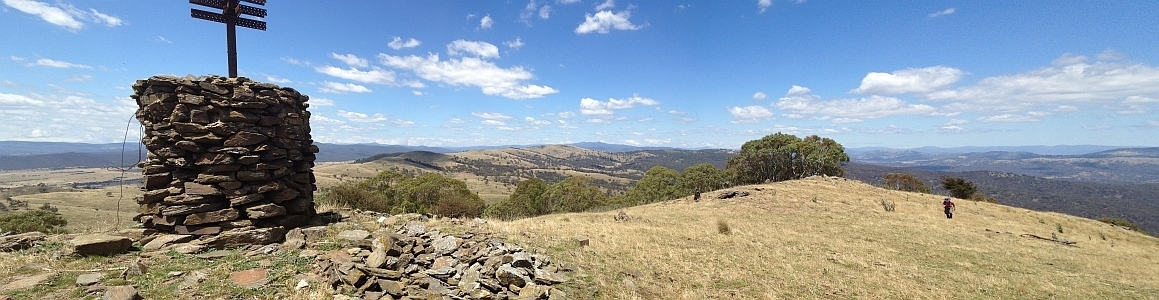
10 Nov 12 | View south from Mt Namadgi, NNP
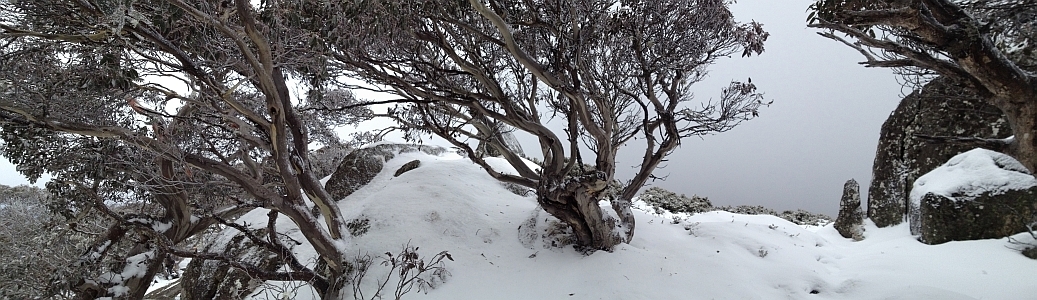
30 Jun 12 | Snow Gums at Mt Gingera, NNP
31 Jan 12 | Molonglo Ridge from Yarrow Pic, Pri
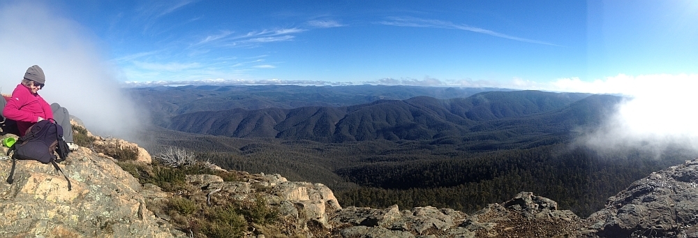
28 Jun 16 | Lunch on Mt Reedy (photo Barrie R), KF
| Walk # | Date | Walk | Distance | Climb | Grading | Photos |
| 653 | 19 Dec 12 | CNP: Tim the Yowie Man’s Majura Stone Walls * | 4.0 | 200 | S/E-M,X; E(5) | Photos |
| 652 | 14-15 Dec 12 | KNP: Ten Hill Tops – but not the Aussie Top Ten * | 37.2 | 1100 | L/M,ptX; H(12) | Photos |
| 651 | 12 Dec 12 | NNP: McKeahnie Trig and Square Rock * | 17.0 | 550 | L/R; H(12) | Photos |
| 650 | 11 Dec 12 | NNP: Mystery Walk – Snowy Flat Creek * |
13.4 | 800 | L/R,W; H(13) | Photos |
| 649 | 8 Dec 12 | NNP: Licking Hole Creek Quartz Ridge |
34.7 | 900 | L/E-M,ptX; H(14) | Photos |
| 648 | 6 Dec 12 | MRC: Southside evening stroll – Kambah Pool to Red Rocks Gorge * | 6.9 | 100 | S/E; E(5) | Photos |
| 647 | 4 Dec 12 | NNP: Border Marker hunting on the ACT Border Straight Line * |
13.6 | 750 | L/R,ptX; H(13) | Photos |
| 646 | 1 Dec 12 | NNP: Middle Creek – Towards Mt Namadgi ! |
19.3 | 250 | L/M-R; M(10) | Photos |
| 645 | 29 Nov 12 | ANU/ACTF: Mt Stromlo ! | 6.6 | 125 | S/E; E(5) | Photos |
| 644 | 27 Nov 12 | NNR: Nadgigomar left and right banks (of the Shoalhaven River) | 13.4 | 250 | M/M; M(9) | Photos |
| 643 | 20 Nov 12 | NNP: Breakfast Creek Ridges & Tors |
20.0 | 600 | L/R; H(12) | Photos |
| 642 | 17 Nov 12 | NNP: Rendezvous Creek and AAWT * |
22.1 | 650 | L/R; H(13) | Photos |
| 641 | 13 Nov 12 | MoNP:Monga Exploratory |
11.0 | 300 | M/R; M(10) | Photos |
| 640 | 12 Nov 12 | CNP:Cooleman Ridge | 7.0 | 50 | S/E; E(5) | |
| 639 | 10 Nov 12 | NNP:Birthday drinks on Mt Namadgi * |
30.0 | 800 | L/R; VH(15) | Photos |
| 638 | 6 Nov 12 | ANU/ACTF: Mt Stromlo Wild West Walks ! | 7.1 | 300 | S/E; E(6) | Photos |
| 637 | 3 Nov 12 | NNP: In the shadow of Mt Namadgi – Big Creamy Flats * | 24.8 | 550 | L/M-R; H(13) | Photos |
| 636 | 30 Oct 12 | TSF: Mt Lowden and Serenity Rocks |
14.9 | 500 | M/R,ptX; M(11) | Photos |
| 635 | 27 Oct 12 | NNP: Brindabella Gaps and Border Markers * |
46.7 | 1800 | L/E-R,ptX; VH(15) | Photos |
| 634 | 23 Oct 12 | TSF: Jerrabattgulla Creek | 11.4 | 350 | M/R; M(11) | Photos |
| 633 | 20 Oct 12 | ANU/ACTF/SCNR: Mt Stromlo and W to Murrumbidgee River ! |
14.6 | 450 | M/M,ptX; M(9) | Photos |
| 632 | 16 Oct 12 | BuNP: Mt Budawang and Currowan Falls |
17.8 | 650 | L/R; H(13) | Photos |
| 631 | 13 Oct 12 | NNP: Corin Dam to Pryors Hut / Gingera return | 19.9 | 950 | L/E; H(12) | Photos |
| 630 | 9 Oct 12 | NNP: Prairie Dog Creek Granite Outcrops | 17.4 | 650 | L/R; H(13) | Photos |
| 629 | 7 Oct 12 | NNP: Hikers without Pants – Do It In A Dress – Mt Tennent * | 14.6 | 800 | L/E; M(9) | Photos |
| 628 | 30 Sep 12 | NNP: Sunset from Mt Coree * | 17.8 | 700 | L/E; M(10) | Photos |
| 627 | 25 Sep 12 | CBC Navigation Refresher #7 – An Introduction to PC Software for GPS * | ||||
| 626 | 25 Sep 12 | ACTF/GiNR: Border Markers W of Angle Crossing * | 10.2 | 400 | M/M,ptXW; M(8) | Photos |
| 625 | 22 Sep 12 | CNP/Urban: Lily’s Walkathon Recce ! | 14.2 | 100 | M/E,ptX; E(6) | Photos |
| 624 | 15 Sep 12 | NNP: An absolutely insane walk! – Yankee Hat Ridge – but we did it! |
21.3 | 700 | L/R,ptX; VH(15) | Photos |
| 623 | 12 Sep 12 | Presentation for Canberra Cross Country Ski Club ! | ||||
| 622 | 11 Sep 12 | BGNR: Barren Grounds Nature Reserve |
22.7 | 200 | L/E; M(9) | Photos |
| 621 | 8-9 Sep 12 | NNP: Border Markers W85, X85 and Sentry Box * |
43.6 | 1100 | L/M-R,ptX; H(13) | Photos |
| 620 | 4 Sep 12 | NNP: Yet more Border Markers S of Mt Clear – ride and stride ! | 36.8 | 1074 | H | Photos |
| 619 | 28 Aug 12 | TNR: Mt Domain via spur to Snowy Corner * |
8.5 | 800 | M/R; H(12) | Photos |
| 618 | 25 Aug 12 | WNR: Art/Photography, Shepherds Lookout, Murrumbidgee River | 5.8 | 188 | S/E; E(4) | Photos |
| 617 | 21 Aug 12 | NNP: Border Markers near Mt Clear – ride and stride ! | 43.5 | 1500 | H | Photos |
| 616 | 18 Aug 12 | Urban/CNP: Canberra Centenary Trail: Sections 7 and 8 – Tuggeranong to Parliament House via S Canberra ridges ! |
27.8 | 450 | L/E,ptX;M(10) | Photos |
| 615 | 14 Aug 12 | NNP: Granite Tors: Honeysuckle Creek |
13.2 | 400 | M/R; M(11) | Photos |
| 614 | 11 Aug 12 | Pri/ACTF: 12 Historic Sites at Glenburn-Burbong Walk and Work * | 1.0 | 10 | S/E; VE(3) | Photos |
| 613 | 7 Aug 12 | NNP: More Border Markers on the Clear Range from Caloola * | 25.3 | 950 | L/R,ptX; H(14) | Photos |
| 612 | 4 Aug 12 | CNP: Worn Boot Bash # 10 – Kambah – Hall via the proposed Centenary Trail | 35.1 | 600 | L/E; M(10) | Photos |
| 611 | 31 Jul 12 | NNP/BNP: Border Markers South of Mt Coree from Two Sticks Rd * | 21.2 | 1050 | L/R,ptX; H(14) | Photos |
| 610 | 28 Jul 12 | NNP: Nursery Swamp & Nursery Hill | 18.0 | 550 | L/R; H(12) | Photos |
| 609 | 24 Jul 12 | TSF: Gourock Range-Tallaganda Forest | 16.2 | 650 | L/E-M; M(11) | Photos |
| 608 | 21 Jul 12 | NNP: Some mickey mouse track walks to regain fitness and for other reasons – Square Rock and Orroral Lookout; Gibraltar Falls; Rendezvous Creek Loop; Orroral Valley Heritage Trail ! | 24.6 | 350 | L/E,ptX; M(9) | Photos |
| 607 | 14 Jul 12 | CNP/MRC: Canberra Centenary Trail: Section 6 – Stromlo Forest Park to Tuggeranong * | 22.9 | 250 | L/E; M(9) | Photos |
| 606 | 10 Jul 12 | TiNR: Tinderry Region | 17.2 | 1150 | L/R; H(13) | Photos |
| 605 | 7-8 Jul 12 | NNP/SRNR: Mt Kelly |
30.4 | 1050 | L/R; H(12) | Photos |
| 604 | 3 Jul 12 | NNP: Mt Herlt Granite Slabs * |
16.9 | 850 | L/R; H(13) | Photos |
| 603 | 2 Jul 12 | Walks Planning evening | ||||
| 602 | 30 Jun 12 | NNP: First day of retirement – Corin Dam to Mt Gingera ! |
19.7 | 1100 | L/M; H(13) | Photos |
| 601 | 26 Jun 12 | NNP: Granite Ridges South-East of Orroral Hill |
9.9 | 450 | M/R; M(10) | Photos |
| 600 | 23 Jun 12 | Urban/CNP: Canberra Centenary Trail: Section 1 – Parliament House to the Federal Highway * |
22.7 | 600 | L/E,ptX; M(10) | Photos |
| 599 | 19 Jun 12 | TNR: More B&B Sites at TNR – including footpad to Snowy Corner cairn * |
10.1 | 700 | M/E-M,ptX; M(11) | Photos |
| 598 | 16 Jun 12 | CNP: Six Trig Points | 22.3 | 750 | L/E; H(12) | Photos |
| 597 | 9 Jun 12 | NNP: a repeat of …Indigenous and European Sites – a day in the bush * | 12.0 | 200 | M/E; E(7) | Photos |
| 596 | 26 May 12 | NNP: Orroral Hill | 11.6 | 650 | M/R; M(11) | Photos |
| 595 | 22 May 12 | Pri/DNP: Exploring the Upper Shoalhaven | 18.4 | 300 | L/M; M(11) | Photos |
| 594 | 19 May 12 | NNP: A (relatively) easy look at the Mt Tennent scar from the top * |
14.5 | 800 | L/E-R,ptX;H(13) | Photos |
| 593 | 19 May 12 | ABC 666 radio interview 7.30-7.45am with Tim the Yowie Man | ||||
| 592 | 15 May 12 | NNP: A search for … McKeahnie Hut site with Matthew H + Rendezvous Creek * | 19.0 | 400 | L/M,ptX;M(10) | Photos |
| 591 | 12 May 12 | SRNR: Sentry Box from Yaouk Road |
12.5 | 650 | M/R;M(11) | Photos |
| 590 | 8 May 12 | NNP: A search for Old Fishloch Yards and SH1339 * |
21.3 | 600 | L/E-R,ptX;H(13) | Photos |
| 589 | 1 May 12 | NNP: Scar on Mt Tennent |
15.7 | 1000 | L/R; H(13) | Photos |
| 588 | 28 Apr 12 | NNP: Canberra & Region Heritage Festival – Orroral Homestead Heritage Ramble | Photos | |||
| 587 | 27 Apr 12 | BSRA: Abseiling at Bungonia |
Photos | |||
| 586 | 24 Apr 12 | TNR/NNP: Johns Peak, Tidbinbilla Peak, Snowy Corner, Cascade Trail * | 14.3 | 900 | L/R,ptX; H(13) | Photos |
| 585 | 21 Apr 12 | NNP: Canberra & Region Heritage Festival – Indigenous and European Sites – A Day in the Bush * | 11.2 | 200 | M/E; E(7) | Photos |
| 584 | 17 Apr 12 | TiNR: An introduction to the Tinderrys – tor 066461 * | 8.9 | 350 | M/M,ptX; M(9) | Photos |
| 583 | 15 Apr 12 | CNP: Canberra & Region Heritage Festival – Marking the ACT Border – A Ramble * | 7.0 | 200 | S/E; E(7) | Photos |
| 582 | 15 Apr 12 | Scrivener’s Breakfast | ||||
| 581 | 14 Apr 12 | YNP: Mt Foxlow | 14.8 | 600 | M/M; M(10) | Photos |
| 580 | 10 Apr 12 | Pri/NNP: More Border Markers on the Clear Range * |
24.3 | 900 | L/E-R,X; H(14) | Photos |
| 579 | 6 Apr 12 | TNP: Mt Palerang |
9.6 | 600 | M/M; M(10) | Photos |
| 578 | 27 Mar 12 | NNP: Bad hair day at …Hospital Creek cascades and Hut * |
18.1 | 450 | L/E-M; M(11) | Photos |
| 577 | 24 Mar 12 | NNP: Honeysuckle, Booroomba, Bushfold and Mt Tennent * |
27.0 | 1000 | L/E-M; H(14) | Photos |
| 576 | 20 Mar 12 | NNP: Rendezvous Creek/Gudgenby River confluence * | 7.2 | 300 | S/E-R; M(9) | Photos |
| 575 | 18 Mar 12 | CNP: Goorooyarroo Woodland Reserve to X4 ! | 6.9 | 250 | S/E-M; E(6) | Photos |
| 574 | 17 Mar 12 | NNP: Square Rock and Smokers Trail | 14.8 | 350 | M/E; M(8) | Photos |
| 573 | 13 Mar 12 | ACTF/BNP: Back to Two Sticks Hill and Sherwood * | 16.1 | 500 | L/E-M,ptX; M(10) | Photos |
| 572 | 10 Mar 12 | GNR: Gigerline Trig (+ De Salis cemetery) |
11.1 | 300 | M/M; M(9) | Photos |
| 571 | 6 Mar 12 | ACTF/BNP: Two Sticks Hill & Mt Dowling | 15.7 | 550 | L/E-M; M(10) | Photos |
| 570 | 14 Feb 12 | Pri/NNP: Border Markers on the Clear Range from Caloola * | 27.6 | 900 | L/E-RWptX; H(14) | Photos |
| 569 | 13 Feb 12 | CNP: Cooleman Ridge west | 7.2 | 200 | S/E; E(5) | Photos |
| 568 | 7 Feb 12 | KNP: Tabletop Mountain near Kiandra | 29.8 | 650 | L/E-M; H(12) | Photos |
| 567 | 4 Feb 12 | NNP: Orroral to Bimberi Peak * |
50.1 | 1850 | L/E-M; H(14) | Photos |
| 566 | 31 Jan 12 | Pri: Molonglo Ridge – Mt Molonglo and Yarrow Peak * |
20.6 | 700 | L/M,X; H(12) | Photos |
| 565 | 30 Jan 12 | CNP: Gossan Hill | 6.5 | 100 | S/E; E(5) | Photos |
| 564 | 28 Jan 12 | NNP: NVC to Blue Gum Creek * | 25.2 | 900 | L/E; H(13) | Photos |
| 563 | 26 Jan 12 | CNP: Urambi Hills | 6.7 | 175 | S/E; E(5) | Photos |
| 562 | 24 Jan 12 | Pri/CNP: Border Markers in Majura Range W of Sutton Road; Environa; Border markers on the rail line S of Queanbeyan; and Mt Wanniassa * |
17.8 | 150 | M/E,X; M(8) | Photos |
| 561 | 23 Jan 12 | CNP: Yarramundi Peninsula | 6.7 | 50 | S/E; E(4) | Photos |
| 560 | 19 Jan 12 | CNP: Mt Majura | 5.2 | 250 | S/E; E(4) | Photos |
| 559 | 17 Jan 12 | Rail: Border Markers on the railway at the back of Hume ! | 17.2 | 100 | M/E,X; M(8) | Photos |
| 558 | 16 Jan 12 | CNP: Goorooyarroo Nature Park again | 4.5 | 200 | S/E; E(5) | Photos |
| 557 | 12 Jan 12 | CNP: Mulligans Flat | 7.4 | 100 | S/E; E(5) | Photos |
| 556 | 9 Jan 12 | ACTF: Kowen Forest | 8.8 | 250 | S/E; E(5) | Photos |
| 555 | 7 Jan 12 | CNP: Red Hill north | 10.1 | 150 | M/E | Photos |
| 554 | 5 Jan 12 | CNP: Campbell Park | 7.1 | 150 | S/E; E(5) | Photos |
| Further completed trips will be added.Meanwhile, they can be accessed via the old blog at www.johnevans.id.au | ||||||