
Climbing back out at 730m
Saturday 25 August: Bullen Range – L/E,R,ptX. GC22HRJ Bullen’s Crack. Walk the fire trail along the crest of the Bullen Range from Tidbinbilla Road through Barnes Hill and Brett Trig. A further 1km north, we go off-track and descend 200vm into the drainage lines to geocache Bullen’s Crack. Regaining the crest, we return via the pisé ruin ‘Calvary’. Around 18km and 700m climb. Map: Tuggeranong. Leader: John Evans 0417 436 877 john@johnevans.id.au . Limit: 8. Transport: ∼$5 per person. Book by 2pm Thursday 23 August.
Summary
Distance: 16.5km | Climb: 850m | Time: 7.50am – 1.35pm (5hrs 45mins), including 50 mins of breaks | Grading: L/E,M,R,ptX; H(12-)
Photographs
Photographs are available, where you can start a large sized slideshow.
Waypoint and Track Files
Download the gpx file for this trip (if your browser does not automatically download the file, it will open the gpx file in a new window and you can then save it). To use in Google Earth, do File, Open… and select Gps or All files as the File Type.
Track Notes
An early meet (as usual) and a short drive had us walking by 7.50am. A walk suitable for my poor feet – still walking, still suffering, but getting no worse.
Through the gate into the old TSR (Travelling Stock Route), although I think it’s been renamed the Miowera Pines Walk. After around 900m we left the fire trail and headed up the crest to Barnes trig. Kambahkid (Derek S) had some geocaches to find and log, which he quickly did.
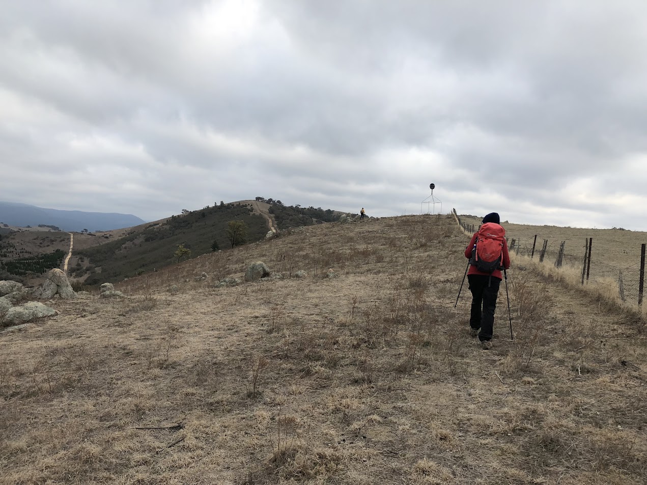
Climbing to Barnes trig
Down, then up, to the next hill top, where the next cache was quickly dispatched.
Was it around here that I learned my first lesson for the day? And a very valuable one too. It was how to interpret the common BoM forecast. Has it ever bothered you when you see a 0% chance of 3-5mm of rain? I can’t find one at the moment, but here’s the Canberra forecast for next Saturday:
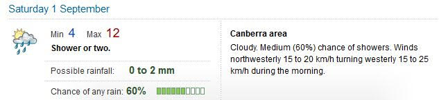
It should be interpreted as there being a 60% chance of there being 0.2mm of rainfall, plus a 50% chance of being 0mm and a 25% chance of being 2mm.
A quick down from the hill top to join the Bullen Range Fire Trail along the crest (not shown on my 2006 digital maps). Easy walking through another cache for Derek and up to Brett trig for another.
Some undulations and a final up to my planned turnoff point. We enjoyed morning tea nearby. No view, but probably a better no view than down at the objective.
Starting off again, I experienced my second lesson for the day. Sadly, it involved the rest of the party. I get a little excited by the smell of a geocache at 500m and tend to head straight towards it. This caused us to ignore my planned route down a nearby spur and we ended up sidling down the side of the spur. Have a look:

Caching detail Bullen Range Crest
At the little blip point I took a review – the crest of the spur was to our right and the seemingly more open drainage line closer to our left. So I turned down hill, of course. (we didn’t cross the drainage line, as the map shows, just wandered down it for a while). To my mind, since I enjoy scrub and on the descent it was very light, it didn’t matter. But it was inelegant.
Arriving at the cache location, I first saw a rock pile cairn. I did have the spoiler pic with me, so knocked the cairn down and looked under the rock shelf to find the cache. Log signed, I relented and rebuilt the cairn. A nice little area, quite a few kurrajong trees and distant views down to the Murrumbidgee River. We paused to take it in.

Geocache and kurrajong trees at our destination
The return route was a breeze. Open woodland on the dry crest of the spur, very little scrub. With Derek in the lead towards the top, he advised us to swing left to avoid the last 10vm of climb. Sweet.
Climbing back out at 730m
We retraced our journey back along the fire trail through Brett trig. A glance down the power line track which can be seen from Canberra southern suburbs.

Looking down the power line trail at Brett trig
Reaching a point about east of ‘Calvary’, we turned down towards it. A scrubby area, but fortunate enough to find animal pads though the shrubs.
Lunch and other cache at the ‘Calvary’ pisé homestead ruins.

‘Calvary’
We left the site to the SW, followed the fallen fence line for a while, then turned to join the old vehicle track which heads up the join the crest route. I was interested in this return route, as TL and I had talked about ‘candles and canapes at Calvary’ and participants would have to walk out with head torches in the dark – 4.2km in 1hr 32mins.
Thanks all. Just too long for my sore feet, but one can’t stop walking.
Track Maps

Track overview

Track 1

Track 2

Track 3

Profile

Google Earth snip
Party
6 walkers – Chris F, Braham H, Cate Le M, Stephen M, Derek S, me.