2009

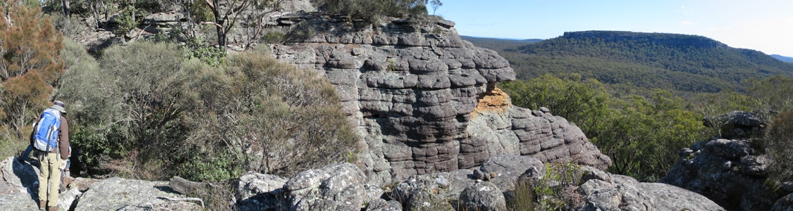
28 Jun 15 | The top of Binnari Pass to Quiltys Mountain, the Budawangs, Morton NP
Text Layer

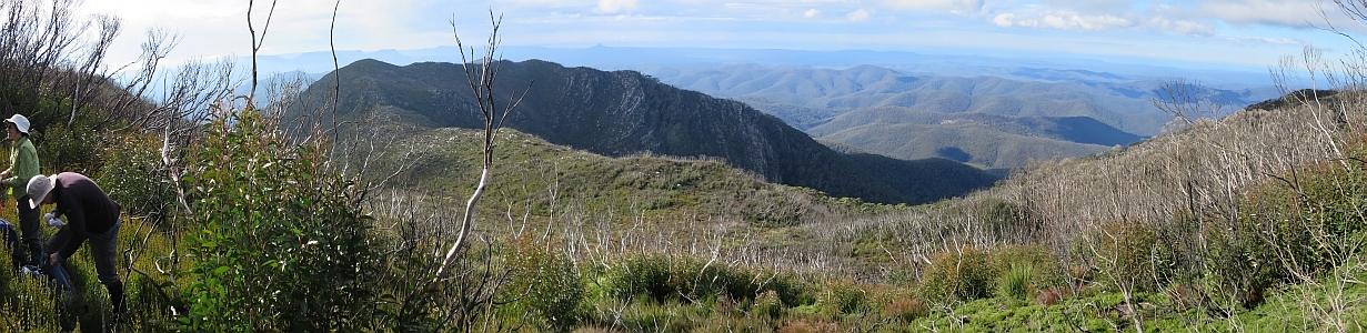
30Jun 15 | Views from north of Currockbilly Mountain over the source of the Yadboro River to Wirritin Basin and beyond to Pigeon House and the ocean, Budawang NP

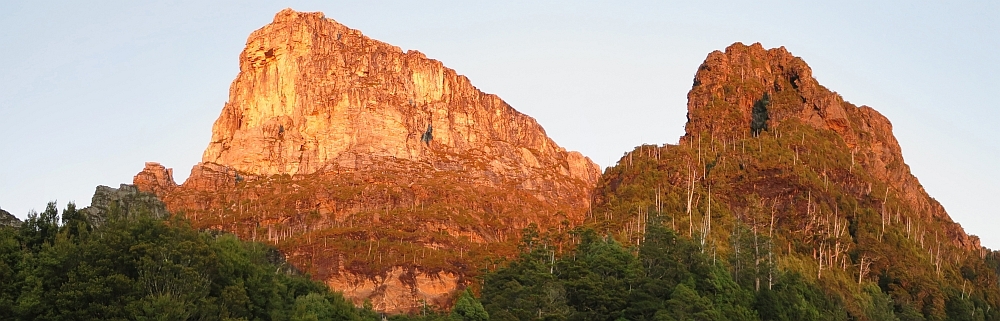
22 Apr 15 | Morning light on Frenchmans Cap and Lions Head, Tasmania

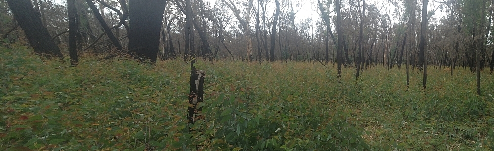
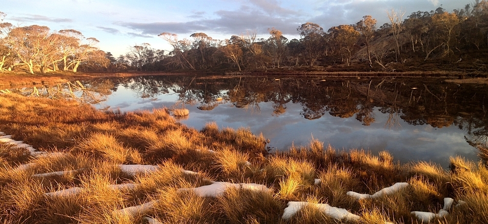
3 Mar 15 | Eucalyptus 'grass', Nadgigomar NR
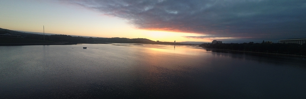
7 Feb 15 | Sunrise over Lake Burley Griffin at 6.30am, Canberra
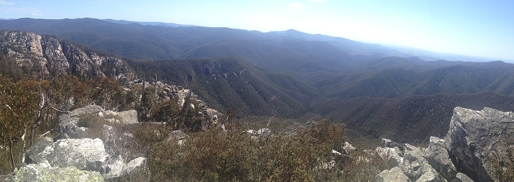
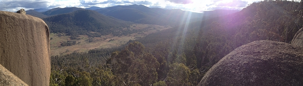
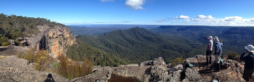
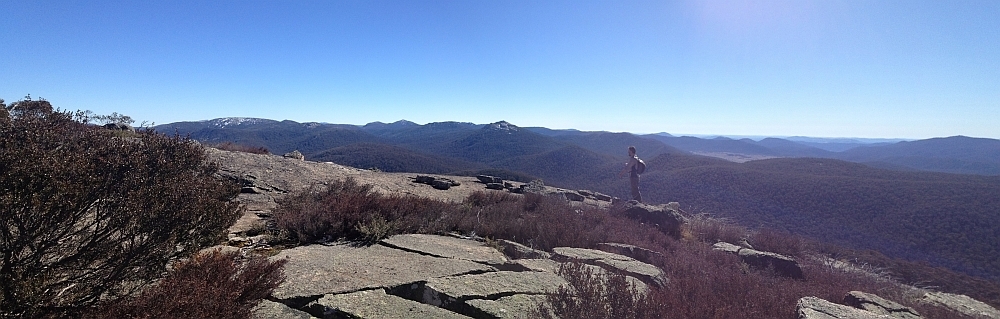
30 Sep 14 | Views down the south arm of Burkes Creek from The Pimple,NNP
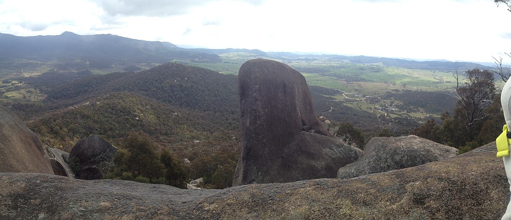
13 Sep 14 | Tidbinbilla Ridge, Mt Eliza and the main tor from Gibraltar Peak,TNR
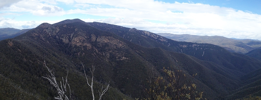
2 Sep 14 | View south to Johns Peak, Tidbinbilla Peak, Tidbinbilla Mountain and The Pimple, TNR and NNP
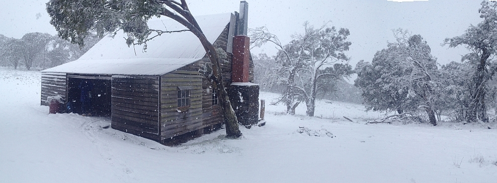
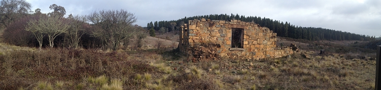
28 Jun 14 | Gooandra Homestead, KNP
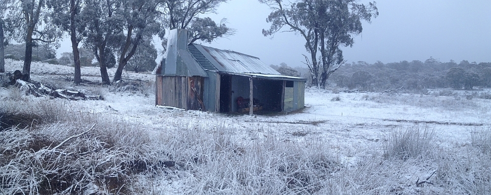
12 Jul 14 | Waterhole Hut, NNP
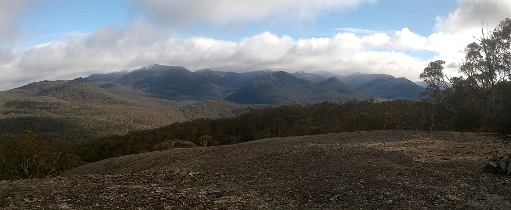
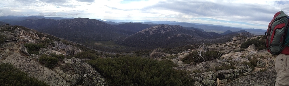
6 Jul 14 | Mt Gudgenby and the high hills of the Namadgi from Boboyan tor lookout, NNP
7 Jun 14 | Blue Gum Hill and the South Buttress of Booroomba Rocks from SH1353, NNP
24 May 14 | Orroral Valley from GC1XAJQ Ridge of Stone geocache, NNP
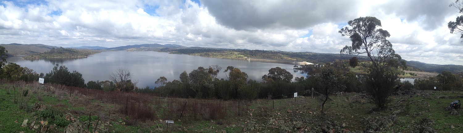
29 Mar 14 | Googong Dam from Googong Lookout, GF
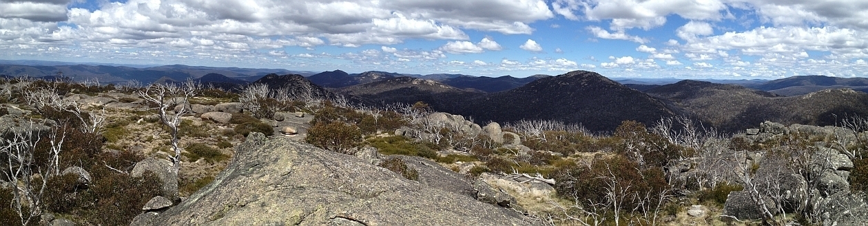
15 Mar 14 | Mt Namadgi, Rotten Swamp, Mt Burbidge, Bogong Gap, Gudgenby Grasslands and Yankee Hats from Mt Kelly, NNP
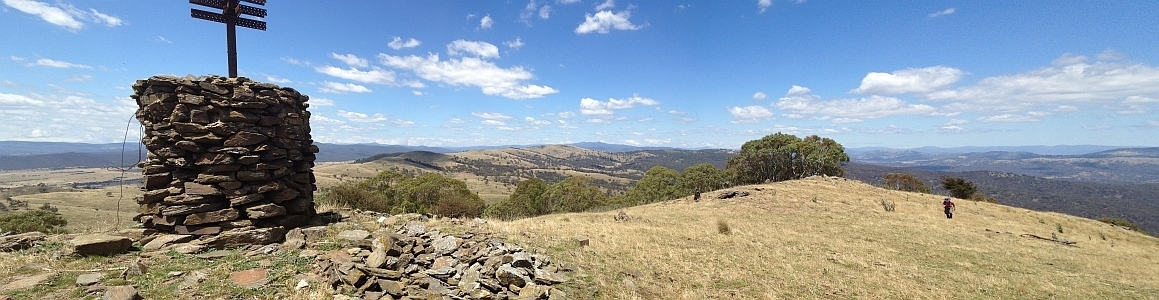
10 Aug 13 | Plains trig, Pri
13 Jul 13 | Scabby Tarn at sunset, NNP
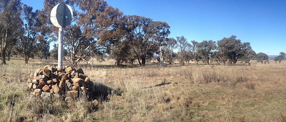
25 Jun 13 | Colliers homestead and orchard, Pri
8 June 13 | Webbs Ridge from Mt Coree, BNP
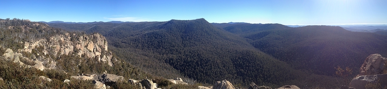
4 Jun 13 | Mt Moollattoo from the Carrialoo plateau, MNP
9 Sep 12 | Mt Gudgenby from granite slabs E of Sentry Box Mountain, NNP
View south from Mt Namadgi
10 Nov 12 | View south from Mt Namadgi, NNP
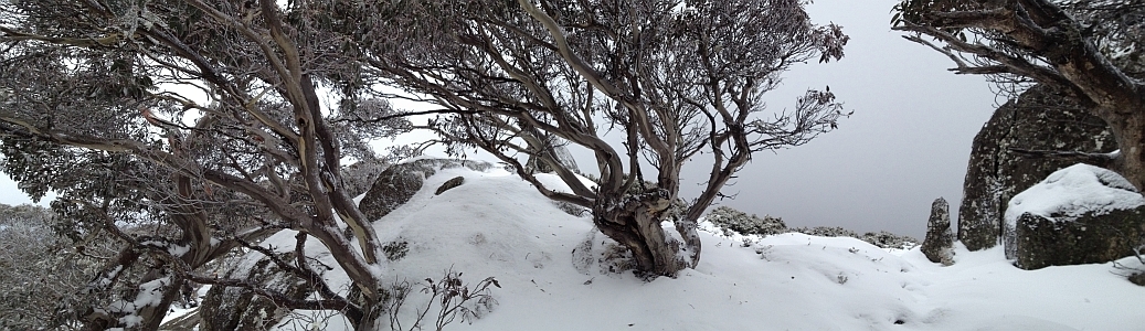
30 Jun 12 | Snow Gums at Mt Gingera, NNP
31 Jan 12 | Molonglo Ridge from Yarrow Pic, Pri
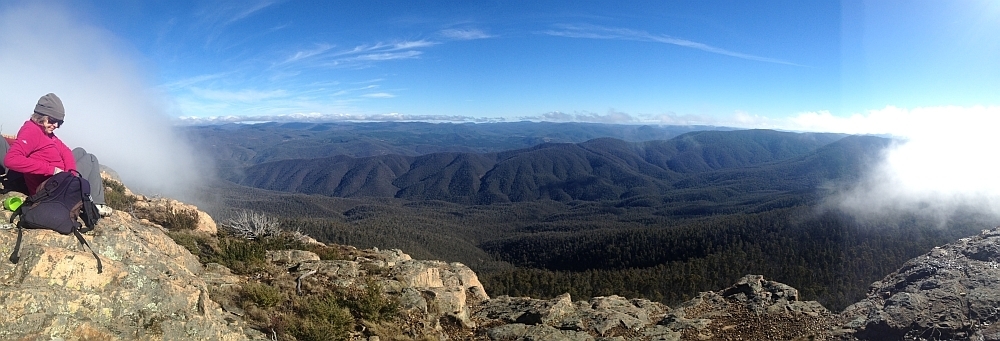
28 Jun 16 | Lunch on Mt Reedy (photo Barrie R), KF
376 29 Dec 09 KNP: Mt Anton and Mt Twynam – plus Blue Lake – from Guthega 19.3 700 L/M; H(12) Photos
375 22 Dec 09 NNP: Rendezvous Creek 11.5 450 M/M; M(9) Photos
374 15 Dec 09 CRNP: Clyde River kayaking 20.6 0 E Photos
373 8 Dec 09 KNP: The Rolling Ground and East Tate Ridge via Guthega Trig 20.4 700 L/M; H(12) Photos
372 1-2 Dec 09 KNP: Mt Jagungal and Round Mountain 42.3 1300 L/M-R; H(12) Photos
371 29 Nov 09 BRNR: CBC/Parkway Ramble – Calvary */Parkway 10.2 250 M/E; E(6) Photos
370 24 Nov 09 NNP: Try yet again for… Mt Mavis and Mt Herlt * 18.8 1200 L/R,ptX; VH(15) Photos
369 17 Nov 09 NNP: Mt Burbidge 19.8 850 L/R; H(14) Photos
368 16 Nov 09 CNP: Red Hill 4.7 150 S/E; E(4)
367 7 Nov 09 NNP: Mt Namadgi * 26.3 800 L/R; VH(15) Photos
366 3 Nov 09 DNP: Wyanbene Trig and the Minuma Range 14.9 550 L/M-R; M(11) Photos
365 27 Oct 09 NNP: Left Hand Creek and Mt Clear – Now a 34km mountain bike ride * 34.3 950 L/E-M,ptX; H(12) Photos
364 25 Oct 09 CNP: CBC/Parkway Ramble – Percival Hill NR, Palmerville Heritage Park and Gungahlin Pond */Parkway 9.4 150 S/E,X; E(6) Photos
363 20 Oct 09 BSRA: Brian’s birthday bash – Waterfalls and a Castle 10.0 450 M/R,WX; M(10) Photos
362 13 Oct 09 MNP: Corang Circuit 22.6 500 L/M; H(12) Photos
361 10 Oct 09 CNP: Border Markers between Gundaroo Road and Old Joe Hill ! 18.0 250 L/E,X; M(8) Photos
360 6 Oct 09 NNP: Shanahans Falls Creek 14.0 600 L/M; M(11) Photos
359 3 Oct 09 NNP: Rendezvous Creek Ridge and Nursery Swamp * 13.9 600 M/M; M(11) Photos
358 29 Sep 09 NNP: Border Markers between Bulls Head and Aggie Gap * 25.4 950 L/E-M,X; H(14) Photos
357 27 Sep 09 CNP: CBC/Parkway Ramble – Gungahlin Hill, Gungaderra Grasslands and Mulangarri Grasslands Nature Reserves */Parkway 7.0 100 S/E,X; E(6) Photos
356 26 Sep 09 CNP/Pri: Border Markers between Oak Hill and One Tree Hill ! 18.3 600 L/E-M,X; M(10) Photos
355 19 Sep 09 NNP: CBC Annual Worn Boot Bash #8 – Mt Kelly 27.8 900 L/R; H(14) Photos
354 15 Sep 09 NNP: Orroral Rocks – 3 walks – Lunar Laser Rocks, The Cloisters, European Sites * 20.5 900 L/M-R,ptX; H(14) Photos
353 1,2 8 Sep 09 NNP: Rendezvous Creek and Mt Tennent-Bushfold Flats ! 29.4 1050 L/E;H(13) Photos
352 5 Sep 09 NNP: Corin Dam to Pryors Hut 14.1 800 L/M; M(9) Photos
351 1,2 4 Sep 09 TNR: Camels Hump, The Sanctuary, Hanging Rock ! 13.8 600 M/E-M; M(9) Photos
350 1 Sep 09 TiNR: Mt Woolpack and Roberts Creek * 19.0 600 L/M,X; M(11) Photos
349 30 Aug 09 CNP: CBC/Parkway Ramble on The Pinnacle */Parkway – co-led with Rene M 7.0 100 S/E; E(5) Photos
348 25 Aug 09 NNP: Attempt on … Yankee Hat 9.4 350 M/M; M(8) Photos
347 18 Aug 09 MNP: Long Point * 11.9 550 M/M,X; M(10) Photos
346 11 Aug 09 NNP: Coronet Peak 27.0 1100 L/M; H(14) Photos
345 8 Aug 09 CNP: Walk for Uganda ! 31.7 200 L/E; M(9) Photos
344 4 Aug 09 Advanced GPS *
343 4 Aug 09 GNR/RRNR: Gigerline Nature Reserve and Gorge to Mt Rob Roy * 21.8 850 L/M-R,X: H(13) Photos
342 1 Aug 09 NNP: Orroral Valley-Legoland 17.0 500 L/M-R; M(11) Photos
341 28 Jul 09 CNP: Mulligans Flat Nature Reserve (½ day am only) * 17.5 250 M/E,ptX; M(8) Photos
340 25 Jul 09 NNP: CBC/Parkway Ramble – Chimneys and Thrones of the Southern ACT * 14.0 250 M/E-M,ptX; M(8) Photos
339 21 Jul 09 NNP/SRNR: Lower Sams Creek 24.1 750 L/R,X; H(14) Photos
338 20 Jul 09 CNP: Mt Painter and The Pinnacle Nature Reserves ! 8.6 200 S/E,X; E(6) Photos
337 12 Jul 09 NNP: Parkway Ramble – Walk for Uganda training – Square Rock ! 9.1 250 S/E; E(5) Photos
336 7 Jul 09 NNP: Mt Coree and the Brindabella Range * 8.3 800 M/R,ptX; H(12) Photos
335 6 Jul 09 Urban: Walk for Uganda Recce – Cork Oak Plantation to Scrivener Dam ! 9.9 50 S/E; E(4) Photos
334 4 Jul 09 Urban: Walk for Uganda training – Ellenborough St to Belconnen Way; Crinigan’s Stone Hut ! 9.3 150 S/E; E(5) Photos
333 30 Jun 09 Urban: Walk for Uganda Recce – Cotter Road to Lyons ! 4.4 50 S/E; VE(3) Photos
332 28 Jun 09 TNR: Parkway Ramble – Walk for Uganda training – TNR: Gibraltar Peak ! 5.7 400 S/E; E(6) Photos
331 27 Jun 09 Urban: Ugandathon Recce – Bruce-O’Connor Ridge NRs and Molonglo River ! 11.7 100 M/E,X; E(6) Photos
330 23 Jun 09 NNP: Prairie Dog Creek and the Orroral Valley * 19.6 700 L/R,ptX;H(14) Photos
329 21 Jun 09 CNP: Parkway Ramble – Walk for Uganda Recce – Belconnen Way to Zoo ! 9.0 100 S/E,X; E(5) Photos
328 20 Jun 09 Urban: Walk for Uganda Recce – Gungahlin; Lyneham Ridge Eucalypt Plantation; N Black Mountain ! 20.5 100 L/E; M(8)
327 16 Jun 09 NNP: Hospital Creek and Boboyan Trig Includes clickable map image with photos 14.7 550 M/M-R; M(10) Photos
326 15 Jun 09 Urban: Walk for Uganda Recce – Heysen St/Devonport St Lyons to Parkway ! 8.6 150 S/E; E(5)
325 13 Jun 09 NNP: Rock Flats 23.3 700 L/R; H(14) Photos
324 9 Jun 09 ACTF: Condor Creek and the Six Fords * 7.7 150 S/R,WX; M(8) Photos
323 6 Jun 09 NNP: Ridge East of Nursery Swamp 12.3 550 M/R,X; M(11) Photos
322 2 Jun 09 MNP: Wineglass Tor via the Shoalhaven River * 14.8 1100 L/R,WX; H(14) Photos
321 19 May 09 NNP: Border Markers on the SE Spur of Mt Gingera * 23.8 1220 L/M-R,ptX; H(14) Photos
320 16 May 09 NNP: Parkway Youth Ramble – Gorilla Rock and Booroomba Rocks; De Salis Cemetery ! 10.8 350 M/E-M;M(8) Photos
319 12 May 09 NNP: Hardy Range to Camels Hump 18.2 900 L/R,X; H(14) Photos
318 5 May 09 NNP: Snowy Flat Creek – North Tributary 9.1 700 M/R; H(12) Photos
317 2 May 09 NNP: Burbidge Ridge 18.1 750 L/R; H(13) Photos
316 28 Apr 09 NNP: Gorilla Rock and Booroomba Rocks * 10.4 500 M/M; M(9) Photos
315 21 Apr 09 NNP: Snowy Flat Creek from Corin Dam 13.3 850 L/R,W;H(13) Photos
314 18 Apr 09 NP: Border Markers around Mt Ginini ! 23.4 1350 L/E-M; H(13) Photos
313 14 Apr 09 NNP: Border Marker Hunting in the Southern Brindabellas * 20.9 1350 L/M; H(12) Photos
312 11 Apr 09 TNR: New trails at Tidbinbilla Nature Reserve and Camels Hump ! 14.1 750 L/E; M(9) Photos
311 7 Apr 09 KNP: Mt Murray from Yaouk 17.6 800 L/R; H(12) Photos
310 4 Apr 09 NNP: Mt Orroral 10.1 700 M/R; M(10) Photos
309 31 Mar 09 KNP: Big Talbingo Mountain and Landers Falls; Kiandra 12.9 700 M/R; M(10) Photos
308 24 Mar 09 NNP: Lower Stockyard Creek 16.7 1300 L/R; H(14) Photos
307 21 Mar 09 NNP: Mt Gingera and Mt Ginini 26.9 1500 L/E-M; H(13) Photos
306 17 Mar 09 NNP: Snowy Flats, Mt Gingera and Brumbys Flats * 18.3 1250 L/M-R,ptX: H(13) Photos
305 16 Mar 09 CNP: Mt Pleasant Nature Reserve and Jerrabomberra Wetlands Nature Reserve ! 5.9 130 S/E; E(5) Photos
304 10 Mar 09 BjNR: Barren Jack Falls and Trig, off Lake Burrinjuck 12 700 M/M-R; H(12) Photos
303 3 Mar 09 MNP: Great Horseshoe Bend and Little Horseshoe Bend 17.5 550 L/R; H(12) Photos
302 24 Feb 09 MNP: Corang Peak/Arch/Lagoon 22.9 400 L/M; H(12) Photos
301 17 Feb 09 CNP: Farrer Ridge NR, Wanniassa Hills NR, Isaacs Ridge NR, Mt Mugga Mugga NR ! 15.8 500 L/E,X; M(8) Photos
Here’s a way to visualise and another access method for walks #1 – #300 – an ACT clickable map image. Please note that it’s 3MB to download and is 2570*1915 pixels to view.
300 12 Feb 09 CNP: Bruce and O’Connor Ridges 6.8 150 S/E; E(5) Photos
299 10 Feb 09 BuNP: Sugarloaf Creek Tributary 6.6 500 S/R,W; M(10) Photos
298 7 Feb 09 CNP: McQuoids Hill Nature Reserve and Urambi Hills Nature Reserve ! 11.9 250 M/E; E(6) Photos
297 3 Feb 09 NNP: Gibraltar Creek and Falls * 6.9 50 S/R,WX; M(8) Photos
296 2 Feb 09 CNP: Aranda Bushland Nature Reserve 4.6 100 S/E; VE(3) Photos
295 31 Jan 09 NNP: Mt Ginini, Little Ginini and Stockyard Arboretum 10.6 650 M/M-R; M(10) Photos
294 29 Jan 09 NNP: Naas Valley Fire Trail (additional material available via password) Photos
293 27 Jan 09 Pri/KNP: Goodradigbee River Gorge 11.5 200 M/R,WX; HW Photos
292 24 Jan 09 MRC: Murrumbidgee River Li-Lo Wallow 8.3 50 S/R,W; E(6) Photos
291 20 Jan 09 NNP: West Coree Creek Volcanics * 5.5 400 S/R,X; M(9) Photos
290 17 Jan 09 CNP: Goorooyarroo Nature Reserve – Crack-of-Dawn No 2 10.7 300 M/E-M; E(7) Photos
289 9-10 Jan 09 NNP: Leura Gap and Gallipoli Flats * 44.8 1200 L/M,X; H(13) Photos
288 6 Jan 09 GNR: De Sallis Cemetery * 2.6 20 S/E; VE(3) Photos
287 6 Jan 09 NNP: Back to Blue Gum Creek Brumby Yards * 9.4 400 M/M; M(9) Photos
286 3 Jan 09 CNP: Theodore Hills – Tuggeranong Hill Nature Reserve 7.6 350 S/E; E(6) Photos
285 1 Jan 09 CNP: Red Hill Nature Park ! 11.2 350 M/E; E(7) Photos