Johnny Boy's Walkabout Blog
... bushwalking in the ACT and nearby NSW
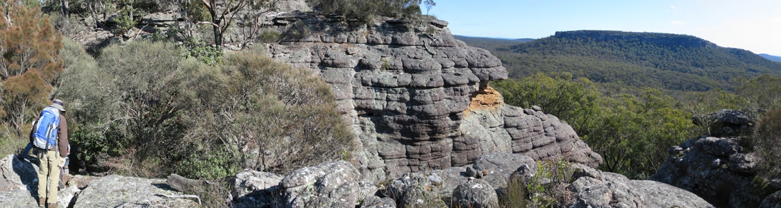
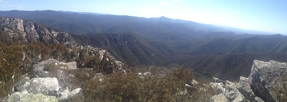
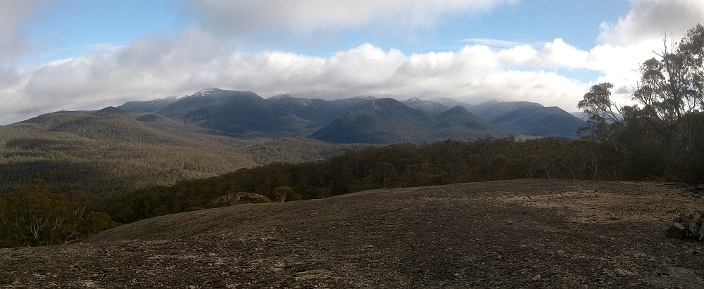
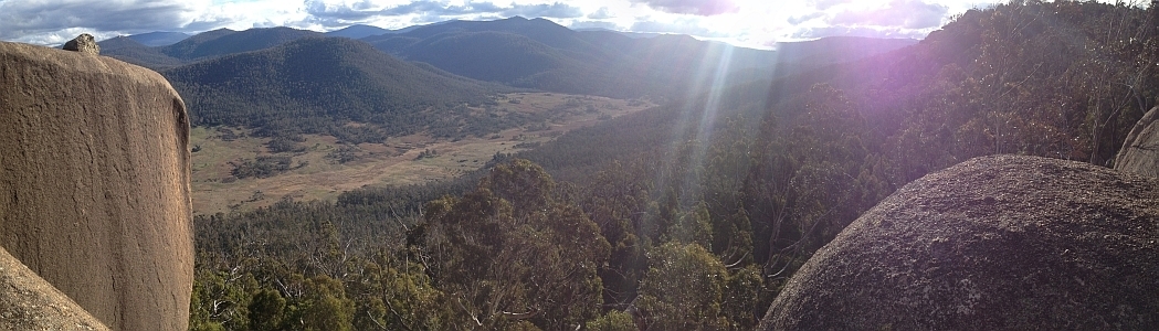
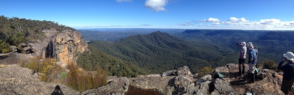
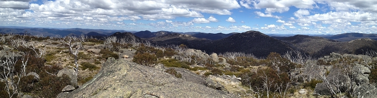
28 Jun 15 | The top of Binnari Pass to Quiltys Mountain, the Budawangs, Morton NP
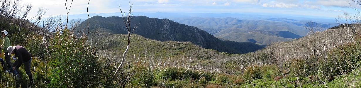
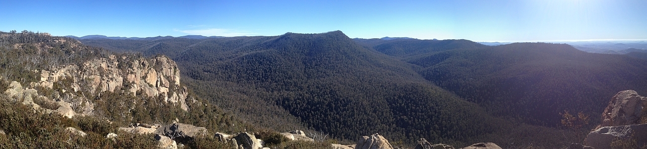
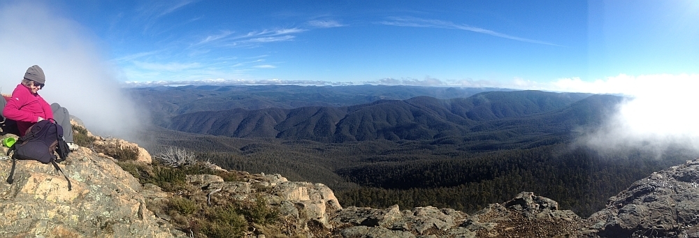
30Jun 15 | Views from north of Currockbilly Mountain over the source of the Yadboro River to Wirritin Basin and beyond to Pigeon House and the ocean, Budawang NP
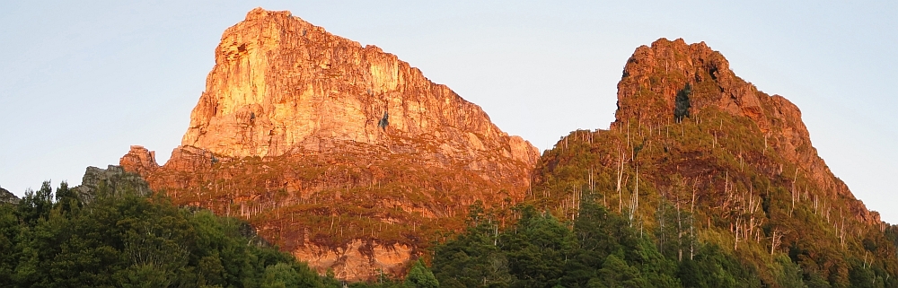
22 Apr 15 | Morning light on Frenchmans Cap and Lions Head, Tasmania
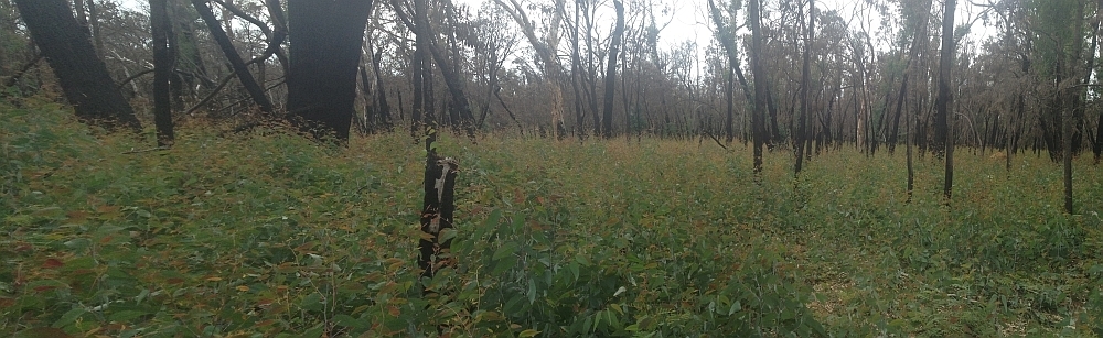
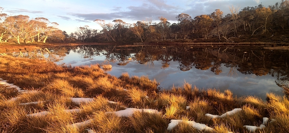
3 Mar 15 | Eucalyptus 'grass', Nadgigomar NR
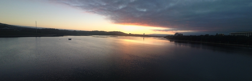
7 Feb 15 | Sunrise over Lake Burley Griffin at 6.30am, Canberra
30 Sep 14 | Views down the south arm of Burkes Creek from The Pimple,NNP
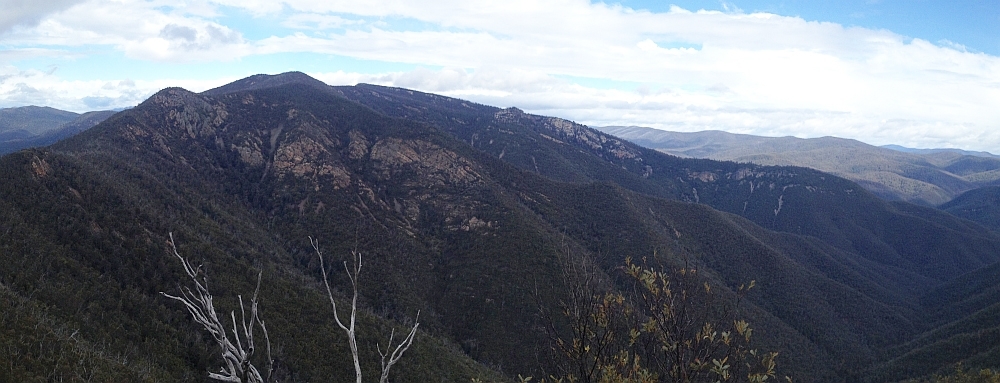
13 Sep 14 | Tidbinbilla Ridge, Mt Eliza and the main tor from Gibraltar Peak,TNR
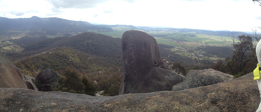
2 Sep 14 | View south to Johns Peak, Tidbinbilla Peak, Tidbinbilla Mountain and The Pimple, TNR and NNP
28 Jun 14 | Gooandra Homestead, KNP
12 Jul 14 | Waterhole Hut, NNP
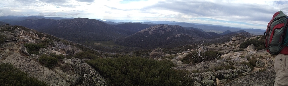
6 Jul 14 | Mt Gudgenby and the high hills of the Namadgi from Boboyan tor lookout, NNP
7 Jun 14 | Blue Gum Hill and the South Buttress of Booroomba Rocks from SH1353, NNP
24 May 14 | Orroral Valley from GC1XAJQ Ridge of Stone geocache, NNP
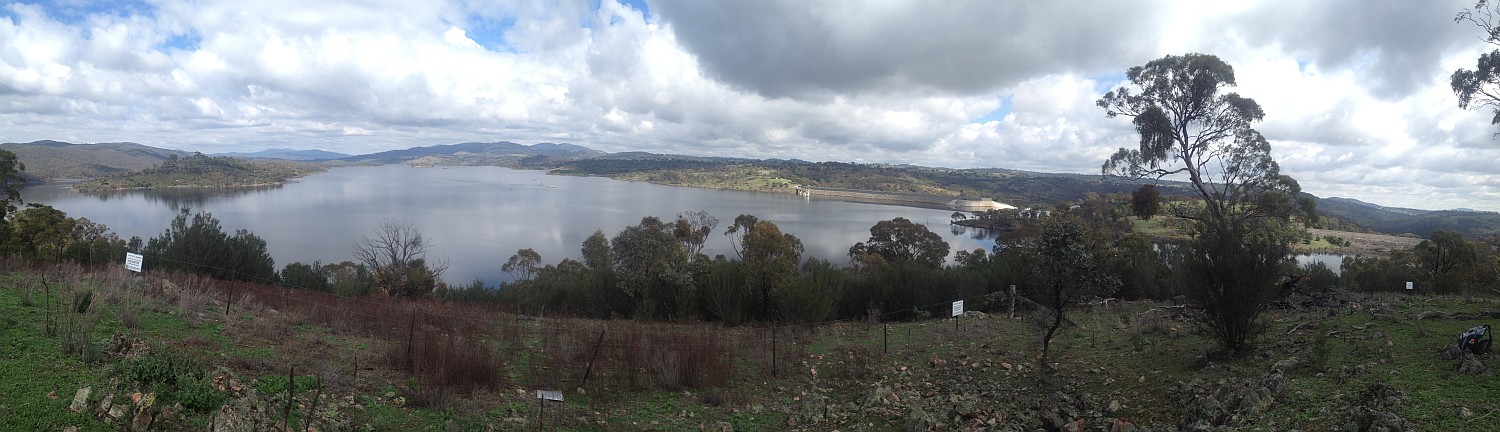
29 Mar 14 | Googong Dam from Googong Lookout, GF
15 Mar 14 | Mt Namadgi, Rotten Swamp, Mt Burbidge, Bogong Gap, Gudgenby Grasslands and Yankee Hats from Mt Kelly, NNP
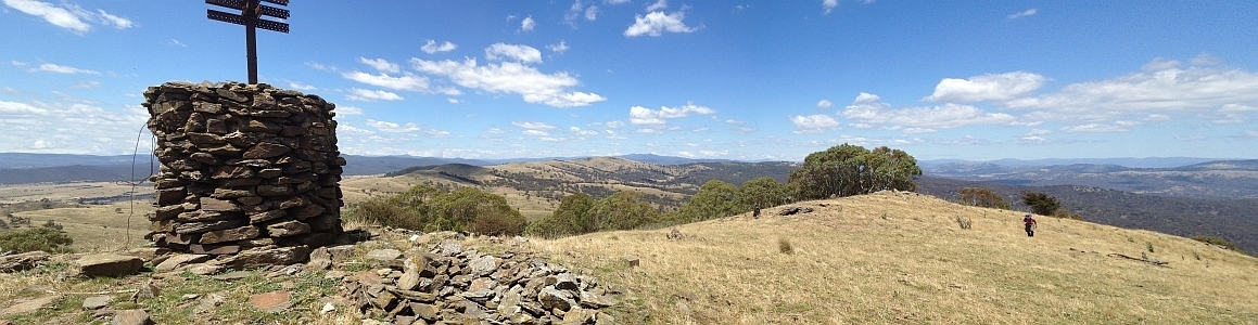
10 Aug 13 | Plains trig, Pri
13 Jul 13 | Scabby Tarn at sunset, NNP
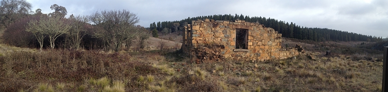
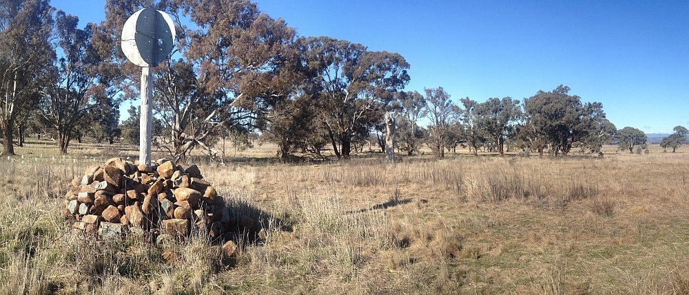
25 Jun 13 | Colliers homestead and orchard, Pri
8 June 13 | Webbs Ridge from Mt Coree, BNP
4 Jun 13 | Mt Moollattoo from the Carrialoo plateau, MNP
9 Sep 12 | Mt Gudgenby from granite slabs E of Sentry Box Mountain, NNP
10 Nov 12 | View south from Mt Namadgi, NNP
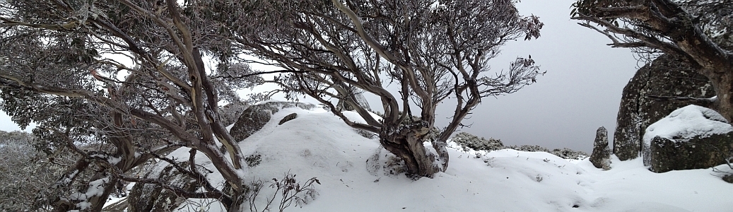
30 Jun 12 | Snow Gums at Mt Gingera, NNP
31 Jan 12 | Molonglo Ridge from Yarrow Pic, Pri
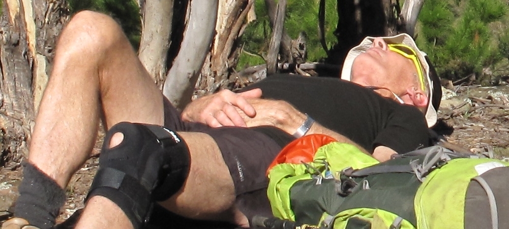
28 Jun 16 | Lunch on Mt Reedy (photo Barrie R), KF
| All | All Trip Destinations and Parking via a Google Map/Google Earth | |||||
| 2015 | 2018-2014 Trip Destinations and Parking via a Google Map | |||||
| 958 | 21 Dec 15 | CNP: Mt Taylor triple | 7.6 | 540 | M/E; E(7) | Photos |
| 957 1, 2 | 19 Dec 15 | NNP: Southern Namadgi Walkabout * | 8.5 | 280 | S/M,ptX; E(7) | Photos |
| 956 | 12 Dec 15 | NNP: Mt Tennent | 14.3 | 780 | L/E; M(9) | Photos |
| 955 | 3 Dec 15 | CNP: Weetangera Methodist Cemetery * | 5.7 | 95 | S/E; E(4) | Photos |
| 954 | 10 Nov 15 | BRNR: Bullen Range | 22.2 | 700 | L/R; H(14-) | Photos |
| 953 | 9 Nov 15 | CNP: Cooleman Ridge | 7.2 | 140 | S/E; E(5) | Photos |
| 952 | 7 Nov 15 | MNP: Gilberts Mountain |
13.5 | 325 | M/M; M(10+) | Photos |
| 951 | 5 Nov 15 | CNP: Lower Majura | 6.7 | 220 | S/E; E(5) | Photos |
| 950 | 3 Nov 15 | NNP: The Bog Hut site plus Max and Berts Hut | 16.7 | 1170 | L/R; H(14) | Photos |
| 949 | 2 Nov 15 | CNP: Earlybird walk – A different Black Mountain walk | 5.8 | 450 | S/E; E(6) | Photos |
| 948 | 28 Oct 15 | TNR: The Sanctuary at TNR ! | 2 | 50 | S/E; VE(3) | Photos |
| 947 | 20 Oct 15 | TNP: Northern Tallaganda National Park | 20.7 | 660 | L/R; H(12) | Photos |
| 946 | 15 Oct 15 | Pri: Navigation Refresher #7 – GPSr and PC | – | – | – | – |
| 945 | 13 Oct 15 | NNP: Bobeyan vales and hills | 12.6 | 485 | M/M; M(10) | Photos |
| 944 | 12 Oct 15 | CNP: Early Bird walk – Mt Majura | 6.1 | 280 | S/E-M; E(7) | Photos |
| 943 | 18,25 Sep 15 | Floriade: 8am Floriade Walk | short | flat | S/E | Photos 1, 2 |
| 942 | 8 Sep 15 | NNP: Yankee Hat Slabs and Middle Creek |
14.7 | 670 | L/R,ptX; H(12+) | Photos |
| 941 1, 2 | 5 Sep 15 | NNP: Fitzs Hill, Glendale drystone walls and Billy Range * |
13.7 | 880 | L/M-R,ptX; H(12) | Photos |
| 940 | 1 Sep 15 | NNP: Rocks above Breakfast Creek * |
16.3 | 650 | L/M-R,ptX; H(12) | Photos |
| 939 | 29 Aug 15 | NNP/Pri: Punch Bowl Creek and Blythburn Cottage *s |
16.9 | 730 | L/E-M,ptX; M(11) | Photos |
| 938 | 18 Aug 15 | NNP: Return to our Southernmost Point |
18.7 | 520 | L/M; M(11) | Photos |
| 937 | 15 Aug 15 | NNP: CBC Worn Boot Bash to Mt Clear | 36.2 | 1200 | L/E; H(13) | Photos |
| 936 | 11 Aug 15 | NNP: An interesting cave site on the southern approach to Mt Herlt |
12.5 | 500 | M/R; H(12) | Photos |
| 935 | 8 Aug 15 | GNR: Gigerline Geocaching *s |
8.7 | 215 | S/M,X; M(8) | Photos |
| 934 | 4 Aug 15 | TiNR: Tinderry Range |
22.7 | 980 | L/R; VH(15) | Photos |
| 933 | 2 Aug 15 | SwCNR: Swamp Creek Nature Reserve |
7.8 | 330 | S/M-R; M(9) | Photos |
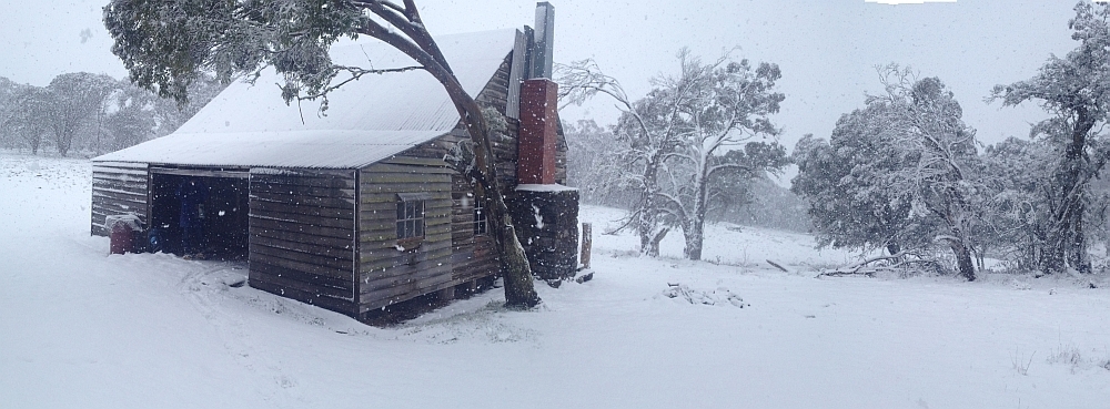
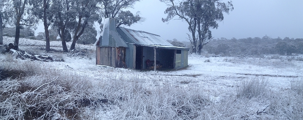
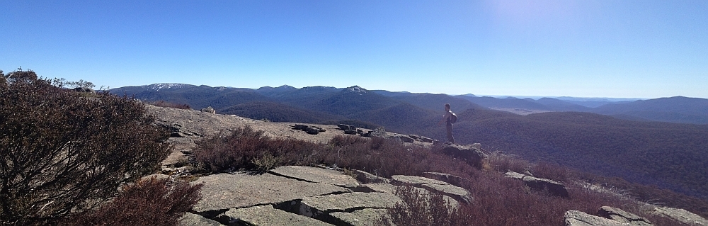
| 932 | 28 Jul 15 | MNP: Binnari Pass |
17.3 | 470 | L/R; M(11+) | Photos |
| 931 | 25 Jul 15 | NNP: Coronet Peak |
29.8 | 1280 | L/R,ptX; H(14) | Photos |
| 930 | 21 Jul 15 | GF: A Googong Wander | 12.2 | 360 | M/E-M; M(9) | Photos |
| 929 | 18 Jul 15 | MRC/BRNR: Cotter to Kambah |
16.0 | 600 | L/E; M(10) | Photos |
| 928 | 14 Jul 15 | NNP: Nursery Hill |
16.2 | 550 | L/M-R; M(11) | Photos |
| 927 1, 2 | 9 Jul 15 | Pri/Rail/Urban: Rail trip towards Sydney *s | 10.7 | 230 | M/E,X; M(10) | Photos |
| 926 | 7 Jul 15 | NNP: Gudgenby Valley Wander | 16 | 300 | M/M; M(10) | Photos |
| 925 | 4 Jul 15 | NNP: Sentry Box Rock and southern Namadgi geocaching ! |
5.5+43.5 | 1320 | M/M-R; H(13) | Photos |
| 924 | 30 Jun 15 | BuNP: Currockbilly Mountain | 9.1 | 560 | M/R; M(11) | Photos |
| 923 | 27-28 Jun 15 | NNP/SRNR: Mt Scabby |
30.8 | 1300 | L/R; H(12) | Photos |
| 922 | 25 Jun 15 | Launch of The Mouat Tree project | Photos | |||
| 921 | 23 Jun 15 | DNR: Dananbilla Nature Reserve | 15.8 | 930 | L/R; H(13) | Photos |
| 920 | 20 Jun 15 | NNP: Nursery Creek Rock Art and Nursery Swamp *s | 12.9 | 465 | M/E-M; M(9) | Photos |
| 919 | 16 Jun 15 | Belconnen Walks | A presentation for the Belconnen Community Council meeting | ||||
| 918 | 13 Jun 15 | TNR: Tidbinbilla Mountain |
9.9 | 795 | M/R; H(12) | Photos |
| 917 | 9 Jun 15 | BuSF: Bungongo State Forest |
19.5 | 925 | L/R; H(13) | Photos |
| 916 | 8 Jun 15 | DGNR: Tara Territory – Dunlop Grasslands NR ! | 5.6 | 65 | S/E; E(4) | Photos |
| 915 | 6 Jun 15 | CCT: The Bedulluck Waltz * | 16.1 | 440 | L/E; M(9) | Photos |
| 914 | 2 Jun 15 | NNP: South Arm of Middle Creek * | 15.0 | 585 | L/R,ptX; H(12) | Photos |
| 913 | 30-31 May 15 | NNP/SRNR: Border Markers on the SE Scabby Range |
37.4 | 1325 | L/R; H(13) | Photos |
| 912 | 23-24 May 15 | KNP/NNP: Bimberi Peak from the West * | 24.9 | 1320 | M/M-R,ptX; M(10) | Photos |
| 911 | 19 May 15 | YNP: Yanununbeyan National Park (incl Mt Foxlow and Harrisons Peak) | 21.6 | 1005 | L/M-R; H(14) | Photos |
| 910 | 16 May 15 | NNP: Lower Mavis Ridge towards Mt Herlt | 16.9 | 670 | L/R,ptX; H(13) | Photos |
| 909 | 13 May 15 | CoNR: Cookbundoon Nature Reserve | 18.6 | 585 | L/M; M(11) | Photos |
| 908 | 5 May 15 | YNR: Yaouk Peak |
14.5 | 820 | L/R,ptX; H(13) | Photos |
| 907 | 28 Apr 15 | KSCA: Keverstone State Conservation Area | 14.8 | 725 | L/R; H(12) | Photos |
| 906 – D1, D1pm, D2, D2a, D3, D4 | 20-23 Apr 15 | Tas: Frenchmans Cap Walking Track |
46.6 | 2500 | L/M-R; H(12) | D0, D1, D1pm, D2, D2a, D3, D4, D5 |
| 905 | 11 Apr 15 | ACTF/NNP: Arvo tea at Orroral Homestead and morning Yet More HMAS geocaching ! | 8.0 | 150 | S/E; VE(3) | Photos |
| 904 | 9 Apr 15 | ACTF: Geocaching (more of the HMAS series) ! | 5.7 | 90 | S/E; VE(3) | Photos |
| 903 | 7 Apr 15 | MNR: North Mundoonen Nature Reserve | 11.6 | 435 | M/M; M(9) | Photos |
| 902 | 4 Apr 15 | PCPF/TNR/NNP: Tidbinbilla Road geocaching | 7.1 | 460 | S/E-R; M(9) | Photos |
| 901 | 21-22 Mar 15 | Urban/CNP: Cbr100Challenge 100km * | 100.0 | 1980 | L/E; H(12+) | Photos |
| 900 | 19 Mar 15 | CNP: Cbr100Challenge – Checkout joining Acacia Trail ! | 4.1 | 110 | S/E; E(4) | Photos |
| 899 | 15 Mar 15 | Urban: Cbr100Challenge fundraising Walk and Cakes from Eternity Church ! | 1.8 | 32 | S/E; VE(3) | Photos |
| 898 | 14 Mar 15 | Urban/CNP: Cbr100Challenge Night Walk – Duffy to Narrabundah ! | 16.5 | 435 | M/E; M(9) | Photos |
| 897 | 12 Mar 15 | MRC: Southside Stroll – North from Kambah Pool * | 4.6 | 230 | S/E; E(4) | Photos |
| 896 | 7 Mar 15 | Urabn/CNP: Cbr100Challenge 70km training | 72.2 | 1025 | L/E; H(12+) | Photos |
| 895 | 5 Mar 15 | CNP: Cbr100Challenge Training – Check out Black Mountain ! | 5.9 | 310 | S/E; E(6) | Photos |
| 894 | 3 Mar 15 | NNR: Nadgigomar Nature Reserve, Western Section | 19.0 | 470 | L/M; M(11) | Photos |
| 893 | 28 Feb 15 | Urban/CNP: Cbr100Challenge Training – 50km on the 100km route to Hall * | 51.5 | 1240 | L/E; H(12+) | Photos |
| 892 | 24 Feb 15 | NNP: Cbr100Challenge Training – (near) Cotter Hut * | 35.8 | 1035 | L/E,W; H(13) | Photos |
| 891 | 23 Feb 15 | Urban/CNP: Cbr100Challenge Training – Cooleman Ridge ! | 15.6 | 560 | L/E;M(8) | Photos |
| 890 | 21 Feb 15 | NNP: Gibraltar Creek * | 15.5 | 480 | L/M,W; M(10) | Photos |
| 889 | 14Feb 15 | Urban/CNP: Cbr100Challenge Training – Around Lake Burley Griffin ! | 49.3 | 920 | L/E; H(12+) | Photos |
| 888 1,2 | 12 Feb 15 | Urban/CNP: Cbr100Challenge Training – Scriveners Camp to End and Kent St to Red Hill ! | 16.0 | 475 | M/E; M(8) | Photos |
| 887 | 10 Feb 15 | NNP: Rendezvous Crags | 12.9 | 660 | M/R; H(12) | Photos |
| 886 | 7 Feb 15 | CCT: Cbr100Challenge Training – Mt Ainslie-Federation Stone-Mt Majura | 29.9 | 870 | L/E; M(11) | Photos |
| 885 | 3 Feb 15 | CCT: Cbr100Challenge Training – War Memorial to Hall ! | 46.0 | 1215 | L/E; H(12+) | Photos |
| 884 | 31 Jan 15 | Urban/CNP: Cbr100Challenge Training – Weston Creek Circuit | 30.1 | 1110 | L/E; H(12) | Photos |
| 883 | 28 Jan 15 | Urban/CNP: Cbr100Challenge Training – Walk from Duffy to meeting in Higgins ! | 21.4 | 410 | L/E; M(9) | Photos |
| 882 | 26 Jan 15 | NNP: Mt Tennent ! | 13.9 | 820 | L/E; M(9) | Photos |
| 881 | 24 Jan 15 | NNP: Orroral Training for Cbr100Challenge | 33.1 | 950 | L/E; H(12) | Photos |
| 880 | 20 Jan15 | Urban/CCT/CNP: Finish the 50km Cbr100Challenge route *s | 27.4 | 510 | L/E; M(10) | Photos |
| 879 | 19 Jan 15 | CNP: Mt Majura | 6.4 | 295 | S/E; E(5) | Photos |
| 878 | 17 Jan 15 | Urban/CCT: Cbr100Challenge Training – Forde to Hall and return on the CCT * | 38.0 | 825 | L/E; M(11+) | Photos |
| 877 | 14 Jan 15 | LT: Southside stroll – Lake Tuggeranong * | 6.0 | 40 | S/E; E(4) | Photos |
| 876 | 13 Jan 15 | KNP: Source of the Murrumbidgee River |
11.6 | 330 | M/E-M;M(9-) | Photos |
| 875 | 12 Jan 15 | CNP: Mt Ainslie | 9.4 | 435 | M/E-M;E(7) | Photos |
| 874 | 10 Jan 15 | Urban/CCT: Cbr100Challenge Training – 40km on the 50km route *s | 38.2 | 960 | L/E; H(12) | Photos |
| 873 | 7 Jan 15 | Pri: Southside Stroll in daylight savings – William Farrer’s grave * | 1.6 | 45 | S/E; VE(3) | Photos |
| 872 | 6 Jan 15 | NNP: Orroral Hill Outcrops |
11.6 | 690 | M/R; H(12) | Photos |
| 871 | 5 Jan 15 | NNP: Mt Taylor Triple | 8.0 | 545 | M/E; E(7) | Photos |
| 870 | 3 Jan 15 | NNP: Cbr100Challenge Training: Mt Tennent *s | 13.8 | 830 | L/E; M(9) | Photos |