Last trip on the ACT border to hunt border markers. “Sounds pretty ordinary but I will give it a go” said one party member
Burbong railway bridge

Thursday 9 July: Rail trip towards Sydney – M/M,X. For the last few years I’ve been ‘religiously’ walking the ACT border. Today may be the last day. We’ll see what we can find between Queanbeyan and the Burbong bridge. Likely a wet day. Around 15km. Maps: Bungendore and Canberra. Leader: John Evans 0417 436 877 john@johnevans.id.au . Transport: ∼$6 per person. Bookings taken up till 6am Thursday.
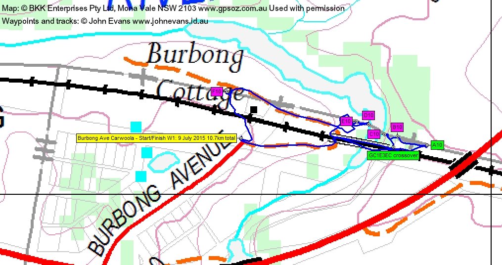
5 of us drove to Burbong Ave Carwoola, after leaving a car in Oaks Estate. After a short walk, we drove back towards Queanbeyan and left the car on the side of the Kings Highway to start the main walk.
Further Information
I cannot recommend this walk. Although we had permission to walk around Burbong Cottage from the resident, the rest of the trip was on the railway line. This is trespassing, which is a sin. Enough said.
Summary
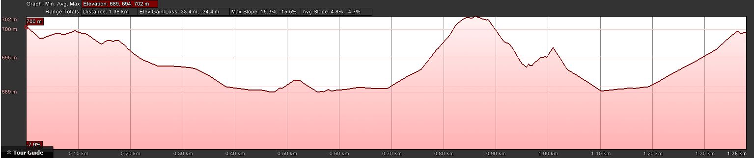
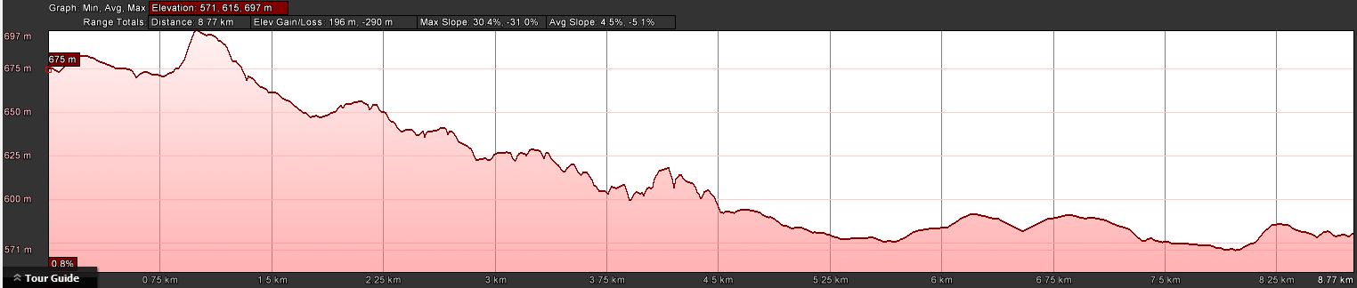
Distance: 10.7km | Climb: 230m | Time: 8.10am-1.45pm (5hrs 35mins), including 1hr 10mins of breaks and a short drive | Grading: M/E,X; E(6)
Track Maps
Track Walk 1
Profile Walk 1
Track overview Walk 2

Track 1 Walk 2
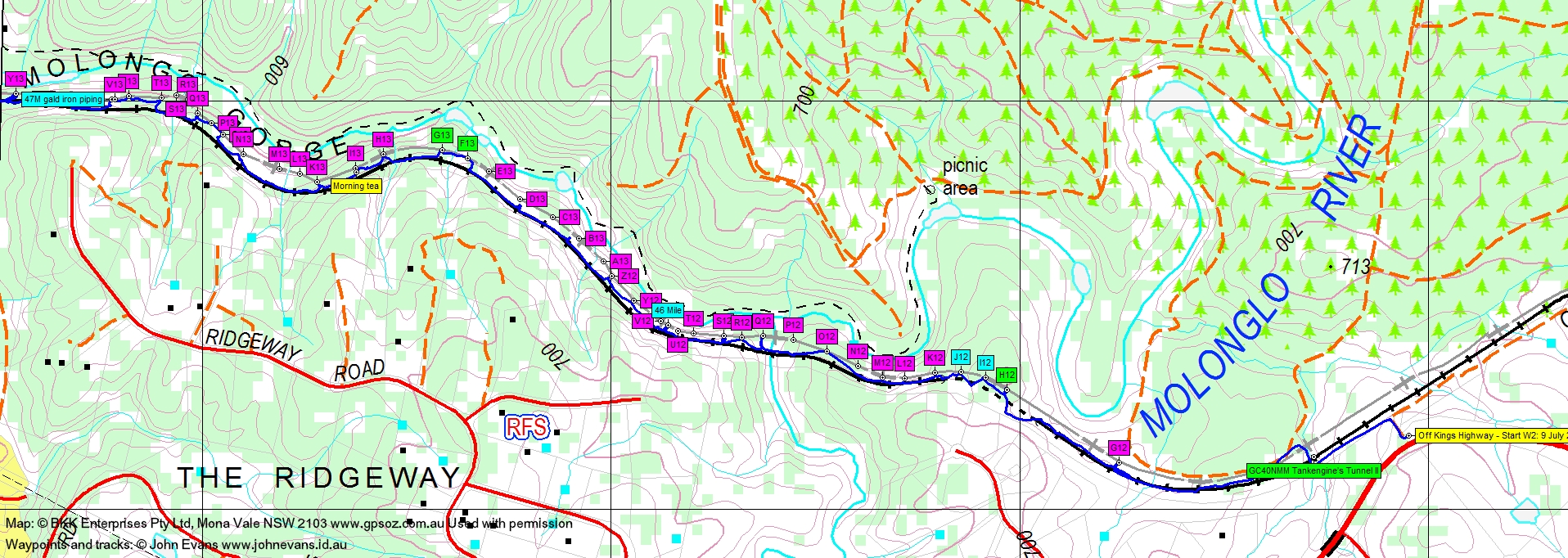
Track 2 Walk 2
Profile Walk 2
Photographs
Photographs are available, where you can start a large sized slideshow.
Waypoint and Track Files
Download the .gpx file. (Right click, Save Link As…, Save – if you want to use it.)
Download the .kml file.
Track Notes
I actually agreed with the party member’s comment and had been putting this walk off for some considerable time. I suspected that it would not yield many border markers, as the access roads associated with the railway line disturb the border markings. I was going to do it as a private lone walk. But thanks to Max S who stirred me up recently and great friends who responded to the 48 hour short-notice walk invitation, we did it. Not with a bang, but with a whimper. So border marker hunting has been completed, after starting on 18 Feb 06!
On the way out the Kings Highway we stopped briefly to find and log geocache GC1HBCC ICANCU.
I had previously covered the railway line to the east side of the Burbong railway bridge on 21 Jul 11 to border marker B10 and to the west side of Burbong Cottage on 2 Apr 13 to border marker F10. So there was only a few hundred metres to complete now that I had the resident’s nod to wander around their back yard.
We walked across the railway line and to one side of Burbong Cottage (the ACT border is on the ACT side of the rail easement, so that the line is in NSW). As last time, not F10. Heading east, no E10 or D10. This brought us to the bank of the Molonglo River near to the Burbong railway bridge. Somehow we got across to the other side of the river. No C10 or B10. Found A10 as last time. In addition, the east side of the bridge yielded geocache GC1E3EC crossover. We crossed back to the car.
After ringing Burbong Cottage to say thanks for the access permission, we had a short drive back towards Queanbeyan to park on the side of the Kings Highway.
Down to the railway line and soon a little drainage tunnel under a significant embankment yielded geocache GC40NMM Tankengine’s Tunnel II. Border marker hunting started from G12, which was the west most marker visited on 2 Apr 13. Again, no joy.
We soon came to a tunnel and walking over it did yield a find of H12, possibly I12 and possibly J12.
It was pretty lean picking after that, not only because of site disturbance, but because the extreme fall off of the gorge made many border marker sites too dangerous to visit. No K12, L12 or M12. Did not visit N12. No O12. Did not visit P12. No Q12, R12 or S12. Did not visit T12 or U12. A possible identification of 46 Mile. Did not visit V12 or Y12. No Z12. Did not visit A13, B13, C13, D13, E13. Found F13 and G13. No H13 or I13.
It was now 10.22am and I knew the XPT was due at Bungendore at 10.37am and Queanbeyan at 11.06am. So it was a good time to have morning tea. A 37min break! The train having gone through, we resumed our walk.
No K13. Did not visit L13, M13 or N13. No O13, P13 or Q13. Did not visit R13 or S13. No T13, U13 or V13. A possible identification of 47 Mile. No W13, Y13, Z13. By this point we were opposite the downstream end of the Molonglo Gorge, having passed across the top of a pretty wild slope down to the river. NO A14, B14 or C14.
D14 was identified under the rail easement fence. I took an educated guess that this would be the last ACT border marker to be hunted, so we took some celebratory photos.
No E14, F14 or G14. These were previously not found on 21 Jul 11.
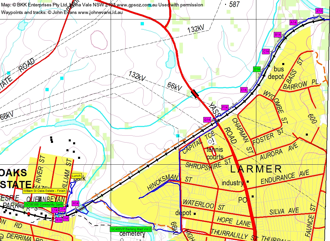
Here, at the Yass Road, I was faced with a dilemma. The railway line was fenced off with “Trespassers Will Be Prosecuted, Video Surveillance in Use” and nearby grazing land signed “Private Property, No Trespassing”. We were on the edge of town as well, so we meekly took a way as close as possible to the border, via the streets. Capital Tce paralleled the border, but High St took us away. We turned down Hincksman St and at the factory at the bottom, asked if we could walk through to the Queanbeyan River. No. However, further south down High St there was a broad public easement down to the river. Marmaduke Rothschild, ever vigilant cacher, even found us an unexpected goecache, so we duly logged GC480VP Barking Mad Vol.2.
We headed to the Queanbeyan River railway bridge, but the weir just downstream of it that I’d seen on Google Earth had too much flow over it. However, fortunately, we were able to wade across just upstream from the bridge. Up the other side, no H14, I14, J14, K14 or L14.
The L14 site was at the corner of a high cyclone fence. A pretty inconsequential place to join up with a previous track and thus end my border marker hunting.
There was one last geocache to amuse us, so we collected the data required and sat on the grass in the playground that yielded the last clues. Bless his cotton socks, Max produced a bottle of bubbly and I was easily convinced to break my 3 month pledge and enjoy a glass. Lunch. And we slipped back for Jacqui to find the cache at the final GZ for GC5B38B Community Spirit.
Huge thanks to Roger for doing the day’s recording (and walking on his birthday!) and for all my companions for suffering a pretty ordinary trip … to end and interesting lap of the ACT.
Party
5 walkers – Roger E, Eric G, Jacqui R, Max S, me.
Washup
It has been a rather extraordinary set of trips. With other responsibilities constraining me to usually only day walk, it’s taken 74 trips to cover the 306km of the ACT border. More than 90 different people have walked with me on border marker hunting trips. We’ve seen some wild country.
It would not have been possible without the assistance of Alex Petrow from the ACT Survey Office who supplied the locations of the border markers to me. Nor without Max Smith (who did 20 trips with me), Eric Glass (16), Mike Bremers (10) and Roger Edwards (10). Roger led the first trip on 18 Feb 06 on which I started to hunt and record border markers. Max has constantly encouraged me.
It has been an exercise in persistence and pedantry. Want to see photos of more than a thousand piles of rocks and posts? See the various parts of ACT Border Markers.
Next Tuesday Walk
Tuesday 14 July: A different approach to Nursery Hill via the N-W and some nice boulders – M/M. The walk wanders up Nursery Swamp then turns up the main feeder creek to the west. After crossing the creek and following it for about a km we head for a saddle that then leads up a wooded spur graced by some interesting granite boulders, to Nursery Hill at 1428 metres. Return down the N-E slopes to the swamp. Nice wooded country, not too scrubby. Climb of ∼480 m and scrapes into the M for distance and M for terrain. Leader: Jenny H.
Mike B
10 July , 2015 6:32 pmCongratulations John! I only accompanied you 10 times? – funny how it seems a lot more.
Johnny Boy
11 July , 2015 12:00 am10 of the 74 that contributed to first sightings of border markers, Mike. There would have been more trips that we did together on the border that covered areas already seen.