Misty arvo break

Tuesday 19 May: Yanununbeyan National Park – L/R. This is the wet weather alternative to the advertised walk to Parliament Hill in the Blue Mountains National Park. The walk starts on the Captains Flat road and follows untracked spurs or fire-trails to Foxlow Peak and possibly Harrisons Peak. Minimum distance: 18 km with approx. 850 metres of ascent. Map: Captains Flat. Leader: Ian W. Transport: 100 km return.
4 of us drove in 1 car to the start point near a bridge on the Captains Flat Road.
Further Information
We were to do:
Tuesday 19 May: Parliament Hill, Blue Mountains National Park – L/R/X. The walk starts at the junction of the Little River fire-trail and the Jerong Road, 34 km northeast of Taralga. This is a new area for the leader. We will follow the fire-trail north for 6 km then head off-track for the day. We will climb Parliament Hill and explore the woodlands and forests in the catchments of Parliament Creek and Cunninghams Creek. This is a long day, with numerous ascents and descents. There is a 2 hour 35 minute drive each way. Minimum distance: 16 km with approx. 850 metres of ascent. Map: Mount Armstrong. Leader: Ian W. Transport: 371 km return Limit: 8.
but the weather was a bit dodgy for a lot of dirt. So Ian put this little ditty on.
Summary
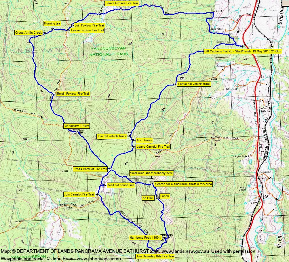
Distance: 21.6km | Climb: 1005m (from Google Earth)| Time: 8.00am-3.40pm (7hrs 40mins), with 50 mins of breaks | Grading: L/M-R; H(14-)
Track Maps
Track overview
Track 1

Track 2
Profile

Photographs
Photographs are available, where you can start a large sized slideshow.
Waypoint and Track Files
Download the .gpx file here. (Right click, Save Link As…, Save – if you want to use it.)
Download the .kml file here.
Track Notes
Ian did a great job with this little walk at short notice. And we were fortunate with the weather, only experiencing a little drizzle.
The fourth walk for me (fifth for some) in this nice area, others on 1 Jul 14, 17 Jun 14 and 29 Apr 14.
We did a misshapen figure of eight, going west, then south and south-east, south again, north-west and north-east. A combination of fire trail (but with plenty of large corners cut) and off-track up and down the spurs and along the ridges. Mostly open woodland going, so we surprised ourselves with the distance covered and also the climbs that added up.
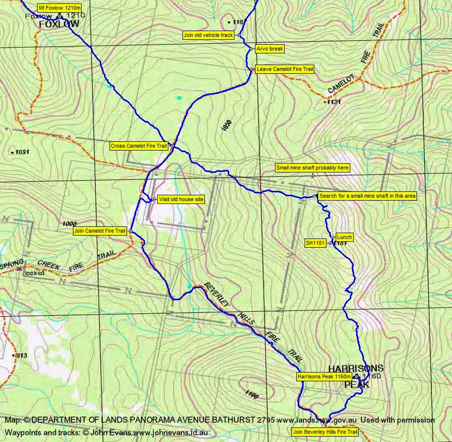
We took in Mt Foxlow (which I’d visited previously) and Harrisons Peak (which was a new destination for me). We didn’t quite have the correct location for a small mine shaft that Ian and Eric had seen on a previous trip.
All-in-all a great trip with some lovely open woodland going made to look quite enchanting at times by the low cloud.
A nice nearly 2km of old vehicle track paralleling Camelot Fire Trail on our exit, not marked on any of my maps.
Party
4 walkers – Eric G, Ian H, Ian W (leader), me.
Next Tuesday Walk
Ian W will again put something on. Watch the Planned Walks on the blog homepage and the CBC short-notice walks email.