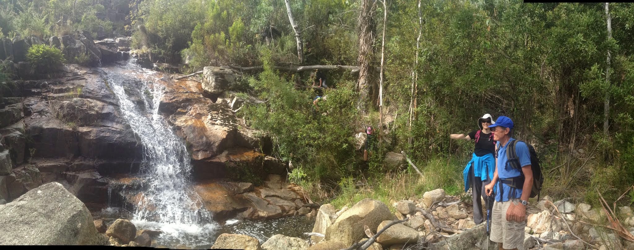
Jasmine (flapping her arms about) and Roger at a cascade below Gibraltar Falls
Saturday 21 February: Gibraltar Creek – S/M,W. Access Gibraltar Creek through old pine forest a crowlometer or so above the Falls. Wend our way down to Gibraltar Falls, then in underneath for a good look. Continue down through Woods Reserve, then rock-hop or splash a few more crowlometers. Visit Mushroom Rock if we feel like it. Some geocaches – GC2J5Q1 Weird Weir I – Gibraltar; GC10ZN6 Gibraltar’s Glory; GC3HMW4 Waterfall Wonder II; GC2GRRZ Wild Woods. Map: Tidbinbilla. Leader: John Evans 0417 436 877 john@johnevans.id.au . Transport: ~$10 per person, car shuttle required. Late bookings considered.
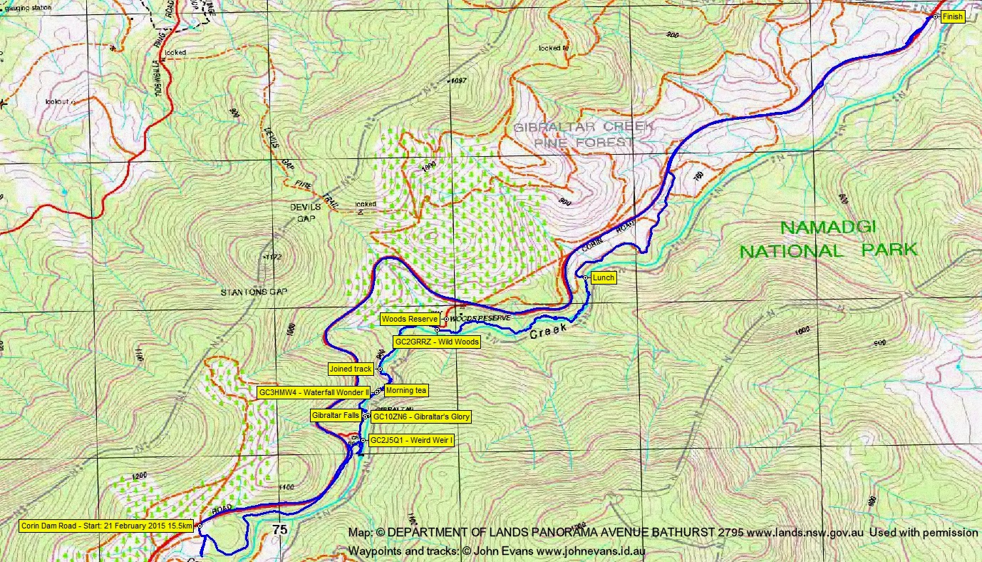
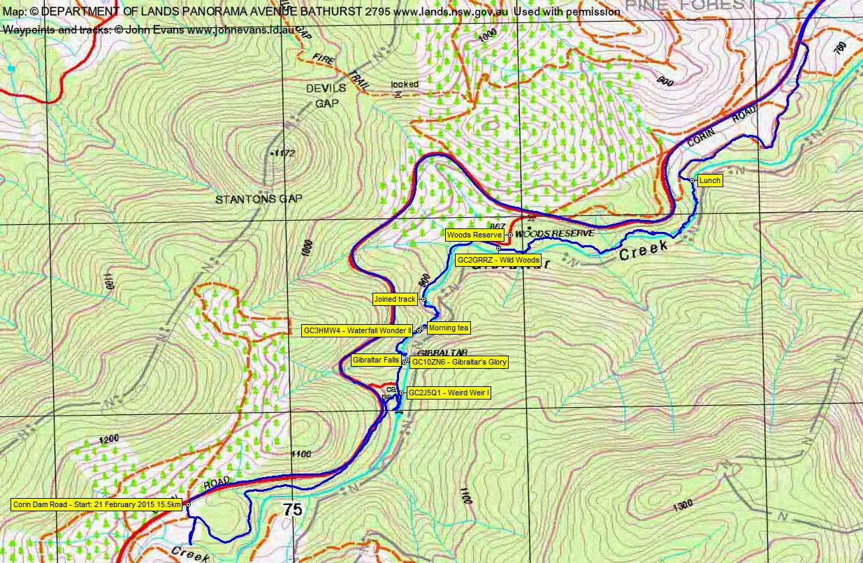
9 of us met at my home and we drove in 3 cars via Point Hut Crossing, Tidbinbilla Rd and Corin Rd. We left a car on the side of the road near Mushroom Rock and took the party in the other 2 vehicles to the start, at the first fire trail on the left above Gibraltar Falls.
Summary
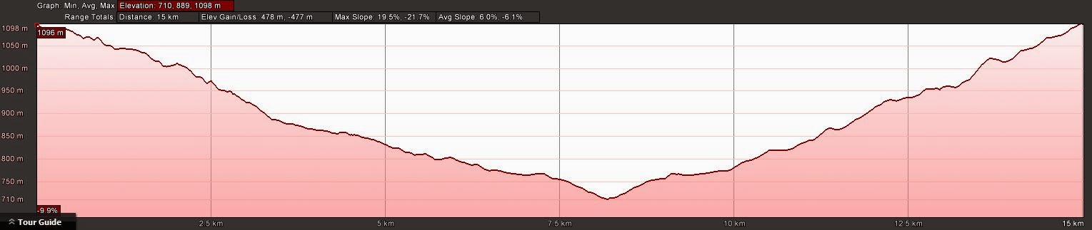
Distance: 15.5km | Climb: 480m | Time: 8.25am-2.55pm (6hrs 30mins), with 35 mins of breaks | Grading: L/M,W; M(10)
Track Maps
Track overview
Track 1
Track 2
Profile
Photographs
Photographs are available, where you can start a large sized slideshow.
gpx File
Download the .gpx file here. (Right click, Save Link As…, Save – if you want to use it.)
kml File
Download the .kml file here.
Track Notes
A most inelegant start as I followed the fire trail down to Billy Billy Creek. Trying unsuccessfully to cover my mistake, we returned up the fire trail and found the correct one!
It soon deteriorated into a footpad along an old benched alignment which swung round to parallel Corin Rd and just under it. We heard talking – but it was 2 cyclists above us on the road. Strange to be able to call out hello as they cycled past. The footpad took us 1.9km in 40mins to within sight of the Gibraltar Falls car park.
Here, the dark side members of the party (geocachers KittyKatch, Marmaduke Rothschild and JohnnyBoyACT) needed time to do the first cache, GC2J5Q1 Weird Weir I. And a mighty fine one it was too, well put together by the cache owner Tank Engine. It was a multi and took us to a number of the structures associated with the weir on Gibraltar Creek. Many thanks to KittyKatch for doing all the working out. We had our first taste of wet feet as we wandered up the watercourse.
Back to the walking, we proceeded through the picnic area (with toilets) and car park and down the steps to the lookout beside Gibraltar Falls. A great view and a second cache, GC10ZN6 Gibraltar’s Glory.
Here we left civilisation and descended steeply to the creek. We attempted to get back in under the falls, but there was a little more water than on 3 Feb 09 and we were a larger party with a range of abilities.
A slow trip down Gibraltar Creek, sometimes in the water, sometimes in the nearby bush. A find and log of GC3HMW4 Waterfall Wonder II high up on a huge boulder overlooking the creek then, soon after, a stop for morning tea.
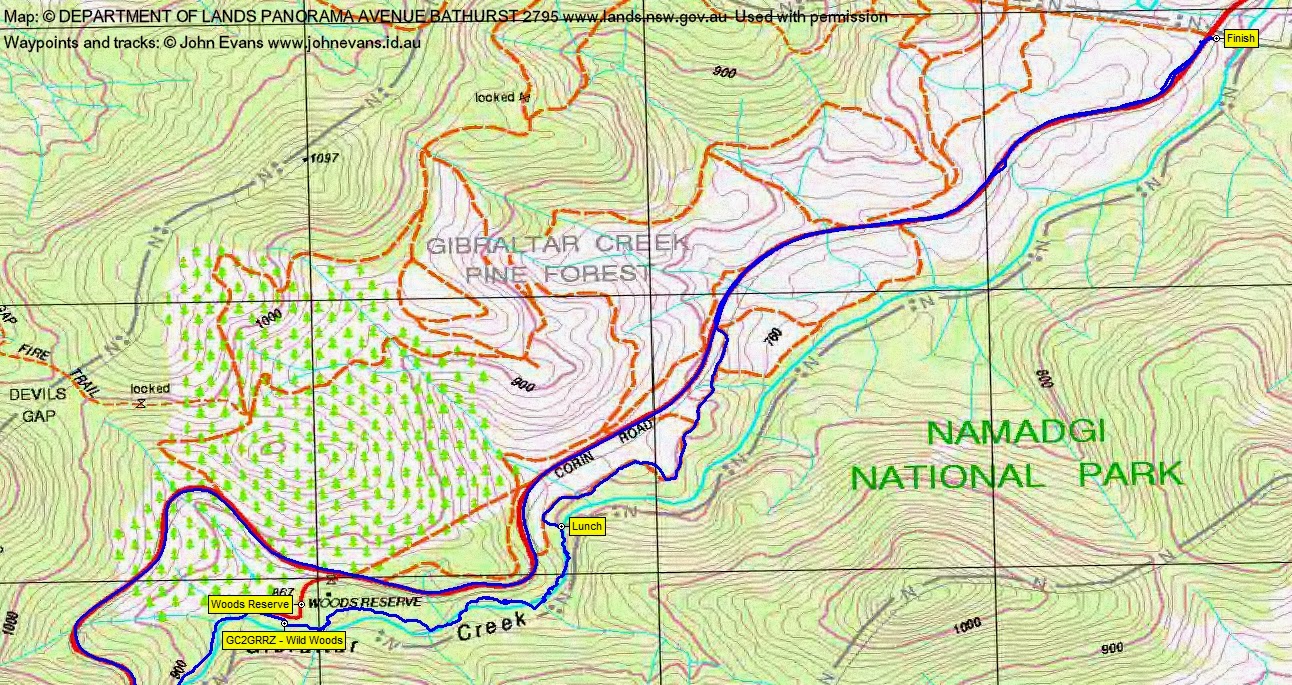
More slow sloshing, rock-hopping and nearby bush-bashing as we followed the creek down. Fortunately, we hit upon the creek-side footpad sooner than in 2009 and that took us quickly to Woods Reserve. Here we logged the fourth geocache, GC2GRRZ Wild Woods.
Back in Gibraltar Creek, it took 1hr 25mins to cover 1.5km to the lunch spot. The process is quite tiring, not only the physical effort of walking in the water, rock-hopping, avoiding/coping with slips and bush-bashing through the scrub and occasional blackberry infestation (they were yummy!), but it takes mental effort to concentrate too. We were all glad to prop for lunch.
Time to go and, in a departure from the leader’s usual directive style, options were presented.
5 of us headed up towards Corin Rd and soon picked up an old fire trail. It generally paralleled Corin Rd for a while, then joined the main road which took us back to the car at the finish point. Warm as we walked. 3.2km in 55mins. This party’s trip was 8.5km with 75m climb (and 460m descent).
Roger led 4 to continue down the creek. They reported some nice slabs, possible Aboriginal axe-grinding groves and a combination of creek walking and pushing through the creek-side scrub. They got back to the finish point around 3pm.
Once we 5 gained the finish point, my guilt at not doing any Cbr100Challenge training since last Saturday got the better of me, so I wandered back up Corin Rd to fetch my car. 7km in 1hr 15mins.
I was driving close to the finish point when Roger and Kath drove past, going up to pick up the remaining car.
A great party! Iris (just 3 weeks in Australia from Germany) experienced an Aussie BUSH walk; Margaret stepped up from urban fringe walking and has the battle wounds to prove it; Danny is an experienced walker from Queensland new to CBC trips; Jasmine and Bubbles, mild-mannered young ladies, have another sport that you would not want to mix with them in; Kath is the best geocacher to have with you (and my geo-mother); Roger and Ian – stalwarts, many thanks.
Well timed – we were back in Canberra well before the thunderstorms started.
Party
9 walkers – Iris C, Roger E, Kath H, Danny M, Lauren O, Jasmine S, Margaret W, Ian W, me.