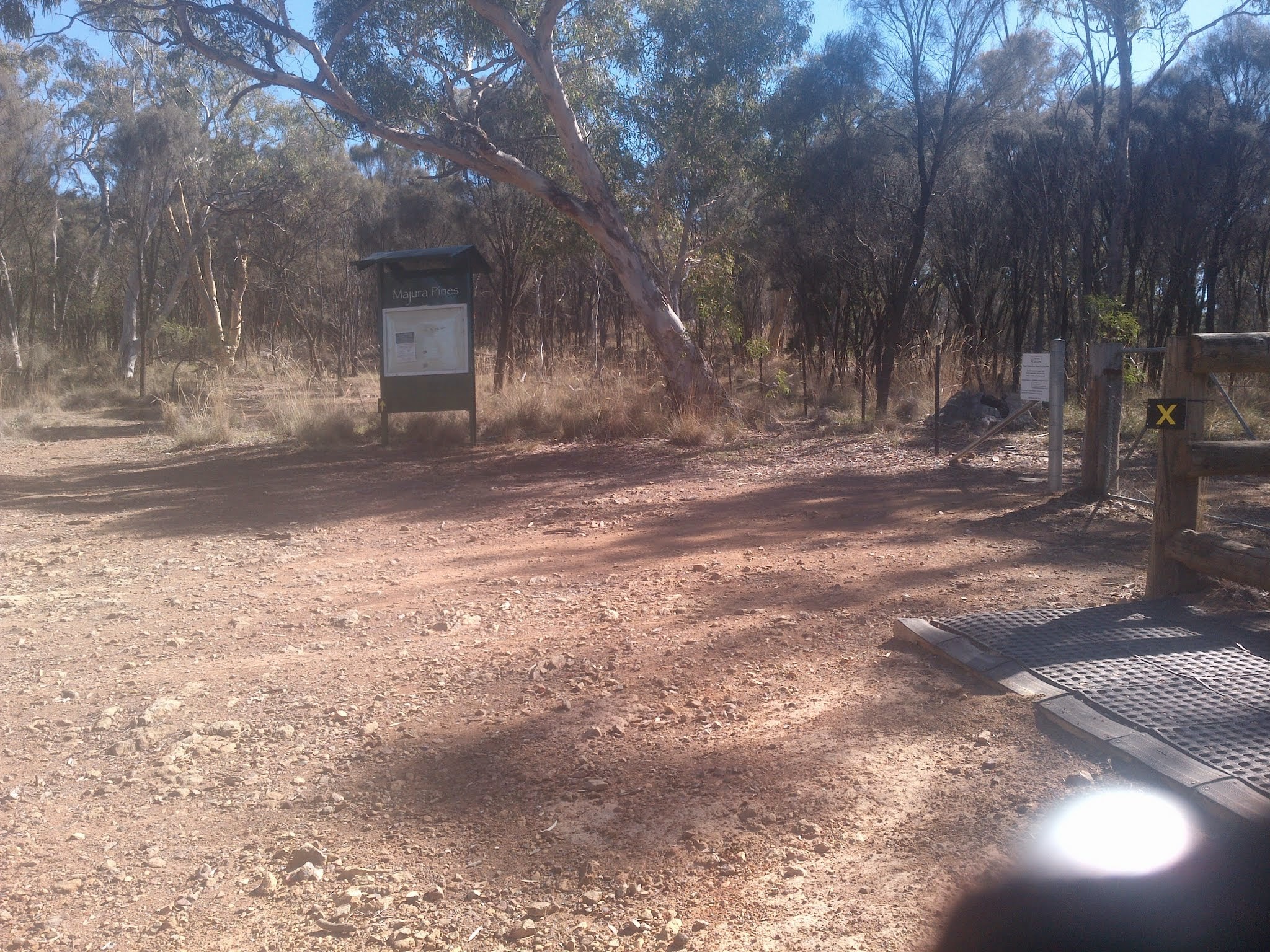
Cbr100Challenge course marking at the Majura Pines signage – go straight ahead, not over horse gate
Thursday 19 March: Checkout the Cbr100Challenge 100km route joining the Acacia Trail – S/E. Checkout this bit of the course that has fooled me.
Drove to the MacKenzie St Hackett entrance to the Mt Majura Nature Reserve.
Summary
Distance: 4.1km | Climb: 110m | Time: 10.20am-11.00am (40mins) | Grading: S/E; E(4)
Track Map
Track

Photographs
Photographs are available, where you can start a large sized slideshow.
gpx File
Download the .gpx file here. (Right click, Save Link As…, Save – if you want to use it.)
kml File
Download the .kml file here.
Track Notes
I apologise; I hangs me head in shame; I tugs me (balding) forelock to Cbr100Challenge and dips me lid to them.
The Cbr100Challenge 100km route east of Hackett is exactly as described in the event’s gpx file and maps. I have no idea how I missed it on 3 Feb 15. It is very well signed and taped.
Just to emphasise that the fault is with me, I lost my GPSr case on the way back and had to return to find it.
To patient subscribers – this is the penultimate urban fringe walk post, back to the bush after the weekend.
Party
1 walker – me.