Coronet Peak and the bottom of the Kelly Spur from west of the Cotter River

Tuesday 24 February: Cbr100Challenge Training – Cotter Hut – L/E,W. Walk in along Cotter Hut Rd to Cotter Hut, splash through the Cotter River and return via the AAWT. 5 geocaches along the way. Around 38km and 1050m total climb. Maps: Rendezvous Creek and Corin Dam. Leader: John Evans 0417 436 877 john@johnevans.id.au . Transport: ∼$12. Late bookings welcome.
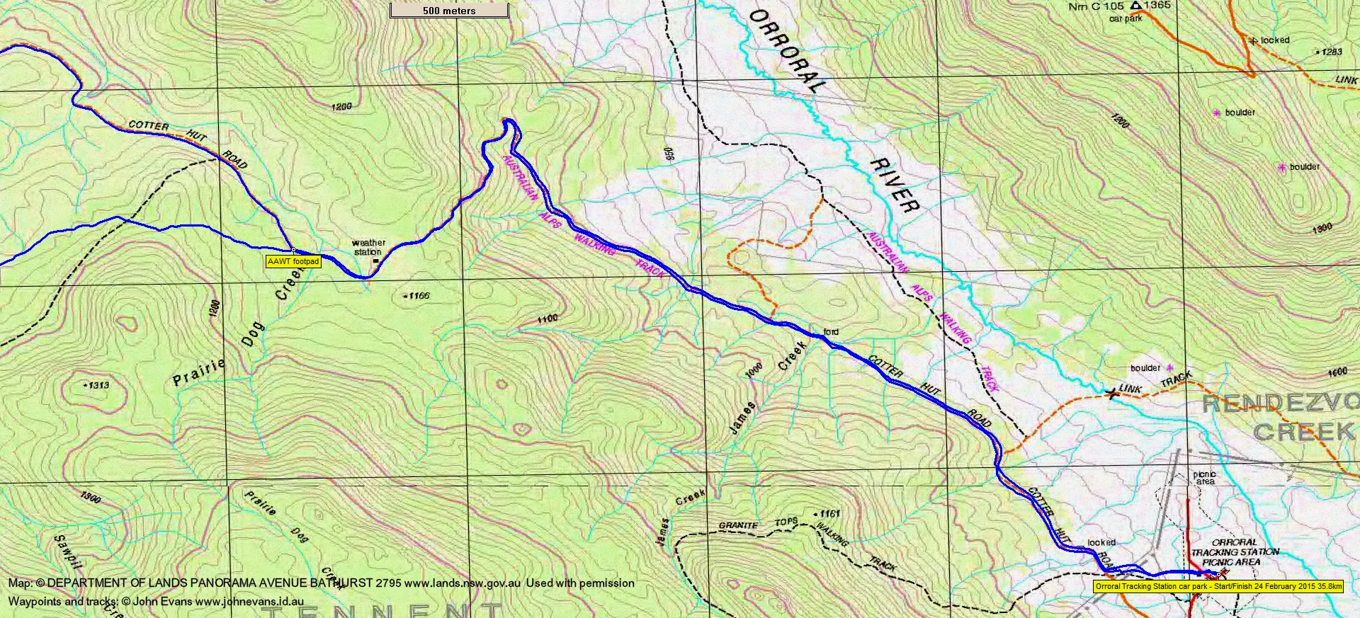
3 of us drove to the Orroral Tracking Station car park.
Further Information
Look for geocaches GC2EZ5D Narya, GC1X97H Cotter Magic, GC1X5AY Cotter – River of Life, GC1X2QH The Eden of Namadgi, GC1ZK83 The grey bush calling…..
Summary
Distance: 35.8km | Climb: 1035m | Time: 7.30am-3.30pm (8hrs), with 25 mins of breaks | Grading: L/E; H(13)
Track Maps
Track overview

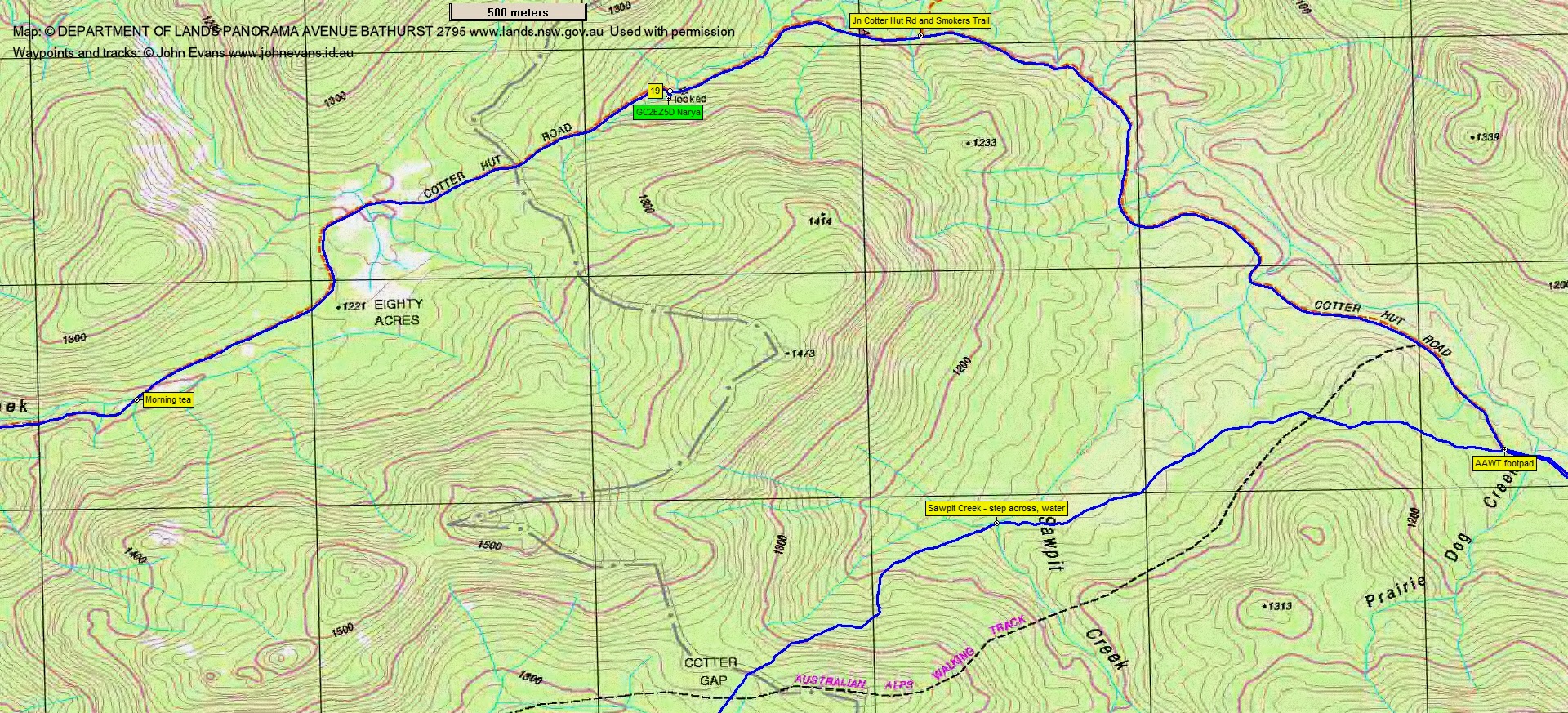
Track 1
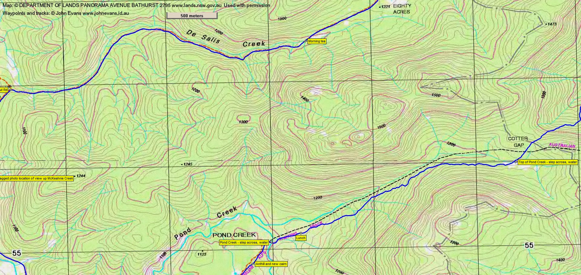
Track 2
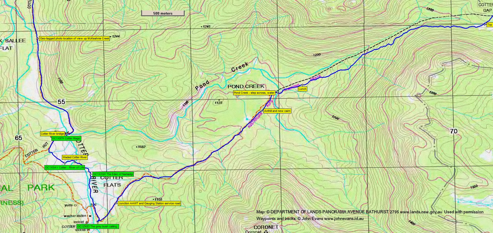
Track 3
Track 4
Profile

Photographs
Photographs are available, where you can start a large sized slideshow.
gpx File
Download the .gpx file here. (Right click, Save Link As…, Save – if you want to use it.)
kml File
Download the .kml file here.
Track Notes
A pretty straight forward walk, except for a little variation finding the geocaches. The day was clear sky and sunny in the morning, but the clouds thankfully rolled in in the afternoon to keep the temperature down. The usual for this season thunderstorms rolled in mid afternoon and we just beat the rain back to the car.
12.7km in 2hrs 30mins from the start to morning tea a bit past Eighty Acres, with only a brief stop to find and log GC2EZ5D Narya.
I got my walking poles out after morning tea and, after Chris had instructed me on how to hold them and the correct length, I’m sure they provided a bit more speed, some rhythm and something else to think about to counter the boredom of long track walks. So I’ll use them on the Cbr100Challenge, maybe from tea and on through the night. In addition, I wore some old, soft Kathmandu boots, 2 pairs of socks, 1 toe tube, my Rebel Sports generic insoles and Gay’s old orthotics that I’ve walked on for years. I think I’ll also use this combo from tea onwards on 21-22 March. 6.1km in 1hr 5mins from morning tea to the Cotter River bridge.
Another quick find, this time of GC1X97H Cotter Magic. We then set off on our cross country geocaching. No gaiters today, so plenty of grass seeds in my socks to be removed tomorrow. Along the Cotter Hut Rd a bit, then down through the scrub and onto the open river flats to find and log GC1X5AY Cotter – River of Life. Next we headed down to the river and found a shallow crossing point. I went in boots and all; the others changed shoes. So I pushed on to the next cache, GC1X2QH The Eden of Namadgi, and had a bit of a wait whilst the others de- and re-booted. Finally, up the east side of the Cotter River to do GC1ZK83 The grey bush calling…., which Roger had done last month on his AAWT trip. This little exercise was 1.9km in 55mins.
We’d left the softer AAWT to return on (when compared with the harder Cotter Hut Rd), although my feet were a lot better today (due to the poles?). 3.4km in 42mins to just past Pond Creek at the bottom of the climb up to Cotter Gap for lunch at 12.50pm.
An 11.7km walk out in 2hrs 25mins (that’s a fairly smart time), with the weather chasing us.
To cap off an excellent day of training and caching, Roger gave me the ultimate clue and I bagged GC4RKRC Trees need water on the way home.
Party
3 walkers – Roger E, Chris F, me.
Next Tuesday Walk
Tuesday 3 March: Nadgigomar Nature Reserve, Western Section – L/M. The walk is in the Sunset Mountain section of Nadgigomar Nature Reserve 35 km north of Braidwood. The terrain is hilly or slightly undulating and there are extensive mature, dry sclerophyll woodlands. A fire has recently burned through some of the reserve and our route will take us in and out of burnt areas. The route is mostly off-track. Minimum distance: 18 km with approx. 400 metres of ascent Map: Oallen Leader: Ian W. Transport: 192 km return Limit: 8.