
Descending to Lanyon/Rob Roy Falls
Follow a rocky stream up to join a short section of fire trail to Mt Rob Roy and its trig. Descend off-track to the W to avoid the leased portion of the NR. Cross open going and descend to the top of Lanyon Falls. Climb out and head to Big Monks, ‘Little Monks’ and down to the Black and White Mine. Descend steeply and return via the edge of suburban Banks. Around 12km and 620vm climb.
Canberra Nature Park – a breath of fresh air for busy walkers. There are 39 Nature Reserves in the
Canberra Nature Park. How many can we walk in? This is number 18.
This walk covers destinations visited by recent CBC led Wednesday Walks and provides an opportunity for weekend walkers. Meet time and place communicated to booked walkers. Limit 10.
Summary
From Garmin Connect – Distance: 11.76km | Climb: 862m | Time: 3:55 moving + 1:32 of stops = 5:27 |
Grading: M/M,ptX; M(11). That climb seems a bit high. The gpx track fed into
AllTrails indicates 636vm.
Photographs
Photographs are available here. Not many photos today. Some more in the area from
27 Jul 22 and
29 Jul 22.
gpx File
The gpx file is available here.
Track Notes
I was last at Lanyon Falls on
27 Jul 22 and around Big Monks on
29 Jul 22.
Totally disgusted with my uphill performance today. And embarrassed. Led from the rear whenever we were going up. Will I ever improve?
We met in Orange Thorn Cres, Banks. Parked elegantly so as to not disturb residents or block through traffic. Weather a little cloudy and cool, but the sky cleared during the day. Temperature ranged from 6°C to high teens, a little cooler in the breeze and shade.
We walked down to behind the flood mitigation wall and headed up the creek line. Water flowing. I don’t know why it looks so murky – the catchment has no grazing or cropping and is relatively short and small. A couple of nice little cascades as we crisscrossed the waterway.

A little cascade on the creek we followed up
Left the creek …

Climbing away from the creek
… and headed up to a checkpoint at a fence corner and gate.
This is where things went pear-shaped. I wanted to handrail the fence for a while to get round the top of the gully to its east. But I was so far behind and so buggered that I couldn’t call out, so the next gathering point was the fire trail! So we had to suffer a fair bit more fire trail to get to Mt Rob Roy, with me again trailing far behind.
Morning tea by the trig. Discussion about a recent incident here. If you need to call 000 (needing mobile phone reception of course), get to know how to give your location via what3words, available through the Emergency+ mobile app (works via your mobile’s GPS which functions in airplane mode or out of reception areas, but you still need mobile or other comms from the field to get this location out to 000). Maybe best to have a PLB or inReach/SOS device in the party.
We backed off down the fire trail around 200 metres and took to the bush to head generally SW-W down to the flank fire trail.

Top of descent from Rob Roy fire trail
For me, this was the most pleasant part of the trip. It was downhill, through easily walked native woodland/forest and I’d never been here before.

Bottom of descent from Rob Roy fire trail
From here, it was further to the west across open country and a couple of small creek lines to approach the top of Lanyon Falls. Thanks to Peter C and his trip on
27 Jul 22 for the route here and back out to near Big Monks. We handrailed down the main Lanyon Falls creek line and cascades appeared as we approached the objective.

Cascades a hundred metres or so above Lanyon Falls
Finally down into the creek.
Descending to Lanyon Falls
A scramble down to the flat area at the top of the falls and a peer over the drop.

View down from the top of Lanyon Falls
I can’t estimate how high it is – maybe 20-30m. There’s a motorbike wreck down there – hope they didn’t go over the top.
We reversed out and headed north towards Big Monks. Most walkers took a bit of a B-line including over a fence, me trailing along behind hit the fire trail to Big Monks at the gate.
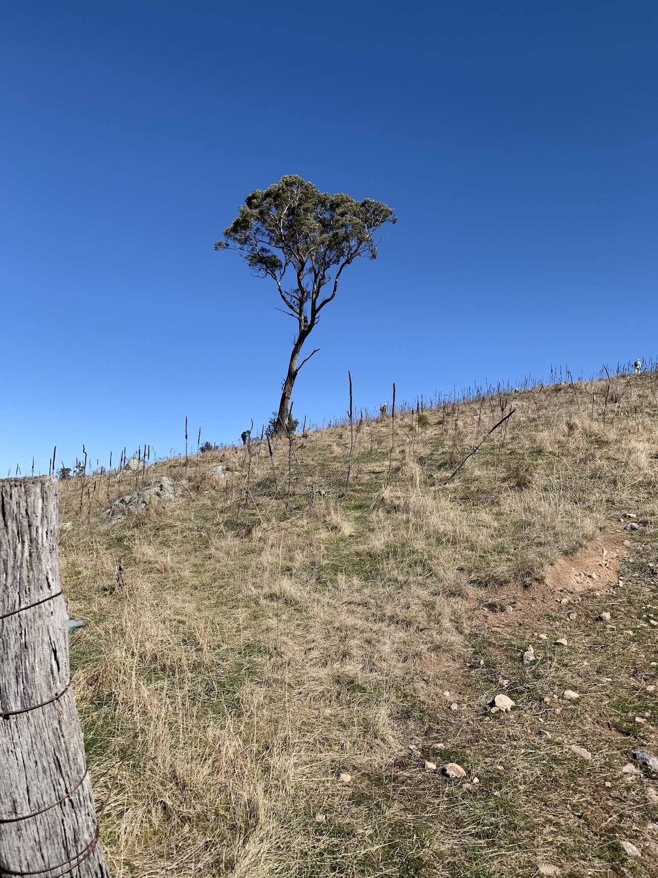
View at the gate near Big Monks
Lunch at Big Monks. I was last to arrive, so got the worst seat out of the breeze and in the sun. So much for respecting an aged leader.
We then headed across to the Kurrajong tree on ‘Little Monks’ and down to the Black and White Mine.

Black and White Mine
The signage at the top side of the mine site reads:
“This is the site of a copper mine, established in 1910.
The mine was owned by Andrew Jackson Cunningham, of Lanyon Station, in partnership with TE Woodger, a local stock and station agent.
It was called the Black and White mine, so-called because members of both black and white races were employed here.
Plans were afoot to develop the mine fully, but abandoned when it appeared the mine would not be profitable.
Please take care around this site and stay outside the fenced barrier.”
A footpad leads down from the site around the south side of a knoll then, turning NW, it’s follow your nose down to the gate at the SE edge of Banks. Houses not shown on my topo map segment, as it was produced in 2003.

Flattening out from the descent from ‘Little Monks’
Walked back to the start via suburban edge fire trail. Canberra Nature Park Nature Reserve #18, tick.
Track Map
Here’s where we went.
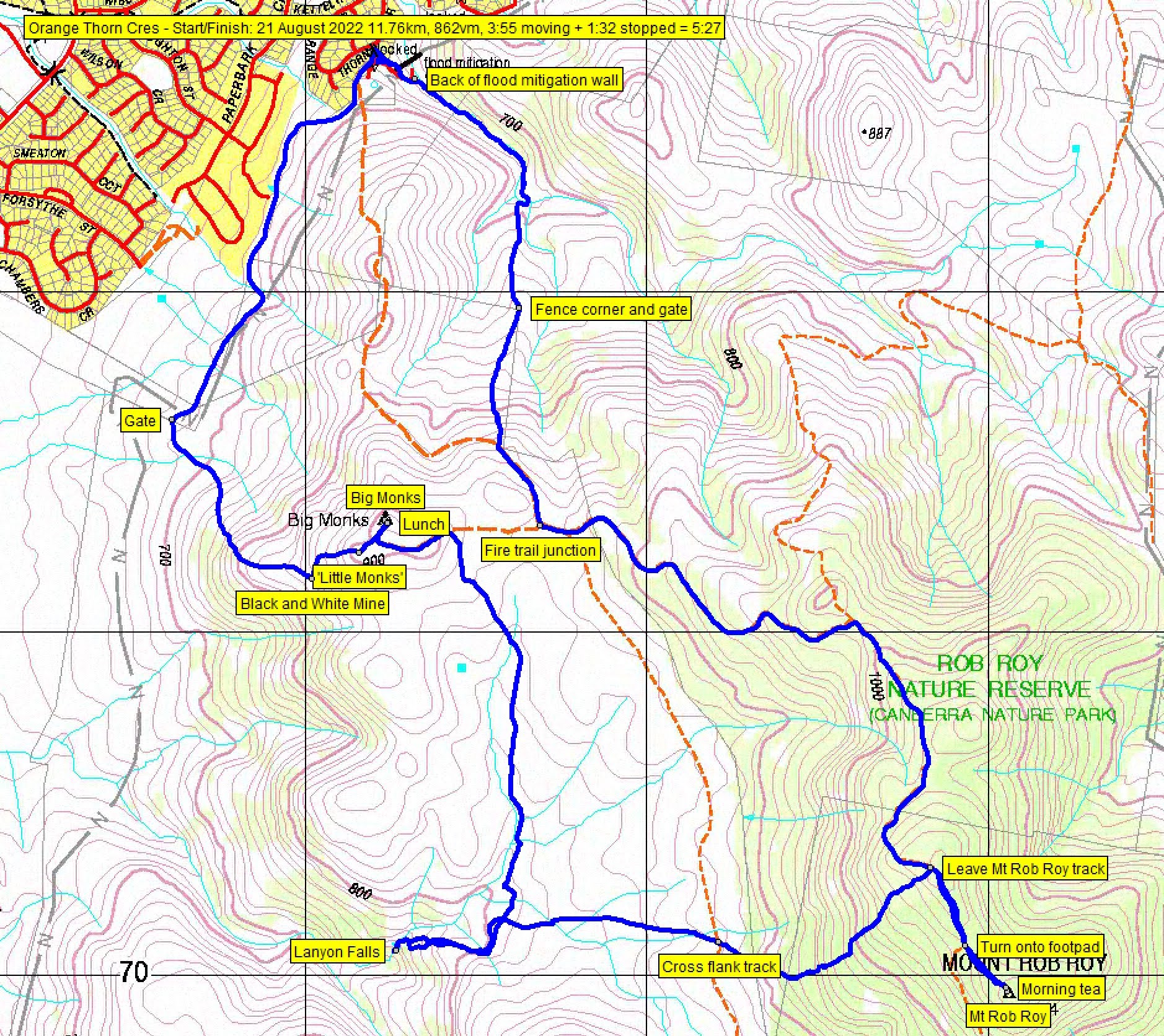
Track Rob Roy NR on 2006-published Topoview Tuggeranong map, copyrighted 2003

Track Rob Roy NR on OziExplorer satellite maps
Party
10 walkers – Khuong, Laisarn, Malcolm, Mark, Richard, Sonja, Stephen, Terrylea, Tilly, me.
John Hall
21 August , 2022 8:58 pmThanks John
What an epic walk. I’ve only ever done the conventional track to Mt Rob Roy but your walks always push the envelope!
Great stuff!
Johnny Boy
21 August , 2022 9:12 pmYou are too kind, good friend. Yes, there was a bit of everything and the descent from Mt Rob Roy was nice. But the trip pushed my envelope!
Beat Oppikofer
22 August , 2022 10:00 amwhen i was down at Lanyon Falls, at that time was a red motorcycle down there, i couldn’t see it on your photos? is it still there?
i went up from creek more to the right-side (where 800m number is on your map) towards Mt Rob Roy
Johnny Boy
22 August , 2022 10:02 amYes, it’s still there.