
Easterly views from Gibraltar Peak, next hill on left
Wednesday 3 April 2024: Mushroom Rock and Gibraltar Peak on West side, SH985 on East side of Corin Road ! – M/E-M,ptXptW. A fire trail wander on both sides of the lower Corin Road.
Summary
From Garmin Connect (recorded on Epix Gen 2 watch) – Distance: 14.64km | Climb: 710vm (Elev Corrections Enabled) | Time: 3:41 moving +1:00 of stops = 4:41 | Grading: M/E-M,ptXptW; M(11).
Walking by myself I don’t stop for smoko. 1 hour of stops were for gasps of air, gasps of admiration of views and photo snapping.
Photographs
View photographs here.
gpx file
Download the gpx file here.
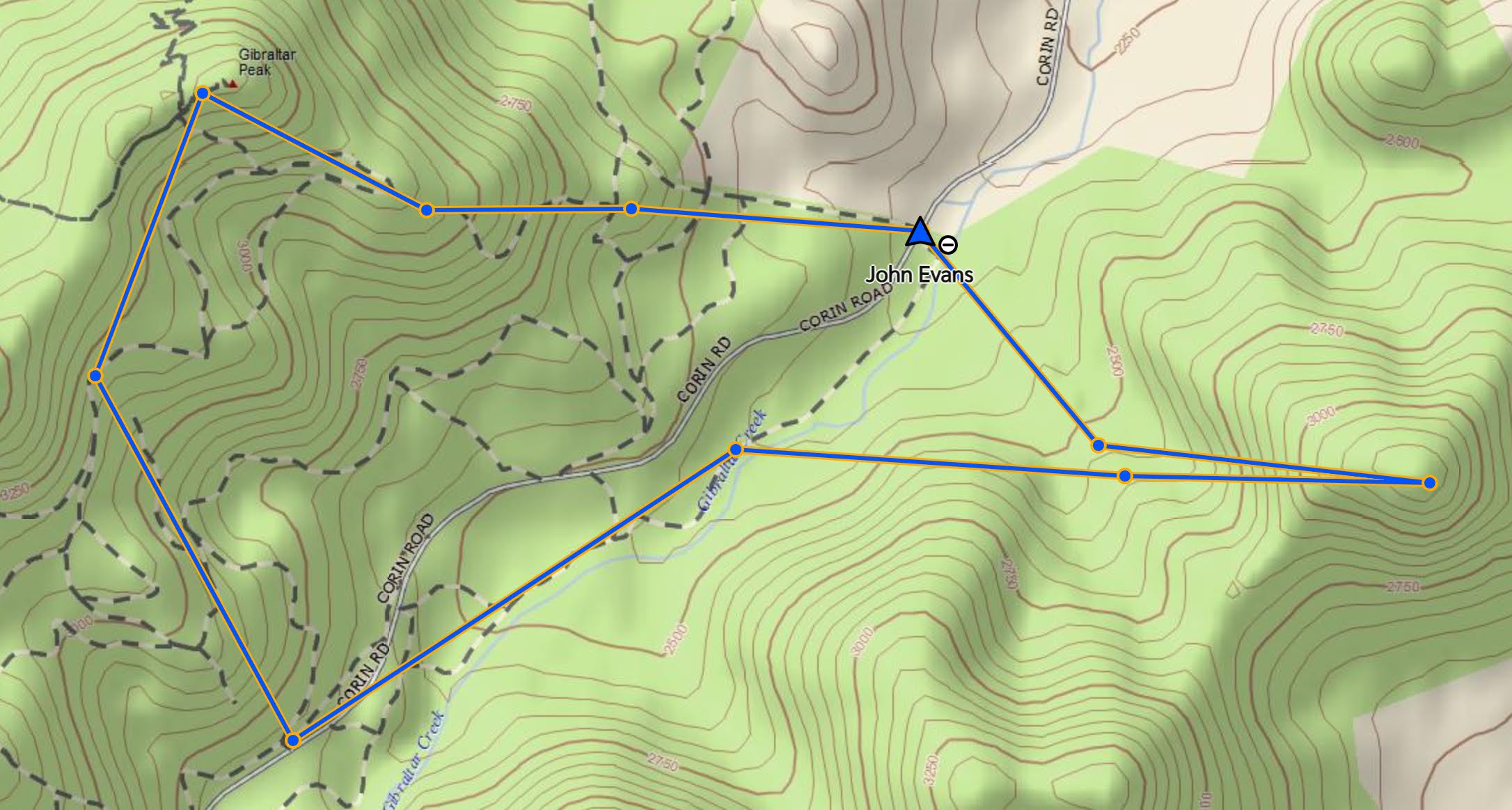
Track Map
Here’s where I went. This is from a ©October 2022 map. I have finally got my act together to download the latest SIX data and calibrate the map in OziExplorer. See here if you want the details.

Track Views from both sides of Corin Rd
Trip Report
I was last at Mushroom Rock on 19 Aug 17, Gibraltar Peak from the East never, and SH985 on 2 Aug 22.
Here’s the views from both sides of Corin Rd, haha.

Views from both sides of Corin Rd
Walking at 7.15am up the steep straight Gibraltar Nth Trail fire trail. A lot of the fire trails today were steep and made with fine gravel.
Good thing I was alone (with 30-minute InReach pings to my dear wife) as I made at least 3 whoopsies.
30-minute inReach pings on Garmin Explore map
Mushroom Rock has multiple map markings, even on the current Tidbinbilla map. It’s on a knoll surrounded by fire trails at GR 77875-73977. You can’t miss it. Just to make sure I circumnavigated it in a stagger – not too good on my feet this morning as the daily chemo pill I take gives me peripheral neuropathy, so there’s not much ground contact feeling.

Mushroom Rock from the West
A lovely rock wave.

A nice wave rock near Mushroom Rock
Some more photos in the album.
Continuing west, I climbed the fire trails to Gibraltar Peak.
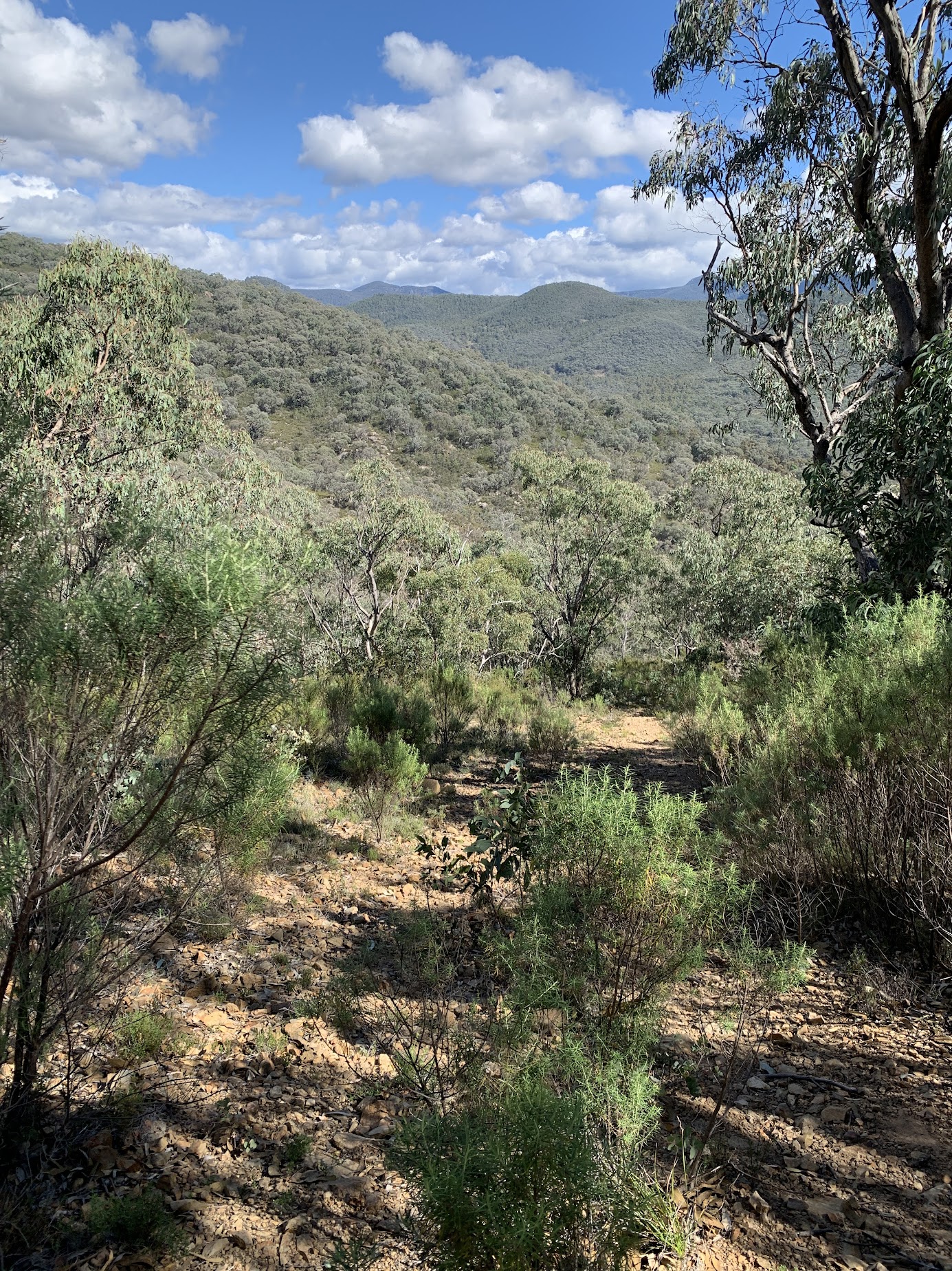
Wonderful views from the top of the track looking east.
Easterly views from Gibraltar Peak, next hill on left
SH985 on the other side of Corin Rd and my next destination, is the knoll on the left.
Back down a bit for the awesome views to the west.

Mt Eliza and Tidbinbilla Range peaks from Gibraltar Peak
Some more photos in the album.
The return down to Corin Rd was a mixture of well established fire trails and a little off-track and disused fire trail to join bits.

Open going on an off-track descent between fire trails
After crossing Corin Road, the next leg paralleled Gibraltar Creek for a couple of kilometres. The ‘track’ varied between rocky and overgrown old fire trail.

Varied fire trail on the south side of Corin Road
The southside ascent began with a crossing of Gibraltar Creek.
Followed by a plod up a fire trail, steep in places. Great views all round from the top.

Views from SH985
Finally, back down to my car.
Heading home from SH985
The speed map from Garmin Connect is interesting (to me). Blue = slow, Red = fast.

Speed map from Garmin Connect
Party
1 walker – just me.
AllTrails
The AllTrails map is here, where you can pan and zoom.
Johnny Boy’s Walkabout Blog FaceBook Page
I’ve started up a FaceBook page. Each trip report posts to it. It’s another way to get some info to get out and breathe a bit of fresh air. Why not pop over and Follow the page, or give a post a Like.