
Making our way below Booroomba’s southern buttress
Saturday 19 May: The Highs and Lows of Booroomba Rocks (again) – M/M-R. The previous trip was oversubscribed, so let’s go again. The Booroomba Rocks cliff top is a great vantage point, with views over Blue Gum Creek to Blue Gum Hill and further into Canberra. But what lies above and below? We’ll follow the footpad north-east to SH1353 above the northern buttress, then return to the central cliff and enjoy the easy scramble south-west up over granite slabs through SH1372 to SH1396. A great spot for morning tea. We’ll then descend and take another easy pad (with a scramble or two) beneath the southern buttress of Booroomba Rocks. Grand views up the monstrous cliff faces where rock climbers ascend. Returning the way we came, we’ll then descend the Middle Rocks area. This is below the cliff top view point and, although there is a little exposure below, the footpad is indeed wide and easy. It’s quite a thrill to get down under the northern buttress with its massive cliffs. We return the same way, huffing and puffing slowly up across Booroomba’s Middle Rocks. Scene-ed out, we’ll walk back down to the Booroomba Rocks car park on the walking track. Around 9km and 600m climb. Map: Corin Dam. Leader: John Evans 047436 877 john@johnevans.id.au Transport: ∼$8. Limit: 12.
Further Information
This was a repeat of the trip on 21 Apr 18. A different view of Booroomba Rocks and, because there was only one Canberra Bushwalking Club trip on the program for today, there were 14 walkers on the wait list. Do we need a third trip here?
Summary
Distance: 8.4km | Climb: 730m | Time: 8.50am – 2.45pm (5hrs 55mins), including 45 mins of breaks | Grading: M/R; M(11)
Photographs
Photographs are available, where you can start a large sized slideshow.
Waypoint and Track Files
Download the gpx file for this trip (if your browser does not automatically download the file, it will open the gpx file in a new window and you can then save it). To use in Google Earth, do File, Open… and select Gps or All files as the File Type.
Track Notes
Sporting a head cold, I felt the -1ºC in Tuggeranong when we met opposite my old folks home. Great to welcome old and new friends.
We shook out in the Booroomba Rocks car park and, after a walk briefing, wandered up the Walking Track to the cliff view point. 27mins for the 1.2km walk, so the 30mins sign at the start is pretty much spot on. We enjoyed the views across to Blue Gum Hill, new to a couple in the party. A clear morning, so excellent views to the Tinderrys, Mt Gudgenby, the Brindabella Range and parts of the Tidbinbilla Range. The tors of Split Rock and Dutchies Peak stood out.
We backed off down to the fireplace area and took the footpad to the NE to the vantage point near SH1353.
Returning, we crossed the main track and winkled our way through the bands of scrub and across the granite slabs up through SH1372 to SH1396. A friendly wallaby. It was cool in the slight breeze and occasional cloud cover, so we found a spot a bit further on and sheltered from the NW air for morning tea.
A foray down the nearby granite slabs:

Wandering the granite slabs below SH1396, Blue Gum Hill behind
Returning, the hopeless leader (guess who?) tracked towards some cairns which probably mark a shortcut to our next destination – you can see the little NW detour in the track map. Corrected, I got back on track and we returned down to join the footpad that went off the main Booroomba Rocks Walking Track.
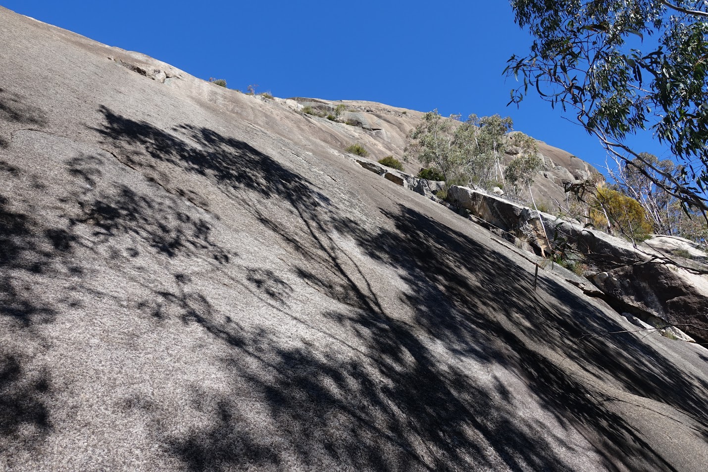
Now we turned left on the footpad, which descends gently to round under the South Buttress. 3 little scrambles that slightly challenged the short-legged members of the party. Wonderful views up:

View up Booroomba’s southern butt(ress)
Again we retraced our steps and, after 50m of off-track through light scrub, arrived at the top of the Middle Rocks descent footpad. Time for lunch.
The start of the descent is easy to follow, turning sharp left near a large fallen tree and using a rock ledge. I tried to remember it for the return, but failed. Anyway, we sidled down and across Middle Rocks. The GPS track is a bit flaky, showing separate down and up routes. They were the same – I guess half the sky is occluded by the cliffs. Great views:

Top of North Buttress from the Middle Rocks descent
We kept left and low at the cairn. But another booboo a little further on. Instead of following the footpad over a stripped fallen sapling:

… I followed another faint pad (including a pink tape) that took up up and across to a view of the required footpad 20m away and 20m down from us. Obviously a rock climbing access point:

Rock climber on the North Buttress
About turn. Back on the straight and narrow we continued on under the northern slabs:
View up the Northern Slabs
With time ticking away to return to meet two of the party who didn’t do this leg and the footpad petering out, we returned the way we came. At the top, my memory failed and I scrambled up over the big tree. Going down a little to meet the tail of the party, I used the rock ledge down and up, hopefully imprinting it on my mind.
All over bar the shouting. We regrouped and walked back down to the car park. Plenty of walkers, including family groups, still coming up.
Great weather, great group. Thanks all!
Track Map
Track

Track
Profile

Profile
Google Earth snip

Google Earth snip
GE snip of North Buttress detail

Google Earth snip Under the northern buttress
PS. Phillip S – we got another 100m further along under the northern slabs than last time. Cynthia Bu confirmed that when she did some rock climbing eons ago, she came down via the route you want to explore. The Google Earth snip ‘Under the northern buttress’ confirms that it can be done – can even see a footpad on it. Must have a look some time.
Party
12 walkers – Cynthia Bu, Julie H, Lisa Q, Chris R, Dan S, Llewellyn S, Jim S, James V, Richard V, Matthew W, Mary W, me.