
6.15am near Cooleman trig
Saturday 18 February 2023: Canberra Centenary Trail Stage 6 – Stromlo Forest Park to Tuggeranong Town Centre * – L/E. This urban fringe walk passes through several interesting locations and provides some excellent views. Points of interest include the Stromlo Bushfire Memorial, Cooleman Ridge, Kambah Pool (not the nude swimming beach), Red Rocks Gorge and the Tuggeranong Stone Wall. Around 23km and 550m climb, 6-7 hours walking, plus stops. For RU⇧4it , we can bag Narrabundah Hill/trig, Cooleman Hill/trig and Arawang trig. Car shuttle required.
A forecast 35°C day in Canberra, so we shortened the walk. But added a couple of hills.
Summary
From Garmin Connect (Epix Gen 2) – Distance: 20.39km | Climb: 653m | Time: 4:24 moving + 1:33 of stops = 5:57 | Grading: L/E-M; M(10).
Photographs Photographs are available here.
gpx File The gpx file is available here.
Track Notes
I last did this section of the CCT on 14 Jul 12.
Happy to try out a new bit of gear, a Garmin Epix Gen 2 sapphire titanium. I can press the Start/Stop button, but that’s about all so far. Hugely feature rich. One difference I’d already noticed when others have given me a Fenix watch gpx file is the wearable’s track point density. Today, the Epix recorded 4784 track points, the MAP66i handheld 1422 track points. As would be expected with more track points, Epix distance was 20.32km, MAP66i was 19.62km.
Southern residents were disturbed as we got up with a fine thunderstorm around 4am. Heavy rain at the old folks home in north Cooma (Gordon). But a check of the weather radar indicated that it would pass.
Our plan B had us meeting in Tuggeranong at 5am with a car shuttle to the top of Warragamba Av in Duffy. So we didn’t walk Stromlo Forest Park to Duffy this time. Walking at 5.22am.
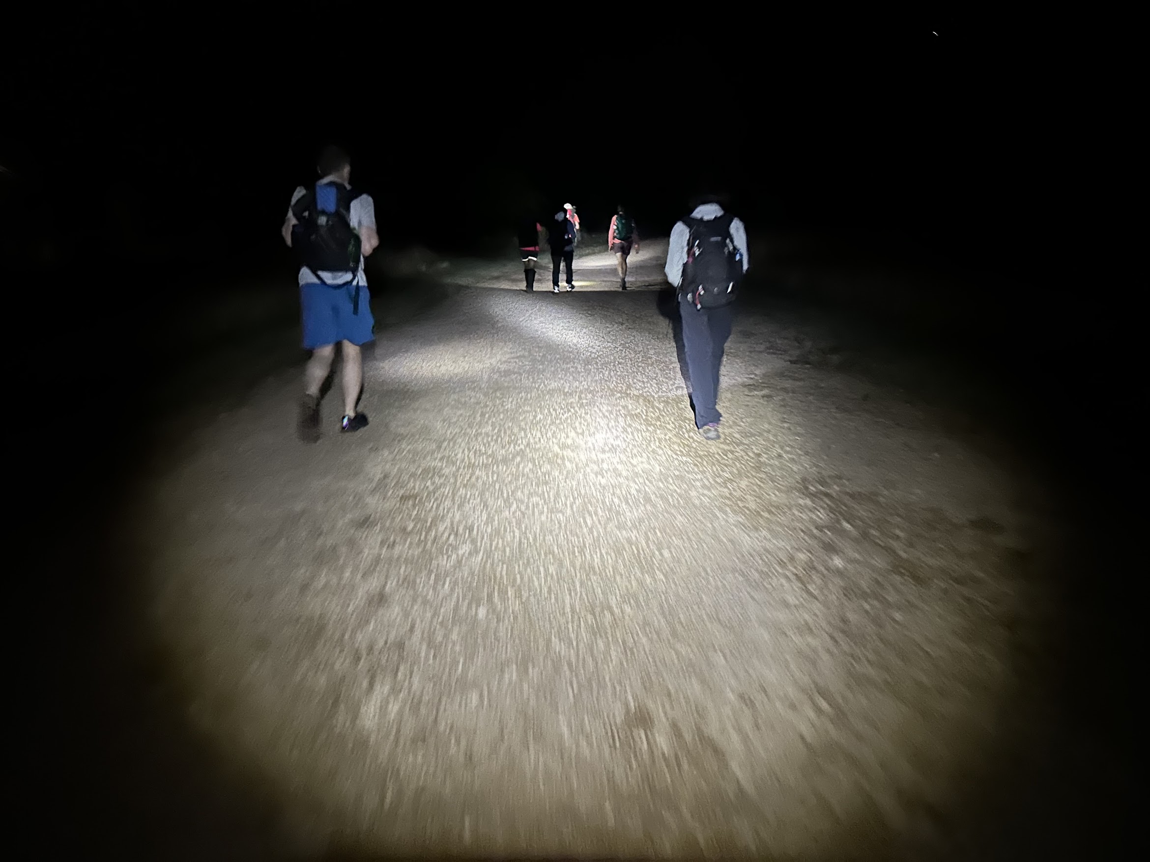
The only light at Narrabundah Hill/trig was from our head torches and phone flashes. But a bag and an ‘N’ for RU⇧4it.

5.33am Narrabundah trig (photo Craig L)
Lovely light was starting to colour the sky.

5.34am Descending from Narrabundah trig – fabulous sky (photo Craig L)
Down at the Duffy reservoir, we headed for Kathner St in Chapman and the northern end of Cooleman Ridge NR.

5.49am Between Narrabundah Hill NR and N end of Cooleman Ridge NR (photo Craig L)
Lovely reflections in the dam, which my old iPhone 10 didn’t capture too well (unless it was the old operator’s shaky hands).

5.59am at the north Cooleman Ridge dam
We turned SE and winkled our way, sometimes on the CCT and sometimes not, up to Cooleman Hill/trig.

6.19am At Cooleman trig (photo Craig L)
We continued to head SE towards Arawang trig. Sunrise was at 6.39am, a bit later with a hill in the way.

6.45am Looking to Arawang trig
Arawang trig bagged us an ‘A’ …

7.01 At Arawang trig (photo Craig L)
… and some nice views to the west.

7.02am View west from Arawang trig to Bullen Range, Tidbinbilla Range and Mt Gingera on the Brindabella Range
South off Arawang, we circled across the top of the little section of Kambah houses. A hoy from behind had us greeting Jen H and Abbie the dog, out for their morning constitutional.
We took a detour, west up and south down, to Neighbour Hill. A bloody (like, on aspirin, I bleed) fence crossing or two. A mite weedy on top.

McQuoids Hill from Neighbour Hill (photo Craig L)
McQuoids Hill was our next destination and I knew there was fire trail access up and down. Slippery gravel.
Down beside Kambah Pool Rd, it was pleasant beside the Murrumbidgee Country Club golf course, so green. But a little boring for a kilometer or so after the Mt Vernon Dr turn in to Gleneagles.
A slashed route allows cutting the corner of Kambah Pool and avoiding the temptation of the nude swimming beach. We were rewarded with blackberries.
Back on the CCT/Kambah Pool to Pine Island Walking Trail, we pulled into the Red Rocks Gorge Lookout at 9.30am. Actually, we sat under it to get some shade. A good 20 minutes for smoko.
Craig and Ming went down closer to the river.

Closer to the Murrumbidgee River below the Lookout (photo Craig L)
The obligatory photo up-river as we left.

9.56am Looking up Red Rocks Gorge
15 minutes later, we took the footpad down to get a better look at the red cliffs on the opposite side of the river.

10.13am The red cliffs of Red Rocks Gorge
It was starting to warm up in the sun and the occasional bit of shade and waft of breeze were welcome. Plenty of drink stops. Eventually the CCT rounds a corner to views down to the river and to the office buildings of Tuggeranong.

10.41am A sweeping bend in the Murrumbidgee River below Tuggeranong offices
A joy (I hope) for Yuan newly walking with this gang was a foot-cooling crossing of Tuggeranong Creek. It’s a very special place for one of our walkers. Once we were all across, I thought it useful to point out that there is a fine bridge around 200m upstream.
The last POI was the Tuggeranong Stone Wall, which we crossed in style at the stile.

11.08am At the stile over the Tuggeranong Stone Wall (photo Craig L)
We handrailed up alongside it.
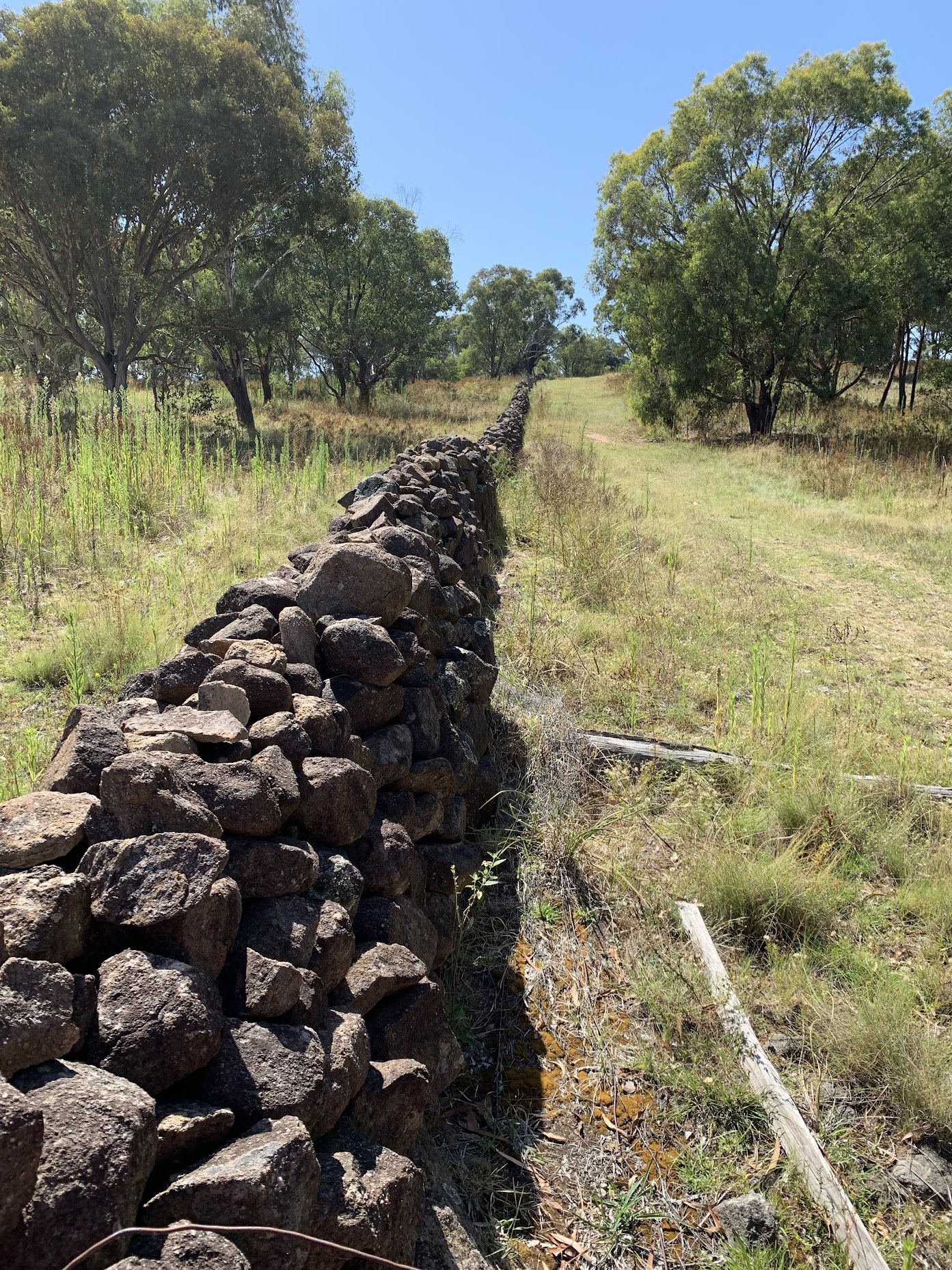
11.09am Tuggeranong Stone Wall looking E
The walk finished with an inglorious crossing of Athllon Drive at the traffic lights.
I think we were all pleased to finish by 31°C, rather than 35°C. So that’s it for my CCT list, the last stage ticked off.
Relive the trip
Track Maps
Here’s where we went.

Track overview CCT 6

Track 1 CCT 6

Track 2 CCT 6

Track 3 CCT 6
The AllTrails map is here, where you can pan and zoom.
Party
7 walkers – Stephen J, Ming L, Craig L, Lam S, Sandra T, Yuan T, me.
Johnny Boy’s Walkabout Blog FaceBook Page
I’ve started up a FaceBook page. Each trip report posts to it. So it’s another way to get some info to get out and breathe a bit of fresh air. Why not pop over and Follow the page, or give a post a Like.