
View from under Square Rock
Summary
From Garmin Connect – Distance: 9.31km | Climb: 277m | Time: 2hrs 55mins including 30mins of exploring | Grading: M/M; E(7).Photographs
Photographs are available here.Track Notes
A quick in, explore under Square Rock and home. Vandalism on the way in.
Shocking vandalism on the Square Rock Track

A new name for this rock just before Square Rock – Wombat Poo Rock
View from under Square Rock

View up from under Square Rock
Party
4 walkers – Linda and Peter, Phillip, me. 12 July 2022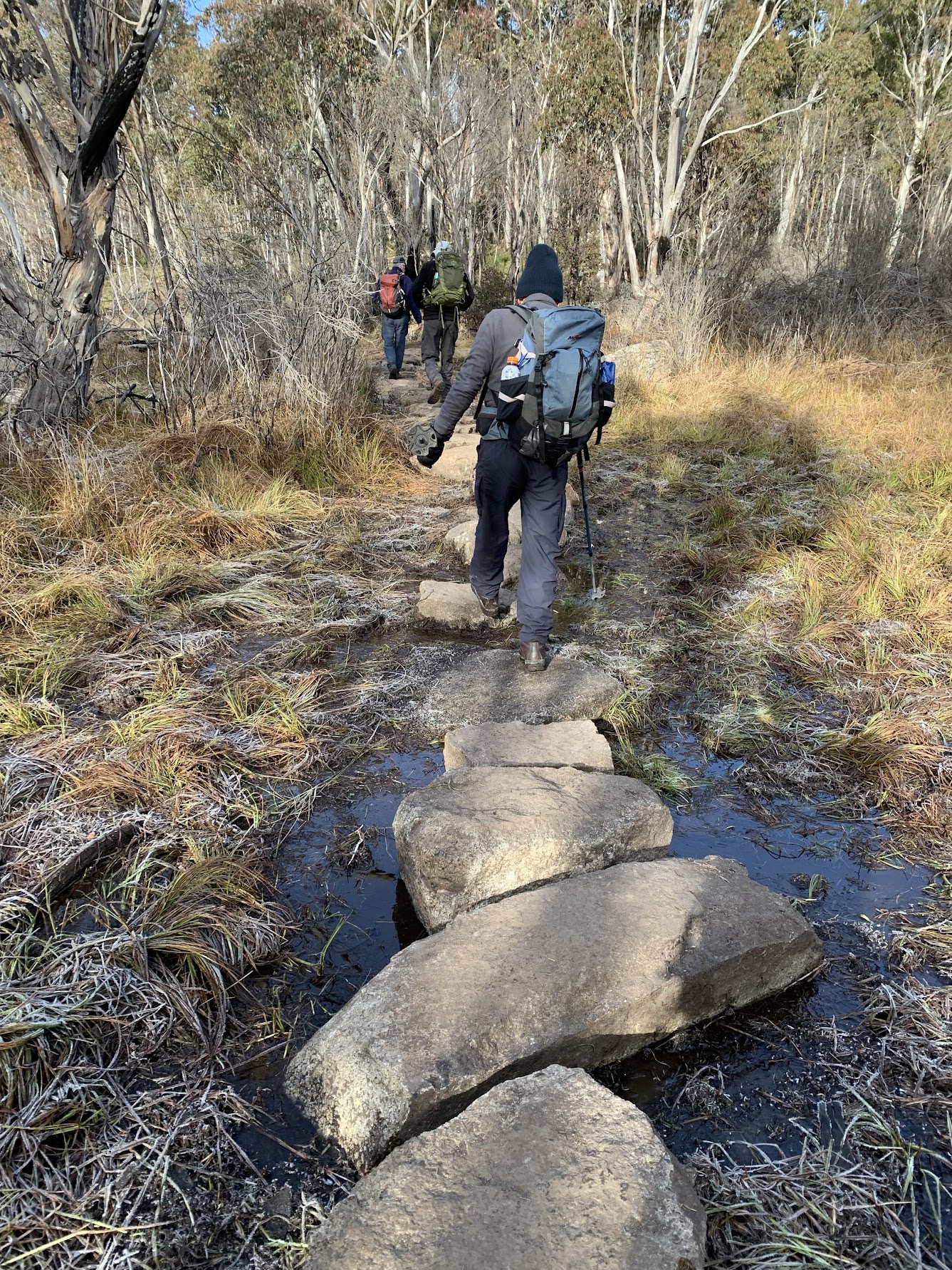
Square Rock Track crosses Smokers Flat
Summary
From Garmin Connect – Distance: 13.52km | Climb: 369m | Time: 4hrs 30mins including 55mins of stops | Grading: M/E; E(7).Photographs
Photographs are available here.gpx File
The gpx file is available here.Track Notes
The last recent times I did this trip were 5 Mar 22 and 8 Feb 22. Plenty more photos there. Today’s trip was for old timers, although at 73 I was the second youngest in the pack. We’ve been mates for years. I learned a few things. One, instead of trying to keep up with young, quick walkers and maintaining friendships so they will take my ashes to Mt Namadgi, I should keep walking with these more mature gentlemen. Surely they will have the wherewith-all to hire a helicopter to do the job. Very muddy on the initial part of the Square Rock Walking Track, in the sections where there are no walkways or steps. It obviously gets a lot of walkers.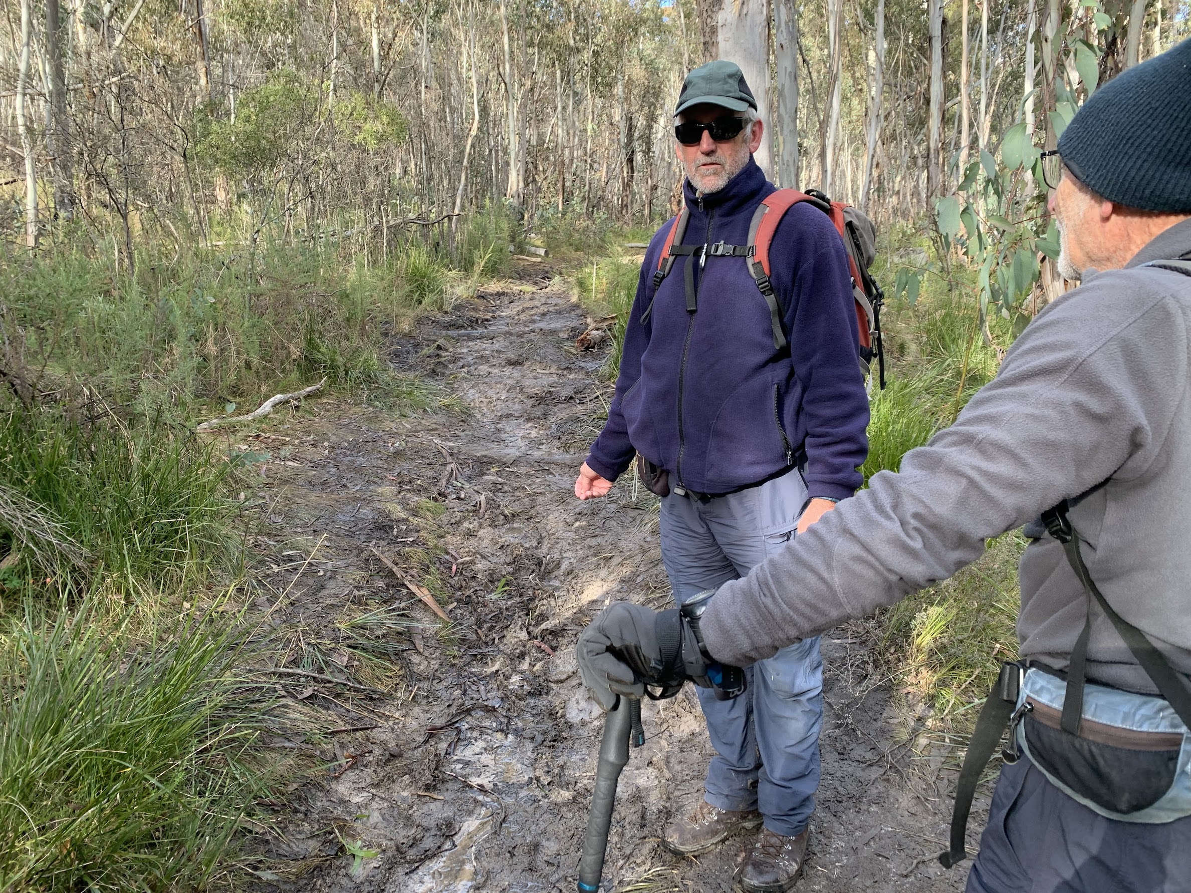
The best of the muddy initial section of the Square Rock Track

Pleasant walking on Square Rock Track

‘Table’ structures down on the SE part of Smokers Flat

Walking down the newish section of Smokers Trail to Corin Hub
Track Map

Track Square Rock and Smokers Trail
Party
5 walkers – Eric, Max (leader), Mike, Phillip, me.What else did I learn?
Mike uses an app called Footpath with associated web services at Footpath Route Planner | Footpath Route Planner (footpathapp.com) to, wait for it, quickly measure the thousands of kilometres of rivers he’s paddling. Better than using a piece of string on a map, he says. Must have a play. Phillip pointed out that with AllTrails, there is a free draw feature. When creating a map (planning a walk), turn off Smart Routing, hold down Shift and free draw with the left mouse button held down. I live and learn.Technobabble
Can’t resist one little bit of technobabble. Today’s temperature. Minimum was 4°C.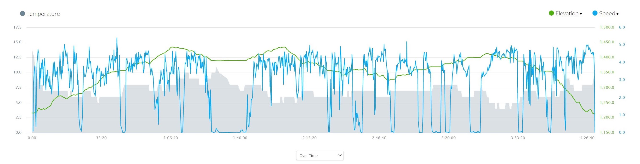
Garmin tempe temperature plot from Garmin Connect