Wild flowers
Saturday 16 February: Mt Ginini, Little Ginini & Mt Gingera – L/M. From Ginini car park on Mount Franklin Road a short walk to Mt Ginini then off track to Little Ginini. Next partly off track to Pryor’s Hut for morning tea. We continue from there, partly on fire trail and partly on footpad, to Mt Gingera. After enjoying lunch with great views we will return, off track, to Pryor’s Hut and then back along the fire trail to our cars. Leader: Phillip S.
Further Information
This was a re-enactment of Phillip’s first led CBC walk on 30 Apr 11.
Summary
Distance: 15.1km | Climb: 640m | Time: 9.40am – 4.25pm (6hrs 45mins), including 35 mins of breaks and lots of looking time | Grading: L/M; M(11)
Photographs
Photographs are available, where you can start a large sized slideshow.
Video
Waypoint and Track Files
Download the gpx file for this trip (if your browser does not automatically download the file, it will open the gpx file in a new window and you can then save it). To use in Google Earth, do File, Open… and select Gps or All files as the File Type.
Track Notes
We met at Weston at 8am. It took around 1hr 30mins to drive via the Cotter, Brindabella Rd to Piccadilly Circus and south along the Mt Franklin Rd to the parking area at the locked gate below Mt Ginini.
We shook out and wandered up the old ski run, onto the road to the top and up to the Air Navigation Facility. A few changes since I was last here – a big, low concrete construction inside the security fence which, I believe, is built on top of the Mt Ginini high point. A time to take in the lovely views.
Then off down the old ski run/top of Harrys Spur footpad to the west of south. I was on the lookout for some old friends and soon came across Harry Mouat’s ACT/NSW border corner lockspits U56 and V56.
Phillip turned us south into the bush where the Harrys Spur pad turns to the west. Immediately we were at the old brumby running yard.

Old brumby running yard
The bush soon cleared and we enjoyed the beginning of a lovely slope down to Stockyard Gap. Another old friend was visited.

Border marker X56 3″ downpipe and cairn
We pulled up in the shade for morning tea whilst views were still to be had.
Perfect walking on a perfect day with perfect company ensued, along with views to our next objectives.

Just after morning tea, Little Ginini and Mt Gingera in sight
The Snowgums closed in a little as we descended the spur.

Lovely Snowgum woodland at 1640m contour
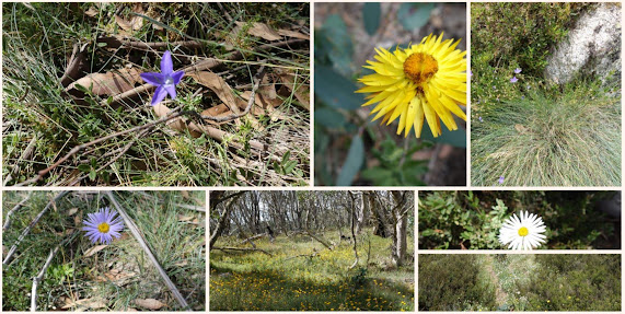
Wild flowers in abundance.

Daisies
More friends revisited as we descended to Stockyard Gap

Border markers C57, D57, E57 on descent to Stockyard Gap
Just south of Stockyard Gap the party split, with some going direct to Pryors Hut via the Mt Franklin Rd and the rest puffing up over Little Ginini Mountain. A pleasant little top, actually the 9th highest named hill in the ACT.

Alison and Lauren at Little Ginini Mountain
Border marker M57 nearby, but you’ve probably seen enough of those!
But I had to visit just one more, P57 downpipe and cairn, only around 400m up from Pryors Hut.

Border marker P57
We regrouped at the hut and had a quick lunch, as our companions had been waiting there some time. A little discussion on Pryors Hut and the nearby Scotts Pines – the hut was built in 1952, by Lindsay Pryor and party, as a shelter for those working in the Alpine Botanical Gardens, an annex to the National Botanical Gardens (nearby); the pines planted in the 1950s by members of the Snowy Mountains Authority Landscape Section (they are not one of the ACT arboreta). Follow the links above for more information.
A walk along the Mt Franklin Rd for a while, passing a newly installed sign with very informative information.

All Namadgi National Park/Bimberi Wilderness Area users should adhere to these management guidelines
Snowy Flats Creek was running crystal clear, although less volume than usual. We turned up the Gingera footpad, walking through lovely flowers.

Flowers by the Mt Gingera footpad
Excellent views from the pad just below Gingera.

View NE thru SE from the footpad just below Mt Gingera
We first visited the Gingera guyed pole. The nearby little windswept Snowgum is tenaciously hanging on and, in fact, beating the harsh conditions and growing.

The little tree at the Gingera guyed pole is getting bigger
After soaking in the view, we moved around 100m to the NW to the actual Mt Gingera high point.

Tantangara Dam from Mt Gingera
Our next leg took us NW along the Mt Gingera ridge. A landscape attesting to the prevailing westerly winds.

Windswept skeleton on the Gingera Ridge
A visit by me to border marker T57, then over the northern nose of the ridge and down towards Pryors Hut.

Snowy Flats from the northern nose of the Gingera Ridge
A break at Pryors Hut to keep up our hydration, then the 4 crowlometer (4.9km on the road) walk back to the cars.
A lovely walk full of good memories and good friends. Thanks Phillip and all.
Track Maps

Track overview

Track 1

Track 2

Profile
Party
9 walkers – Alison, Janice H, Stephen and Lisa M, Quentin M, Lauren O, Phillip S (leader), me.