| Walk # |
Date |
Walk |
Distance |
Climb |
Grading |
Photos |
| 1197 |
29 Sep – 2 Oct 18 |
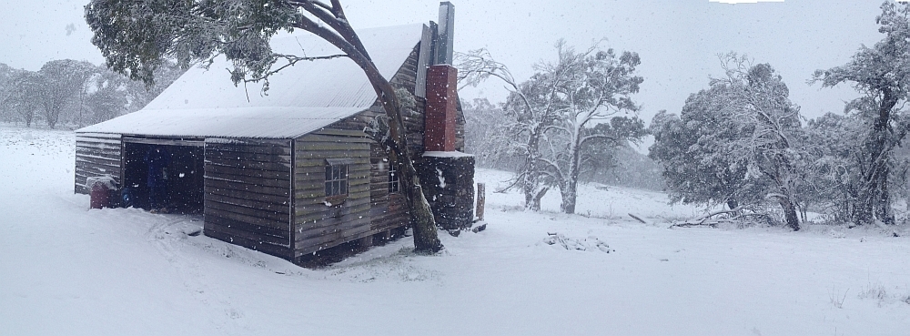
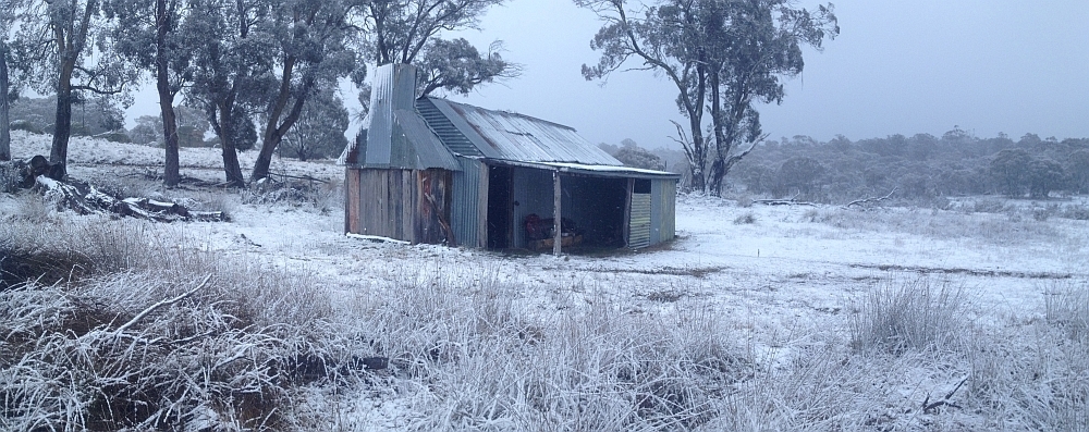
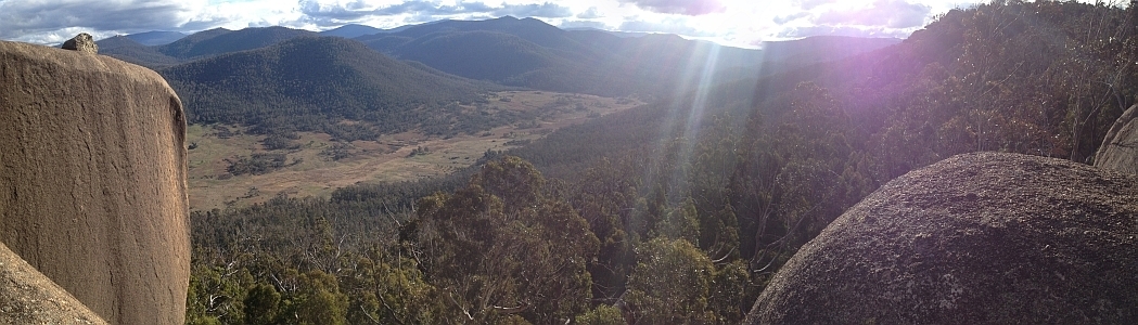
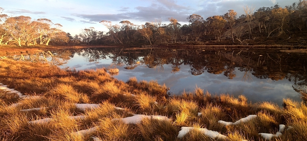
MNP: Budawangs THE LATEST |
|
|
|
|
| 1196 |
22 Sep 18 |
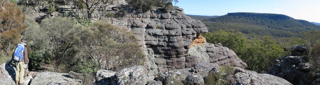
NNP: Billy Billy Rocks Circuit |
|
|
|
|
| 1195 |
20 Sep 18 |
CNP: Bushwalking for Covenant College ! |
|
|
|
|
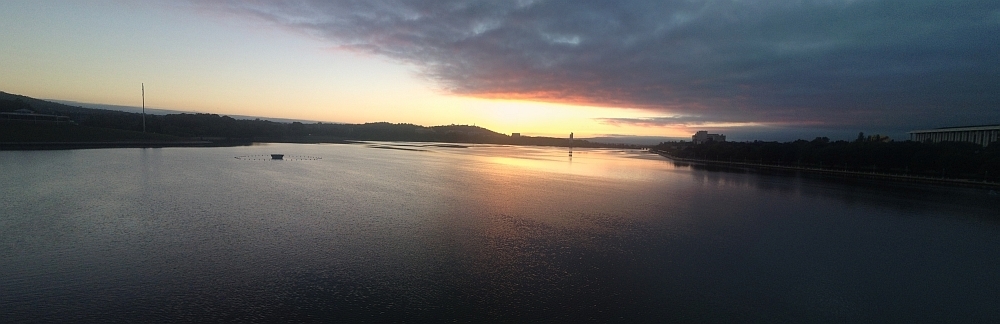
| 1194 |
19 Sep 18 |
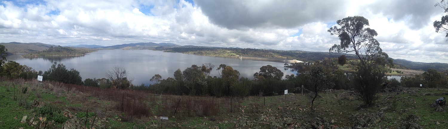
LBG: Lake Burley Griffin paddle with Max |
7.1 |
|
|
Photos |
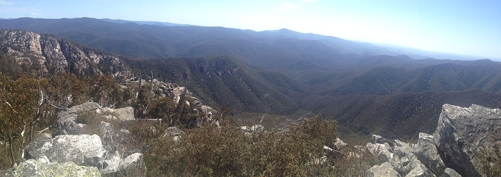
| 1193 |
15 Sep 18 |
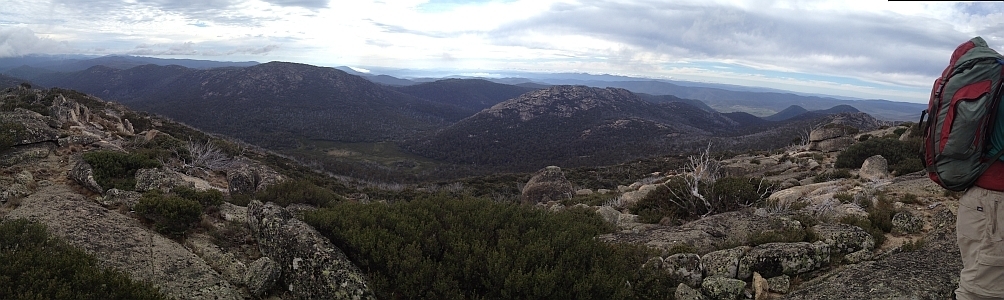
YNP: Mt Foxlow |
13.0 |
680 |
M/M; M(10) |
Photos |
| 1192 |
13 Sep 18 |
Pri: Navigation Refresher #7 – GPSr and PC * |
|
|
|
|
| 1191 |
13 Sep 18 |
MRC: Bushwalking for Covenant College |
|
|
|
|
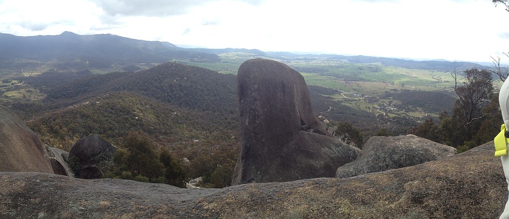
| 1190 |
8 Sep 18 |
TNR: Camels Hump and Tidbinbilla Peak * |
12.7 |
920 |
L/R; H(12) |
Photos |
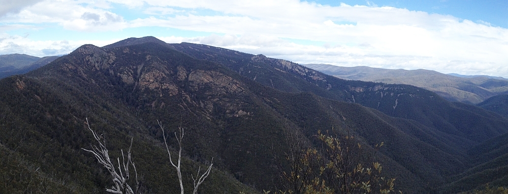
| 1189 |
25 Aug 18 |
BRNR: Bullen Range Crest *
|
16.5 |
850 |
L/E,M,R,ptX; H(12-) |
Photos |
| 1188 |
18 Aug 18 |
NNP: Tennent Ridge and Bushfold Flats * |
19.0 |
750 |
L/E; M(11) |
Photos |
| 1187 |
16 Aug 18 |
CNP: Red Hill d’Lights *
|
4.9 |
150 |
S/E; E(4) |
|
| 1186 |
11 Aug 18 |
TNR: Mt Domain * |
12.3 |
700 |
M/M; M(11) |
Photos |
| 1185 |
9 Aug 18 |
KNP: The Paralyser Snowshoe  |
10.0 |
400 |
M/M; M(10) |
Photos |
| 1184 |
2 Aug 18 |
KNP: Guthega Snowshoe |
13.0 |
590 |
M/M; M(10) |
Photos |
| 1183 |
28 Jul 18 |
BSCA: Bungonia Lookouts and Caves |
14.9 |
500 |
M/M; M(10) |
Photos |
| 1182 |
25 Jul 18 |
Lakes: An additional option – Mirage 532 Featherlight |
|
|
|
Photos |
| 1181 |
15 Jul 18 |
CNP: Walking with Winners – Mulligans Flat NR with Robyn Hall, Tara Cheyne, Alison Neil and others *s
|
9.6 |
200 |
S/M; E(6) |
Photos |
| 1180 |
10 Jul 18 |
Road: Geocaching Point Hut and Tidbinbilla Rds and Tharwa Drive by bike !
|
23.3 |
flat |
M |
Photos |
| 1179 |
3 Jul 18 |
BRNR: UFO Caching in the Bullen Range Nature Reserve |
16.4 |
500 |
M/E-M; M(10) |
Photos |
| 1178 |
25 Jun 18 |
CNP/CCT: Mulligans Flat and CCT Geocaching !
|
16.5 |
250 |
M/E-M,ptX; M(8) |
Photos |
| 1177 1&2,3 |
23 Jun 18 |
NNP: Stockyard Creek Waterfall and Corin Caching |
8.5 |
800 |
M/M-R; M(11+) |
Photos |
| 1176 |
21 Jun 18 |
NNP: Around Orroral on the shortest day of the year *
|
12.8 |
650 |
M/R; H(12) |
Photos |
| 1175 |
19 Jun 18 |
TiNR: Tinderry Nature Reserve Western Slopes |
17.2 |
750 |
L/M-R; H(12-) |
Photos |
| 1174 |
16 Jun 18 |
NNP: Near Mt Tennent *
|
16.4 |
900 |
L/E; M(11) |
Photos |
| 1173 |
14 Jun 18 |
CNP: Black Mountain Geocaching with Kambahkid
|
10.5 |
510 |
M/M; M(9) |
Photos |
| 1172 |
7 Jun 18 |
GNR/MRC: Gigerline Geocaching with Marmaduke Rothschild |
16.3 |
400 |
M/M; M(10) |
Photos |
| 1171 |
2 Jun 18 |
Pri: Molonglo Ridge from Mt Molonglo to Yarrow Pic * … with guest blogger Lauren O and guest recorder Stephen M |
18.9 |
700 |
L/M; H(12-) |
Photos |
| 1170 |
29 May 18 |
NNP: West of Orroral Hill, Granite Tors Walking Track |
14.5 |
950 |
L/R; H(14) |
Photos |
| 1169 |
28 May 18 |
CNP: The Long Weekend Rocks! (Part 3) – Mt Ainslie Quarry and the Labyrinth |
9.2 |
450 |
M/M: M(6) |
Photos |
| 1168 1,2 |
26 May 18 |
Pri/TNR: The Long Weekend Rocks! (Part 1) – Castle Hill and Gibraltar Peak |
11.6 |
620 |
M/M; M(9) |
Photos |
| 1167 |
25 May 18 |
CNP: Goorooyarroo Geocaching |
14.3 |
490 |
M/M; M(9) |
Photos |
| 1166 |
24 May 18 |
MtAR: Nattai Gorge and Boxvale Tramway |
12.7 |
350 |
M/M; M(9) |
Photos |
| 1165 |
19 May 18 |
NNP: The Highs and Lows of Booroomba Rocks (again) * |
8.4 |
730 |
M/R; M(11) |
Photos |
| 1164 |
15 May 18 |
NNP: Mt Herlt … with guest blogger Terrylea R |
19.8 |
800 |
L/R; H(14) |
Photos |
| 1163 |
5 May 18 |
NNP: Geocaches above Blue Gum Creek
|
21.3 |
1150 |
L/R; VH(16) |
Photos |
| 1162 |
28 Apr 18 |
NNP: Ridge between Nursery Swamp and Rendezvous Creek
|
15.5 |
550 |
L/R; H(12-) |
Photos |
| 1161 |
(22) 23-25 Apr 18 |
KNP: Rowan’s Roam Round 2100+m Hills |
54.0 |
2460 |
L/M-R; H(13) |
Photos |
| 1160 |
21 Apr 18 |
NNP: The Highs and Lows of Booroomba Rocks * |
7.5 |
700 |
M/R,ptX; M(11) |
Photos |
| 1159 |
19 Apr 18 |
YNR: Queanbeyan River and Spring Creek Gorge |
9.8 |
350 |
M/M-R; M(9) |
Photos |
| 1158 |
17 Apr 18 |
NNP: Yankee Hat Cliff above Bogong Creek |
14.4 |
700 |
L/R; H(13+) |
Photos |
| 1157 |
16 Apr 18 |
NNP: Around Lutons with KHA and Rhonda ! |
4.2 |
90 |
S/E; E(5) |
Photos |
| 1156 |
14 Apr 18 |
MNP: Bundanoon Lookouts and Dimmocks Creek
|
12.5 |
350 |
M/M; M(10) |
Photos |
| 1155 |
10 Apr 18 |
NNP: Mt Mavis
|
16.7 |
1050 |
L/R; VH(15) |
Photos |
| 1154 |
7 Apr 18 |
TNR: TNR Skyline Track south *
|
11.6 |
930 |
M/R; H(13) |
Photos |
| 1153 |
5 Apr 18 |
KNP: Gavells Hut and Gang Gang Mountain |
21.3 |
800 |
L/M; H(13) |
Photos |
| 1152 |
31 Mar 18 |
KNP/NNP: Bimberi Peak |
21.6 |
950 |
L/M; H(13) |
Photos |
| 1151 |
17 Mar 18 |
NNP: Naas Valley FT and Clear Range flanks *
|
19.5 |
600 |
L/M; M(11) |
Photos |
| 1150 |
6 Mar 18 |
TiNR: Tinderry Nature Reserve – northern area |
22.0 |
1300 |
L/R; VH(15) |
Photos |
| 1149 |
27 Feb 18 |
JNP/YSF: Jerrawangala Cliffs and Main Creek |
11.5 |
560 |
M/R; H(12) |
Photos |
| 1148 1,2,3&4 |
22 Feb 18 |
CbrLakes: Northern pond paddling
|
6.3 |
0 |
S/E,W; E(7) |
Photos |
| 1147 |
20 Feb 18 |
TRNP: Tarlo River NP, southern section |
12.6 |
425 |
M/R; M(10) |
Photos |
| 1146 |
18 Feb 18 |
NNP: River crossing training |
|
|
S/R,W;E(4) |
Photos |
| 1145 |
17 Feb 18 |
NNP: Beneath Booroomba’s beautiful butt(resses) *
|
4.7 |
500 |
S/R,ptX; M(10+) |
Photos |
| 1144 |
16 Feb 18 |
GF: Googong island caches |
2.5 |
0 |
S/E; VE(3) |
Photos |
| 1143 |
13 Feb 18 |
DNP: Big Oaky Creek
|
17.9 |
1100 |
L/R; H(14) |
Photos |
| 1142 |
10 Feb 18 |
RRNR: Caching On the Rocks and Vertigo |
10.2 |
450 |
M/M; M(8) |
Photos |
| 1141 |
6 Feb 18 |
MoNP: ‘Pooh Corner’ Creek |
8.6 |
530 |
M/R; M(11+) |
Photos |
| 1140 |
3 Feb 18 |
MNP: Bundanoon Creek |
9.7 |
700 |
M/M; M(10) |
Photos |
| 1139 1,2 |
30 Jan 18 |
NNP: Geocaching near Stockyard Creek Falls and Billy Billy Rocks *s |
12.2 |
1200 |
L/R; H(13) |
Photos |
| 1138 |
28 Jan18 |
BRNR: Evening Ramble – Kambah Pool, Forster Hill circuit |
4.5 |
300 |
S/E-M; E(6) |
Photos |
| 1137 |
27 Jan 18 |
NNP: Dawn Sortie – Booroomba Rocks |
10.1 |
210 |
M/E-M: E(5) |
Photos |
| 1136 |
23 Jan 18 |
NNP: White Sands Creek and Cotter River |
7.5 |
440 |
M/R; M(10+) |
Photos |
| 1135 |
22 Jan 18 |
CNP: Mt Mugga Mugga NR |
7.0 |
175 |
S/E; E(5) |
|
| 1134 |
20-21 Jan 18 |
NNP: Upper Cotter River * |
25.5 |
1080 |
M/R,ptX; M(11+) |
Photos |
| 1133 |
16 Jan 18 |
KNP: Wallaces Creek Fire Trail – mountain bike |
35.1 |
450 |
L/E; M(8) |
Photos |
| 1132 |
15 Jan 18 |
CNP: Isaacs Ridge |
7.4 |
290 |
S/E; E(6) |
|
| 1131 1,2,3 |
9 Jan 18 |
NNP: Brindabella Caching – Namadgi Bog, Bendora Dam, fire trails * |
7.3 |
270 |
S/M-R,ptX; M(8) |
Photos |
| 1130 |
8 Jan 18 |
CNP: Mt Taylor (via ‘cascades’ and western ‘cliffs’) |
4.6 |
200 |
S/M; E(6) |
|
| 1129 |
6 Jan 18 |
NNP: Dawn sortie to The Spinnaker |
4.4 |
380 |
S/R; M(9) |
Photos |
| 1128 |
31 Dec 17 |
CNP: Evening ramble – Wanniassa Hills |
4.3 |
180 |
S/E; E(5) |
|
| 1127 |
16 Dec 17 |
ACTF/NNP: Bulls Head Range, Brindabellas *
|
17.5 |
700 |
L/E-M; M(11) |
Photos |
| 1126 1,2 |
4, 5-10 Dec 17 |
KNP: Thredbo to Kiandra on the AAWT |
114.8 |
3185 |
M-L/M; M(10++) |
Photos
Photos |
| 1125 |
23 Nov 17 |
NNP: Long time walkabout to Cotter Hut *
|
36.3 |
1100 |
L/E; H(12) |
Photos |
| 1124 |
22 Nov 17 |
CNP: Southside Stroll in daylight savings – Theodore knolls and aboriginal grinding grooves *
|
6.4 |
270 |
S/E-M,ptX; E(7) |
Photos |
| 1123 |
21 Nov 17 |
NNP: Billy Billy Rocks from the east *
|
6.2 |
500 |
S/M-R,ptX: M(10) |
Photos |
| 1122 1,2 |
19 Nov 17 |
NNP: Corin caching – again ! |
7.3 |
400 |
S/M,ptX; M(8) |
Photos |
| 1121 |
15 Nov 17 |
Pri: Visit ‘the trig which cannot be named’
|
20m |
<1 |
S/E,X; VE(¼) |
Photos |
| 1120 |
10-12 Nov 17 |
NNP: Corin Cottage weekend *
|
32.1 |
2215 |
S,M-L/E-R; M(11) |
Photos |
| 1119 |
7 Nov 17 |
NNP: White Horse Rocks and Punch Bowl Creek
|
8.8 |
490 |
M/R; M(9) |
Photos |
| 1118 |
6 Nov 17 |
CNP: Southside Stroll in daylight savings – MacArthur Park * |
7.0 |
220 |
S/E-M; E(6) |
Photos |
| 1117 |
2 Nov 17 |
H&HWT: Micalong Creek |
11.7 |
370 |
M/E; E(7) |
Photos |
| 1116 |
31 Oct 17 |
NNP: Mt Mouat *s
|
18.6 |
900 |
L/R; H(14+) |
Photos |
| 1115 |
28-29 Oct 17 |
NNP: Split Rock and Coronet Peak *
|
32.9 |
1550 |
L/E,R; H(13) |
Photos |
| 1114 |
26 Oct 17 |
Pri: Navigation refresher #7 GPS and PC software *
|
|
|
|
|
| 1113 |
25 Oct 17 |
CbrOpenSpace: Southside Stroll in daylight savings – A Lap of Lake Tuggeranong |
5.7 |
30 |
S/E; VE(3) |
|
| 1112 |
20-21 Oct 17 |
CCT/MFNR: Long time and night walkabout – Hall to Forde, critter spotting , Forde to Hall *
|
43.6 |
1050 |
L/E-M; H(12) |
Photos |
| 1111 |
19 Oct 17 |
GNR: Southside Stroll in daylight savings – De Salis cemetery and Gudgenby-Murrumbidgee Rivers |
3.6 |
38! |
S/E; E(4) |
Photos |
| 1110 |
17 Oct 17 |
TNR: 11 hours on the TNR Skyline ‘Track’ |
21.4 |
1260 |
L/R; VH(15) |
Photos |
| 1109 |
14 Oct 17 |
NNP: Worn Boot Bash to Mt Clear * |
28.0 |
995 |
L/E-M; H(14) |
Photos |
| 1108 |
12 Oct 17 |
Pri: (Geocaching and) Southside Stroll in daylight savings – William Farrer’s grave * |
1.6 |
40 |
S/E-M; VE(3) |
Photos |
| 1107 |
10 Oct 17 |
Crown land: Shoalhaven River rock ribs |
11 |
200 |
M/R,W; M(10+) |
Photos |
| 1106 |
7 Oct 17 |
NNP: ‘Ginger Ale’ |
31.0 |
1260 |
L/M: H(14) |
Photos |
| 1105 |
29-30 Sep 17 |
NNP: Dutchies Peak, Mt McKeahnie and beyond |
32.2 |
1240 |
L/R; H(14) |
Photos |
| 1104 |
26 Sep 17 |
KNP: Chimney Rock above Blowering Cliffs and Blowering Cliffs Walk *s |
11.4 |
920 |
L/M; H(12) |
Photos |
| 1103 |
23-24 Sep 17 |
NNP: Mountain bike riding in the Southern Namadgi |
42.5 |
890 |
M/M; M(11) |
Photos |
| 1102 |
20 Sep 17 |
CP: 8am Floriade walk |
~1 |
– |
S/E |
Photos |
| 1101 |
19 Sep 17 |
NNP: Mt Gudgenby and beyond |
17.4 |
920 |
L/R; H(14) |
Photos |
| 1100 |
17 Sep 17 |
NNP: Mt Tennent sunset and Bushfold Flats |
20.3 |
1050 |
L/E; H(12) |
Photos |
| 1099 |
5 Sep 17 |
TNR/ACTF: Nil Desperandum and beyond |
20.9 |
670 |
L/E-M; M(10) |
Photos |
| 1098 |
29 Aug 17 |
NNP: Boboyan Trig from Hospital Creek Hut * |
15.5 |
615 |
L/R: M(11) |
Photos |
| 1097 |
26 Aug 17 |
NNP: McKeahnie Trig *s |
13.6 |
540 |
M/R; H(12) |
Photos |
| 1096-1,2 |
24 Aug 17 |
NNP: Corin Road caches ! |
5.1 |
455 |
S/R,X; M(9+) |
Photos |
| 1095 |
22 Aug 17 |
SCNR: Swamp Creek exploratory
|
6.1 |
250 |
S/R; M(9++) |
Photos |
| 1094 |
19 Aug 17 |
TNR: Gibraltar geocaching !
|
12.0 |
675 |
M/E,R,ptX; M(10) |
Photos |
| 1093-1,2 |
15 Aug 17 |
NNP: Orroral Ridge of Stone revisited and the ‘Forgotten Road’ * |
13.3 |
510 |
M,M-R: M(11) |
Photos |
| 1092 |
8 Aug 17 |
TRNP: Tarlo River |
14.6 |
500 |
M/R; M(11) |
Photos |
| 1091 |
5 Aug 17 |
NNP: Booths Hill
|
10.1 |
810 |
M/R; H(12) |
Photos |
| 1090 |
29 Jul 17 |
RRNR: Callaghan Hill * |
12.1 |
795 |
M/M,ptX; M(11) |
Photos |
| 1089 |
25 Jul 17 |
RRNR: Three Creeks of Rob Roy |
9.6 |
525 |
M/R; M(11) |
Photos |
| 1088 |
22 Jul 17 |
Urban: Burley Griffin Ramble Part 2 |
21.1 |
– |
L/E; E(7+) |
Photos |
| 1087 |
15 Jul 17 |
NNP/BNP/ACTF: Mt Coree and nearby geocaching * |
19.7 |
980 |
L/E; H(12) |
Photos |
| 1086 |
11 Jul 17 |
NNP: Orroral Ridge of Stone loop *s
|
12.8 |
660 |
M/R,ptX; H(12) |
Photos |
| 1085 |
8 Jul 17 |
TNR: Tidbinbilla (T)romp *
|
6.4 |
445 |
S/E-M; M(9) |
Photos |
| 1084 |
1 Jul 17 |
NNP: Hardy Range geocaching *
|
12.8 |
800 |
M/M-R; H(13) |
Photos |
| 1083 |
28 Jun 17 |
TNR: Tidbinbilla Nature Reserve Skyline Track, middle and northern sections ! |
13.6 |
900 |
L/R; H(13) |
Photos |
| 1082 |
24 Jun 17 |
TNR: Tidbinbilla Peak via the northern Skyline Track * |
13.8 |
900 |
L/M-R; H(13) |
Photos |
| 1081 |
22 Jun 17 |
NNP: Apollo Rocks and other places |
2.6 |
345 |
S/R; M(9++) |
Photos |
| 1080 |
21 Jun 17 |
NNP: Mt Tennent Scar |
10.9 |
800 |
M/R; H(12) |
Photos |
| 1079 |
17 Jun 17 |
NNP: Nursery Swamp and Rendezvous Creek * |
17.1 |
450 |
L/E-M; M(10) |
Photos |
| 1078 |
14 Jun 17 |
NNP: Mt Gingera from Corin Dam |
20.0 |
1160 |
L/E-M; H(13) |
Photos |
| 1077 |
8 Jun 17 |
NNP: Corin Caching ! |
8.0 |
395 |
M/M; M(8) |
Photos |
| 1076 |
6 Jun 17 |
NNR: Nadgigomar Nature Reserve |
19.0 |
150 |
L/M; M(9) |
Photos |
| 1075 |
3 Jun 17 |
NNP: High Hills East of Gibraltar Creek |
6.2 |
425 |
S/R; M(10) |
Photos |
| 1074 |
30 May 17 |
MNP: Coolumburra Cliffs |
7.5 |
350 |
S/R; M(10++) |
Photos |
| 1073 |
27 May 17 |
TNR: Tidbinbilla Mountain and Tidbinbilla Peak
|
9.6 |
780 |
M/R; M(11) |
Photos |
| 1072 |
23 May 17 |
MNP: Caoura Ridge |
19.4 |
575 |
L/M-R; H(12) |
Photos |
| 1071 |
21 May 17 |
CNP: Big Monks *s |
5.9 |
375 |
S/E; E(7) |
Photos |
| 1070 |
13 May 17 |
BNR: Honeysuckle Trail to Brindabella Valley and Bendora Hill *s |
19.6 |
1010 |
L/E,ptX; H(12-) |
Photos |
| 1069 |
7-8 May 17 |
TNR: Conservation Volunteers at Tidbinbilla Nature Reserve |
10 |
400 |
S/E; E(5) |
Photos |
| 1068 |
22 Apr 17 |
NNP: Warking in the Brindabellas *s
|
18.4 |
400 |
L/E-M; M(10) |
Photos |
| 1067 |
15-17 Apr 17 |
NNP: Mt Namadgi and Squirrel geocaching
|
34.1 |
1150 |
M/R,ptX; M(11++) |
Photos |
| 1066 |
12 Apr 17 |
NNP: Orca Rock and geocaching |
15.2 |
670 |
L/R; H(12) |
Photos |
| 1065 |
8 Apr 17 |
NNP: Geocaches on Coronet Peak *s |
19.0
+ 11.4 |
1320 |
L/R,ptX; H(14) |
Photos |
| 1064 |
14 Mar 17 |
NNP: Blue Gum Hill |
15.6 |
750 |
L/R; H(13) |
Photos |
| 1063 |
7 Mar 17 |
Tasmania: Mt Field – Tarn Shelf Circuit ; 8 May 17 – Waddamana Power Station photos |
15.5 |
600 |
M/M; M(10) |
Photos |
| 1062 |
6 Mar 17 |
Tasmania: Mt Field West |
19.0 |
850 |
L/R; H(12) |
Photos |
1061
1060 |
5 Mar 17 |
Tasmania: Mt Field – Lady Barron Falls Circuit and Lake Seal Lookout |
5.9
6.7 |
|
S/E; E(7)
S/E; E(6) |
Photos |
| 1059 |
4 Mar 17 |
Tasmania: Cape Raoul |
15.8 |
|
M/M; M(10) |
Photos |
| 1058 |
28Feb-3Mar 17 |
Tasmania: Three Capes Walk |
45.7
+ 20.5 |
|
S-M/M; M(9) |
Photos |
| 1057 |
21 Feb 17 |
PSF: The secrets of Penrose State Forest
|
21.2 |
480 |
L/R; H(12) |
Photos |
| 1056 |
14 Feb 17 |
GNR: Gigerline trig geocaching |
8.3 |
300 |
S/M; M(8) |
Photos |
| 1055 |
10-12 Feb 17 |
KNP: Mt Jagungal from Cesjacks Hut |
24.4 |
800 |
M/R; M(11) |
Photos |
| 1054 |
7 Feb 17 |
CuNR: Cuumbeun Nature Reserve |
18.6 |
640 |
L/M; M(11) |
Photos |
| 1053 |
4 Feb 17 |
Public/MRC/BRNR: Caching on the west bank (that’s geo and ‘bidgee) with OSM ! |
19.2 |
300 |
M (ride) |
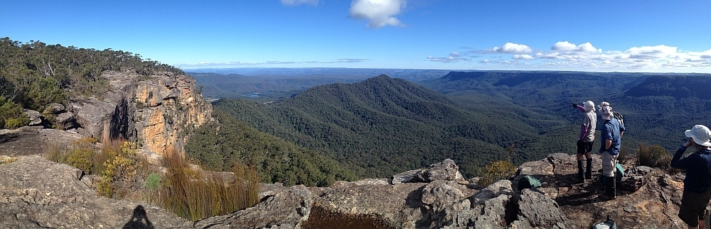
Photos |
| 1052 |
3 Feb 17 |
Road: Tharwa Engineered Log Jam ! |
23 |
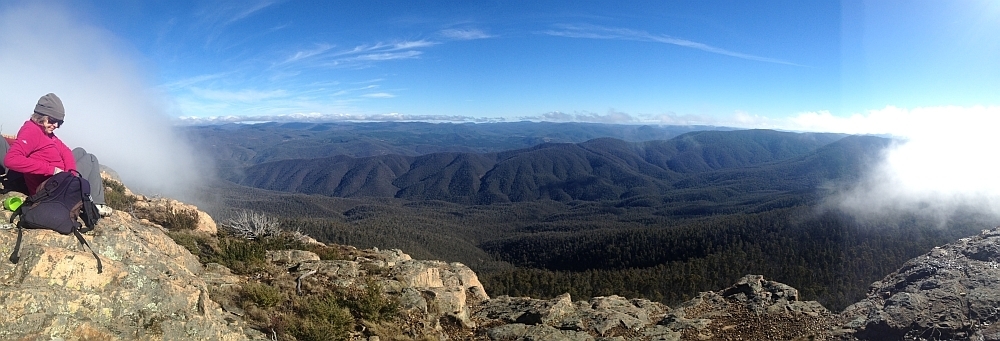
290 |
E (ride) |
Photos |
| 1051 |
31 Jan 17 |
NNP: Mt Tennent (with Rudy) s*
|
14.1 |
830 |
L/E; M(9) |
Photos |
| 1050 |
23 Jan17 |
BNR: Calvary caching ! |
32.1 |
590 |
L/E; M(8) |
Photos |
| 1049 |
21 Jan 17 |
NNP: Orroral Tor
|
10.9 |
450 |
M/M-R; M(10) |
Photos |
| 1048 |
(13)14-15 Jan 17 |
KNP: Tabletop Mountain and nearby huts and diggings
|
32.5 |
950 |
M/M; M(10) |
Photos |
| 1047 |
10 Jan 17 |
NNP: McKeahnie Trig and nearby granite from Kangaroo Creek |
7.4 |
530 |
M/R; M(11+) |
Photos |
| 1046 |
3 Jan 17 |
NNP: The compleat Booroomba Rocks – cliff, top and butt(ress) *
|
5.6 |
400 |
S/M; M(9) |
Photos |
| 1045 |
2 Jan 17 |
GNR: De Salis Cemetery * |
3.0 |
flat |
S/E; VE(3) |
Photos |
| 1044 |
10 Dec 16 |
NNP: Ginini Falls with geocacher Cankid s* |
10.7 |
685 |
M/R; M(11+++) |
Photos |
| 1043 |
29 Nov 16 |
MoNP: Upper Buckenbowra River |
10.4 |
760 |
M/R; H(12) |
Photos |
| 1042 |
26 Nov 16 |
NNP: Top end of Corin Dam s* |
43.0 |
1130 |
L/E,W; H(12) |
Photos |
| 1041 |
22 Nov 16 |
NNP: Booroomba Rocks via Gorilla Rock
|
10.9 |
500 |
M/R; H(12) |
Photos |
| 1040 |
21 Nov 16 |
KNR: Kama NR geocaching ! and CBC evening walk |
9.5 |
220 |
S/E; E(4) |
Photos |
| 1039 |
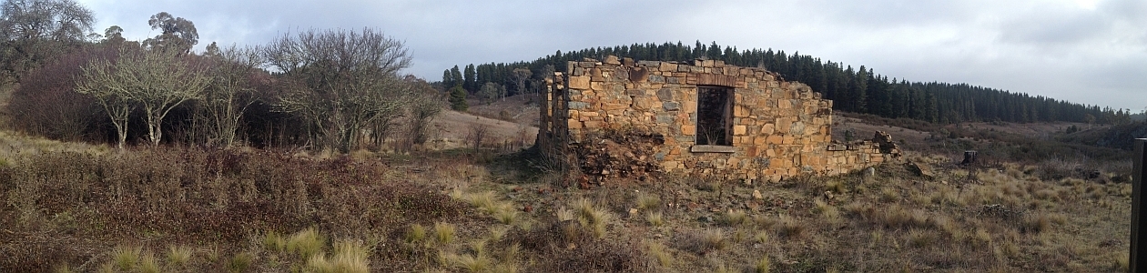
21 Nov 16 |
MRC: Point Hut Crossing to Kambah Pool ride with Pat |
33.7 |
480 |
L/E; M(10) ride |
Photos |
| 1038 |
15 Nov 16 |
CNP: Red Hill Moon Walk * |
5.2 |
220 |
S/E; E(4) |
Photos |
| 1037 |
15 Nov 16 |
NNP: Forests of Snowy Flat Creek |
14.5 |
1160 |
L/R; H(13) |
Photos |
| 1036 |
14 Nov 16 |
CNP: Red Hill |
5.5 |
250 |
S/E; E(4) |
Photos |
| 1035 |
6-7 Nov 16 |
NNP: Bimberi Peak from Orroral |
51.2 |
2060 |
L/E; H(12) |
Photos |
| 1034 |
5 Nov 16 |
NNP: Mt Gingera |
20.1 |
1160 |
L/E-M; H(13) |
Photos |
| 1033 |
3 Nov 16 |
NNP: Cypress Pine Lookout and the cascades |
4.5 |
100 |
S/E; E(4) |
Photos |
| 1032 |
2 Nov 16 |
NNP: Pipeline Rd ride with Pat !
|
21.9 |
1190 |
L/E; H(12) ride |
Photos |
| 1031 |
29 Oct 16 |
CNP: Red Hill |
10.6 |
365 |
M/E; E(7) |
Photos |
| 1030 |
26 Oct 16 |
NNP: Thunder Bluff |
13.1 |
620 |
M/R; H(12) |
Photos |
| 1029 |
16-17 Oct 16 |
NNP: Bimberi Peak with joy Joy !
|
64.0 |
2120 |
L/E-M; VH(16) |
Photos |
| 1028 |
13 Oct 16 |
MNP: Wave Cave via ‘Skinny Woman Pass’ * |
5.6 |
285 |
S/R; M(9+) |
Photos |
| 1027 |
12 Oct 16 |
Pri: Navigation Refresher #7: Use of PC with GPSr * |
|
|
|
|
| 1026 |
10 Oct 16 |
NNP: Mt Tennent Scar * |
12.1 |
760 |
M/R; H(12) |
Photos |
| 1025 |
8 Oct 16 |
NNP: Mt Orroral * |
11.2 |
690 |
M/R; M(11) |
Photos |
| 1024 |
1 Oct 16 |
NNP: Greens Peak (SH1409) |
8.0 |
640 |
M/R; M(11+) |
Photos |
| 1023 |
24 Sep 16 |
NNP: Naas Creek and Sentry Box geocaching * |
38.2 |
1000 |
L/R; H(14) |
Photos |
| 1022 |
20 Sep 16 |
TNR: Tidbinbilla Traverse – Snowy Corner to Fishing Gap
|
16.1 |
1040 |
L/R; H(14) |
Photos |
| 1021 |
13 Sep 16 |
NNP/LCC: More Brindabella geocaching ride/walk ! |
27.6 |
600 |
L/M,ptX; M(11) |
Photos |
| 1020 |
11 Sep 16 |
MRC: Murrumbidgee River stroll ! |
10.7 |
120 |
M/E,X; E(5) |
Photos |
| 1019 |
6 Sep 16 |
CC: Back of Cotter Dam geocaching ride and walk |
24.5 |
720 |
L/M; H(12) ride |
Photos |
| 1018 |
3 Sep 16 |
CNP: Mulligans Flat Nature Reserve |
9.8 |
140 |
S/E; E(5) |
Photos |
| 1017 |
30 Aug 16 |
NNP: Brandy Flat geocaching ! |
14.2 |
490 |
M/M; M(10) ride |
Photos |
| 1016 |
27 Aug 16 |
NNP: Potters Hill wander * |
9.2 |
380 |
M/M,ptX;M(8) |
Photos |
| 1015 |
22 Aug 16 |
NNP: Booroomba’s Southern Butt and Deadmans Hill s* |
12.6 |
710 |
M/R,ptX; H(12) |
Photos |
| 1014 |
16 Aug 16 |
CNP: Night Walk on Black Mountain |
5.2 |
265 |
S/E; E(5) |
Photos |
| 1013 |
16 Aug 16 |
ACTF/NNP: Blue Ridge geocaching |
15.8 |
980 |
L/M: H(13) |
Photos |
| 1012 |
13 Aug 16 |
TNR: Mt Domain
|
12.9 |
675 |
M/R; M(11) |
Photos |
| 1011 |
10 Aug 16 |
YNR: Queanbeyan River and Spring Creek Gorge
|
10.6 |
380 |
M/M-R; M(10) |
Photos |
| 1010 |
4 Aug 16 |
NNP: (A walk for Lindsay) Head butting at Booroomba s* |
9.7 |
500 |
M/R,ptX; M(11) |
Photos |
| 1009 |
2 Aug 16 |
NaNP: (Near) Bonum Pic |
14.4 |
300 |
M/M; M(10) |
Photos |
| 1008 |
30 Jul 16 |
NNP: Geocaches above the Cotter Hut Rd s* (aka ‘Wretched Ridge’) |
24.0 |
780 |
L/E&R,ptX; H(14) |
Photos |
| 1007 |
26 Jul 16 |
NNP: Spinnaker Rock
|
7.6 |
430 |
S/M; M(10) |
Photos |
| 1006 |
19 Jul 16 |
MNP: Headwaters of Ettrema Creek
|
8.7 |
150 |
S/R; M(9+) |
Photos |
| 1005 |
16 Jul 16 |
TNR: Mt Domain
|
13.2 |
830 |
L/R; H(12) |
Photos |
| 1004 |
14 Jul 16 |
NNP: Mt Tennent and Bushfold Flats ! |
19.7 |
950 |
L/E; M(11) |
Photos |
| 1003 |
9-10 Jul 16 |
NNP: Sub 24 hour camping #5: Pryors Hut and Mt Gingera |
24.5 |
1350 |
M/M; M(10) |
Photos |
| 1002 |
2 Jul 16 |
CNP/CCT: Northern Geocaching ! |
34.0 |
500 |
L/E; M(11) ride |
Photos |
| 1001 |
28 Jun 16 |
KPF: Creeks of Kowen Forest |
8.5 |
305 |
S/R; M(9) |
Photos |
| 1000 |
25 Jun 16 |
NNP: A Weir-d day in the Brindabellas *s |
18.5 |
850 |
L/E-M; H(12) |
Photos |
| 999 |
13 Jun 16 |
CNP: Geocaching off-track in the deep south (suburbs) of the ACT ! |
2.9 |
250 |
S/M,X; E(6) |
Photos |
| 998 |
8 Jun 16 |
TSF: Mt Minor from the west |
5.8 |
360 |
S/R; M(9) |
Photos |
| 997 |
24 May 16 |
NNP: Mt Tennent scar again !
|
13.6 |
950 |
L/E,R; H(12) |
Photos |
| 996 |
17 May 16 |
NNP: Tennent geocaching |
7.0 |
435 |
M/R; M(10) |
Photos |
| 995 |
14 May 16 |
NNP: Billy Billy Rocks from Fishing Gap fire trail |
8.9 |
650 |
M/R; M(11) |
Photos |
| 994 |
11 May 16 |
BNP: Wave Cave and beyond
|
6.1 |
315 |
S/R; M(10) |
Photos |
| 993 |
6 May 16 |
CNP: Mt Ainslie Quarry ! |
2.1 |
180 |
S/M,X; E(6) |
Photos |
| 992 |
19 Apr 16 |
KSCA: Mt Pleasant and Kybeyan River gorge |
11.2 |
560 |
M/R; M(10) |
Photos |
| 991 |
16 Apr 16 |
NNP: Split Rock * |
23.1 |
750 |
L/E&R; H(12) |
Photos |
| 990 |
13 Apr 16 |
NNP: Geocaching McKeahnie in the Middle
|
15.4 |
645 |
L/R; H(12+) |
Photos |
| 989 |
12 Apr 16 |
TiNR: The Onion and Tinderry granite |
14.0 |
585 |
L/R; H(12) |
Photos |
| 988 |
5 Apr 16 |
ACTF: Two Sticks Hill and Mt Dowling |
21.3 |
890 |
L/E&R; H(13) |
Photos |
| 987 |
3 Apr 16 |
NNP: Mt Gudgenby |
16.8 |
880 |
L/R; H(14) |
Photos |
| 986 |
28 Mar 16 |
TNR: Mt Domain |
12.3 |
700 |
M/R; H(13) |
Photos |
| 985 |
26 Mar 16 |
NNP: Middle Creek |
20.0 |
530 |
L/E-R; M(11) |
Photos |
| 984 |
22 Mar 16 |
BMNP: Parliament Hill, Blue Mountains National Park |
17.3 |
860 |
L/R; H(13) |
Photos |
| 983 |
16 Mar 16 |
TNR: Mt Domain * |
12.5 |
700 |
M/R; H(13) |
Photos |
| 982 |
12 Mar 16 |
CNP: Rob Roy via the gully |
11.5 |
585 |
M/R; M(11) |
Photos |
| 981 |
5-6 Mar 16 |
CNP/CCT/Urban: Cbr100Challenge 100km route for Beryl Women’s Shelter * |
101.7 |
2095 |
L/E; H(13++) |
Photos |
| 980 |
1 Mar 16 |
TNR: Camels Hump and beyond |
18.6 |
965 |
L/E-M; H(13-) |
Photos |
| 979 |
27 Feb 16 |
CCT: Night Walking on the northern Canberra Centenary Trail *s |
19.8 |
465 |
L/E; M(8+) |
Photos |
| 978 |
23 Feb 16 |
CNP/CCT: Majura Stone Walls and the Cbr100 route *s |
21.9 |
735 |
L/E; M(11) |
Photos |
| 977 |
20 Feb 16 |
CNP/CCT: Cbr100 Training Gold Creek to Watson |
39.3 |
770 |
L/E; M(11+) |
Photos |
| 976 |
16 Feb 16 |
NNP: Ridge West of Bushfold Flats |
13.2 |
700 |
L/R; H(12) |
Photos |
| 975 |
13 Feb 16 |
NNP: Mt Coree |
19.2 |
825 |
L/E; M(11) |
Photos |
| 974 |
8-10 Feb 16 |
KNP: Kidmans Hut and the Great Dividing Range
|
46.8 |
1395 |
L/R,X; H(12) |
Photos |
| 973 |
6 Feb 16 |
TNR: Gibraltar Peak |
7.3 |
370 |
S/E; E(6) |
Photos |
| 972 |
2 Feb 16 |
NNP: More Headwaters of Honeysuckle Creek |
13.7 |
625 |
M/R; H(12) |
Photos |
| 971 |
31 Jan 16 |
Presentation to Artists Society of Canberra – A brush with the Border ! |
|
|
|
Photos |
| 970 |
30 Jan 16 |
Urban/CCT: Cbr100 Training for Beryl Womens Shelter !
|
46.6 |
860 |
L/E; M(11+) |
Photos |
| 969 |
28 Jan 16 |
TNR: Chinese tour group to Tidbinbilla Nature Reserve !
|
4.7 |
180 |
S/E; E(4) |
Photos |
| 968 |
26 Jan 16 |
NNP/Rural: Orroral Adventures *s
|
17.5 |
870 |
L/E,M,R,ptX; H(13) |
Photos |
| 967 |
23 Jan 16 |
Urban: Lap of Lake Burley Griffin *s
|
30.8 |
150 |
L/E; M(8) |
Photos |
| 966 |
21 Jan 16 |
CNP: Aranda Bushland, Kiers Trig and Frost Hollow |
5.6 |
140 |
S/E; E(4) |
Photos |
| 965 |
17 Jan 16 |
NNP: High Range and near SH1409 |
12.2 |
580 |
M/R; H(12) |
Photos |
| 964 |
16 Jan 16 |
NNP: Blatant Brindabella Geocaching *s |
18.6 |
920 |
L/E,M,R; H(13-) |
Photos |
| 963 |
12 Jan 16 |
MRC/CCT: Murrumbidgee Walking Track (CCT) from Pine Island to Kambah Pool
and return !
|
22.0 |
540 |
L/E-M; M(11+) |
Photos |
| 962 |
11 Jan 16 |
CNP: Farrer Ridge and Wanniassa Hills NRs |
7.7 |
340 |
S/E; E(7) |
Photos |
| 961 |
9 Jan 16 |
NNP: Cbr100 training – Mt Tennent *s
|
15.6 |
890 |
L/E; M(9) |
Photos |
| 960 |
8 Jan 16 |
MNP: Bainbrig Creek and Wave Cave |
9.9 |
365 |
M/R,X; M(10) |
Photos |
| 959 |
2 Jan 16 |
Urban: Cbr100 training – 25km route *s
|
29.9 |
720 |
L/E; H(12-) |
Photos |
| 958 |
21 Dec 15 |
CNP: Mt Taylor triple
|
7.6 |
540 |
M/E; E(7) |
Photos |
| 957 |
19 Dec 15 |
NNP: Southern Namadgi Walkabout * |
8.5 |
280 |
S/M,ptX; E(7) |
Photos |
| 956 |
12 Dec 15 |
NNP: Mt Tennent |
14.3 |
780 |
L/E; M(9) |
Photos |
| 955 |
3 Dec 15 |
CNP: Weetangera Methodist Cemetery * |
5.7 |
95 |
S/E; E(4) |
Photos |
| 954 |
10 Nov 15 |
BRNR: Bullen Range |
22.2 |
700 |
L/R; H(14-) |
Photos |
| 953 |
9 Nov 15 |
CNP: Cooleman Ridge |
7.2 |
140 |
S/E; E(5) |
Photos |
| 952 |
7 Nov 15 |
MNP: Gilberts Mountain |
13.5 |
325 |
M/M; M(10+) |
Photos |
| 951 |
5 Nov 15 |
CNP: Lower Majura |
6.7 |
220 |
S/E; E(5) |
Photos |
| 950 |
3 Nov 15 |
NNP: The Bog Hut site plus Max and Berts Hut |
16.7 |
1170 |
L/R; H(14) |
Photos |
| 949 |
2 Nov 15 |
CNP: Earlybird walk – A different Black Mountain walk |
5.8 |
450 |
S/E; E(6) |
Photos |
| 948 |
28 Oct 15 |
TNR: The Sanctuary at TNR ! |
2 |
50 |
S/E; VE(3) |
Photos |
| 947 |
20 Oct 15 |
TNP: Northern Tallaganda National Park |
20.7 |
660 |
L/R; H(12) |
Photos |
| 946 |
15 Oct 15 |
Pri: Navigation Refresher #7 – GPSr and PC |
– |
– |
– |
– |
| 945 |
13 Oct 15 |
NNP: Bobeyan vales and hills |
12.6 |
485 |
M/M; M(10) |
Photos |
| 944 |
12 Oct 15 |
CNP: Early Bird walk – Mt Majura |
6.1 |
280 |
S/E-M; E(7) |
Photos |
| 943 |
18,25 Sep 15 |
Floriade: 8am Floriade Walk |
short |
flat |
S/E |
Photos |
| 942 |
8 Sep 15 |
NNP: Yankee Hat Slabs and Middle Creek |
14.7 |
670 |
L/R,ptX; H(12+) |
Photos |
| 941 |
5 Sep 15 |
NNP: Fitzs Hill, Glendale drystone walls and Billy Range *
|
13.7 |
880 |
L/M-R,ptX; H(12) |
Photos |
| 940 |
1 Sep 15 |
NNP: Rocks above Breakfast Creek *
|
16.3 |
650 |
L/M-R,ptX; H(12) |
Photos |
| 939 |
29 Aug 15 |
NNP/Pri: Punch Bowl Creek and Blythburn Cottage *s
|
16.9 |
730 |
L/E-M,ptX; M(11) |
Photos |
| 938 |
18 Aug 15 |
NNP: Return to our Southernmost Point
|
18.7 |
520 |
L/M; M(11) |
Photos |
| 937 |
15 Aug 15 |
NNP: CBC Worn Boot Bash to Mt Clear |
36.2 |
1200 |
L/E; H(13) |
Photos |
| 936 |
11 Aug 15 |
NNP: An interesting cave site on the southern approach to Mt Herlt |
12.5 |
500 |
M/R; H(12) |
Photos |
| 935 |
8 Aug 15 |
GNR: Gigerline Geocaching *s |
8.7 |
215 |
S/M,X; M(8) |
Photos |
| 934 |
4 Aug 15 |
TiNR: Tinderry Range |
22.7 |
980 |
L/R; VH(15) |
Photos |
| 933 |
2 Aug 15 |
SwCNR: Swamp Creek Nature Reserve
|
7.8 |
330 |
S/M-R; M(9) |
Photos |
| 932 |
28 Jul 15 |
MNP: Binnari Pass
|
17.3 |
470 |
L/R; M(11+) |
Photos |
| 931 |
25 Jul 15 |
NNP: Coronet Peak ! |
29.8 |
1280 |
L/R,ptX; H(14) |
Photos |
| 930 |
21 Jul 15 |
GF: A Googong Wander |
12.2 |
360 |
M/E-M; M(9) |
Photos |
| 929 |
18 Jul 15 |
MRC/BRNR: Cotter to Kambah * |
16.0 |
600 |
L/E; M(10) |
Photos |
| 928 |
14 Jul 15 |
NNP: Nursery Hill |
16.2 |
550 |
L/M-R; M(11) |
Photos |
| 927 |
9 Jul 15 |
Pri/Rail/Urban: Rail trip towards Sydney *s
|
10.7 |
230 |
M/E,X; M(10) |
Photos |
| 926 |
7 Jul 15 |
NNP: Gudgenby Valley Wander |
16 |
300 |
M/M; M(10) |
Photos |
| 925 |
4 Jul 15 |
NNP: Sentry Box Rock and southern Namadgi geocaching ! |
5.5+43.5 |
1320 |
M/M-R; H(13) |
Photos |
| 924 |
30 Jun 15 |
BuNP: Currockbilly Mountain |
9.1 |
560 |
M/R; M(11) |
Photos |
| 923 |
27-28 Jun 15 |
NNP/SRNR: Mt Scabby |
30.8 |
1300 |
L/R; H(12) |
Photos |
| 922 |
25 Jun 15 |
Launch of The Mouat Tree project |
|
|
|
|
| 921 |
23 Jun 15 |
DNR: Dananbilla Nature Reserve |
15.8 |
930 |
L/R; H(13) |
Photos |
| 920 |
20 Jun 15 |
NNP: Nursery Creek Rock Art and Nursery Swamp *s |
12.9 |
465 |
M/E-M; M(9) |
Photos |
| 919 |
16 Jun 15 |
Belconnen Walks | A presentation for the Belconnen Community Council meeting |
|
|
|
|
| 918 |
13 Jun 15 |
TNR: Tidbinbilla Mountain |
9.9 |
795 |
M/R; H(12) |
Photos |
| 917 |
9 Jun 15 |
BuSF: Bungongo State Forest
|
19.5 |
925 |
L/R; H(13) |
Photos |
| 916 |
8 Jun 15 |
DGNR: Tara Territory – Dunlop Grasslands NR ! |
5.6 |
65 |
S/E; E(4) |
Photos |
| 915 |
6 Jun 15 |
CCT: The Bedulluck Waltz *
|
16.1 |
440 |
L/E; M(9) |
Photos |
| 914 |
2 Jun 15 |
NNP: South Arm of Middle Creek *
|
15.0 |
585 |
L/R,ptX; H(12) |
Photos |
| 913 |
30-31 May 15 |
NNP/SRNR: Border Markers on the SE Scabby Range |
37.4 |
1325 |
L/R; H(13) |
Photos |
| 912 |
23-24 May 15 |
KNP/NNP: Bimberi Peak from the West * |
24.9 |
1320 |
M/M-R,ptX; M(10) |
Photos |
| 911 |
19 May 15 |
YNP: Yanununbeyan National Park (incl Mt Foxlow and Harrisons Peak) |
21.6 |
1005 |
L/M-R; H(14) |
Photos |
| 910 |
16 May 15 |
NNP: Lower Mavis Ridge towards Mt Herlt |
16.9 |
670 |
L/R,ptX; H(13) |
Photos |
| 909 |
13 May 15 |
CoNR: Cookbundoon Nature Reserve |
18.6 |
585 |
L/M; M(11) |
Photos |
| 908 |
5 May 15 |
YNR: Yaouk Peak * |
14.5 |
820 |
L/R,ptX; H(13) |
Photos |
| 907 |
28 Apr 15 |
KSCA: Keverstone State Conservation Area |
14.8 |
725 |
L/R; H(12) |
Photos |
906 – D1,
D1pm, D2,
D3, D4 |
20-23 Apr 15 |
Tas: Frenchmans Cap Walking Track |
46.6 |
2500 |
L/M-R; H(12) |
1, 2, 3,
4, 5, 6,
7, 8, 9 |
| 905 |
11 Apr 15 |
ACTF/NNP: Arvo tea at Orroral Homestead and morning Yet More HMAS geocaching ! |
8.0 |
150 |
S/E; VE(3) |
Photos |
| 904 |
9 Apr 15 |
ACTF: Geocaching (more of the HMAS series) ! |
5.7 |
90 |
S/E; VE(3) |
Photos |
| 903 |
7 Apr 15 |
MNR: North Mundoonen Nature Reserve |
11.6 |
435 |
M/M; M(9) |
Photos |
| 902 |
4 Apr 15 |
PCPF/TNR/NNP: Tidbinbilla Road geocaching |
7.1 |
460 |
S/E-R; M(9) |
Photos |
| 901 |
21-22 Mar 15 |
Urban/CNP: Cbr100Challenge 100km * |
100.0 |
1980 |
L/E; H(12+) |
Photos |
| 900 |
19 Mar 15 |
CNP: Cbr100Challenge – Checkout joining Acacia Trail !
|
4.1 |
110 |
S/E; E(4) |
Photos |
| 899 |
15 Mar 15 |
Urban: Cbr100Challenge fundraising Walk and Cakes from Eternity Church !
|
1.8 |
32 |
S/E; VE(3) |
Photos |
| 898 |
14 Mar 15 |
Urban/CNP: Cbr100Challenge Night Walk – Duffy to Narrabundah !
|
16.5 |
435 |
M/E; M(9) |
Photos |
| 897 |
12 Mar 15 |
MRC: Southside Stroll – North from Kambah Pool *
|
4.6 |
230 |
S/E; E(4) |
Photos |
| 896 |
7 Mar 15 |
Urabn/CNP: Cbr100Challenge 70km training |
72.2 |
1025 |
L/E; H(12+) |
Photos |
| 895 |
5 Mar 15 |
CNP: Cbr100Challenge Training – Check out Black Mountain ! |
5.9 |
310 |
S/E; E(6) |
Photos |
| 894 |
3 Mar 15 |
NNR: Nadgigomar Nature Reserve, Western Section |
19.0 |
470 |
L/M; M(11) |
Photos |
| 893 |
28 Feb 15 |
Urban/CNP: Cbr100Challenge Training – 50km on the 100km route to Hall * |
51.5 |
1240 |
L/E; H(12+) |
Photos |
| 892 |
24 Feb 15 |
NNP: Cbr100Challenge Training – (near) Cotter Hut *
|
35.8 |
1035 |
L/E,W; H(13) |
Photos |
| 891 |
23 Feb 15 |
Urban/CNP: Cbr100Challenge Training – Cooleman Ridge !
|
15.6 |
560 |
L/E;M(8) |
Photos |
| 890 |
21 Feb 15 |
NNP: Gibraltar Creek *
|
15.5 |
480 |
L/M,W; M(10) |
Photos |
| 889 |
14Feb 15 |
Urban/CNP: Cbr100Challenge Training – Around Lake Burley Griffin !
|
49.3 |
920 |
L/E; H(12+) |
Photos |
| 888 |
12 Feb 15 |
Urban/CNP: Cbr100Challenge Training – Scriveners Camp to End and Kent St to Red Hill !
|
16.0 |
475 |
M/E; M(8) |
Photos |
| 887 |
10 Feb 15 |
NNP: Rendezvous Crags |
12.9 |
660 |
M/R; H(12) |
Photos |
| 886 |
7 Feb 15 |
CCT: Cbr100Challenge Training – Mt Ainslie-Federation Stone-Mt Majura |
29.9 |
870 |
L/E; M(11) |
Photos |
| 885 |
3 Feb 15 |
CCT: Cbr100Challenge Training – War Memorial to Hall ! |
46.0 |
1215 |
L/E; H(12+) |
Photos |
| 884 |
31 Jan 15 |
Urban/CNP: Cbr100Challenge Training – Weston Creek Circuit |
30.1 |
1110 |
L/E; H(12) |
Photos |
| 883 |
28 Jan 15 |
Urban/CNP: Cbr100Challenge Training – Walk from Duffy to meeting in Higgins ! |
21.4 |
410 |
L/E; M(9) |
Photos |
| 882 |
26 Jan 15 |
NNP: Mt Tennent !
|
13.9 |
820 |
L/E; M(9) |
Photos |
| 881 |
24 Jan 15 |
NNP: Orroral Training for Cbr100Challenge |
33.1 |
950 |
L/E; H(12) |
Photos |
| 880 |
20 Jan15 |
Urban/CCT/CNP: Finish the 50km Cbr100Challenge route *s |
27.4 |
510 |
L/E; M(10) |
Photos |
| 879 |
19 Jan 15 |
CNP: Mt Majura |
6.4 |
295 |
S/E; E(5) |
Photos |
| 878 |
17 Jan 15 |
Urban/CCT: Cbr100Challenge Training – Forde to Hall and return on the CCT * |
38.0 |
825 |
L/E; M(11+) |
Photos |
| 877 |
14 Jan 15 |
LT: Southside stroll – Lake Tuggeranong *
|
6.0 |
40 |
S/E; E(4) |
Photos |
| 876 |
13 Jan 15 |
KNP: Source of the Murrumbidgee River |
11.6 |
330 |
M/E-M;M(9-) |
Photos |
| 875 |
12 Jan 15 |
CNP: Mt Ainslie |
9.4 |
435 |
M/E-M;E(7) |
Photos |
| 874 |
10 Jan 15 |
Urban/CCT: Cbr100Challenge Training – 40km on the 50km route *s |
38.2 |
960 |
L/E; H(12) |
Photos |
| 873 |
7 Jan 15 |
Pri: Southside stroll – William Farrer’s Grave *
|
1.6 |
45 |
S/E; VE(3) |
Photos |
| 872 |
6 Jan 15 |
NNP: Orroral Hill Outcrops |
11.6 |
690 |
M/R; H(12) |
Photos |
| 871 |
5 Jan 15 |
NNP: Mt Taylor Triple |
8.0 |
545 |
M/E; E(7) |
Photos |
| 870 |
3 Jan 15 |
NNP: Cbr100Challenge Training: Mt Tennent *s |
13.8 |
830 |
L/E; M(9) |
Photos |