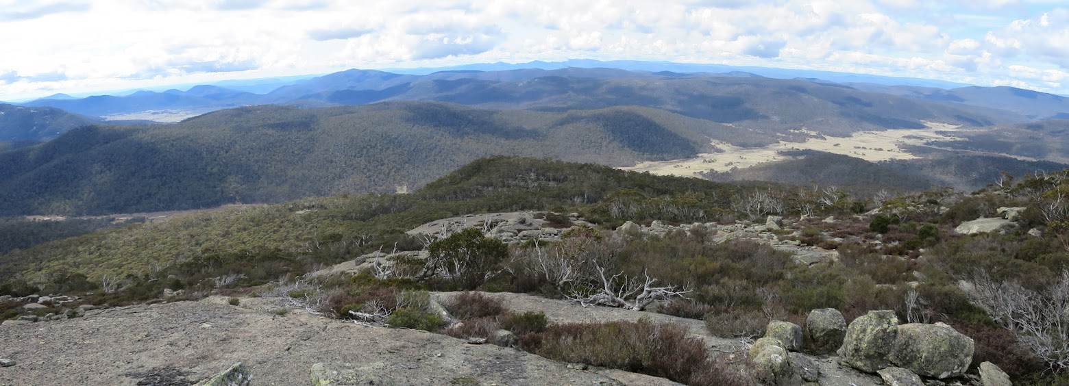
Looking down the Sentry Box granite slabs to SH1577 and the Naas Creek valley
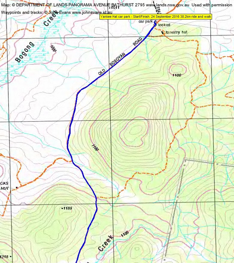
Saturday 24 September: Naas Creek and Sentry Box geocaching ride/walk – L/M-R. From the Yankee Hat car park, ride the Old Boboyan Rd to Lutons crutching shed. Up Sentry Box for GC1GP38 Cache of the Sentry. If time and inclination, ride the Naas Creek valley for additional geocaches. Map: Yaouk. Leader: John Evans, john@johnevans.id.au 0417436877. Transport: ∼$20 per person.
3 of us met.
Further Information
Due to the weather, this was about plan Z. Was to be a weekend with the CBC Navigation Refresher and another CBC trip, but the former relocated to the Booth Range and the latter postponed. As it turned out, all but one of our objectives realised.
Summary
Distance: 38.2km (25.1km ride + 14.1km walk) | Climb: ~1000m | Time: 7.25am – 4.15pm (8hrs 50mins), including 35 mins of breaks | Grading: L/R; H(14)
Photographs
Photographs are available, where you can start a large sized slideshow.
Videos
Waypoint and Track Files
Download the .gpx file. (Right click, Save Link As…, Save – if you want to use it.)
To use in Google Earth, do File, Open… and select Gps or All files as the File Type.
Track Notes
3 mountain bikes don’t fit on a 3-slot bike rack, so two vehicles were required. Plenty of water Hospital Creek, but the fords were passable by a 2WD and SUV.
This was about plan Z, thanks to Cankid, but a great day. A mild and cloudy day with a little sun at times.
We rode away from the Yankee Hat car park and stopped at the beginning of the old vehicle track route into Hospital Creek Hut. 3.9km in 30mins.
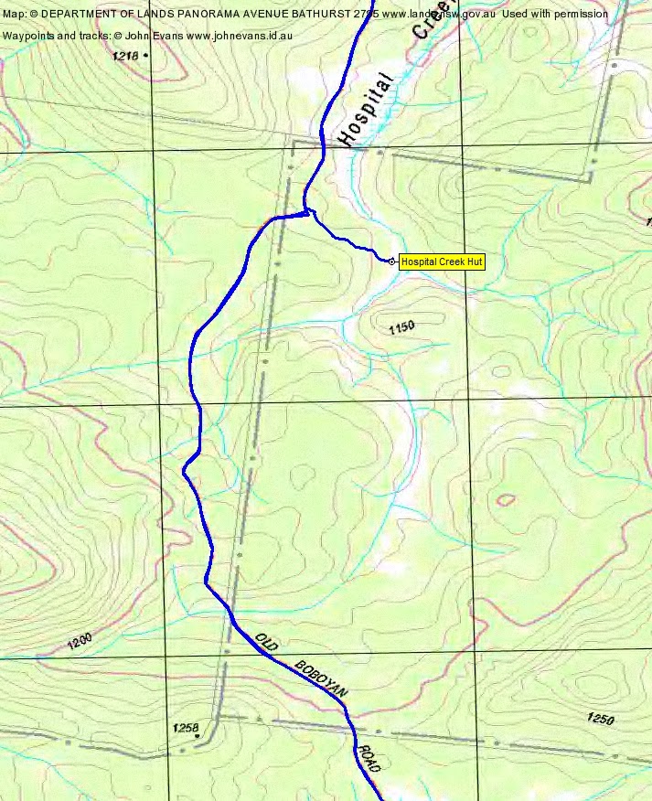
A stroll into the hut, where we met a scout group (led by a geocacher – they’re everywhere!) who had camped there overnight. We walked on a little further, then returned. First (but not last) wet feet for the day. 1.2km in 30mins.
Back on our bikes, I engaged my granny wheel (lowest front cog) and didn’t leave it for the rest of the day. A ride (with some pushing up the hills and over Breakfast Creek and the Naas Creek ford) to Lutons Crutching Shed. 6.9km in 50mins. The restored drop log fencing is weathering nicely.
Here we dumped the bikes and headed for Sentry Box Mountain, using the Navigation Refresher route that I first did in 2004. It goes via SH1282, SH1319, SH1577, then via the granite slabs to a cairn near SH1727. The first leg, up the east facing slope to SH1287, is a bit scrubby, but then the route to SH1577 is quite pleasant (but up). A particularly nice area of tall trees in one spot. The Boboyan Divide, including this route, was not burnt in 2003. Morning tea at SH1577. A little down from here, then a belt of scrub and a little rock wall to negotiate. Once through that, easy walking (puffing) up through open vegetation and vegetation lines to come out onto the granite slabs after their very steep bottom section. Increasingly spectacular views as we climbed the slabs to the cairn. It was strange to be here without Rob H leaning against it having morning tea. I think this was my third attempt to log GC1GP38 Cache of the Sentry. I did have the spoiler pics with me this time and, more importantly, I had Cankid and Marmaduke Rothschild with me. A quick find was made; my GPSr showed 7m away but, I hope, with the spoiler pics, I would have found the cache if I was by myself. Do watch the videos for the fantastic views. An about turn and down the hill. I called a water break at SH1319. I was wacked, with a 50 year younger walker right on my heels all the time – the only way to slow Cankid is to not let him in front, but it is a little embarrassing to be huffing and heaving whilst he calmly breathes though his nose. I got a little smart and skirted SH1282 to the dryer and more open going on the northern flank. We wandered down to see the Crawford Homestead (Old Station) site, then to the Shed. This leg 8.7km in 4hrs 20mins.
It was 1.35pm and although Cankid was champing at the bit to next ride a further 17km round trip into NSW, this elder statesman needed his lunch before deciding the next objective. Thanks to whoever who left the chairs at the crutching shed.
Along the way, Cankid had further lust for additional caches, so left me to pedal off at a great rate of knots into the distance. It took me 1hr to ride/push the 10.8km back to the car. I loaded by bike and had an old man’s doze until Cankid arrived.
During the day we logged the final GZ of GC1DZYD A-Z Namadgi Tours. Of course, the waypoints and track are doctored so that no hint is given as to where these caches were. My friends picked up additional caches that I had done.
An exhausting, enjoyable day in amongst all this wet weather. Thanks Roger and Hugh. My butt is not made for bike riding!
Track Maps
Track overview
Track 3
Track 4

Party
3 riders/walkers – Hugh C (Cankid), Roger E (Marmaduke Rothschild), me (JohnnyBoyACT).