Exploring de Salis cemetery

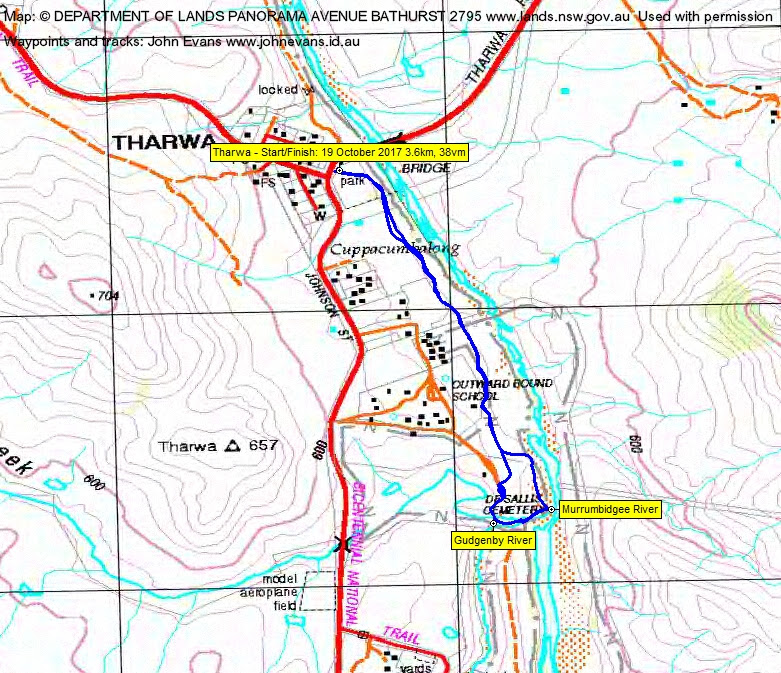
Thursday 19 October: Southside Stroll in daylight savings – De Salis cemetery – S/E. It is a short (3km return and flat) stroll through an avenue of poplars and elms to this unique site. This cemetery above the surrounding ground level was first used in 1878. We can also access the sandy banks of the Murrumbidgee River. Drive yourself to meet at the Tharwa Reserve car park at 6.30pm, on the left immediately after crossing the bridge. Sunset is at 7.21pm, with civil twilight lasting till 7.47pm, but bring a torch just in case. Map: Williamsdale. Leader: John Evans 0417 436 877 john@johnevans.id.au . No need to book.
Summary
Distance: 3.6km | Climb: 38m! | Time: 6.30 – 7.50pm (1hr 20mins), including lots of mucking around time | Grading: S/E; E(4)
Photographs
Photographs are available, where you can start a large sized slideshow.
Waypoint and Track Files
Download the .gpx file. (Right click, Save Link As…, Save – if you want to use it.)
To use in Google Earth, do File, Open… and select Gps or All files as the File Type.
Track Notes
Great to see everyone (except one with another appointment) back from last Tuesday’s evening walk.
A little rain didn’t stop eager participation in tonight’s daylight savings evening walk. We visited the de Salis cemetery at Tharwa, walked down (some were in) the Gudgenby River and along the sandy bank of the Murrumbidgee. Great fun!
A chat over the fence on the way back with an Outward Bound leader. He and his group were just back and were cooking a camp oven lamb roast. Smelt yummy 🙂
Track Map
Party
8 walkers – Kim and Amaya B, Peter C, Linda G, Greg J, Tammy and Ursula L, me.