Last updated 12May26
ACT High Hills
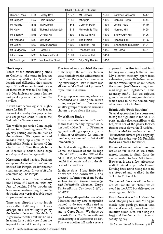
Here’s a list of the 21 named peaks in the ACT over 1500m:
| Peak | Height (m) |
Location UTM 55H (GDA94) |
Date Visited * = photo from this walk |
Click on a thumbnail below to see the full sized photo |
| 1 Bimberi Peak | 1913 | Rendezvous Creek 662082-6052355 |
5 May 19 31 Mar 18 6-7 Nov 16 16-17 Oct 16 23-24 May 15 25 Apr 13 5-6 Apr 13 4 Feb 12 12-14 Sep 06* |
 |
| 2 Mt Gingera | 1857 | Corin Dam 661255-6061566 (the real Mt Gingera) NB See the discussion at 14 Apr 09 as to the real Mt Gingera |
21 Jan 23 26 Mar 22 20 Mar 22 18 Jul 19 16 Feb 19 11 Nov 17 14 Jun 17 5 Nov 16 10 Jul 16 9 Jul 16 16 Aug 14 1 Feb 14 15 Jun 13 30 Jun 12 15-16 Oct 11 28 Jun 11 30 Apr 11 5 Feb 11 12 Jun 10 19 May 09 14 Apr 09* 21 Mar 09 17 Mar 09 3 Jun 08 4 Jul 06 25 May 05 |
 |
| 3 Mt Murray | 1845 | Rendezvous Creek 662098-6049003 |
23-24 May 15 5-6 Apr 13 7 Apr 09* 8-9 Apr 06 |
 |
| 4 Mt Kelly | 1829 | Rendezvous Creek 669856-6046043 |
18-19 Oct 14 14-16 Mar 14 13-14 Jul 13 7-8 Jul 12 19 Sep 09* 15 Dec 07 21-22 Jul 07 9-11 Dec 06 8-9 Jul 06 22-24 Apr 06 2-3 Jan 06 |
 |
| And from Mike R of the Bankstown Bushwalkers Apr09 comes…”One thing I have found that may interest you is in regard My Kelly. Its height is generally regarded as 1829m. The current Rendezvous Creek topo marks a trig but no height. This trig does not appear on the NSW trig register as most border trigs are. The topo has a minimum contour of 1820m but less than 1830m. I queried the trig height with Alex P who advised “the height of Mt Kelly is 1829m as per our non metric trig card. The ACT geodetic survey was undertaken during WW1. Secondary trigs like Kelly were constructed, heights from the mark to the top of the sighting disc measured and the trigs were basically abandoned. Heights may have been determined by barometric levelling or by trig heighting. Not sure what was done in Kelly’s case. Judging by the fact that its height of 6001 feet was not metricated and recorded on the metric card indicates the height was not considered reliable.” | ||||
| 5 Mt Scabby | 1798 | Yaouk 667687-6041179 |
22 Mar 14 13-14 Jul 13 7-8 Jun 08 15 Apr 08* 8-9 Jul 06 |
 |
| 6 Mt Namadgi | 1780 | Rendezvous Creek 670978-6048104 |
17-18 Nov 18 15-17 Apr 17 8 Nov 14 10 Nov 12 6 Nov 10 7 Nov 09 7 Nov 08 10 Nov 07* 30 Sep-2 Oct 06 |
 |
| 7 Mt Ginini | 1762 | Corin Dam 660723-6066781 |
7 Mar 26 26 Mar 22 6 Jul 19 16 Feb 19 16 Jan 16 15 Jun 13 30 Apr 11 5 Feb 11 16 Jan 10 18 Apr 09 21 Mar 09 31 Jan 09 8 Apr 08 18 Nov 06 15 Mar 06* 25 Feb 06 |
 |
| 8 Mt Gudgenby | 1739 | Yaouk 672655-6039670 |
19 Sep 17 3 Apr 16 8 Oct 13 8 May 10 30 Sep-2 Oct 06 12 Nov 05* |
 |
| 9 Little Ginini | 1735 | Corin Dam 661057-6063854 |
21 Jan 23 19 Oct 22 26 Mar 22 6 Jul 19 16 Feb 19 15 Jun 13 30 Apr 11 5 Feb 11 14 Apr 09* 31 Jan 09 15 Mar 06 |
 |
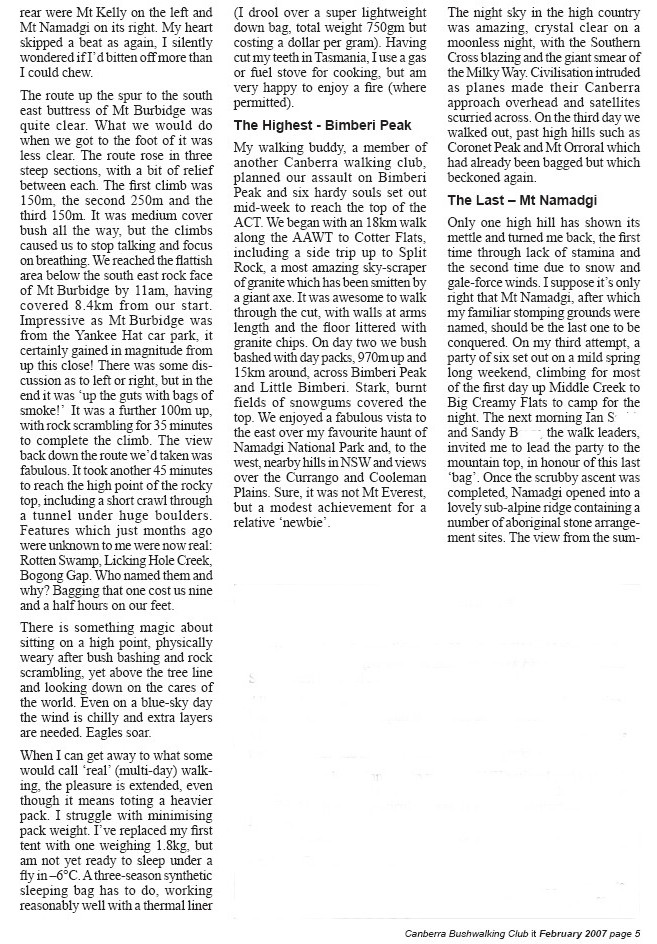
| 10 Mt Burbidge | 1720 | Rendezvous Creek 671583-6046264 |
6-7 Apr 19 18-19 Oct 14 17 Nov 09* 9-11 Dec 06 19 Nov 05 |
 |
| 11 Sentry Box Mountain/ Sentry Box Rock |
1696/ 1673 |
Yaouk 671929-6033702 |
24 Sep 16 4 Jul 15 8-9 Sep 12 12 May 12 30 Aug 11* 26 Apr 11 28 Nov 06* 3 July 04 |
  |
| 12 Little Bimberi | 1650 | Rendezvous Creek 663478-6050507 |
12-14 Sep 06* |  |
| 13 Mt Franklin | 1646 | Tidbinbilla 661117-6071680 |
7 Mar 26 10 Dec 16 16 Jan 16 30 Apr 13 2 May 10 1 May 10 16 Jan 10* 15 Oct 08 6 Nov 07 17 Apr 07 15 Mar 06 |
 |
| 14 Tidbinbilla Mountain | 1615 | Tidbinbilla 669510-6075957 |
12 May 26 3 Jun 25 19 Oct 24 8 Apr 24 20 May 23 19 Nov 22 26 Oct 22 31 Jul 19 17 Oct 17 27 May 17 13 Jun 15 30 Sep 14 18 Dec 10 2 Nov 10 29 Mar 08 3 Apr 07 10 Oct 06* 13 Jun 05 |
 |
| 15 NMC107 (Orroral Hill) |
1609 | Rendezvous Creek 674901-6053719 |
17 Aug 19 8 Oct 16 14 Jan 14 26 May 12 4 Apr 09 5 Aug 08* 21 Nov 06 9 Aug 06 22 Oct 05 20 Aug 05 |
 |
| 16 Mt Clear | 1603 | Bredbo 686352-6027822 |
13 Oct 18 14 Oct 17 15 Aug 15 15 Oct 13 21 Aug 12 27 Oct 09* 14 Sep 05 |
 |
| 17 Mt McKeahnie | 1602 | Corin Dam 669697-6061293 |
29-30 Sep 17 19 Jul 06 |
 |
| 18 Booths Hill |
1585 | Rendezvous Creek 684560-6044198 |
11 May 19 5 Aug 17 22 Feb 14 31 Oct 06 19 Aug 06* 26 Jul 06 |
 |
| 19 Tidbinbilla Peak | 1561 | Tidbinbilla 670683-6076921 |
12 May 26 28 Mar 26 24 Mar 26 27 Oct 25 16 Mar 25 15 Apr 24 11 Feb 23 16 Nov 22 14 Sep 22 31 Jul 19 17 Oct 17 28 Jun 17 24 Jun 17 27 May 17 13 Jun 15 30 Sep 14 16 Nov 13 24 Apr 12 18 Dec 10 2 Nov 10 23 Aug 08 29 Mar 08* 24 Jun 06 20 Jul 05 22 Jun 05 13 Jun 05 13 Sep 04 |
 |
| 20 Yankee Hat South | 1558 | Yaouk 674934-6041542 An excellent article by Graeme Barrow in the December 2009 NPA ACT Bulletin (Vol 46 No 4), identifying Yankee Hat ‘North’ as the real Yankee Hat. |
28 Sep 19 22 Jun 10* 29 Aug 06 5 Feb 05 |
 |
| 21 Mt Domain | 1506 | Tidbinbilla 669666-6072740 |
17 Mar 26 22 Apr 24 5 Feb 23 17 Dec 22 10 Dec 22 30 Nov 22 9 Nov 22 11 Aug 18 7 Apr 18 17 Oct 17 20 Sep 16 13 Aug 16 16 Jul 16 28 Mar 16 16 Mar 16 28 Aug 12 17 Jul 10 3 May 08* 29 Mar 08 9 Oct 07 5 Jun 07 10 Oct 06 13 Jun 05 1 Sep 04 |
 |
Here’s the gpx file of ACT High Hills 1500m plus.
And here’s a map (show in full screen for best results):
Here’s a list of another 15 named peaks in the ACT 1400 – 1500m:
| Peak | Height (m) |
Location UTM 55H (GDA94) |
Date Visited * = photo from this walk |
Click on a thumbnail below to see the full sized photo |
| 1 Mt Aggie | 1496 | Tidbinbilla 660361-6073916 |
16 Mar 19 16 Jan 16 29 Sep 09 15 Mar 06 |
 |
| 2 Coronet Peak | 1494 | Rendezvous Creek 667815-6053115 |
28-29 Oct 17 8 Apr 17 25 Jul 15 21 Oct 14 19 Nov 13 22 Feb 11 11 Aug 09* 30 Oct 07 5-6 Nov 05 |
|
| 3 McKeahnie Trig | 1490 | Corin Dam 669769-6063756 |
29 May 23 13 Apr 16 12 Dec 12 6 Jan 07 4 Oct 04* 22 Sep 04 |
 |
| 4 Blue Gum Hill | 1470 | Corin Dam 678529-6064981 |
14 Mar 17 7 Aug 07 5 Sep 06 23 Oct 04 |
 |
| 5 Mt Boboyan | 1459 | Colinton 679652-6036554 |
10 May 25 9 Mar 22 5-6 Jul 14 21 Jun 14 22 Oct 13 22 Oct 11 5 Mar 11 16 Jun 09 1 Jul 08* 1 Apr 08 25 Apr 07 21 Jun 06 10 Jul 04 See NPA Bulletin Volume 24 number 4 June 1987 page 6 and attached brochure for the construction of the Yerrabi Track. |
 |
| 6 Pheasant Hill | 1455 | Yaouk 677832-6029260 |
27 Oct 24 13 Oct 15 4 Jul 04 |
 |
| 7 Bendora Hill | 1451 | Tidbinbilla 662422-6078197 |
4 May 25 16 Mar 19 16 Jan 16 29 Sep 09* 15 Mar 06 |
 |
| 8 Billy Billy Rocks | 1450 | Corin Dam 671989-6069153 |
20 Jan 24 22 Sep 18 21 Nov 17 14 May 16 26 Jul 14 30 Jan 10* 12 Jan 08 21 May 05 |
 |
| 9 Yankee Hat North | 1447 | Rendezvous Creek 675621-6042421 An excellent article by Graeme Barrow in the December 2009 NPA ACT Bulletin (Vol 46 No 4), identifying Yankee Hat ‘North’ as the real Yankee Hat. |
9 Dec 14 3 Sep 13 5 Feb 05* |
 |
| 10 Johns Peak | 1440 | Tidbinbilla 671378-6077329 |
28 Mar 26 16 Mar 25 15 Apr 24 11 Feb 23 16 Nov 22 14 Sep 22 16 Apr 22 14 Mar 22 31 Jul 19 17 Oct 17 28 Jun 17 24 Jun 17 1 Mar 16 30 Sep 14 16 Nov 13 16 Mar 13 24 Apr 12 30 Jul 11 2 Nov 10 23 Aug 08* 29 Mar 08 24 Jun 06 22 Jun 05 13 Sep 04 |
 |
| 11 Nursery Hill | 1428 | Rendezvous Creek 678092-6048335 |
14 Jul 15 16 Jul 11 23 Sep 05* |
 |
| 12 Snow Gum Hill | 1426 | Tidbinbilla 661005-6075892 |
12 Apr 11 29 Sep 09 15 Mar 06* |
 |
| 13 Hospital Hill | 1425 | Colinton 679925-6038108 |
21 Jun 06* |  |
| 14 Shanahans Mountain | 1424 | Colinton 682516-6032885 |
10 May 25 21 Jun 14 6 Oct 09* 1 Apr 08 23 Nov 05 14 Sep 05 |
 |
| 15 Mt Coree | 1421 | Cotter Dam 664567-6091346 |
15 Jul 17 13 Feb 16 8 Jun 13 30 Sep 12 31 Jul 12 25 May 10 7 Jul 09* 2 Sep 08 19 Feb 05 |
 |
Here’s the gpx file of ACT High Hills 1400-1500m.
And here’s a map (show in full screen for best results):
(Courtesy of Terence U in CBC Newsletter November 2004)
Of course, it’s the relative height (= clean prominence) of the approach that’s the real crunch!
Here’s maybe some additions, 2 more:
| Peak | Height (m) |
Location UTM 55H (GDA94) |
Date Visited * = photo from this walk |
Click on a thumbnail below to see the full sized photo |
| 1 The Pimple | 1460 | Tidbinbilla 669434-6077097 |
17 Nov 25 3 Jun 25 19 Oct 24 19 Nov 22 30 Sep 14 29 Mar 08* 24 Jun 06 20 Jul 05 |
 |
| 2 Camels Hump | 1444 | Tidbinbilla 671988-6079094 |
16 Mar 25 16 Nov 24 15 Apr 24 11 Feb 23 23 Apr 22 16 Apr 22 1 Jun 19 8 Sep 18 17 Oct 17 1 Mar 16 16 Nov 13 1 Nov 11 29 Oct 11 2 Oct 11 30 Jul 11 26 Mar 11 4 Sep 09 12 May 09 11 Apr 09 2 Sep 08 29 Mar 08* 15 Jan 08 27 Oct 07 5 Dec 06 13 Sep 04 |
 |
Here’s the gpx file of ACT High Hills 1400-1500m.
And here’s a map (show in full screen for best results):
Here’s 5 not bad additions, not named on maps:
| Peak | Height (m) |
Location UTM 55H (GDA94) |
Date Visited * = photo from this walk |
Click on a thumbnail below to see the full sized photo |
| 1 ‘Ginger Ale’ | 1760+ | Corin Dam 660187-6058609 |
7 Oct 17 27 Oct 12 11 May 10* |
 |
| 2 ‘Mt Mavis’ (SH1711) | 1711 | Rendezvous Creek 672279-6049323 |
14 Sep 19 10 Apr 18 20 May 14 2 Apr 11 24 Nov 09 17 Jun 08 23 Sep 06* |
 |
| 3 ‘Mt Herlt’ | 1620 | Rendezvous Creek 673975-6047963 |
24 Nov 09* 14 Aug 07 28 Jun 06 |
 |
| 4 ‘Dutchies Peak’ | 1590 | Corin Dam 670009-6060840 |
29-30 Sep 17 19 Jul 06* |
 |
| 5 Cotter Rocks/ ‘Split Rock’ |
1560 | Rendezvous Creek 670068-6055509 |
10 Jun 23 28-29 Oct 17 16 Apr 16 2 Jul 11 22 May 10 12-14 Sep 06* 5 Nov 05 30 Sep 05 11 Dec 04 |
 |
| 6 ‘Thunder Bluff’ | 1400 | Rendezvous Creek 673545-6053050 |
26 Oct 16 26 Oct 10 29 Apr 08* 9 Aug 06 |
 |
Here’s the gpx file of ACT High Hills 6 additions not named on maps.
And here’s a map (show in full screen for best results):
Here’s the lot:
Here’s the gpx file of ACT High Hills.
And here’s a map (show in full screen for best results):
High hills in Australia
Here’s a list of high hills in Australia and the highest in each state.
NSW High hills nearby
See the list here.
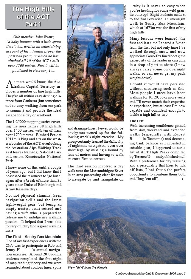
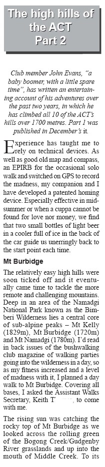
Here’s a bit of a story about wandering up the ACT’s high hills
Leave a Comment