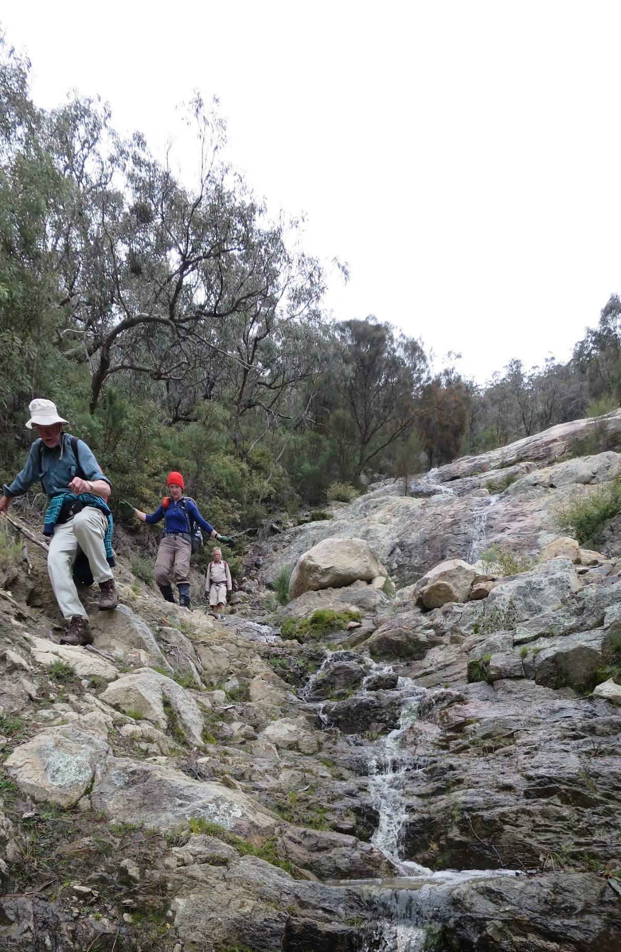
We came down there

Descending the Mt Tennent scar
Monday 10 October: Mt Tennent Scar – M/R. Ascend Mt Tennent via the AAWT and Mt Tennent fire trail for views. Descend via the scar. Plan B instead of Mt Gingera.
6 of us met at Lanyon Marketplace car park, opposite my old folks home.
Further Information
After a 4-day Budawangs walk for the Hobart Bushwalking Club visitors led by Linda G, and a fabulous welcome drinks occasion and Chris and Cynthia’s last night, 2 walks were scheduled for today. Unfortunately there was a severe weather warning for the ACT ranges, with wind gusting to 120kph on the Brindabellas and the possibility of snow above 1200m. So both walks were relocated to plan Bs, mine from Mt Gingera to the Mt Tennent scar.
Summary
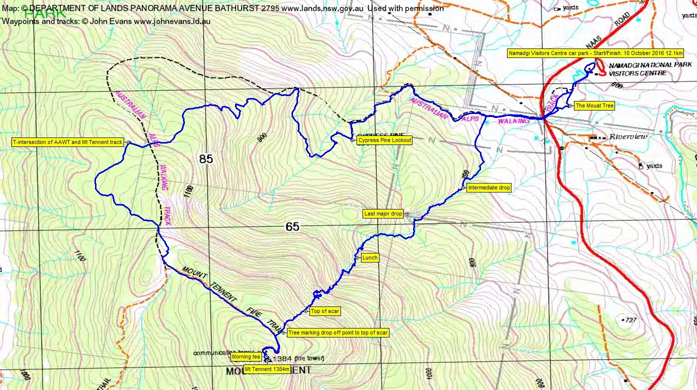
Distance: 12.1km | Climb: 760m (contour difference)/860m (GE) | Time: 7.50am – 2.20pm (6hrs 30mins), including 45 mins of breaks | Grading: M/R; H(12)
Photographs
Photographs are available, where you can start a large sized slideshow.
Videos
Waypoint and Track Files
Download the .gpx file. (Right click, Save Link As…, Save – if you want to use it.)
To use in Google Earth, do File, Open… and select Gps or All files as the File Type.
Track Notes
We wandered up the 7.4km to Mt Tennent in 2hrs 25mins after a brief stop at Gudgenby in a Box. Amazed by the scope and variety of wildflowers, a few of which I could identify. Windy at the top. Lovely views to the west across Booroomba Rocks, Deadmans Hill, Blue Gum Hill to our original destination of Mt Gingera on the horizon. We retreated a little for morning tea.
Then back down the Mt Tennent fire trail a bit and right to a marker tree and down to the top of the scar.
Easy at first, although one of the party was working with only four points of contact – 2 feet, 1 butt, 1 arm due to a frozen shoulder on the other side. I’d seen a trickle down the scar on other trips, but today the stream was flowing well. With some wet and slippery granite, it was a lot slower today. At one point, John K was able to scramble down a log, but the rest of the party had to endure a 30 minute loop though the scrub and ledges to the left. A slippery near fall at the top of a decent granite slope.
So it was a slow and careful descent. The showers started at lunchtime.
Took the last major drop to the right this time after previously doing it to the left.
At last we bent away to the north through opening woodland to strike the AAWT.
Back near the Visitors Centre we visited the standing (but still propped) Mouat Tree and I related the story. Then a stop in the NVC to enquire about the Cotter River at the ford near Cotter Hut for next Sunday-Monday.
A reasonable plan B. Great Hobart Walking Club new friends and very stout walkers. Ditto CBC.
Track Map
Party
6 walkers – John and Vonda K, Ian M, Bob L, Terrylea R, me.