View West leaving Mt Wanniassa

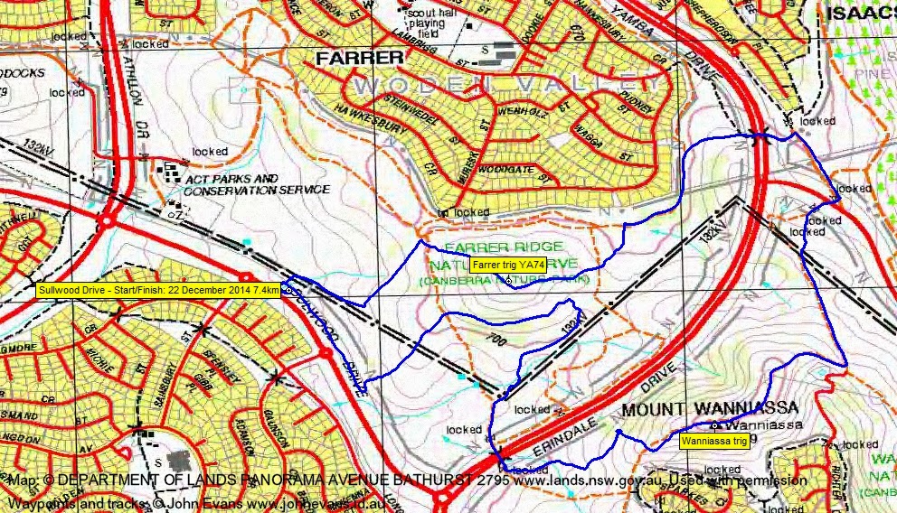
Monday evening, 22 December: Farrer Ridge and Wanniassa Hills – S/E. We will stroll along Farrer Ridge then on to Wanniassa Hills. Return via a different route. Meet at 6:30pm on Sulwood Drive, Wanniassa, between Sainsbury Street and Gaunson Crescent. Map: Tuggeranong Leader: Phillip S. Transport: Drive yourself. No need to book.
4 of us met.
Summary
Distance: 7.4km | Climb: 350m | Time: 6.30am-8.25pm (1hr 55mins) | Grading: S/E; E(7)
Track Map
Track
Profile

Photographs
Photographs are available, where you can start a large sized slideshow.
gpx File
Download the .gpx file here. (Right click, Save Link As…, Save – if you want to use it.)
kml File
Download the .kml file here.
Track Notes
Soooo nice to feel the wind between my toes after a bit of a forced break due to sickness.
A beaut area of the Canberra Nature Park – Farrer Ridge Nature Reserve and Wanniassa Hills Nature Reserve. Very ably and pleasantly led by Phillip, who knows this area well.
We won’t mention the gracious allowed for detour to look for a 1.5 difficulty geocache which I couldn’t find.
I guess this could be classed as my first Cbr100Challenge training!
Thanks Phillip and great to catch up with Therese and Gavin.
Party
4 walkers – Gavin F, Therese P, Phillip S (leader), me.