Home Page

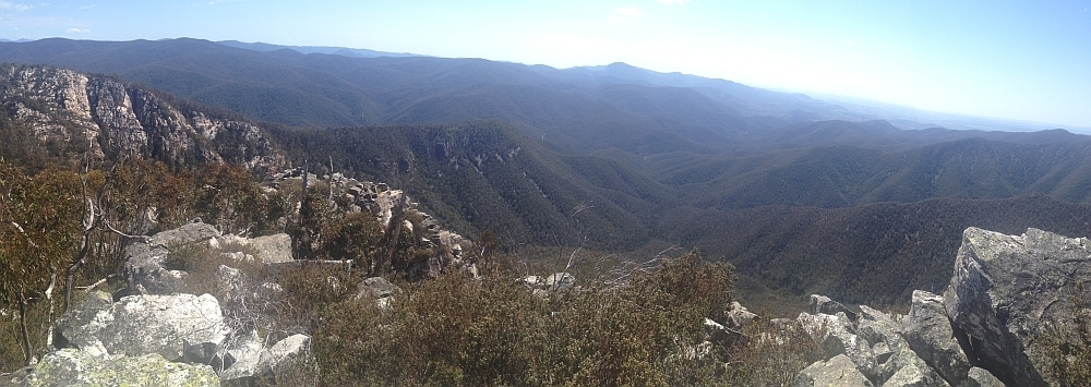
28 Jun 15 | The top of Binnari Pass to Quiltys Mountain, the Budawangs, Morton NP
Text Layer

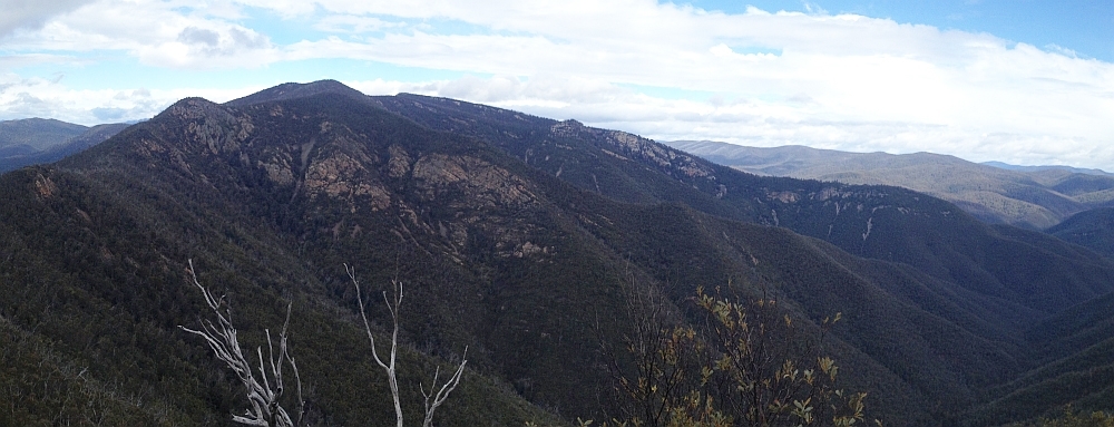
30Jun 15 | Views from north of Currockbilly Mountain over the source of the Yadboro River to Wirritin Basin and beyond to Pigeon House and the ocean, Budawang NP

22 Apr 15 | Morning light on Frenchmans Cap and Lions Head, Tasmania

3 Mar 15 | Eucalyptus 'grass', Nadgigomar NR
7 Feb 15 | Sunrise over Lake Burley Griffin at 6.30am, Canberra
30 Sep 14 | Views down the south arm of Burkes Creek from The Pimple,NNP
13 Sep 14 | Tidbinbilla Ridge, Mt Eliza and the main tor from Gibraltar Peak,TNR
2 Sep 14 | View south to Johns Peak, Tidbinbilla Peak, Tidbinbilla Mountain and The Pimple, TNR and NNP
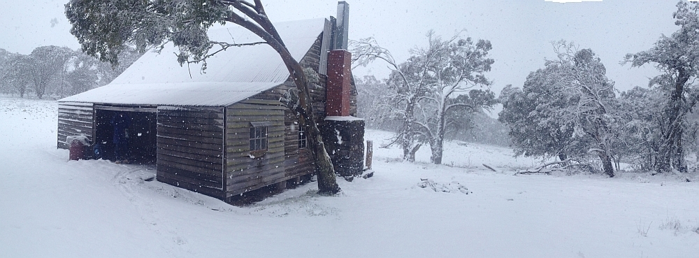
28 Jun 14 | Gooandra Homestead, KNP
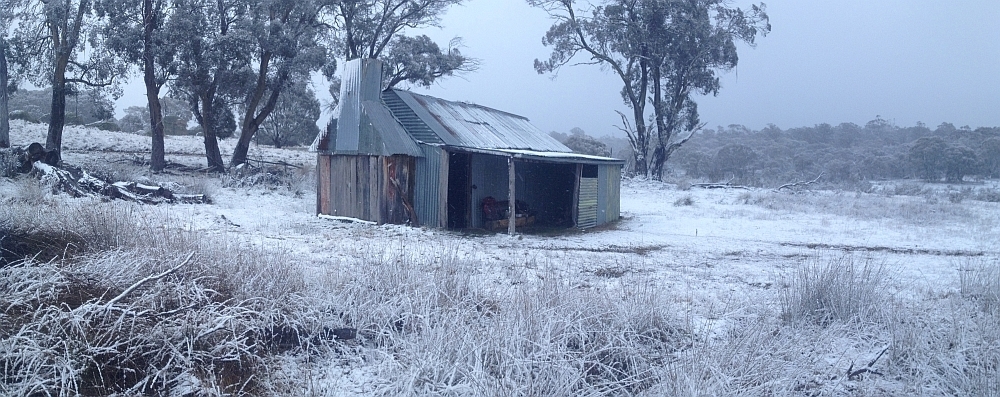
12 Jul 14 | Waterhole Hut, NNP
6 Jul 14 | Mt Gudgenby and the high hills of the Namadgi from Boboyan tor lookout, NNP
7 Jun 14 | Blue Gum Hill and the South Buttress of Booroomba Rocks from SH1353, NNP
24 May 14 | Orroral Valley from GC1XAJQ Ridge of Stone geocache, NNP
29 Mar 14 | Googong Dam from Googong Lookout, GF
15 Mar 14 | Mt Namadgi, Rotten Swamp, Mt Burbidge, Bogong Gap, Gudgenby Grasslands and Yankee Hats from Mt Kelly, NNP
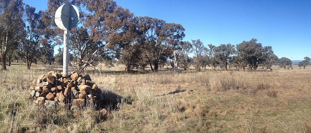
10 Aug 13 | Plains trig, Pri
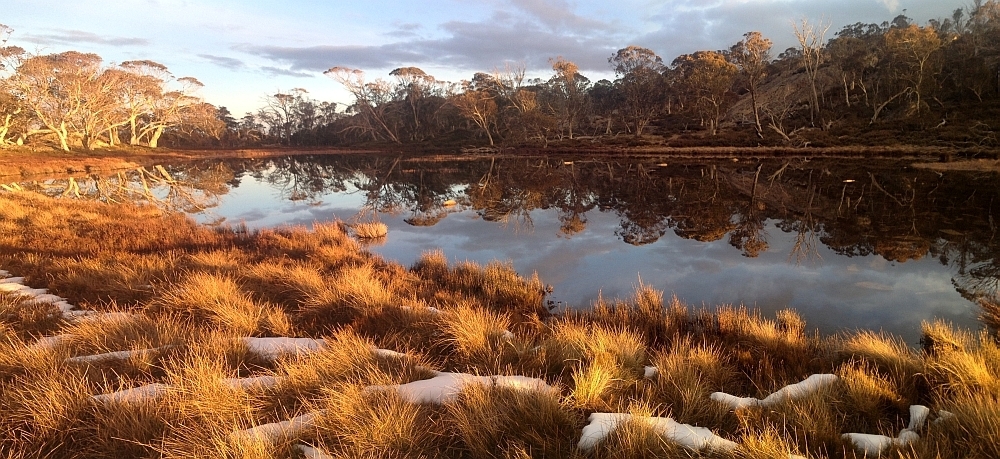
13 Jul 13 | Scabby Tarn at sunset, NNP
25 Jun 13 | Colliers homestead and orchard, Pri
8 June 13 | Webbs Ridge from Mt Coree, BNP
4 Jun 13 | Mt Moollattoo from the Carrialoo plateau, MNP
9 Sep 12 | Mt Gudgenby from granite slabs E of Sentry Box Mountain, NNP
View south from Mt Namadgi
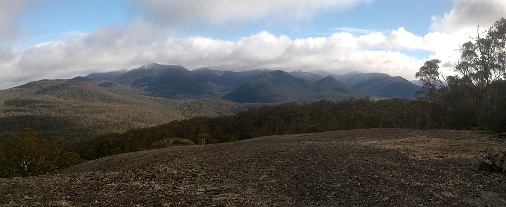
10 Nov 12 | View south from Mt Namadgi, NNP
30 Jun 12 | Snow Gums at Mt Gingera, NNP
31 Jan 12 | Molonglo Ridge from Yarrow Pic, Pri
28 Jun 16 | Lunch on Mt Reedy (photo Barrie R), KF

Last updated 15Oct18


News: Into cutting edge music and SEO? Check out my mate’s services | The plugin that does new trip notifications to subscribers is busted, sorry. Come back every week if you are interested in new trips | Looking for a particular destination? Try my Google Maps/Google Earth search | I’ve brushed up ACT High Hills, ACT PercysACT Trigs, ACT Waterfalls and ACT Weirs with embedded Google maps | Want no-cost ACT and NSW topo map segments? | A Google map of trip destinations, linked to trip reports and populated with 2016, 2015 and 2014 trips | Search facility Google powered and across both new and old blogs | Watch a slideshow of the theme photos from each trip (not available via mobile access) | Old News

Walk LOOKING FOR A PARTICULAR DESTINATION? USE THE GOOGLE CUSTOM SEARCH BOX AT THE BOTTOM OF THIS PAGE OR IN THE SIDE BAR OF ANY POSTED TRIP REPORT. OR TRY A GOOGLE MAP/EARTH SEARCH
Distance Climb Grading
b Saturday 22 September: Billy Billy Rocks Circuit – M/R. Follow the track up the spur parallel to Billy Billy Creek, scramble to the top of the Rocks, continue south to the Aboriginal shelter, then approximately north east through the bush to cut the outward track back to the vehicles.
b Saturday 29 September – Tuesday 2 October: Budawangs – L/R,ptX. This walk is mainly on track with some off track sections to visit interesting features. From the Nerriga entrance we will follow the Redgrounds Track to the Endrick River and visit the Natural arch and Peg-Top Monolith with close views of Battleship Rock. We will then follow the Endrick River Trail to just past Camp Rock and take a short cut over to the Folly Point Track and then walk out to Folly Point. From there we go down Watson Pass, past both Munnuldi Falls and Sluice Box Falls and up to Sturgiss Mountain. We will climb down into Hidden Valley and then go via track to south of Round Mountain and then through some open forest back to the cars. Please note that this is a 4 day walk. Leader: Ian H. L/R,ptX
b Thursday 11 October: North of Billy Billy Rocks – M/R. On the northern side of Billy Billy Rocks there is a geocache, GC1PVHC . This is the goal for the day. There are lots and lots of granite boulders to be negotiated. Participants will need to be comfortable in scrambling over steep rock. Leader: Roger E.
b Saturday 13 October: WBB – Mt Clear – L/M. Our annual madness: ~ 30 km with a mountain or two. This is the same as last year: Mt Clear car park, Sam Aboud’s Dunny, Long Flat, border trail, Mt Clear, northerly spur off track down to Demandering Hut, Naas Valley firetrail, car park. About 25km and roughly 600 m ascent. Leaders: Rob and Jen H.
Geocaches GC7E6T8 Twisted Tree and GC3YZPX Demanding Ride for me.
25 600 L/M
b 18-23 October: Snowy River – Byadbo Wilderness ExpeditionThe trip starts with paddling through sections of steep, rocky gorge country. Throughout the journey this opens up into open, scenic valleys, which emphasise the extent and remoteness of the Byadbo wilderness. The river includes a variety of paddling, from contemplative pools mixed in with grade 1 to 3 rapids. Day one will involve paddle skills training which will be built throughout the trip and will endure through a lifetime. The trip offers ample, comfortable and sheltered camping, with plenty of opportunities for exploring or just sitting by the river at the end of each day.​ This trip involves one long portage (on day 2) to negotiate (and view) the rarely seen but renown Snowy Falls. This trip involves completing 70km of wilderness paddling.​ 70 W
b ! Thursday 25 October: Bushwalking for Covenant College.
b ! Thursday 1 November: Bushwalking for Covenant College.
Saturday 3 November: no walking for me
b Sunday 11 November: Canyoning and abseiling training, White Rocks, Queanbeyan – S/R. A second opportunity to get ready for the summer canyoning season with this training in abseiling and canyoning techniques, 8 am to 12 noon. Suitable for complete beginners and also for canyoners who want to refresh their skills. If you do not have your own helmet, harness and descender, please mention that in ‘Comments’ when you book; a few spare sets will be available. Each participant must fee a $5 ‘rope fee’ to help compensate the leaders who provide the ropes. All participants must be CBC members. Note that the trainers have experience in canyoning but are generally not professionally qualified. Leaders: Linda G and Allan D.
b Thursday 15 November: Canyoning and abseiling training, Red Rocks Lookout, Murrumbidgee – S/R. A third opportunity to get ready for the summer canyoning season with this training in abseiling and canyoning techniques, with the chance to practice some more advanced abseiling including overhangs. 3 pm to 6.30 pm. Suitable for people who have attended the a previous training session or have prior experience. If you do not have your own helmet, harness and descender, please mention that in ‘Comments’ when you book; a few spare sets will be available. Each participant must fee a $5 ‘rope fee’ to help compensate the leaders who provide the ropes. All participants must be CBC members. Note that the trainers have experience in canyoning but are generally not professionally qualified. Leaders: Linda G and Peter C.
b * Saturday-Sunday 17-18 November: Mt Namadgi Birthday Celebrations – M/R. Leave from the Yankee Hat car park and walk the grasslands into the mouth of Middle Creek and to the aboriginal rock shelter. Handrail the main arm of Middle Creek up to Big Creamy Flats to camp. It would be nice to summit twice, once for pre-dinner drinks and again for post-breakfast views. See the fabulous aboriginal stone arrangements. For quick walkers. Around 30km and 950vm climb over 2 days. Maps: Rendezvous Creek and Yaouk. Leader: John Evans 0417 436 877 john@johnevans.id.au . Limit: 8. Transport: ~$15. 30 950 M/R
b Monday-Saturday 3-8 December: Thredbo Village and KNP – A variety of walks S,M,L (E&M). Please note that this trip is now full and names will be waitlisted. From Silver Brumby Ski Lodge as our base we’ll do a series of half and full day medium walks commencing on the Monday after lunch. Proposed walks include Dead Horse Gap, Cascade Hut and Kosciuszko, Merritt’s Nature Track and more. All walks are flexible – if the weather is terrible we may stay in the lodge and play cards or you can go to the AIS and swim. Leader: Terrylea R.
b Saturday-Monday 8-10 December: Hannels Spur. Leader: Julie H. See here.
Tuesday 11 December: No walking for me
b Saturday-Sunday 15-16 December: Leura Gap – L/M. Day 1: Drive via Cooma, Adaminaby, Tantangara Dam to the locked gate on Pockets Saddle Road at Gurrangorambla Creek. Walk the 1.5km to the Murrays Gap fire trail turnoff and drop overnight gear. Walk a 7km loop along the Goodradigbee Aqueduct Track – I wonder what we’ll see. Return to pick up our gear and walk a further 3.5km along the Australian Alps Walking Track to Pockets Hut. Day 2: Leave overnight gear at Pockets Hut. Walk with day packs north to Rolling Ground Ridge, then south-east roughly following the ridge before turning east to Leura Gap hoping to find Leura Hut (ruin) on the way. Bonus for those who have gone over to the dark side is a cache at Leura Gap). We then retrace our steps to Pockets Hut. All on old track shown on maps (if track not overgrown) Most of track seems to show on Google Earth. After picking up our overnight gear we will walk the 5km back to our vehicles and return home through Cooma. Leader: Phillip S. 35 1100 L/M
b (Friday 11) Saturday-Sunday 12-13 January: Opera House and Little Austria – L/R,ptX. Travel to Jindabyne Friday evening to camp at Island Bend overnight. On Saturday, depart Charlotte Pass to Club Lake, over to Lake Albina, then down Lady Northcote canyon to Opera House Hut where we spend the night. On Sunday, ascend the ridge to Carruthers Peak, through the Little Austria area and alongside The Sentinel (rough, 900m climb), then via Blue Lake back to the cars. About 16-18km and 1500m of climbing. Note: I originally planned to go up the ridge of The Sentinel itself, but after recently studying the terrain from nearby peaks have decided that the terrain risks are too subject to conditions and other factors. Leader: Rowan P.
16-18 1500 L/R

2015/16/17 completed walks

Walk # Date Walk Distance Climb Grading Photos
1197 29 Sep – 2 Oct 18 MNP: Budawangs THE LATEST
1196 22 Sep 18 NNP: Billy Billy Rocks Circuit
1195 20 Sep 18 CNP: Bushwalking for Covenant College !
1194 19 Sep 18 LBG: Lake Burley Griffin paddle with Max 7.1 Photos
1193 15 Sep 18 YNP: Mt Foxlow 13.0 680 M/M; M(10) Photos
1192 13 Sep 18 Pri: Navigation Refresher #7 – GPSr and PC *
1191 13 Sep 18 MRC: Bushwalking for Covenant College
1190 8 Sep 18 TNR: Camels Hump and Tidbinbilla Peak *  12.7 920 L/R; H(12) Photos
1189 25 Aug 18 BRNR: Bullen Range Crest *
16.5 850 L/E,M,R,ptX; H(12-) Photos
1188 18 Aug 18 NNP: Tennent Ridge and Bushfold Flats * 19.0 750 L/E; M(11) Photos
1187 16 Aug 18 CNP: Red Hill d’Lights *
4.9 150 S/E; E(4)
1186 11 Aug 18 TNR: Mt Domain * 12.3 700 M/M; M(11) Photos
1185 9 Aug 18 KNP: The Paralyser Snowshoe   10.0 400 M/M; M(10) Photos
1184 2 Aug 18 KNP: Guthega Snowshoe  13.0 590 M/M; M(10) Photos
1183 28 Jul 18 BSCA: Bungonia Lookouts and Caves 14.9 500 M/M; M(10) Photos
1182 25 Jul 18 Lakes: An additional option – Mirage 532 Featherlight Photos
1181 15 Jul 18 CNP: Walking with Winners – Mulligans Flat NR with Robyn Hall, Tara Cheyne, Alison Neil and others  *s
9.6 200 S/M; E(6) Photos
1180 10 Jul 18 Road: Geocaching Point Hut and Tidbinbilla Rds and Tharwa Drive by bike !
23.3 flat M Photos
1179 3 Jul 18 BRNR: UFO Caching in the Bullen Range Nature Reserve 16.4 500 M/E-M; M(10) Photos
1178 25 Jun 18 CNP/CCT: Mulligans Flat and CCT Geocaching !
16.5 250 M/E-M,ptX; M(8) Photos
1177 1&2,3 23 Jun 18 NNP: Stockyard Creek Waterfall and Corin Caching 8.5 800 M/M-R; M(11+) Photos
1176 21 Jun 18 NNP: Around Orroral on the shortest day of the year *
12.8 650 M/R; H(12) Photos
1175 19 Jun 18 TiNR: Tinderry Nature Reserve Western Slopes 17.2 750 L/M-R; H(12-) Photos
1174 16 Jun 18 NNP: Near Mt Tennent *
16.4 900 L/E; M(11) Photos
1173 14 Jun 18 CNP: Black Mountain Geocaching with Kambahkid
10.5 510 M/M; M(9) Photos
1172 7 Jun 18 GNR/MRC: Gigerline Geocaching with Marmaduke Rothschild 16.3 400 M/M; M(10) Photos
1171 2 Jun 18 Pri: Molonglo Ridge from Mt Molonglo to Yarrow Pic * … with guest blogger Lauren O and guest recorder Stephen M  18.9 700 L/M; H(12-) Photos
1170 29 May 18 NNP: West of Orroral Hill, Granite Tors Walking Track 14.5 950 L/R; H(14) Photos
1169 28 May 18 CNP: The Long Weekend Rocks! (Part 3) – Mt Ainslie Quarry and the Labyrinth 9.2 450 M/M: M(6) Photos
1168 1,2 26 May 18 Pri/TNR: The Long Weekend Rocks! (Part 1) – Castle Hill and Gibraltar Peak 11.6 620 M/M; M(9) Photos
1167 25 May 18 CNP: Goorooyarroo Geocaching 14.3 490 M/M; M(9) Photos
1166 24 May 18 MtAR: Nattai Gorge and Boxvale Tramway 12.7 350 M/M; M(9) Photos
1165 19 May 18 NNP: The Highs and Lows of Booroomba Rocks (again) * 8.4 730 M/R; M(11) Photos
1164 15 May 18 NNP: Mt Herlt … with guest blogger Terrylea R 19.8 800 L/R; H(14) Photos
1163 5 May 18 NNP: Geocaches above Blue Gum Creek
21.3 1150 L/R; VH(16) Photos
1162 28 Apr 18 NNP: Ridge between Nursery Swamp and Rendezvous Creek
15.5 550 L/R; H(12-) Photos
1161 (22) 23-25 Apr 18 KNP: Rowan’s Roam Round 2100+m Hills 54.0 2460 L/M-R; H(13) Photos
1160 21 Apr 18 NNP: The Highs and Lows of Booroomba Rocks *  7.5 700 M/R,ptX; M(11) Photos
1159 19 Apr 18 YNR: Queanbeyan River and Spring Creek Gorge 9.8 350 M/M-R; M(9) Photos
1158 17 Apr 18 NNP: Yankee Hat Cliff above Bogong Creek 14.4 700 L/R; H(13+) Photos
1157 16 Apr 18 NNP: Around Lutons with KHA and Rhonda ! 4.2 90 S/E; E(5) Photos
1156 14 Apr 18 MNP: Bundanoon Lookouts and Dimmocks Creek
12.5 350 M/M; M(10) Photos
1155 10 Apr 18 NNP: Mt Mavis
16.7 1050 L/R; VH(15) Photos
1154 7 Apr 18 TNR: TNR Skyline Track south *
 11.6 930 M/R; H(13) Photos
1153 5 Apr 18 KNP: Gavells Hut and Gang Gang Mountain 21.3 800 L/M; H(13) Photos
1152 31 Mar 18 KNP/NNP: Bimberi Peak  21.6 950 L/M; H(13) Photos
1151 17 Mar 18 NNP: Naas Valley FT and Clear Range flanks *
19.5 600 L/M; M(11) Photos
1150 6 Mar 18 TiNR: Tinderry Nature Reserve – northern area 22.0 1300 L/R; VH(15) Photos
1149 27 Feb 18 JNP/YSF: Jerrawangala Cliffs and Main Creek 11.5  560 M/R; H(12) Photos
1148 1,2,3&4 22 Feb 18 CbrLakes: Northern pond paddling
6.3 0 S/E,W; E(7) Photos
1147 20 Feb 18 TRNP: Tarlo River NP, southern section 12.6 425 M/R; M(10) Photos
1146 18 Feb 18 NNP: River crossing training S/R,W;E(4) Photos
1145 17 Feb 18 NNP: Beneath Booroomba’s beautiful butt(resses) *
4.7 500 S/R,ptX; M(10+) Photos
1144 16 Feb 18 GF: Googong island caches 2.5 0 S/E; VE(3) Photos
1143 13 Feb 18 DNP: Big Oaky Creek
17.9 1100 L/R; H(14) Photos
1142 10 Feb 18 RRNR: Caching On the Rocks and Vertigo 10.2 450 M/M; M(8) Photos
1141 6 Feb 18 MoNP: ‘Pooh Corner’ Creek 8.6 530 M/R; M(11+) Photos
1140 3 Feb 18 MNP: Bundanoon Creek 9.7 700 M/M; M(10) Photos
1139 1,2 30 Jan 18 NNP: Geocaching near Stockyard Creek Falls and Billy Billy Rocks *s 12.2 1200 L/R; H(13) Photos
1138 28 Jan18 BRNR: Evening Ramble – Kambah Pool, Forster Hill circuit 4.5 300 S/E-M; E(6) Photos
1137 27 Jan 18 NNP: Dawn Sortie – Booroomba Rocks 10.1 210 M/E-M: E(5) Photos
1136 23 Jan 18 NNP: White Sands Creek and Cotter River 7.5 440 M/R; M(10+) Photos
1135 22 Jan 18 CNP: Mt Mugga Mugga NR 7.0 175 S/E; E(5)
1134 20-21 Jan 18 NNP: Upper Cotter River  * 25.5 1080 M/R,ptX; M(11+) Photos
1133 16 Jan 18 KNP: Wallaces Creek Fire Trail – mountain bike 35.1 450 L/E; M(8) Photos
1132 15 Jan 18 CNP: Isaacs Ridge 7.4 290 S/E; E(6)
1131 1,2,3 9 Jan 18 NNP: Brindabella Caching – Namadgi Bog, Bendora Dam, fire trails *  7.3 270 S/M-R,ptX; M(8) Photos
1130 8 Jan 18 CNP: Mt Taylor (via ‘cascades’ and western ‘cliffs’) 4.6 200 S/M; E(6)
1129 6 Jan 18 NNP: Dawn sortie to The Spinnaker 4.4 380 S/R; M(9) Photos
1128 31 Dec 17 CNP: Evening ramble – Wanniassa Hills   4.3 180 S/E; E(5)
1127 16 Dec 17 ACTF/NNP: Bulls Head Range, Brindabellas *
17.5 700 L/E-M; M(11) Photos
1126 1,2 4, 5-10 Dec 17 KNP: Thredbo to Kiandra on the AAWT 114.8 3185 M-L/M; M(10++) Photos
Photos
1125 23 Nov 17 NNP: Long time walkabout to Cotter Hut *
36.3 1100 L/E; H(12) Photos
1124 22 Nov 17 CNP: Southside Stroll in daylight savings – Theodore knolls and aboriginal grinding grooves *
6.4 270 S/E-M,ptX; E(7) Photos
1123 21 Nov 17 NNP: Billy Billy Rocks from the east *
6.2 500 S/M-R,ptX: M(10) Photos
1122 1,2 19 Nov 17 NNP: Corin caching – again ! 7.3 400 S/M,ptX; M(8) Photos
1121 15 Nov 17 Pri: Visit ‘the trig which cannot be named’
20m <1 S/E,X; VE(¼) Photos
1120 10-12 Nov 17 NNP: Corin Cottage weekend *
32.1 2215 S,M-L/E-R; M(11) Photos
1119 7 Nov 17 NNP: White Horse Rocks and Punch Bowl Creek
8.8 490 M/R; M(9) Photos
1118 6 Nov 17 CNP: Southside Stroll in daylight savings – MacArthur Park * 7.0 220 S/E-M; E(6) Photos
1117 2 Nov 17 H&HWT: Micalong Creek 11.7 370 M/E; E(7) Photos
1116 31 Oct 17 NNP: Mt Mouat  *s
18.6 900 L/R; H(14+) Photos
1115 28-29 Oct 17 NNP: Split Rock and Coronet Peak *
32.9 1550 L/E,R; H(13) Photos
1114 26 Oct 17 Pri: Navigation refresher #7 GPS and PC software *
1113 25 Oct 17 CbrOpenSpace: Southside Stroll in daylight savings – A Lap of Lake Tuggeranong  5.7 30 S/E;  VE(3)
1112 20-21 Oct 17 CCT/MFNR: Long time and night walkabout – Hall to Forde, critter spotting , Forde to Hall *
43.6 1050 L/E-M; H(12) Photos
1111 19 Oct 17 GNR: Southside Stroll in daylight savings – De Salis cemetery and Gudgenby-Murrumbidgee Rivers 3.6 38! S/E; E(4) Photos
1110 17 Oct 17 TNR: 11 hours on the TNR Skyline ‘Track’ 21.4 1260 L/R; VH(15) Photos
1109 14 Oct 17 NNP: Worn Boot Bash to Mt Clear * 28.0 995 L/E-M; H(14) Photos
1108 12 Oct 17 Pri: (Geocaching and) Southside Stroll in daylight savings – William Farrer’s grave * 1.6 40 S/E-M; VE(3) Photos
1107 10 Oct 17 Crown land: Shoalhaven River rock ribs 11 200 M/R,W; M(10+) Photos
1106 7 Oct 17 NNP: ‘Ginger Ale’ 31.0 1260 L/M: H(14) Photos
1105 29-30 Sep 17 NNP: Dutchies Peak, Mt McKeahnie and beyond 32.2 1240 L/R; H(14) Photos
1104 26 Sep 17 KNP: Chimney Rock above Blowering Cliffs and Blowering Cliffs Walk *s 11.4 920 L/M; H(12) Photos
1103 23-24 Sep 17 NNP: Mountain bike riding in the Southern Namadgi 42.5 890 M/M; M(11) Photos
1102 20 Sep 17 CP: 8am Floriade walk ~1 S/E Photos
1101 19 Sep 17 NNP: Mt Gudgenby and beyond  17.4 920 L/R; H(14) Photos
1100 17 Sep 17 NNP: Mt Tennent sunset and Bushfold Flats 20.3 1050 L/E; H(12) Photos
1099 5 Sep 17 TNR/ACTF: Nil Desperandum and beyond 20.9 670 L/E-M; M(10) Photos
1098 29 Aug 17 NNP: Boboyan Trig from Hospital Creek Hut *  15.5 615 L/R: M(11) Photos
1097 26 Aug 17 NNP: McKeahnie Trig *s 13.6 540 M/R; H(12) Photos
1096-1,2 24 Aug 17 NNP: Corin Road caches !  5.1 455 S/R,X; M(9+) Photos
1095 22 Aug 17 SCNR: Swamp Creek exploratory
6.1 250 S/R; M(9++) Photos
1094 19 Aug 17 TNR: Gibraltar geocaching !
12.0 675 M/E,R,ptX; M(10) Photos
1093-1,2 15 Aug 17 NNP: Orroral Ridge of Stone revisited and the ‘Forgotten Road’ * 13.3 510 M,M-R: M(11) Photos
1092 8 Aug 17 TRNP: Tarlo River 14.6 500 M/R; M(11) Photos
1091 5 Aug 17 NNP: Booths Hill
10.1 810 M/R; H(12) Photos
1090 29 Jul 17 RRNR: Callaghan Hill * 12.1 795 M/M,ptX; M(11) Photos
1089 25 Jul 17 RRNR: Three Creeks of Rob Roy 9.6 525 M/R; M(11) Photos
1088 22 Jul 17 Urban: Burley Griffin Ramble Part 2 21.1 L/E; E(7+) Photos
1087 15 Jul 17 NNP/BNP/ACTF: Mt Coree and nearby geocaching *  19.7 980 L/E; H(12) Photos
1086 11 Jul 17 NNP: Orroral Ridge of Stone loop  *s
12.8 660 M/R,ptX; H(12) Photos
1085 8 Jul 17 TNR: Tidbinbilla (T)romp *
6.4 445 S/E-M; M(9) Photos
1084 1 Jul 17 NNP: Hardy Range geocaching *
12.8 800 M/M-R; H(13) Photos
1083 28 Jun 17 TNR: Tidbinbilla Nature Reserve Skyline Track, middle and northern sections ! 13.6 900 L/R; H(13) Photos
1082 24 Jun 17 TNR: Tidbinbilla Peak via the northern Skyline Track *  13.8 900 L/M-R; H(13) Photos
1081 22 Jun 17 NNP: Apollo Rocks and other places 2.6 345 S/R; M(9++) Photos
1080 21 Jun 17 NNP: Mt Tennent Scar  10.9 800 M/R; H(12) Photos
1079 17 Jun 17 NNP: Nursery Swamp and Rendezvous Creek * 17.1 450 L/E-M; M(10) Photos
1078 14 Jun 17 NNP: Mt Gingera from Corin Dam 20.0 1160 L/E-M; H(13) Photos
1077 8 Jun 17 NNP: Corin Caching ! 8.0 395 M/M; M(8) Photos
1076 6 Jun 17 NNR: Nadgigomar Nature Reserve 19.0 150 L/M; M(9) Photos
1075 3 Jun 17 NNP: High Hills East of Gibraltar Creek 6.2 425 S/R; M(10) Photos
1074 30 May 17 MNP: Coolumburra Cliffs  7.5 350 S/R; M(10++) Photos
1073 27 May 17 TNR: Tidbinbilla Mountain and Tidbinbilla Peak
9.6 780 M/R; M(11) Photos
1072 23 May 17 MNP: Caoura Ridge 19.4 575 L/M-R; H(12) Photos
1071 21 May 17 CNP: Big Monks *s 5.9 375 S/E; E(7) Photos
1070 13 May 17 BNR: Honeysuckle Trail to Brindabella Valley and Bendora Hill *s 19.6 1010 L/E,ptX; H(12-) Photos
1069 7-8 May 17 TNR: Conservation Volunteers at Tidbinbilla Nature Reserve 10 400 S/E; E(5) Photos
1068 22 Apr 17 NNP: Warking in the Brindabellas *s
18.4  400 L/E-M; M(10) Photos
1067 15-17 Apr 17 NNP: Mt Namadgi and Squirrel geocaching
34.1 1150 M/R,ptX; M(11++) Photos
1066 12 Apr 17 NNP: Orca Rock and geocaching 15.2 670 L/R; H(12) Photos
1065 8 Apr 17 NNP: Geocaches on Coronet Peak *s 19.0
+ 11.4
1320 L/R,ptX; H(14) Photos
1064 14 Mar 17 NNP: Blue Gum Hill 15.6 750 L/R; H(13) Photos
1063 7 Mar 17 Tasmania: Mt Field – Tarn Shelf Circuit ; 8 May 17 – Waddamana Power Station photos 15.5 600 M/M; M(10) Photos
1062 6 Mar 17 Tasmania: Mt Field West 19.0 850 L/R; H(12) Photos
1061
1060
5 Mar 17 Tasmania: Mt Field – Lady Barron Falls Circuit and Lake Seal Lookout 5.9
6.7
S/E; E(7)
S/E; E(6)
Photos
1059 4 Mar 17 Tasmania: Cape Raoul  15.8 M/M; M(10) Photos
1058 28Feb-3Mar 17 Tasmania: Three Capes Walk   45.7
+ 20.5
S-M/M; M(9) Photos
1057 21 Feb 17 PSF: The secrets of Penrose State Forest
21.2 480 L/R; H(12) Photos
1056 14 Feb 17 GNR: Gigerline trig geocaching 8.3 300 S/M; M(8) Photos
1055 10-12 Feb 17 KNP: Mt Jagungal from Cesjacks Hut 24.4 800 M/R; M(11) Photos
1054 7 Feb 17 CuNR: Cuumbeun Nature Reserve 18.6 640 L/M; M(11) Photos
1053 4 Feb 17 Public/MRC/BRNR: Caching on the west bank (that’s geo and ‘bidgee) with OSM ! 19.2 300 M (ride)  Photos
1052 3 Feb 17 Road: Tharwa Engineered Log Jam ! 23 290 E (ride) Photos
1051 31 Jan 17 NNP: Mt Tennent (with Rudy) s*
14.1 830 L/E; M(9) Photos
1050 23 Jan17 BNR: Calvary caching ! 32.1 590 L/E; M(8) Photos
1049 21 Jan 17 NNP: Orroral Tor
10.9 450 M/M-R; M(10) Photos
1048 (13)14-15 Jan 17 KNP: Tabletop Mountain and nearby huts and diggings  
32.5 950 M/M; M(10) Photos
1047 10 Jan 17 NNP: McKeahnie Trig and nearby granite from Kangaroo Creek 7.4 530 M/R; M(11+) Photos
1046 3 Jan 17 NNP: The compleat Booroomba Rocks – cliff, top and butt(ress) *
5.6 400 S/M; M(9) Photos
1045 2 Jan 17 GNR: De Salis Cemetery * 3.0 flat S/E; VE(3) Photos
1044 10 Dec 16 NNP: Ginini Falls with geocacher Cankid s* 10.7 685 M/R; M(11+++) Photos
1043 29 Nov 16 MoNP: Upper Buckenbowra River 10.4 760 M/R; H(12) Photos
1042 26 Nov 16 NNP: Top end of Corin Dam s* 43.0 1130 L/E,W; H(12) Photos
1041 22 Nov 16 NNP: Booroomba Rocks via Gorilla Rock
10.9 500 M/R; H(12) Photos
1040 21 Nov 16 KNR: Kama NR geocaching ! and CBC evening walk 9.5 220 S/E; E(4) Photos
1039 21 Nov 16 MRC: Point Hut Crossing to Kambah Pool ride with Pat  33.7 480 L/E; M(10) ride Photos
1038 15 Nov 16 CNP: Red Hill Moon Walk * 5.2 220 S/E; E(4) Photos
1037 15 Nov 16 NNP: Forests of Snowy Flat Creek 14.5 1160 L/R; H(13) Photos
1036 14 Nov 16 CNP: Red Hill 5.5 250 S/E; E(4) Photos
1035 6-7 Nov 16 NNP: Bimberi Peak from Orroral 51.2 2060 L/E; H(12) Photos
1034 5 Nov 16 NNP: Mt Gingera 20.1 1160 L/E-M; H(13) Photos
1033 3 Nov 16 NNP: Cypress Pine Lookout and the cascades 4.5 100 S/E; E(4) Photos
1032 2 Nov 16 NNP: Pipeline Rd ride with Pat !
21.9 1190 L/E; H(12) ride Photos
1031 29 Oct 16 CNP: Red Hill 10.6 365 M/E; E(7) Photos
1030 26 Oct 16 NNP: Thunder Bluff  13.1 620 M/R; H(12) Photos
1029 16-17 Oct 16 NNP: Bimberi Peak with joy Joy !
64.0  2120 L/E-M; VH(16) Photos
1028 13 Oct 16 MNP: Wave Cave via ‘Skinny Woman Pass’ * 5.6 285 S/R; M(9+) Photos
1027 12 Oct 16 Pri: Navigation Refresher #7: Use of PC with GPSr *
1026 10 Oct 16 NNP: Mt Tennent Scar * 12.1 760 M/R; H(12) Photos
1025 8 Oct 16 NNP: Mt Orroral * 11.2 690 M/R; M(11) Photos
1024 1 Oct 16 NNP: Greens Peak (SH1409) 8.0 640 M/R; M(11+) Photos
1023 24 Sep 16 NNP: Naas Creek and Sentry Box geocaching *   38.2 1000 L/R; H(14) Photos
1022 20 Sep 16 TNR: Tidbinbilla Traverse – Snowy Corner to Fishing Gap  
16.1 1040 L/R; H(14) Photos
1021 13 Sep 16 NNP/LCC: More Brindabella geocaching ride/walk ! 27.6 600 L/M,ptX; M(11) Photos
1020 11 Sep 16 MRC: Murrumbidgee River stroll ! 10.7 120 M/E,X; E(5) Photos
1019 6 Sep 16 CC: Back of Cotter Dam geocaching ride and walk  24.5 720 L/M; H(12) ride Photos
1018 3 Sep 16 CNP: Mulligans Flat Nature Reserve 9.8 140 S/E; E(5) Photos
1017 30 Aug 16 NNP: Brandy Flat geocaching ! 14.2 490 M/M; M(10) ride Photos
1016 27 Aug 16 NNP: Potters Hill wander * 9.2 380 M/M,ptX;M(8) Photos
1015 22 Aug 16 NNP: Booroomba’s Southern Butt and Deadmans Hill s* 12.6 710 M/R,ptX; H(12) Photos
1014 16 Aug 16 CNP: Night Walk on Black Mountain 5.2 265 S/E; E(5) Photos
1013 16 Aug 16 ACTF/NNP: Blue Ridge geocaching 15.8 980 L/M: H(13) Photos
1012 13 Aug 16 TNR: Mt Domain
12.9 675 M/R; M(11) Photos
1011 10 Aug 16 YNR: Queanbeyan River and Spring Creek Gorge
10.6 380 M/M-R; M(10) Photos
1010 4 Aug 16 NNP: (A walk for Lindsay) Head butting at Booroomba s* 9.7 500 M/R,ptX; M(11) Photos
1009 2 Aug 16 NaNP: (Near) Bonum Pic 14.4 300 M/M; M(10) Photos
1008 30 Jul 16 NNP: Geocaches above the Cotter Hut Rd s* (aka ‘Wretched Ridge’) 24.0 780 L/E&R,ptX; H(14) Photos
1007 26 Jul 16 NNP: Spinnaker Rock
7.6 430 S/M; M(10) Photos
1006 19 Jul 16 MNP: Headwaters of Ettrema Creek
 8.7 150 S/R; M(9+) Photos
1005 16 Jul 16 TNR: Mt Domain
13.2 830 L/R; H(12) Photos
1004 14 Jul 16 NNP: Mt Tennent and Bushfold Flats ! 19.7 950 L/E; M(11) Photos
1003 9-10 Jul 16 NNP: Sub 24 hour camping #5: Pryors Hut and Mt Gingera  24.5 1350 M/M; M(10) Photos
1002 2 Jul 16 CNP/CCT: Northern Geocaching ! 34.0 500 L/E; M(11) ride Photos
1001 28 Jun 16 KPF: Creeks of Kowen Forest 8.5 305 S/R; M(9) Photos
1000 25 Jun 16 NNP: A Weir-d day in the Brindabellas *s 18.5 850 L/E-M; H(12) Photos
999 13 Jun 16 CNP: Geocaching off-track in the deep south (suburbs) of the ACT ! 2.9 250 S/M,X; E(6) Photos
998 8 Jun 16 TSF: Mt Minor from the west 5.8 360 S/R; M(9) Photos
997 24 May 16 NNP: Mt Tennent scar again !
13.6 950 L/E,R; H(12) Photos
996 17 May 16 NNP: Tennent geocaching 7.0 435 M/R; M(10) Photos
995 14 May 16 NNP: Billy Billy Rocks from Fishing Gap fire trail  8.9 650 M/R; M(11) Photos
994 11 May 16 BNP: Wave Cave and beyond
6.1  315 S/R; M(10) Photos
993 6 May 16 CNP: Mt Ainslie Quarry ! 2.1 180 S/M,X; E(6) Photos
992 19 Apr 16 KSCA: Mt Pleasant and Kybeyan River gorge 11.2 560 M/R; M(10) Photos
991 16 Apr 16 NNP: Split Rock * 23.1 750 L/E&R; H(12) Photos
990 13 Apr 16 NNP: Geocaching McKeahnie in the Middle
15.4 645 L/R; H(12+) Photos
989 12 Apr 16 TiNR: The Onion and Tinderry granite  14.0 585 L/R; H(12) Photos
988 5 Apr 16 ACTF: Two Sticks Hill and Mt Dowling 21.3 890 L/E&R; H(13) Photos
987 3 Apr 16 NNP: Mt Gudgenby 16.8 880 L/R; H(14) Photos
986 28 Mar 16 TNR: Mt Domain 12.3 700 M/R; H(13) Photos
985 26 Mar 16 NNP: Middle Creek 20.0 530 L/E-R; M(11) Photos
984 22 Mar 16 BMNP: Parliament Hill, Blue Mountains National Park 17.3 860 L/R; H(13) Photos
983 16 Mar 16 TNR: Mt Domain * 12.5 700 M/R; H(13) Photos
982 12 Mar 16 CNP: Rob Roy via the gully 11.5 585 M/R; M(11) Photos
981 5-6 Mar 16 CNP/CCT/Urban: Cbr100Challenge 100km route for Beryl Women’s Shelter * 101.7 2095 L/E; H(13++) Photos
980 1 Mar 16 TNR: Camels Hump and beyond 18.6 965 L/E-M; H(13-) Photos
979 27 Feb 16 CCT: Night Walking on the northern Canberra Centenary Trail *s 19.8 465 L/E; M(8+) Photos
978 23 Feb 16 CNP/CCT: Majura Stone Walls and the Cbr100 route *s 21.9 735 L/E; M(11) Photos
977 20 Feb 16 CNP/CCT: Cbr100 Training Gold Creek to Watson 39.3 770 L/E; M(11+) Photos
976 16 Feb 16 NNP: Ridge West of Bushfold Flats  13.2 700 L/R; H(12) Photos
975 13 Feb 16 NNP: Mt Coree 19.2 825 L/E; M(11) Photos
974 8-10 Feb 16 KNP: Kidmans Hut and the Great Dividing Range
 46.8 1395 L/R,X; H(12) Photos
973 6 Feb 16 TNR: Gibraltar Peak 7.3 370 S/E; E(6) Photos
972 2 Feb 16 NNP: More Headwaters of Honeysuckle Creek 13.7 625 M/R; H(12) Photos
971 31 Jan 16 Presentation to Artists Society of CanberraA brush with the Border ! Photos
970 30 Jan 16 Urban/CCT: Cbr100 Training for Beryl Womens Shelter !
46.6 860 L/E; M(11+) Photos
969 28 Jan 16 TNR: Chinese tour group to Tidbinbilla Nature Reserve !
4.7 180 S/E; E(4) Photos
968 26 Jan 16 NNP/Rural: Orroral Adventures *s
17.5 870 L/E,M,R,ptX; H(13) Photos
967 23 Jan 16 Urban: Lap of Lake Burley Griffin *s
30.8 150 L/E; M(8) Photos
966 21 Jan 16 CNP: Aranda Bushland, Kiers Trig and Frost Hollow 5.6 140 S/E; E(4) Photos
965 17 Jan 16 NNP: High Range and near SH1409 12.2 580 M/R; H(12) Photos
964 16 Jan 16 NNP: Blatant Brindabella Geocaching *s 18.6 920 L/E,M,R; H(13-) Photos
963 12 Jan 16 MRC/CCT: Murrumbidgee Walking Track (CCT) from Pine Island to Kambah Pool
and return !
22.0 540 L/E-M; M(11+) Photos
962 11 Jan 16 CNP: Farrer Ridge and Wanniassa Hills NRs 7.7 340 S/E; E(7) Photos
961 9 Jan 16 NNP: Cbr100 training – Mt Tennent *s
15.6 890 L/E; M(9) Photos
960 8 Jan 16 MNP: Bainbrig Creek and Wave Cave 9.9 365 M/R,X; M(10) Photos
959 2 Jan 16 Urban: Cbr100 training – 25km route *s
29.9 720 L/E; H(12-) Photos
958 21 Dec 15 CNP: Mt Taylor triple
7.6 540 M/E; E(7) Photos
957 19 Dec 15 NNP: Southern Namadgi Walkabout * 8.5 280 S/M,ptX; E(7) Photos
956 12 Dec 15 NNP: Mt Tennent 14.3 780 L/E; M(9) Photos
955 3 Dec 15 CNP: Weetangera Methodist Cemetery * 5.7 95 S/E; E(4) Photos
954 10 Nov 15 BRNR: Bullen Range 22.2 700 L/R; H(14-) Photos
953 9 Nov 15 CNP: Cooleman Ridge 7.2 140 S/E; E(5) Photos
952 7 Nov 15 MNP: Gilberts Mountain 13.5 325 M/M; M(10+) Photos
951 5 Nov 15 CNP: Lower Majura 6.7 220 S/E; E(5) Photos
950 3 Nov 15 NNP: The Bog Hut site plus Max and Berts Hut 16.7 1170 L/R; H(14) Photos
949 2 Nov 15 CNP: Earlybird walk – A different Black Mountain walk 5.8 450 S/E; E(6) Photos
948 28 Oct 15 TNR: The Sanctuary at TNR ! 2 50 S/E; VE(3) Photos
947 20 Oct 15 TNP: Northern Tallaganda National Park 20.7 660 L/R; H(12) Photos
946 15 Oct 15 Pri: Navigation Refresher #7 – GPSr and PC
945 13 Oct 15 NNP: Bobeyan vales and hills 12.6 485 M/M; M(10) Photos
944 12 Oct 15 CNP: Early Bird walk – Mt Majura 6.1 280 S/E-M; E(7) Photos
943 18,25 Sep 15 Floriade: 8am Floriade Walk short flat S/E Photos
942 8 Sep 15 NNP: Yankee Hat Slabs and Middle Creek 14.7 670 L/R,ptX; H(12+) Photos
941 5 Sep 15 NNP: Fitzs Hill, Glendale drystone walls and Billy Range *
13.7 880 L/M-R,ptX; H(12) Photos
940 1 Sep 15 NNP: Rocks above Breakfast Creek *
 16.3  650 L/M-R,ptX; H(12)  Photos
939 29 Aug 15 NNP/Pri: Punch Bowl Creek and Blythburn Cottage *s
16.9 730 L/E-M,ptX; M(11) Photos
938 18 Aug 15 NNP: Return to our Southernmost Point
18.7 520 L/M; M(11) Photos
937 15 Aug 15 NNP: CBC Worn Boot Bash to Mt Clear 36.2 1200 L/E; H(13) Photos
936 11 Aug 15 NNP: An interesting cave site on the southern approach to Mt Herlt 12.5 500 M/R; H(12) Photos
935 8 Aug 15 GNR: Gigerline Geocaching *s 8.7  215 S/M,X; M(8)  Photos
934 4 Aug 15 TiNR: Tinderry Range 22.7 980 L/R; VH(15) Photos
933 2 Aug 15 SwCNR: Swamp Creek Nature Reserve
7.8 330 S/M-R; M(9) Photos
932 28 Jul 15 MNP: Binnari Pass
17.3 470 L/R; M(11+) Photos
931 25 Jul 15 NNP: Coronet Peak ! 29.8 1280 L/R,ptX; H(14) Photos
930 21 Jul 15 GF: A Googong Wander 12.2 360 M/E-M; M(9) Photos
929 18 Jul 15 MRC/BRNR: Cotter to Kambah *  16.0 600 L/E; M(10) Photos
928 14 Jul 15 NNP: Nursery Hill 16.2 550 L/M-R; M(11)  Photos
927 9 Jul 15 Pri/Rail/Urban: Rail trip towards Sydney *s
10.7 230 M/E,X; M(10) Photos
926 7 Jul 15 NNP: Gudgenby Valley Wander 16 300 M/M; M(10) Photos
925 4 Jul 15 NNP: Sentry Box Rock and southern Namadgi geocaching ! 5.5+43.5 1320 M/M-R; H(13) Photos
924 30 Jun 15 BuNP: Currockbilly Mountain 9.1 560 M/R; M(11) Photos
923 27-28 Jun 15 NNP/SRNR: Mt Scabby 30.8 1300 L/R; H(12) Photos
922 25 Jun 15 Launch of The Mouat Tree project
921 23 Jun 15 DNR: Dananbilla Nature Reserve 15.8 930 L/R; H(13) Photos
920 20 Jun 15 NNP: Nursery Creek Rock Art and Nursery Swamp *s 12.9 465 M/E-M; M(9) Photos
919 16 Jun 15 Belconnen Walks | A presentation for the Belconnen Community Council meeting
918 13 Jun 15 TNR: Tidbinbilla Mountain 9.9  795 M/R; H(12) Photos
917 9 Jun 15 BuSF: Bungongo State Forest
19.5 925 L/R; H(13) Photos
916 8 Jun 15 DGNR: Tara Territory – Dunlop Grasslands NR ! 5.6 65 S/E; E(4) Photos
915 6 Jun 15 CCT: The Bedulluck Waltz *
 16.1  440 L/E; M(9) Photos
914 2 Jun 15 NNP: South Arm of Middle Creek *
15.0 585 L/R,ptX; H(12) Photos
913 30-31 May 15 NNP/SRNR: Border Markers on the SE Scabby Range 37.4 1325 L/R; H(13) Photos
912 23-24 May 15 KNP/NNP: Bimberi Peak from the West * 24.9 1320 M/M-R,ptX; M(10) Photos
911 19 May 15 YNP: Yanununbeyan National Park (incl Mt Foxlow and Harrisons Peak) 21.6 1005 L/M-R; H(14) Photos
910 16 May 15 NNP: Lower Mavis Ridge towards Mt Herlt 16.9 670 L/R,ptX; H(13) Photos
909 13 May 15 CoNR: Cookbundoon Nature Reserve 18.6 585 L/M; M(11) Photos
908 5 May 15 YNR: Yaouk Peak * 14.5 820 L/R,ptX; H(13) Photos
907 28 Apr 15 KSCA: Keverstone State Conservation Area 14.8 725 L/R; H(12) Photos
906 – D1,
D1pm, D2,
D3, D4
20-23 Apr 15 Tas: Frenchmans Cap Walking Track  46.6 2500 L/M-R; H(12) 1, 2, 3,
4, 5, 6,
7, 8, 9
905 11 Apr 15 ACTF/NNP: Arvo tea at Orroral Homestead and morning Yet More HMAS geocaching ! 8.0 150 S/E; VE(3) Photos
904 9 Apr 15 ACTF: Geocaching (more of the HMAS series) ! 5.7 90 S/E; VE(3) Photos
903 7 Apr 15 MNR: North Mundoonen Nature Reserve 11.6 435 M/M; M(9) Photos
902 4 Apr 15 PCPF/TNR/NNP: Tidbinbilla Road geocaching 7.1 460 S/E-R; M(9) Photos
901 21-22 Mar 15 Urban/CNP: Cbr100Challenge 100km * 100.0 1980 L/E; H(12+) Photos
900 19 Mar 15 CNP: Cbr100Challenge – Checkout joining Acacia Trail !
4.1 110 S/E; E(4) Photos
899 15 Mar 15 Urban: Cbr100Challenge fundraising Walk and Cakes from Eternity Church !
1.8 32 S/E; VE(3) Photos
898 14 Mar 15 Urban/CNP: Cbr100Challenge Night Walk – Duffy to Narrabundah !
16.5 435 M/E; M(9) Photos
897 12 Mar 15 MRC: Southside Stroll – North from Kambah Pool *
4.6 230 S/E; E(4) Photos
896 7 Mar 15 Urabn/CNP: Cbr100Challenge 70km training 72.2 1025 L/E; H(12+) Photos
895 5 Mar 15 CNP: Cbr100Challenge Training – Check out Black Mountain ! 5.9 310 S/E; E(6) Photos
894 3 Mar 15 NNR: Nadgigomar Nature Reserve, Western Section 19.0 470 L/M; M(11) Photos
893 28 Feb 15 Urban/CNP: Cbr100Challenge Training – 50km on the 100km route to Hall * 51.5 1240 L/E; H(12+) Photos
892 24 Feb 15 NNP: Cbr100Challenge Training – (near) Cotter Hut *
35.8 1035 L/E,W; H(13) Photos
891 23 Feb 15 Urban/CNP: Cbr100Challenge Training – Cooleman Ridge !
15.6 560 L/E;M(8) Photos
890 21 Feb 15 NNP: Gibraltar Creek *
15.5 480 L/M,W; M(10) Photos
889 14Feb 15 Urban/CNP: Cbr100Challenge Training – Around Lake Burley Griffin !
49.3 920 L/E; H(12+) Photos
888 12 Feb 15 Urban/CNP: Cbr100Challenge Training – Scriveners Camp to End and Kent St to Red Hill !
16.0 475 M/E; M(8) Photos
887 10 Feb 15 NNP: Rendezvous Crags 12.9 660 M/R; H(12) Photos
886 7 Feb 15 CCT: Cbr100Challenge Training – Mt Ainslie-Federation Stone-Mt Majura 29.9 870 L/E; M(11) Photos
885 3 Feb 15 CCT: Cbr100Challenge Training – War Memorial to Hall ! 46.0 1215 L/E; H(12+) Photos
884 31 Jan 15 Urban/CNP: Cbr100Challenge Training – Weston Creek Circuit 30.1 1110 L/E; H(12) Photos
883 28 Jan 15 Urban/CNP: Cbr100Challenge Training – Walk from Duffy to meeting in Higgins ! 21.4 410 L/E; M(9) Photos
882 26 Jan 15 NNP: Mt Tennent !
13.9 820 L/E; M(9) Photos
881 24 Jan 15 NNP: Orroral Training for Cbr100Challenge 33.1 950 L/E; H(12) Photos
880 20 Jan15 Urban/CCT/CNP: Finish the 50km Cbr100Challenge route *s 27.4 510 L/E; M(10) Photos
879 19 Jan 15 CNP: Mt Majura 6.4 295 S/E; E(5) Photos
878 17 Jan 15 Urban/CCT: Cbr100Challenge Training – Forde to Hall and return on the CCT * 38.0 825 L/E; M(11+) Photos
877 14 Jan 15 LT: Southside stroll – Lake Tuggeranong *
6.0 40 S/E; E(4) Photos
876 13 Jan 15 KNP: Source of the Murrumbidgee River 11.6 330 M/E-M;M(9-) Photos
875 12 Jan 15 CNP: Mt Ainslie 9.4 435 M/E-M;E(7) Photos
874 10 Jan 15 Urban/CCT: Cbr100Challenge Training – 40km on the 50km route *s 38.2 960 L/E; H(12) Photos
873 7 Jan 15 Pri: Southside stroll – William Farrer’s Grave *
1.6 45 S/E; VE(3) Photos
872 6 Jan 15 NNP: Orroral Hill Outcrops 11.6 690 M/R; H(12) Photos
871 5 Jan 15 NNP: Mt Taylor Triple 8.0 545 M/E; E(7) Photos
870 3 Jan 15 NNP: Cbr100Challenge Training: Mt Tennent *s 13.8 830 L/E; M(9) Photos

2014 (activate here to view the list of 2014 walks, or to toggle list off)

Walk # Date Walk Distance Climb Grading Photos
869 22 Dec 14 CNP: Farrer Ridge and Wanniassa Hills 7.4 350 S/E; E(7) Photos
868 13 Dec 14 ACTF: Geocaching the HMAS Ships series !
10.9 225 M/E,X: E(5) Photos
867 9 Dec 14 NNP: Yankee Hat North and Middle Creek *s 15.0 580 L/R,ptX; H(12) Photos
866 6 Dec 14 LBG: LBG Western Basin Walk 19.6 50 L/E; E(6) Photos
865 3 Dec 14 GNR: de Salis Cemetery * 3.3 20 S/E; VE(3) Photos
864 2 Dec 14 MNP: Ettrema in a day
10.7 380 M/R,W; M(11+) Photos
863 29 Nov 14 Pri: Woolcara’s Molonglo Ridge to Yarrow Pic *
19.4 85 L/M; H(12-) Photos
862 23 Nov 14 Road: Canberra Lifeline Fun Run (Walk)
5.0 0 S/E; VE(3) Photos
861 21 Nov 14 NNP: Southern Namadgi Ride – Border Project and A-Z Namadgi !
18.8 290 L/M; M(9)ride Photos
860 18 Nov 14 NNP: Hospital Creek and around with Matthew Higgins *
13.1 325 M/M; M(9) Photos
859 15 Nov 14 NNP: A circuit of the upper Orroral Valley *
21.5 380 L/E-M-R,ptX; H(12-) Photos
858 11 Nov 14 TNP: Northern Section of Tallaganda National Park
19.2 530 L/R; H(12) Photos
857 8 Nov 14 NNP: Mt Namadgi Birthday Drinks * /WBB
28.4 800 L/R; VH(15) Photos
856 4 Nov 14 MNP: Sassafras Mountain area 13.7 380 M/M-R; M(11) Photos
855 28 Oct 14 MNP: Upper Coolumburra Creek
7.8 300 S/R; M(10) Photos
854 25 Oct 14 NNP: Mt Tennent plus
16.1 990 L/E-M,ptX; H(12-) Photos
853 21 Oct 14 NNP: Geocaches near Coronet Peak * 30.9 1330 L/R,ptX; H(15) Photos
852 18-19 Oct 14 NNP/SRNR: Mt Kelly and Mt Burbidge
32.8 1260 L/R; H(13) Photos
851 14 Oct 14 MuNR: Mundoonen Nature Reserve
20.2 790 L/R; H(12) Photos
850850 11 Oct 1412 Oct 14 SYD: Sydney Geocaching !
4.612.5 60140 S/E,X; VE(3)M/E,ptX; E(6) PhotosPhotos
849 4 Oct 14 Pri/TNR: Castle Hill and Gibraltar Peak
10.7 710 M/E-M; M(9) Photos
848 30 Sep 14 TNR/NNP: The Pimple and geocaches on the Tidbinbilla Ridge * 16.0 1060 L/R; H(14) Photos
847 29 Sep 14 CNP: Urambi Hills with Canberra’s Social Media Queens * 5.5 125 S/E; E(5) Photos
846 23 Sep 14 NNP: Geocaching (not for me, just …) above Blue Gum Creek * 16.2 650 L/E-R,ptX: H(12) Photos
845 22 Sep 14 LBG: 8am Floriade Walk ! 2.0 20 S/E; VE(3) Photos
844 20 Sep 14 NNP: Southern Namadgi Geocaching *s 25.6 595 L/E-M; M(9) Photos
843 18 Sep 14 Pri: Navigation Refresher #7: GPSr and PC *
842 16 Sep 14 GiNR: Gillindich Nature Reserve 16.1 575 L/R; M(11) Photos
841 13 Sep 14 TNR: Yet More Gentle Geocaching at TNR * 14.0 645 L/E-M; M(10) Photos
840 9 Sep 14 NNR: Nadgigomar Nature Reserve South 22.0 550 L/M; H(12) Photos
839 6 Sep 14 LBG: CBC Gear Selection and Demonstration Photos
838 2 Sep 14 TNR: Tidbinbilla Geocaching * 22.4 1080 L/E; H(12-) Photos
837 30-31 Aug 14 NNP: Southern Namadgi Bike Ride and Sentry Box 51.6 1490 L/R; H(13-) Photos
836 26 Aug 14 TNP: Tallaganda north of Mt Tumanang 17.6 800 L/M-R; H(13) Photos
835 23 Aug 14 TNR: Gentle Geocaching at Tidbinbilla Nature Reserve * 19.2 750 L/E-M; M(11-) Photos
834 19 Aug 14 MCSCA/Pri: Majors Creek to Bells Creek 12.1 445 M/R; M(10+) Photos
833 16 Aug 14 NNP: Nathan’s bucks walk to Mt Gingera 20.0 1150 L/M; H(13) Photos
832 14 Aug 14 KNP: Beginners Snowshoe from Smiggin Holes
10.9 430 M/M; M(9) Photos
831 12 Aug 14 NNR: Nadgigomar Nature Reserve 23.8 240 L/M; M(11) Photos
830 9 Aug 14 RRNR: Mt Rob Roy 12.7 600 M/E-M; M(9) Photos
829 5 Aug 14 KSCA: Kybeyan River and Ridges 13.3 630 M/R; M(11) Photos
828 29 Jul 14 TiNR: North Tinderry Nature Reserve
16.6 765 L/R; H(13) Photos
827 26 Jul 14 NNP: Billy Billy Rocks crossover 7.3 325 S/R; M(10+) Photos
826 22 Jul 14 NSCA: Nuggetty State Conservation Area 16.6 880 L/R; H(12-) Photos
825 19 Jul 14 NNP: Southern Namadgi Geocaching * 24.1 685 L/E-M; H(12-) Photos
824 12 Jul 14 NNP: Long-time Walkabout * 41.4 950 L/E-M; H(14-) Photos
823 8 Jul 14 NNP: Grassy Creek and beyond * 16.9 370 L/E-M; M(10) Photos
822 5-6 Jul 14 NNP: Near Mt Gudgenby, Lutons and Boboyan trig 33.7 1150 L/R; H(12+) Photos
821 1 Jul 14 YNP: Yanununbeyan National Park North 20.4 840 L/M-R; H(12) Photos
820 30 Jun 14 NNP: Mt Tennent ! 14.0 820 L/E; M(9) Photos
819 28 Jun 14 KNP: Gooandra Homestead snowshoe 10.3 215 M/M; M(8) Photos
818 24 Jun 14 BRNR: Bullen Range South 21.1 675 L/E-M; M(11) Photos
817 21 Jun 14 NNP: Blatant Boboyan Bounty * 16.9 560 L/E-M; M(10) Photos
816 17 Jun 14 YNP: Yanununbeyan SCA and NP 15.9 610 L/M; M(10) Photos
815 14 Jun 14 NNP: Yankee Hat rock art, Hospital Creek Hut and geocaching * 15.5 450 M/E-M; M(8) Photos
814 10 Jun 14 NNP: Tennent North Ridge and geocache GC1M2VE Tennent s Tail * 20.4 1050 L/M-R,ptX; H(13-) Photos
813 7 Jun 14 NNP: Booroomba Rocks 10.1 540 M/R; M(9+) Photos
812 3 Jun 14 NNP: Rocky Spurs, Head of Orroral Valley
23.1 830 L/R; H(14-) Photos
811 27 May 14 TNR: Granite above Groggy Creek and Tinderry Peak 12.7 630 M/R; H(12) Photos
810 24 May 14 NNP: The Spinnaker; Orroral Ridge of Stone geocaching ! 13.4 720 M/M,ptX; H(12-) Photos
809 20 May 14 NNP: Mt Mavis Summit 17.5 1120 L/R; VH(15-) Photos
808 17-18 May 14 NNP: Close to … SH1646 above Little Creamy Flat
29.3 1360 L/R; H(12++) Photos
807 13 May 14 TNP: Tallaganda National Park 19.4 710 L/M; H(12) Photos
806 10 May 14 NNP: Cotter Gap for AN and friends ! 20.4 700 L/E; M(11) Photos
805 6 May 14 TSF: Tumanmang Mountain 12.3 620 M/R; M(11) Photos
804 29 Apr 14 YNP: Yanununbeyan National Park 24.5 920 L/M; H(14-) Photos
803 19 Apr 14 NNP: Mt Tennent (part 3) 16.2 1030 L/E-M; H(13-) Photos
802 5 Apr 14 GF: Googong Geocaching s* 9.7 340 M/E-M; M(8+) Photos
801 1 Apr 14 CuNR: Cuumbeun Nature Reserve, Four Ravines 25.7 925 L/M-R; H(14-) Photos
800 29 Mar 14 GF: Bradleys Creek and Black Wallaby Loop – Googong Dam, plus geocaching 18.8 675 L/E; M(9) Photos
799 25 Mar 14 CNR: Plan C – Coornartha Nature Reserve 15.7 450 L/M; M(9) Photos
798 22 Mar 14 NNP: Border Markers from Yaouk Gap to Mt Scabby * 14.9 750 L/R,ptX; H(13) Photos
797 18 Mar 14 NNP: Rocky Outcrops Eastern Flank of Mavis Ridge 19.3 1200 L/R; VH(15) Photos
796 14-16 Mar 14 NNP/SRNR: Border Marker Hunting on the Scabby Range s* 46.4 1790 L/R,ptX; VH(15) Photos
795 11 Mar 14 CNP: Mulligans Flat, Canberra Centenary Trail and Bonner geocaching 21.1 480 L/E-M; M(11) Photos
794 8 Mar 14 NNP: Geocaching Mt Tennent ! 18.6 840 L/E; M(11) Photos
793 4 Mar 14 TSF: Jerrabattgulla Creek, Southern Tributaries 9.1 340 M/R,W; M(10) Photos
792 1 Mar 14 BRNR: Cotter Cave, Paddys River Mine and environs * 8.2 350 S/M; M(9) Photos
791 25 Feb 14 TSF/TSCA: Bombay Creek circuit 15.7 530 L/M-R; H(12-) Photos
790 22 Feb 14 NNP: Booths Hill * 11.3 860 M/R; H(12) Photos
789 18 Feb 14 SCNR: Cotter to Uriarra Crossing (followed by geocaching) * 11.6 350 M/M,X; M(9) Photos
788 17 Feb 14 CNP: Geocaching and Urambi Hills 5.4 200 S/E; E(5) Photos
787 11 Feb 14 NNP: Emu Flat, Upper Blue Gum Creek 17.0 620 L/R; H(13-) Photos
786 8 Feb 14 CNP: Geocaching around Urambi Hills and the Murrumbidgee ! 16.8 470 L/E; M(9) Photos
785 5 Feb 14 Urban: Lake Burley Griffin bike ride * 12.7 85 E Photos
784 4 Feb 14 MNP: Wog Wog, Corang Peak, Canowie Brook, Corang River, Goodsell Creek and return 24.8 675 L/M; H(12) Photos
783 2 Feb 14 CNP: Mt Taylor 4.5 225 S/E; E(4) Photos
782 1 Feb 14 NNP: Brindabella tops from Corin Dam * 23.5 1330 L/E-M,ptX; H(14-) Photos
781 30 Jan 14 CNP: Campbell Park 7.7 200 S/E; E(6) Photos
780 28 Jan 14 NNP: Stockyard Spur and Cotter River 13.3 825 L/R,W; H(13) Photos
779 23 Jan 14 ANU/ACTF: Mt Stromlo and Brown Hill 6.9 190 S/E; E(6) Photos
778 19 Jan 14 CNP: Wanniassa Hills * 5.1 210 S/E; E(5) Photos
777 18 Jan 14 CNP: Mt Painter to Botanic Gardens 9.7 410 M/E-M; M(8) Photos
776 14 Jan 14 NNP: Orroral Hill Ridge 12.8 770 L/R; H(13) Photos
775 11 Jan 14 NNP: McKeahnie trig * 14.4 530 M/R; H(12-) Photos
774 8 Jan 14 CNP: Wednesday Walk – 360 Degree Views from Mount Taylor 8.1 300 S/E; E(6) Photos
773 7 Jan 14 MoNP: Northangera Creek and Monga forest 9.4 470 M/R; M(10) Photos
772 2 Jan 14 MRC: Murrumbidgee River 8.9 210 M/E; E(5) Photos

2013 (activate here to view the list of 2013 walks, or to toggle list off)

Walk # Date Walk Distance Climb Grading Photos
771 28 Dec 13 MRC/BRNR: Paddys River Mine 3.2 85 S/M,W; E(5) Photos
770 21 Dec 13 CCT: Forde to Hall on the Canberra Centenary Trail * 19.8 480 L/E; M(8) Photos
769 16 Dec 13 CNP: Kama Nature Reserve 5.5 130 S/E; E(5) Photos
768 14 Dec 13 KNP: Last 6 of the Top 16 Peaks * 17.4 740 L/M-R,ptX; H(13) Photos
767 12 Dec 13 CNP: Mt Painter 3.7 125 S/E; E(5) Photos
766 11 Dec 13 NNP: Wednesday Christmas lunch at Bushfold Flats 7.3 295 S/E; E(5) Photos
765 10 Dec 13 ACTF: Uriarra Hill, Mt Dowling (not for me), & Blundell Trig 7.8 385 S/E; E(6) Photos
764 9 Dec 13 CNP: Goorooyarroo Nature Reserve 6.5 170 S/E; E(6) Photos
763 8 Dec 13 BRNR: Murrumbidgee River Corridor ramble */Eternity church 7.8 270 S/E; E(6) Photos
762 3 Dec 13 NNP: Pryors Hut and a trip report from Ian Wright on Stockyard Spur Forests 15.9 950 L/E; M(10+) Photos;Photos
761 2 Dec 13 Pri/Rail: Tralee Hill and Tuggeranong Railway Siding 6.6 250 S/M; E(7) Photos
760 30 Nov 13 Pri/MGR: Environments & Changing Landscapes of the ACT and Surrounding RegionInteracting with the Ngunawal Perspective 3.1 20 S/E; E(4) Photos
759 26 Nov 13 KNP: Burrungubugge Hut Ruin Kosciuszko NP 12.9 300 M/M; M(9) Photos
758 23 Nov 13 NNP: Orroral Ridge – The Ridge of Stone * 6.6 120 S/E-M; E(7) Photos
757 19 Nov 13 NNP: Coronet Peak * 28.8 1200 L/R; H(15) Photos
756 16 Nov 13 CNP: Tidbinbilla Peak trig bag * 17.9 1125 L/R; H(15-) Photos
755 14 Nov 13 CNP: Red Hill 5.4 245 S/E; E(4) Photos
754 7 Nov 13 CNP: Black Mt Hat Band 4.3 240 S/E; E(4) Photos
753 5 Nov 13 CNP: De Salis Knobs Ridge 28.2 1180 L/R; VH(16-) Photos
752 4 Nov 13 CNP: Mt Taylor 5.6 270 S/E; E(4) Photos
751 27 Oct 13 CNP/Urban: Canberra Centenary Trail – Hall to Federation Stone/WBB * WBB 51.2 1290 L/E; H(14+) Photos
750 22 Oct 13 NNP: Southern drive to McCormack-Fitz-Boboyan-Wrights Hill * 13.6 600 M/M; M(10) Photos
749 20 Oct 13 Pri: Gooromon Ponds to the Murrumbidgee 12.2 170 M/M; M(8) Photos
748 19 Oct 13 CNP/Urban: Canberra Centenary Trail – Hall to Duffy/WBB * WBB 40.9 790 L/R; H(13+) Photos
747 15 Oct 13 NNP: Bag Mt Clear trig * 21.8 770 L/M-R,ptX; H(13-) Photos
746 12 Oct 13 CNP/Urban: Canberra Centenary Trail – Duffy to Federation Stone/WBB * WBB 52.0 1250 L/R; H(13+) Photos
745 8 Oct 13 NNP: Mt Gudgenby 17.0 850 L/R; H(14) Photos
744 7 Oct 13 CANwalk Floriade 8am walk * 1+ 0+ S/E,VE(3)
743 5 Oct 13 NNP: Border Marker Hunting on the Clear Range – ride and stride ! 34.6 1250 H Photos
742 4 Oct 13 CANwalk Floriade 8am walk * 1 0 S/E,VE(3) Photos
741,741 1 Oct 13 South Coast – Burrawarra Pt to Barlings Is, Broulee Is 10.4 290 M/E-M; E(7) Photos
740 24 Sep 13 NNP: Creeks and Spurs, Western Side of Mt Clear ( frog noises) 16.1 590 L/M-R; H(12-) Photos
739 19 Sep 13 Navigation Refresher #7: GPS3 – GPS and PC *
738 14 Sep 13 Pri/NNP: Booroomba trig and Blythburn Cottage plus extras * 26.8 1100 L/M; H(14) Photos
737 10 Sep 13 Navigation Refresher #6: GPS2 – Creating and using Waypoints 1.3 <10 S/E; VE(3) Photos
736 10 Sep 13 TSF: Mount Major and Unnamed Rocks (now Perplexity Rocks) 10.8 550 M/R; M(11+) Photos
735 6 Sep 13 A repeat of – CNP: Mt Majura at night for the Canberra Womens Adventure Group * 5.1 280 S/E; E(4)
734 3 Sep 13 Navigation Refresher #5: GPS1 – Setting up and position fix
733 3 Sep 13 NNP: Yankee Hat(s) 17.0 500 L/R; H(12) Photos
732 31Aug-1Sep 13 NNP: Navigation Refresher #4: A weekend off-track in the southern Namadgi consolidating the principles and practice of Navigation with map and compass (+ variation) 31.3 1050 L/R; H(12-) Photos
731 27 Aug 13 TNR/NNP: Granite Outcrops, Top of Kangaroo Creek 13.3 550 M/R; H(12) Photos
730 24 Aug 13 NNP: Apollo Rocks 8.4 410 M/R; M(10+) Photos
729 23 Aug 13 CNP: Mt Majura at night for the Canberra Womens Adventure Group * 5.1 280 S/E; E(4) Photos
728 22 Aug 13 NNP: Trig Bagging by Bike – North Side 55.6 650 M Photos
727 20 Aug 13 NNP: Three Trigs and a Waterfall 19.6 1000 L/R; VH(15-) Photos
726 17 Aug 13 Navigation Refresher #3: A day in the hills at the back of Kambah following a route and position fixing 15.4 400 M/E-M; M(9) Photos
725 13 Aug 13 Navigation Refresher #2: An evening review of the principles and practice of Dead Reckonning 3.0 100 S/E; E(5)
724 13 Aug 13 NNP: Deadmans Hill 7.2 450 S/R; M(10) Photos
723 10 Aug 13 CNP/Pri: Drive-by trig bagging * 17.1 300 L/E,X; M(9) Photos
722 6 Aug 13 Navigation Refresher #1: An evening with maps and compass
721 6 Aug 13 NaNP: Wanganderry Walls 17.6 350 L/R: M(11) Photos
720 3 Aug 13 CNP/Urban: BT5 – Trig bagging for the time poor 12.6 500 M/E; M(8) Photos
719 30 Jul 13 NNP: Our Southernmost Point with Matthew Higgins * 19.8 450 L/E-M; M(10) Photos
718 23 Jul 13 CNP/Urban: Mount Wanniassa to Forster Hill 21.6 550 L/E-M; M(11) Photos
717 20 Jul 13 BRNR/ACTF: Bullen Range Trigs; William Farrer\\\\\\\’s grave * 18.4 580 L/E-M; M(11) Photos
716 16 Jul 13 ACTF: Kowen Forest 23 Dams 21.4 300 L/M; M(11) Photos
715 15 Jul 13 CNP: Isaacs Ridge at Night 5.6 200 S/E; E(5) Photos
714 13-14 Jul 13 NNP: Mount Scabby – Mount Kelly 36.6 1500 L/R; H(14+) Photos
713 10 Jul 13 TNR: Listening to lyrebirds on Tidbinbilla slopes 15.3 550 L/E; M(8) Photos
712 9 Jul 13 RRNR/Pri: Various Trig Points South of Canberra Suburbs * 18.8 870 L/E-M; M(11) Photos
711 6 Jul 13 ACTF/Pri/BRNR: Bullen and Black Hill Trigs + Castle Hill and 20 July recce * 23.8 1040 L/E-M,X; H(13-) Photos
710 2 Jul 13 CNP/Pri: Border Markers near Hall + urban trigs * 19.6 600 L/M,X; M(11) Photos
709 1 Jul 13 CNP: Mt Painter trig point at night 3.8 120 S/E; E(4) Photos
708 29 Jun 13 CNP/Pri/ACTF: Trig Bagging Orgy * 24.4 530 L/E-M,X; M(11) Photos
707 25 Jun 13 ACTF:Kowen Forest 32.4 900 L/E-M; H(14) Photos
706 18 Jun 13 ACTF/NNP: Hardy Hill and other trigs 20.8 1050 L/E-R; H(14-) Photos
705 15 Jun 13 NNP: Mt Gingera from Corin Dam (with loooong optional extension up the Brindabellas, returning at night) * 41.7 1800 L/E-M; H(14) Photos
704 12 Jun 13 BuNP: Wednesday Walk – Mt Budawang 14.8 450 M/E; E(7) Photos
703 11 Jun 13 NNP: The Granite Labyrinth 9.6 560 M/R; M(11+) Photos
702 10 Jun 13 NNP: Mt Tennent Challenge (Part 3) “<14.5 ~800 L/E: M(9)
701 8 Jun 13 NNP/BNP: Thank you walk for @In_The_TaratoryMt Coree * 18.3 750 L/E; M(10) Photos
700 4 Jun 13 MNP: Mt Carrialoo 10.7 540 M/R; M(11) Photos
699 3 Jun 13 CNP: Mt Majura at night 5.2 270 S/E; E(4) Photos
698 28 May 13 NNP: Kowen Forest Trigs 31.5 750 L/E-M; H(12) Photos
697 25 May 13 NNP: Ridge parallel to Apollo Road 8.8 750 M/R; H(12) Photos
696 21 May 13 NNP: High Swamp on East Side of Mavis Ridge 19.3 750 L/R; H(14) Photos
695 19 May 13 CNP: Red Hill Nature Reserve and a trig 9.2 280 S/E; E(5) Photos
694 18 May 13 NNP: Brindabella Variety * 18.1 650 L/E&R,ptX; M(11) Photos
693 14 May 13 NNP: Border Markers NE off Pabral Rd through Coree Creek * 11.3 800 M/R,X; H(13) Photos
692 11 May 13 CNP/Urban: Trigonometric Exercise – Weston Creek Trigs * 19.9 670 L/E; M(10) Photos
691 7 May 13 NNP: Owl Rocks Ridge & Prairie Dog Creek 16.5 580 L/R; H(12) Photos
690 5 May 13 CNP/Urban: Blatant Urban Trig Bagging – TG84 (Tuggeranong Hill) and Stranger * 11.7 370 M/E-M,ptX; M(9) Photos
689 30 Apr 13 NNP: Stockyard Gap sites with Matthew Higgins * 15.1 500 M/M-R,ptX; M(11) Photos
688 25 Apr 13 KNP/NNP: Murrays Gap/Bimberi Peak from the West * 22.8 950 L/E-M; H(14) Photos
687 23 Apr 13 BSRA: Tuesday Walk – Renns Bluff 20.7 1200 L/R; VH(15) Photos
686 20 Apr 13 NNP: More Breakfast Creek Granite 15.5 480 L/M-R; M(10) Photos
685 16 Apr 13 NNP: Bogong Creek, Middle Creek 19.0 650 L/R; H(13) Photos
684 14 Apr 13 ANU/ACTF: Mt Stromlo Milestones * 5.9 150 S/E; E(5) Photos
683 9 Apr 13 WNR/SCNR/Pri: Tuesday Walk – Border Markers from Mountain Creek Rd to the Murrumbidgee * 22.9 800 L/M,X; H(13) Photos
682 5-6 Apr 13 NNP: Border Markers from Yaouk Gap to Leura Gap * 44.9 1800 L/R,X; H(14) Photos
681 2 Apr 13 Rail: Border Markers East of Queanbeyan on the rail line ! 9.2 170 S/E-M,X; E(6) Photos
680 30 Mar 13 ACTF: Dowling-Sherwood * 15.3 400 M/E-M; M(9) Photos
679 26 Mar 13 MoNP: Musgrave Creek 9.3 713 M/R; H(13) Photos
678 23 Mar 13 NNP: The Settlers Track for Canberra Women\\\\\\\’s Adventure Group * 15.3 290 M/E-M; M(8) Photos
677 19 Mar 13 NNP: The Battlements Outcrop & Honeysuckle Crag 14.6 550 L/R; H(12) Photos
676 16 Mar 13 NNP: Tidbinbilla Range from the West 16.8 1200 L/R,W; VH(15) Photos
675 12 Mar 13 ACTF: Border Markers from Blue Range Hut * 15.6 900 L/M-R,ptX; H(13) Photos
674 9 Mar 13 Pri/NNP: Border Markers on the Clear Range from the East * 25.6 1000 L/M-R,WX; H(14) Photos
673 7 Mar 13 Sydney Harbour Bridge climb ! Photos
672 5 Mar 13 TSF: Jerrabattgulla Creek, Southern Tributaries 14.4 440 M/R; M(11+) Photos
671 3 Mar 13 NNP: Mt Tennent sunset * 12.2 620 M/E; M(9) Photos
670 28 Feb 13 CNP: Theodore Knolls and axe-grinding grooves ! 5.2 180 S/E; E(5) Photos
669 26 Feb 13 NNP: Isaacs Ridge and Mt Mugga Mugga 15.4 400 M/E-M; M(9) Photos
668 19 Feb 13 NNP: A Circuit to the West of Orroral Hill 13.8 700 L/R; H(13) Photos
667 14 Feb 13 NNP: Ride and stride – Border markers on the Clear Range S of Upper Left Hand Creek FT ! 37.8 950 H; H(12) Photos
666 12 Feb 13 KNP: Club Lake, Kunama Lodge site and Mt Clarke 14.5 620 L/M-R; M(11) Photos
665 9 Feb 13 NNP: Dawn Sortie near Mt Tennent 12.3 450 M/E-M; M(9) Photos
664 6 Feb 13 Rail: Border Markers in Kowen Forest East of Queanbeyan ! 12.5 200 M/E,X; E(7) Photos
663 5 Feb 13 NNP: Naas Creek and Gorge 17.2 300 L/R; M(10) Photos
662 3 Feb 13 CNP: Red Hill and Federal Golf Course circumnavigation 7.0 200 S/E; E(5) Photos
661 2 Feb 13 CNP: Border Markers in Dunlop Grasslands NR ! 7.5 50 S/E,ptX; E(5) Photos
660 29 Jan 13 NNP: Bogong Creek Falls * 17.9 300 L/M-R; M(11) Photos
659 22 Jan 13 NNP: Snowy Flats Creek top cascades * 14.7 900 L/E-M; M(11) Photos
658 19 Jan 13 BNP: Mountain Creek (swimming holes) 11.9 100 M/M; M(8) Photos
657 16 Jan 13 CNP: Wednesday Walk – Mt Taylor 7.5 400 S/E; E(6)
656 15 Jan 13 MoNP: Longer Monga – Eucryphia Flora Reserve 19.6 400 L/R; M(11) Photos
655 12 Jan 13 LBG: Bike ride – Around Lake Burley Griffin * 57.3 343 M
654 9 Jan 13 CNP: A repeat of – Tim the Yowie Man’s Majura Stone Walls * 4.0 200 S/E-M,X; E(5) Photos

2012 (activate here to view the list of 2012 walks, or to toggle list off)

Walk # Date Walk Distance Climb Grading Photos
653 19 Dec 12 CNP: Tim the Yowie Man’s Majura Stone Walls * 4.0 200 S/E-M,X; E(5) Photos
652 14-15 Dec 12 KNP: Ten Hill Tops – but not the Aussie Top Ten * 37.2 1100 L/M,ptX; H(12) Photos
651 12 Dec 12 NNP: McKeahnie Trig and Square Rock * 17.0 550 L/R; H(12) Photos
650 11 Dec 12 NNP: Mystery Walk – Snowy Flat Creek * 13.4 800 L/R,W; H(13) Photos
649 8 Dec 12 NNP: Licking Hole Creek Quartz Ridge ! 34.7 900 L/E-M,ptX; H(14) Photos
648 6 Dec 12 MRC: Southside evening stroll – Kambah Pool to Red Rocks Gorge * 6.9 100 S/E; E(5) Photos
647 4 Dec 12 NNP: Border Marker hunting on the ACT Border Straight Line * 13.6 750 L/R,ptX; H(13) Photos
646 1 Dec 12 NNP: Middle Creek – Towards Mt Namadgi ! 19.3 250 L/M-R; M(10) Photos
645 29 Nov 12 ANU/ACTF: Mt Stromlo ! 6.6 125 S/E; E(5) Photos
644 27 Nov 12 NNR: Nadgigomar left and right banks (of the Shoalhaven River) 13.4 250 M/M; M(9) Photos
643 20 Nov 12 NNP: Breakfast Creek Ridges & Tors 20.0 600 L/R; H(12) Photos
642 17 Nov 12 NNP: Rendezvous Creek and AAWT * 22.1 650 L/R; H(13) Photos
641 13 Nov 12 MoNP:Monga Exploratory 11.0 300 M/R; M(10) Photos
640 12 Nov 12 CNP:Cooleman Ridge 7.0 50 S/E; E(5)
639 10 Nov 12 NNP:Birthday drinks on Mt Namadgi * 30.0 800 L/R; VH(15) Photos
638 6 Nov 12 ANU/ACTF: Mt Stromlo Wild West Walks ! 7.1 300 S/E; E(6) Photos
637 3 Nov 12 NNP: In the shadow of Mt Namadgi – Big Creamy Flats * 24.8 550 L/M-R; H(13) Photos
636 30 Oct 12 TSF: Mt Lowden and Serenity Rocks 14.9 500 M/R,ptX; M(11) Photos
635 27 Oct 12 NNP: Brindabella Gaps and Border Markers * 46.7 1800 L/E-R,ptX; VH(15) Photos
634 23 Oct 12 TSF: Jerrabattgulla Creek 11.4 350 M/R; M(11) Photos
633 20 Oct 12 ANU/ACTF/SCNR: Mt Stromlo and W to Murrumbidgee River ! 14.6 450 M/M,ptX; M(9) Photos
632 16 Oct 12 BuNP: Mt Budawang and Currowan Falls 17.8 650 L/R; H(13) Photos
631 13 Oct 12 NNP: Corin Dam to Pryors Hut / Gingera return 19.9 950 L/E; H(12) Photos
630 9 Oct 12 NNP: Prairie Dog Creek Granite Outcrops 17.4 650 L/R; H(13) Photos
629 7 Oct 12 NNP: Hikers without Pants – Do It In A Dress – Mt Tennant * 14.6 800 L/E; M(9) Photos
628 30 Sep 12 NNP: Sunset from Mt Coree * 17.8 700 L/E; M(10) Photos
627 25 Sep 12 CBC Navigation Refresher #7 – An Introduction to PC Software for GPS *
626 25 Sep 12 ACTF/GiNR: Border Markers W of Angle Crossing * 10.2 400 M/M,ptXW; M(8) Photos
625 22 Sep 12 CNP/Urban: Lily’s Walkathon Recce ! 14.2 100 M/E,ptX; E(6) Photos
624 15 Sep 12 NNP: An absolutely insane walk! – Yankee Hat Ridge – but we did it! 21.3 700 L/R,ptX; VH(15) Photos
623 12 Sep 12 Presentation for Canberra Cross Country Ski Club !
622 11 Sep 12 BGNR: Barren Grounds Nature Reserve 22.7 200 L/E; M(9) Photos
621 8-9 Sep 12 NNP: Border Markers W85, X85 and Sentry Box * 43.6 1100 L/M-R,ptX; H(13) Photos
620 4 Sep 12 NNP: Yet more Border Markers S of Mt Clear – ride and stride ! 36.8 1074 H Photos
619 28 Aug 12 TNR: Mt Domain via spur to Snowy Corner * 8.5 800 M/R; H(12) Photos
618 25 Aug 12 WNR: Art/Photography, Shepherds Lookout, Murrumbidgee River 5.8 188 S/E; E(4) Photos
617 21 Aug 12 NNP: Border Markers near Mt Clear – ride and stride ! 43.5 1500 H Photos
616 18 Aug 12 Urban/CNP: Canberra Centenary Trail: Sections 7 and 8 – Tuggeranong to Parliament House via S Canberra ridges ! 27.8 450 L/E,ptX;M(10) Photos
615 14 Aug 12 NNP: Granite Tors: Honeysuckle Creek 13.2 400 M/R; M(11) Photos
614 11 Aug 12 Pri/ACTF: 12 Historic Sites at Glenburn-Burbong Walk and Work * 1.0 10 S/E; VE(3) Photos
613 7 Aug 12 NNP: More Border Markers on the Clear Range from Caloola * 25.3 950 L/R,ptX; H(14) Photos
612 4 Aug 12 CNP: Worn Boot Bash # 10 – Kambah – Hall via the proposed Centenary Trail 35.1 600 L/E; M(10) Photos
611 31 Jul 12 NNP/BNP: Border Markers South of Mt Coree from Two Sticks Rd * 21.2 1050 L/R,ptX; H(14) Photos
610 28 Jul 12 NNP: Nursery Swamp & Nursery Hill 18.0 550 L/R; H(12) Photos
609 24 Jul 12 TSF: Gourock Range-Tallaganda Forest 16.2 650 L/E-M; M(11) Photos
608 21 Jul 12 NNP: Some mickey mouse track walks to regain fitness and for other reasons – Square Rock and Orroral Lookout; Gibraltar Falls; Rendezvous Creek Loop; Orroral Valley Heritage Trail ! 24.6 350 L/E,ptX; M(9) Photos
607 14 Jul 12 CNP/MRC: Canberra Centenary Trail: Section 6 – Stromlo Forest Park to Tuggeranong * 22.9 250 L/E; M(9) Photos
606 10 Jul 12 TiNR: Tinderry Region 17.2 1150 L/R; H(13) Photos
605 7-8 Jul 12 NNP/SRNR: Mt Kelly 30.4 1050 L/R; H(12) Photos
604 3 Jul 12 NNP: Mt Herlt Granite Slabs * 16.9 850 L/R; H(13) Photos
603 2 Jul 12 Walks Planning evening
602 30 Jun 12 NNP: First day of retirement – Corin Dam to Mt Gingera ! 19.7 1100 L/M; H(13) Photos
601 26 Jun 12 NNP: Granite Ridges South-East of Orroral Hill 9.9 450 M/R; M(10) Photos
600 23 Jun 12 Urban/CNP: Canberra Centenary Trail: Section 1 – Parliament House to the Federal Highway * 22.7 600 L/E,ptX; M(10) Photos
599 19 Jun 12 TNR: More B&B Sites at TNR – including footpad to Snowy Corner cairn * 10.1 700 M/E-M,ptX; M(11) Photos
598 16 Jun 12 CNP: Six Trig Points 22.3 750 L/E; H(12) Photos
597 9 Jun 12 NNP: a repeat of …Indigenous and European Sites – a day in the bush * 12.0 200 M/E; E(7) Photos
596 26 May 12 NNP: Orroral Hill 11.6 650 M/R; M(11) Photos
595 22 May 12 Pri/DNP: Exploring the Upper Shoalhaven 18.4 300 L/M; M(11) Photos
594 19 May 12 NNP: A (relatively) easy look at the Mt Tennent scar from the top * 14.5 800 L/E-R,ptX;H(13) Photos
593 19 May 12 ABC 666 radio interview 7.30-7.45am with Tim the Yowie Man
592 15 May 12 NNP: A search for … McKeahnie Hut site with Matthew H + Rendezvous Creek * 19.0 400 L/M,ptX;M(10) Photos
591 12 May 12 SRNR: Sentry Box from Yaouk Road 12.5 650 M/R;M(11) Photos
590 8 May 12 NNP: A search for Old Fishloch Yards and SH1339 * 21.3 600 L/E-R,ptX;H(13) Photos
589 1 May 12 NNP: Scar on Mt Tennent 15.7 1000 L/R; H(13) Photos
588 28 Apr 12 NNP: Canberra & Region Heritage Festival – Orroral Homestead Heritage Ramble Photos
587 27 Apr 12 BSRA: Abseiling at Bungonia Photos
586 24 Apr 12 TNR/NNP: Johns Peak, Tidbinbilla Peak, Snowy Corner, Cascade Trail * 14.3 900 L/R,ptX; H(13) Photos
585 21 Apr 12 NNP: Canberra & Region Heritage Festival – Indigenous and European Sites – A Day in the Bush * 11.2 200 M/E; E(7) Photos
584 17 Apr 12 TiNR: An introduction to the Tinderrys – tor 066461 * 8.9 350 M/M,ptX; M(9) Photos
583 15 Apr 12 CNP: Canberra & Region Heritage Festival – Marking the ACT Border – A Ramble * 7.0 200 S/E; E(7) Photos
582 15 Apr 12 Scrivener’s Breakfast
581 14 Apr 12 YNP: Mt Foxlow 14.8 600 M/M; M(10) Photos
580 10 Apr 12 Pri/NNP: More Border Markers on the Clear Range * 24.3 900 L/E-R,X; H(14) Photos
579 6 Apr 12 TNP: Mt Palerang 9.6 600 M/M; M(10) Photos
578 27 Mar 12 NNP: Bad hair day at …Hospital Creek cascades and Hut * 18.1 450 L/E-M; M(11) Photos
577 24 Mar 12 NNP: Honeysuckle, Booroomba, Bushfold and Mt Tennent * 27.0 1000 L/E-M; H(14) Photos
576 20 Mar 12 NNP: Rendezvous Creek/Gudgenby River confluence * 7.2 300 S/E-R; M(9) Photos
575 18 Mar 12 CNP: Goorooyarroo Woodland Reserve to X4 ! 6.9 250 S/E-M; E(6) Photos
574 17 Mar 12 NNP: Square Rock and Smokers Trail 14.8 350 M/E; M(8) Photos
573 13 Mar 12 ACTF/BNP: Back to Two Sticks Hill and Sherwood * 16.1 500 L/E-M,ptX; M(10) Photos
572 10 Mar 12 GNR: Gigerline Trig (+ De Salis cemetery) 11.1 300 M/M; M(9) Photos
571 6 Mar 12 ACTF/BNP: Two Sticks Hill & Mt Dowling 15.7 550 L/E-M; M(10) Photos
570 14 Feb 12 Pri/NNP: Border Markers on the Clear Range from Caloola * 27.6 900 L/E-RWptX; H(14) Photos
569 13 Feb 12 CNP: Cooleman Ridge west 7.2 200 S/E; E(5) Photos
568 7 Feb 12 KNP: Tabletop Mountain near Kiandra 29.8 650 L/E-M; H(12) Photos
567 4 Feb 12 NNP: Orroral to Bimberi Peak * 50.1 1850 L/E-M; H(14) Photos
566 31 Jan 12 Pri: Molonglo Ridge – Mt Molonglo and Yarrow Peak * 20.6 700 L/M,X; H(12) Photos
565 30 Jan 12 CNP: Gossan Hill 6.5 100 S/E; E(5) Photos
564 28 Jan 12 NNP: NVC to Blue Gum Creek * 25.2 900 L/E; H(13) Photos
563 26 Jan 12 CNP: Urambi Hills 6.7 175 S/E; E(5) Photos
562 24 Jan 12 Pri/CNP: Border Markers in Majura Range W of Sutton Road; Environa; Border markers on the rail line S of Queanbeyan; and Mt Wanniassa * 17.8 150 M/E,X; M(8) Photos
561 23 Jan 12 CNP: Yarramundi Peninsula 6.7 50 S/E; E(4) Photos
560 19 Jan 12 CNP: Mt Majura 5.2 250 S/E; E(4) Photos
559 17 Jan 12 Rail: Border Markers on the railway at the back of Hume ! 17.2 100 M/E,X; M(8) Photos
558 16 Jan 12 CNP: Goorooyarroo Nature Park again 4.5 200 S/E; E(5) Photos
557 12 Jan 12 CNP: Mulligans Flat 7.4 100 S/E; E(5) Photos
556 9 Jan 12 ACTF: Kowen Forest 8.8 250 S/E; E(5) Photos
555 7 Jan 12 CNP: Red Hill north 10.1 150 M/E Photos
554 5 Jan 12 CNP: Campbell Park 7.1 150 S/E; E(5) Photos
Further completed trips will be added.Meanwhile, they can be accessed via the old blog at www.johnevans.id.au

2011 (activate here to view the list of 2011 walks, or to toggle list off)

553 20 Dec 11 GF: Googong Canoe Trip 10.2 5? M Photos
552 18 Dec 11 CNP: Red Hill south 9.8 300 M/E; E(7) Photos
551 14 Dec 11 NNP: Tuesday walk on Wednesday – Orroral Sites *+ Christmas walk-lunch with Wednesday walkers 18.4 450 L/M,ptX; M(11) Photos
550 6 Dec 11 ACTF/NNP: Bulls Head via Pago Break * 24.5 850 L/E-M,ptX; H(13) Photos
549 1 Dec 11 CNP: Aranda Bushland and Frost Hollow 7.3 100 S/E: E(5) Photos
548 28 Nov 11 ACTF: Coppins Ridge 6.0 50 S/E; E(4) Photos
547 20 Nov 11 NNP: Assist with public walks to/from Namadgi Visitors Centre * 4.6 250 S/E: E(4) Photos
546 6 Nov 11 CNP: Sunday arvo ramble – Mulligans Flat Nature Reserve * 9.4 100 S/E; E(5) Photos
545 1 Nov 11 TNR: Melbourne Cup alternative – A search for GoogleEarth track off Spur 3 * 18.2 800 L/E-R,ptX; H(13) Photos
544 29 Oct 11 TNR: Worn Boot Bash #9 * 33.1 1200 L/E,ptX; H(13) Photos
543 27 Oct 11 CNP: Mt Majura 6.6 350 S/E; E(6) Photos
542 24 Oct 11 CNP: Black Mountain 6.0 200 S/E; E(5) Photos
541 22 Oct 11 NNP: Yerrabi Track, Yankee Hat North * 15.3 750 L/M-R,ptX; H(12) Photos
540 18 Oct 11 Prospective New CBC Walk Leaders Training Night *
539 15-16 Oct 11 NNP: long long time walkabout – 24-hr walk * 64.8 1700 L/E; H(12) Photos
538 12 Oct 11 NNP: Wednesday Walk – Ridge S of Apollo Road (CBC) 7.1 700 M/R; M(11) Photos
537 11 Oct 11 Pri: Navigation refresher #7: Looking at PC software for GPS *
536 11 Oct 11 ACTF: A search for Howells weir and climb to Blundells Hill * 14.3 400 M/E-M,ptX; M(9) Photos
535 8 Oct 11 NNP: The Spinnaker 4.2 400 S/R; M(9) Photos
534 2 Oct 11 TNR: Camels Hump and Pierce Trig * 16.9 600 L/E-M; M(11) Photos
533 1 Oct 11 Pri: Castle Hill 3.2 320 S/M; E(7) Photos
532 27 Sep 11 NNP: A search for 2 indigenous sites in the southern Namadgi ! 18.1 300 L/E-M,ptX; M(10) Photos
531 24 Sep 11 TiNR: Tinderry Peak * 14.3 700 L/R,ptX; H(12) Photos
530 20 Sep 11 Rail/Pri: Border Markers near Williamsdale ! 13.8 250 M/E-M,X; M(8) Photos
529 17 Sep 11 ANBG: Tuckertime Walk at the Botanic Gardens Photos
528 13 Sep 11 TiNR: The Onion * 10.1 500 M/R,ptX; M(10) Photos
527 6 Sep 11 KNP: Pedens and Townsend Huts 18.4 550 L/E-M; M(11) Photos
526 4 Sep 11 CNP: Sunday arvo ramble – Urambi Hills Nature Reserve * 5.2 200 S/E; E(4) Photos
525 3 Sep 11 NNP: long time walkabout – 12-hr walk * 30.8 550 L/E-M; M(11) Photos
524 30 Aug 11 NNP: Sentry Box Rock from the North * 31.2 1100 L/M-R,ptX; VH(15) Photos
523 23 Aug 11 Rail: Border Markers on the Railway Line around Old Cooma Road * 19.0 100 M/E,X; E(7 Photos
522 2 Aug 11 KNP: Snowshoe to Brindle Bull Hill 11.4 380 M/M; M(9) Photos
521 30 Jul 11 TNR: Camels Hump and Johns Peak 13.0 700 M/M-R; H(12) Photos
520 26 Jul 11 MNP: Round Mountain 18.3 450 L/R; H(12) Photos
519 21 Jul 11 Rail: Border markers around Queanbeyan ! 6.9 50 S/E,X; E(4) Photos
518 19 Jul 11 NNP: Brayshaw Territory * 25.0 200 L/E-M,ptX; M(10) Photos
517 16 Jul 11 NNP: Nursery Swamp and Nursery Hill 17.3 500 L/R; H(12) Photos
516 12 Jul 11 NNP: Bushfold Flats with Matthew Higgins FBI 18.9 600 L/E-M; M(11) Photos
515 9 Jul 11 TiNR: Granite tors of the Tinderries 10.3 400 M/R; M(11) Photos
514 8 Jul 11 CNP: Plant Identification on Mt Taylor ! 1.9 100 S/E; E(5) Photos
513 5 Jul 11 Pri: Clear Range from the ‘bidgee * 14.6 800 L/M,X; H(12) Photos
512 2 Jul 11 NNP: Split Rock 19.4 700 L/M; H(12) Photos
511 28 Jun 11 NNP: Mt Gingera from Corin Dam 20.3 1100 L/M; H(13) Photos
510 26 Jun 11 CNP: Mt Taylor * 7.1 250 S/E; E(5) Photos
509 25 Jun 11 CuNP: Faunce Hill 15.0 600 L/E-M; M(10) Photos
508 18 Jun 11 NNP: Brindabella Sites with Matthew H 22.4 800 M/E; M(8) Photos
507 14 Jun 11 KNP: Gavells and Brayshaws Huts and Big Bugtown Hill FBI 32.2 850 L/M,X; H(13) Photos
506 13 Jun 11 Rail: Border Marker Hunting on the Rail line E of Tuggers ! 19.2 100 L/E,ptX; M(8) Photos
505 7 Jun 11 ACTF/NNP: Ride Warks Road * 43.6 1050 BA – M Photos
504 4 Jun 11 Rail: Tuggeranong Siding and border markers ! 7.1 50 S/E,X; E(4) Photos
503 31 May 11 KNP: Mt Nungar and Circuitts and Schofields Huts 21.6 700 L/M; H(13) Photos
502 29 May 11 CNP: Cooleman Ridge * 8.3 250 S/E; E(5) Photos
501 28 May 11 NNP: Mt Tennent 14.2 800 L/E; M(9) Photos
500 24 May 11 TiNR: East Tinderry Cattle Duffing Site * 22.4 800 L/E-M,ptX; H(13) Photos
499 21 May 11 ACTF: Forestry Compartment Cpt 97 Weir and a Search for Howells Weir ! 9.9 150 S/E-,R,X; E(7) Photos
498 17 May 11 TiNR: Tinderry Wanderings – Shine for Sophie recce FBI 13.7 500 M/M,ptX; M(11) Photos
497 14 May 11 NNP: Orroral Heritage Trail ! 14.5 100 M/E; E(6) Photos
496 10 May 11 Pri: Border Markers between the Federal Highway and Sutton Road * 21.8 700 L/E-M,X; H(12) Photos
495 7 May 11 ACTF: Cpt 99 Weir and old Cotter pump – drive/ride ! 6.7 250 S/E-M,X; E(7) Photos
494 30 Apr 11 NNP: Mt Gingera, Little Ginini & Mt Ginini 15.1 620 L/M; M(10) Photos
493 26 Apr 11 NNP: Another try for … Sentry Box from the SE * 30.1 800 L/M-R,ptX; H(14) Photos
492 23 Apr 11 NNP: Rendezvous Creek * 13.2 150 M/E-M; M(8) Photos
491 19 Apr 11 ACTF: Blue Range, Greens, Uriarra and Marshalls weirs ! 11.1+9r 200 M/M-R,ptX; M(10) Photos
490 12 Apr 11 NNP: Flat Rock Spur and Bendora Dam * 30.8 1000 L/E-M,ptX; H(13) Photos
489 9 Apr 11 BNP: Pig Hill … and Tinkers Creek weir 8.5 350 M/M; M(8) Photos
488 (4)5 Apr 11 KNP: Gungartan and Dicky Cooper Bogong 28.8 1150 L/M-R; H(14) Photos
487 2 Apr 11 NNP: Mt Mavis 16.6 1000 L/M-R; H(14) Photos
486 29 Mar 11 NNP: Arboretum, hut, tops and weirs * 21.4 800 L/M,ptX; H(13) Photos
485 28 Mar 11 NNP: Pago and Bushranger weirs ! John Burns talks about Pago weir and Bushranger weir 14.2 300 M/E,ptX; M(9) Photos
484 27 Mar 11 CNP: Dunlop Grasslands Nature Reserve * 7.8 50 S/E,X; E(5) Photos
483 26 Mar 11 TNR: Camels Hump – burn 1500+ calories ! 12.4 540 M/E; M(9) Photos
482 15 Mar 11 NNP: Close to … Sentry Box from the SE * 25.3 450 L/E-M,ptX; M(11) Photos
481 12 Mar 11 KNP: Main Range Loop * 22.5 750 L/E; M(11) Pictures
480 5 Mar 11 NNP: Mt Boboyan 22.6 450 L/M-R; H(12) Photos
479 1 Mar 11 CNP: Jerrabomberra Wetlands paddle 9.2 0 E Photos
478 28 Feb 11 NNP: Finding Pago Weir ! 8.8 200 S/E-R,X; M(8) Photos
477 26 Feb 11 NNP: Billy Billy Rocks 5.6 350 S/R; M(10) Photos
476 22 Feb 11 NNP: Coronet Peak via Mavis Ridge * 30.3 1300 L/R,ptX; VH(16) Photos
475 19 Feb 11 NNP: Crack-of-Dawn 5: Mt Tennent 14.4 800 L/E; M(9) Photos
474 11&15 Feb 11 TNR: Boot and Bulbeck sites in Tidbinbilla Nature Reserve * 19.5 650 L/E-M,ptX; M(10) Photos
473 10 Feb 11 CNP: Goorooyaroo Nature Park Gooroo Hill 8.4 200 S/E-M; E(6) Photos
472 5 Feb 11 NNP: ACT Western Border: Mt Ginini & Gingera 30.0 1450 L/E-M; H(14) Photos
471 1 Feb 11 Rail: Border Markers near HQJOC * 11.4 100 M/E-M;X; E(7) Photos
470 31 Jan 11 CNP: Gossan Hill 6.1 100 S/E; E(4) Photos
469 29 Jan 11 BRNR: A Wander on the South Bullen Range * Lyrebird song 13.5 350 M/E-M,ptX; M(9) Photos
468 25 Jan 11 KNP: West Tate 18.1 650 L/M; M(11) Photos
467 22 Jan 11 MRC: Crack-of-Dawn 3: Kambah Pool to Jews Corner 13.5 200 M/E; E(7) Photos
466 18 Jan 11 ACTF: NE Border from the Kings Highway * 25.9 550 L/E,X; M(10) Photos
465 13 Jan 11 CNP: Mulligans Flat Nature Reserve 7.8 50 S/E; E(4) Photos
464 8 Jan 11 CNP: Crack-of-Dawn 2: Red Hill Nature Reserve 10.5 200 M/E; E(5) Photos
463 6 Jan 11 CNP: The Pinnacle 5.5 100 S/E; VE(3) Photos
462 4 Jan 11 NNP: A search for Pago weir * > 13.0 400 M/E-R,ptX; M(9) Photos
461 3 Jan 11 NNP: Orroral Heritage Trail 10.6 150 M/E; E(5) Photos

2010 (activate here to view the list of 2010 walks, or to toggle list off)

460 28 Dec 10 NNP: The Settlers Track + extras * 14.6 250 M/E-M; M(8) Photos
459 18 Dec 10 TNR: Tidbinbilla Mountain 10.2 700 M/R; H(12) Photos
458 14 Dec 10 Burrinjuck Canoe Trip Devils Pass 15.2 E-M Photos
457 13 Dec 10 ACTF: Mt Stromlo 6.2 150 S/E;E(6) Photos
456 7 Dec 10 TNR: Jedbinbilla and beyond ! 25.1 900 L/E; H(12) Photos
455 4 Dec 10 NNP: Mt Tennent 14.4 800 L/E; M(9) Photos
454 3 Dec 10 Australian Senate Occasional Lecture Series – Devotion, Daring and Sense of Destiny – Surveyors of the Early Commonwealth
453 1 Dec 10 CNP: Mount Majura Mount Ainslie traverse 14.4 500 M/E; M(9) Photos
452 24 Nov 10 Drive time (5-6.30pm) 1 Way FM radio interview with David Lee (transmitters at BlackMountain on 91.9 FM and Isaacs Ridge 94.3 FM.)
451 20 Nov 10 NNP: Border Markers around Burnt Hill and Long Flat* 19.2 650 L/E-M,X; M(11) Photos
450 16 Nov 10 NNP: A weir-d day in the Brindabellas (at least it’s a change from border markers) * 18.1 550 L/E&R,ptX; M(11) Photos
449 14 Nov 10 NNP: Dry stone walls above Glendale Crossing (afternoon ramble) * 4.2 250 S/M;E(7) Photos
448 13 Nov 10 NNP: Broom Clearing (18th year) at Cotter Hut and Walk Out 18.4 400 L/E-M; M(9) Photos
447 9 Nov 10 ACTF: The ACT’s NE Border * 19.3 400 L/E,ptX;M(8) Photos
446 9 Nov 10 U3A Australian History Group presentationMarking Your Territory and The Settlers Track !
445 6 Nov 10 NNP: Mt Namadgi * 29.3 800 L/R;VH(15) Photos
444 2 Nov 10 TNR: Tidbinbilla Mountain 14.7 850 L/R; H(13) Photos
443 31 Oct 10 Sunday arvo ramble – National Arboretum Canberra */Parkway 5.4 150 S/E; E(4) Photos
442 30 Oct 10 NNP: The real Black Springs (NPA/CBC) * 16.1 800 L/R,ptX; H(14) Photos
441 26 Oct 10 NNP: Thunder Bluff and Rendezvous Creek * 16.8 700 L/R; H(13) Photos
440 20 Oct 10 ACT Regional Studies Network presentation – Marking Your Territory !
439 19 Oct 10 NNP: Little Creamy Flats ! 33.5 1100 L/R,ptX; VH(15) Photos
438 1-4 Oct 10 AAWT: Kiandra to Orroral Valley on the AAWT * 93.8 1875 L/E-M,W,ptX; M(11) Photos
437 28 Sep 10 NNP: Circumnavigation of Mt Gudgenby (including border marker hunting) * 21.3 700 L/R,ptX; H(14) Photos
436 26 Sep 10 MRC: Sunday arvo ramble – Kambah Pool to Tuggeranong */Parkway 7.1 100 S/E; E(5) Photos
435 21 Sep 10 MNP: Snedden Pass 20.4 600 L/M; H(12) Photos
434 17 Sep 10 TNR: TNR Sites ! 19.6 700 L/E; M(11) Photos
433 14 Sep 10 NNP: Border Marker Hunting on the Naas and Sams Creeks watershed * 24.8 700 L/R,ptX; H(14) Photos
432 8 Sep 10 NNP: Rendezvous and Middle Creeks – A scout around Rendezvous Creek and the Gudgenby grasslands (Wednesday walk) * 18.0 250 L/M; M(9) Photos
431 31 Aug 10 NaNP: Bonnum Pic * 16.4 400 L/M,X; M(11) Photos
430 30 Aug 10 International Arboretum – disabled access to the Canberra International Arboretum ! Photos
429 28 Aug 10 Caving at Wee Jasper; Micalong Creek * 2.0 175 S/E; E(6) Photos
428 24 Aug 10 KNP: Snow Shoeing from Guthega Power Station 16.5 500 L/E: M(9) Photos
427 21 Aug 10 CNPR/Pri: ACT Govt Talk and Walk – Border Markers on the N Urban Fringe – Mulligans Flat Nature Reserve * with Peter Dowling from the National Trust of Australia 4.2 150 S/E; E(5) Photos
426 17 Aug 10 TNP: Mt Palerang and Lowden Forest Park * 13.6 550 M/M,X; M(10) Photos
425 14 Aug 10 NNP: Nursery Swamp 15.0 475 M/M; M(10) Photos
424 9-10 Aug 10 MNP: Folly Point Budawangs 36.5 400 M/M; M(10) Photos
423 3 Aug 10 Navigation Refresher 2010 #7 – An evening looking at PC software and GPS * Photos
422 3 Aug 10 GNR/Pri: Border Marker Hunting on the N Clear Range* 15.5 700 L/M,X; M(11) Photos
421 27 Jul 10 KNP: Beginners Cross Country Skiing 4.3 50 B… hard Photos
420 25 Jul 10 CNP: Umbagong District Park * 5.8 30 S/E,X: VE(3) Photos
419 24 Jul 10 ABC radio 666 interview with Greg Bayliss
418 20 Jul 10 NNP: More Border Marker Hunting on the Boboyan Divide* 20.2 300 L/M,ptX; M(10) Photos
417 17 Jul 10 TNR: Mt Domain 12.8 700 M/R; H(12) Photos
416 12-13 Jul 10 NNP/SRNR: Sams Creek area 37.8 900 L/M-R; H(14) Photos
415 10 Jul 10 CNP: ACT Govt Talk and Walk – Border Markers on the N Urban Fringe – Goorooyarroo Nature Reserve * with Alex Petrow, Senior Surveyor ACTPLA 6.8 200 S/E; E(7) Photos
414 6 Jul 10 BRNR/Pri: Jacks Lookout * 17.2 750 L/E-M,ptX; M(11) Photos
413 5 Jul 10 CNP: Recce next Saturday ! 6.6 200 S/E; E(7)
412 29 Jun 10 GF: Curley Falls and Queanbeyan River Loop ! 20.0 550 L/E,X; M(10) Photos
411 27 Jun 10 MRC: Sunday arvo ramble – Point Hut Crossing-Pine Island-Tuggeranong stone wall * 7.3 50 S/E; E(4) Photos
410 22 Jun 10 NNP: Yankee Hat South * 14.2 600 L/R,ptX; H(12) Photos
409 12 Jun 10 NNP: Corin Dam to Mt Gingera 20.1 1100 L/E; M(11) Photos
408 1-2 Jun 10 KNP: Pretty Plain Hut 43.0 1000 L/M; H(12) Photos
407 30 May 10 Pri/GNR: William Farrer’s Grave and the De Salis Cemetery * 5.3 50 S/E; VE(3) Photos
406 25 May 10 NNP: Mt Coree – border commemorative plaque * 14.2 700 L/R; H(12) Photos
405 22 May 10 NNP: Split Rock 27.1 800 L/E-M; H(13) Photos
404 18-20 May 10 MNP: Budawangs – Around Quiltys 51.6 800 M/M; M(10)
403 15 May 10 NNP: Mt Tennent 14.5 800 L/E; M(9) Photos
402 11 May 10 NNP: Border Markers south of Mt Gingera * 31.1 1300 L/M-R,ptX; H(14) Photos
401 8 May 10 NNP: Mt Gudgenby 18.2 750 L/R; H(13) Photos
400 2 May 10 NNP: ‘Show Us Your Limits’ Mt Franklin Talk and Walk * 6.0 200 S/E; E(6) Photos
399 1 May 10 NNP: ‘Show Us Your Limits’ Talk and Walk recce ! 8.0 200 S/E; E(6) Photos
398 27 Apr 10 BSRA: Paddys Castle from Bungonia Creek 12.3 600 M/R,ptX; H(12) Photos
397 25 Apr 10 TNR: Sunday arvo ramble – Nil Desperandum */Parkway 7.2 300 S/E,W; E(7) Photos
396 16-17 Apr 10 BM: Guided Abseiling in the Blue Mountains ! 10.0 400 S/E,X; E(5) Photos
395 13 Apr 10 NNP: Border Marker Hunting on the Boboyan Divide* 20.2 250 L/E-M,ptX;M(9) Photos
394 10 Apr 10 NNP: Corin Dam to Tidbinbilla via Stockyard Spur, Black Springs and Fishing Gap */NPA 16.7 1050 L/R;H(14) Photos
393 28 Mar 10 Pri: Sunday arvo ramble – Castle Hill */Parkway 5+ 250 S/M;E(6) Photos
392 23-25 Mar 10 KNP: Paddy Pallin’s route around Mt Jagungal 52.6 1700 L/M-R; M(11) Photos
391 16 Mar 10 BSF: Corn Trail * 30.5 850 L/E-M,WX; H(13) Photos
390 9 Mar 10 NNP: Ridge SE of Gudgenby Saddle * 21.1 700 L/R,ptX; H(13) Photos
389 2 Mar 10 KNP: Kiandra 22.2 700 L/M; H(13) Photos
388 26-28 Feb 10 KNP: The High Country 55.1 1700 L/M; H(12) Photos
387 20 Feb 10 KNP: The Sentinel 15.4 950 L/M; M(11) Photos
386 9-11 Feb 10 KNP: The Dargals 53.5 1500 L/M-R; H(13) Photos
385 2 Feb 10 NNP: Border Marker Hunting Around Piccadilly Circus * 13.0 200 M/M,ptX; M(8) Photos
384 30 Jan 10 MRC: A Night At Red Rocks (a once in a blue moon walk) 6.8 100 S/E-M,W; E(6) Photos
383 30 Jan 10 NNP: Billy Billy Rocks 5.6 350 S/R; M(9) Photos
382 26-27 Jan 10 KNP: Talbingo Reservoir Paddle and Walk 25 p+w 925 L/R; M(11) ? Photos
381 19 Jan 10 MNP: Ettrema 10.5 400 M/R,W; M(11) Photos
380 16 Jan 10 NNP: Border Marker Hunting in the Brindabellas * 16.2 700 L/R,ptX; H(13) Photos
379 (8)-9 Jan 10 MNP: The Castle 12.8 900 L/R,X; H(13) Photos
378 5 Jan 10 BMSD: Bargo Gorge 10.9 250 M/R,W; M(9) Photos
377 1 Jan 10 CNP: Border Markers N of Gungahlin ! 12.6 350 M/E-M, ptX; M(8) Photos

2009 (activate here to view the list of 2009 walks, or to toggle list off)

376 29 Dec 09 KNP: Mt Anton and Mt Twynam – plus Blue Lake – from Guthega 19.3 700 L/M; H(12) Photos
375 22 Dec 09 NNP: Rendezvous Creek 11.5 450 M/M; M(9) Photos
374 15 Dec 09 CRNP: Clyde River kayaking 20.6 0 E Photos
373 8 Dec 09 KNP: The Rolling Ground and East Tate Ridge via Guthega Trig 20.4 700 L/M; H(12) Photos
372 1-2 Dec 09 KNP: Mt Jagungal and Round Mountain 42.3 1300 L/M-R; H(12) Photos
371 29 Nov 09 BRNR: CBC/Parkway Ramble – Calvary */Parkway 10.2 250 M/E; E(6) Photos
370 24 Nov 09 NNP: Try yet again for… Mt Mavis and Mt Herlt * 18.8 1200 L/R,ptX; VH(15) Photos
369 17 Nov 09 NNP: Mt Burbidge 19.8 850 L/R; H(14) Photos
368 16 Nov 09 CNP: Red Hill 4.7 150 S/E; E(4)
367 7 Nov 09 NNP: Mt Namadgi * 26.3 800 L/R; VH(15) Photos
366 3 Nov 09 DNP: Wyanbene Trig and the Minuma Range 14.9 550 L/M-R; M(11) Photos
365 27 Oct 09 NNP: Left Hand Creek and Mt Clear – Now a 34km mountain bike ride * 34.3 950 L/E-M,ptX; H(12) Photos
364 25 Oct 09 CNP: CBC/Parkway Ramble – Percival Hill NR, Palmerville Heritage Park and Gungahlin Pond */Parkway 9.4 150 S/E,X; E(6) Photos
363 20 Oct 09 BSRA: Brian’s birthday bash – Waterfalls and a Castle 10.0 450 M/R,WX; M(10) Photos
362 13 Oct 09 MNP: Corang Circuit 22.6 500 L/M; H(12) Photos
361 10 Oct 09 CNP: Border Markers between Gundaroo Road and Old Joe Hill ! 18.0 250 L/E,X; M(8) Photos
360 6 Oct 09 NNP: Shanahans Falls Creek 14.0 600 L/M; M(11) Photos
359 3 Oct 09 NNP: Rendezvous Creek Ridge and Nursery Swamp * 13.9 600 M/M; M(11) Photos
358 29 Sep 09 NNP: Border Markers between Bulls Head and Aggie Gap * 25.4 950 L/E-M,X; H(14) Photos
357 27 Sep 09 CNP: CBC/Parkway Ramble – Gungahlin Hill, Gungaderra Grasslands and Mulangarri Grasslands Nature Reserves */Parkway 7.0 100 S/E,X; E(6) Photos
356 26 Sep 09 CNP/Pri: Border Markers between Oak Hill and One Tree Hill ! 18.3 600 L/E-M,X; M(10) Photos
355 19 Sep 09 NNP: CBC Annual Worn Boot Bash #8 – Mt Kelly 27.8 900 L/R; H(14) Photos
354 15 Sep 09 NNP: Orroral Rocks – 3 walks – Lunar Laser Rocks, The Cloisters, European Sites * 20.5 900 L/M-R,ptX; H(14) Photos
353 8 Sep 09 NNP: Rendezvous Creek and Mt Tennent-Bushfold Flats ! 29.4 1050 L/E;H(13) Photos
352 5 Sep 09 NNP: Corin Dam to Pryors Hut 14.1 800 L/M; M(9) Photos
351 4 Sep 09 TNR: Camels Hump, The Sanctuary, Hanging Rock ! 13.8 600 M/E-M; M(9) Photos
350 1 Sep 09 TiNR: Mt Woolpack and Roberts Creek * 19.0 600 L/M,X; M(11) Photos
349 30 Aug 09 CNP: CBC/Parkway Ramble on The Pinnacle */Parkway – co-led with Rene M 7.0 100 S/E; E(5) Photos
348 25 Aug 09 NNP: Attempt on … Yankee Hat 9.4 350 M/M; M(8) Photos
347 18 Aug 09 MNP: Long Point * 11.9 550 M/M,X; M(10) Photos
346 11 Aug 09 NNP: Coronet Peak 27.0 1100 L/M; H(14) Photos
345 8 Aug 09 CNP: Walk for Uganda ! 31.7 200 L/E; M(9) Photos
344 4 Aug 09 Advanced GPS *
343 4 Aug 09 GNR/RRNR: Gigerline Nature Reserve and Gorge to Mt Rob Roy * 21.8 850 L/M-R,X: H(13) Photos
342 1 Aug 09 NNP: Orroral Valley-Legoland 17.0 500 L/M-R; M(11) Photos
341 28 Jul 09 CNP: Mulligans Flat Nature Reserve (½ day am only) * 17.5 250 M/E,ptX; M(8) Photos
340 25 Jul 09 NNP: CBC/Parkway Ramble – Chimneys and Thrones of the Southern ACT * 14.0 250 M/E-M,ptX; M(8) Photos
339 21 Jul 09 NNP/SRNR: Lower Sams Creek 24.1 750 L/R,X; H(14) Photos
338 20 Jul 09 CNP: Mt Painter and The Pinnacle Nature Reserves ! 8.6 200 S/E,X; E(6) Photos
337 12 Jul 09 NNP: Parkway Ramble – Walk for Uganda training – Square Rock ! 9.1 250 S/E; E(5) Photos
336 7 Jul 09 NNP: Mt Coree and the Brindabella Range * 8.3 800 M/R,ptX; H(12) Photos
335 6 Jul 09 Urban: Walk for Uganda Recce – Cork Oak Plantation to Scrivener Dam ! 9.9 50 S/E; E(4)
334 4 Jul 09 Urban: Walk for Uganda training – Ellenborough St to Belconnen Way; Crinigan’s Stone Hut ! 9.3 150 S/E; E(5) Photos
333 30 Jun 09 Urban: Walk for Uganda Recce – Cotter Road to Lyons ! 4.4 50 S/E; VE(3)
332 28 Jun 09 TNR: Parkway Ramble – Walk for Uganda training – TNR: Gibraltar Peak ! 5.7 400 S/E; E(6) Photos
331 27 Jun 09 Urban: Ugandathon Recce – Bruce-O’Connor Ridge NRs and Molonglo River ! 11.7 100 M/E,X; E(6) Photos
330 23 Jun 09 NNP: Prairie Dog Creek and the Orroral Valley * 19.6 700 L/R,ptX;H(14) Photos
329 21 Jun 09 CNP: Parkway Ramble – Walk for Uganda Recce – Belconnen Way to Zoo ! 9.0 100 S/E,X; E(5) Photos
328 20 Jun 09 Urban: Walk for Uganda Recce – Gungahlin; Lyneham Ridge Eucalypt Plantation; N Black Mountain ! 20.5 100 L/E; M(8)
327 16 Jun 09 NNP: Hospital Creek and Boboyan Trig Includes clickable map image with photos 14.7 550 M/M-R; M(10) Photos
326 15 Jun 09 Urban: Walk for Uganda Recce – Heysen St/Devonport St Lyons to Parkway ! 8.6 150 S/E; E(5)
325 13 Jun 09 NNP: Rock Flats 23.3 700 L/R; H(14) Photos
324 9 Jun 09 ACTF: Condor Creek and the Six Fords * 7.7 150 S/R,WX; M(8) Photos
323 6 Jun 09 NNP: Ridge East of Nursery Swamp 12.3 550 M/R,X; M(11) Photos
322 2 Jun 09 MNP: Wineglass Tor via the Shoalhaven River * 14.8 1100 L/R,WX; H(14) Photos
321 19 May 09 NNP: Border Markers on the SE Spur of Mt Gingera * 23.8 1220 L/M-R,ptX; H(14) Photos
320 16 May 09 NNP: Parkway Youth Ramble – Gorilla Rock and Booroomba Rocks; De Salis Cemetery ! 10.8 350 M/E-M;M(8) Photos
319 12 May 09 NNP: Hardy Range to Camels Hump 18.2 900 L/R,X; H(14) Photos
318 5 May 09 NNP: Snowy Flat Creek – North Tributary 9.1 700 M/R; H(12) Photos
317 2 May 09 NNP: Burbidge Ridge 18.1 750 L/R; H(13) Photos
316 28 Apr 09 NNP: Gorilla Rock and Booroomba Rocks * 10.4 500 M/M; M(9) Photos
315 21 Apr 09 NNP: Snowy Flat Creek from Corin Dam 13.3 850 L/R,W;H(13) Photos
314 18 Apr 09 NP: Border Markers around Mt Ginini ! 23.4 1350 L/E-M; H(13) Photos
313 14 Apr 09 NNP: Border Marker Hunting in the Southern Brindabellas * 20.9 1350 L/M; H(12) Photos
312 11 Apr 09 TNR: New trails at Tidbinbilla Nature Reserve and Camels Hump ! 14.1 750 L/E; M(9) Photos
311 7 Apr 09 KNP: Mt Murray from Yaouk 17.6 800 L/R; H(12) Photos
310 4 Apr 09 NNP: Mt Orroral 10.1 700 M/R; M(10) Photos
309 31 Mar 09 KNP: Big Talbingo Mountain and Landers Falls; Kiandra 12.9 700 M/R; M(10) Photos
308 24 Mar 09 NNP: Lower Stockyard Creek 16.7 1300 L/R; H(14) Photos
307 21 Mar 09 NNP: Mt Gingera and Mt Ginini 26.9 1500 L/E-M; H(13) Photos
306 17 Mar 09 NNP: Snowy Flats, Mt Gingera and Brumbys Flats * 18.3 1250 L/M-R,ptX: H(13) Photos
305 16 Mar 09 CNP: Mt Pleasant Nature Reserve and Jerrabomberra Wetlands Nature Reserve ! 5.9 130 S/E; E(5) Photos
304 10 Mar 09 BjNR: Barren Jack Falls and Trig, off Lake Burrinjuck 12 700 M/M-R; H(12) Photos
303 3 Mar 09 MNP: Great Horseshoe Bend and Little Horseshoe Bend 17.5 550 L/R; H(12) Photos
302 24 Feb 09 MNP: Corang Peak/Arch/Lagoon 22.9 400 L/M; H(12) Photos
301 17 Feb 09 CNP: Farrer Ridge NR, Wanniassa Hills NR, Isaacs Ridge NR, Mt Mugga Mugga NR ! 15.8 500 L/E,X; M(8) Photos
Here’s a way to visualise and another access method for walks #1 – #300 – an ACT clickable map image. Please note that it’s 3MB to download and is 2570*1915 pixels to view.
300 12 Feb 09 CNP: Bruce and O’Connor Ridges 6.8 150 S/E; E(5) Photos
299 10 Feb 09 BuNP: Sugarloaf Creek Tributary 6.6 500 S/R,W; M(10) Photos
298 7 Feb 09 CNP: McQuoids Hill Nature Reserve and Urambi Hills Nature Reserve ! 11.9 250 M/E; E(6) Photos
297 3 Feb 09 NNP: Gibraltar Creek and Falls * 6.9 50 S/R,WX; M(8) Photos
296 2 Feb 09 CNP: Aranda Bushland Nature Reserve 4.6 100 S/E; VE(3) Photos
295 31 Jan 09 NNP: Mt Ginini, Little Ginini and Stockyard Arboretum 10.6 650 M/M-R; M(10) Photos
294 29 Jan 09 NNP: Naas Valley Fire Trail (additional material available via password) Photos
293 27 Jan 09 Pri/KNP: Goodradigbee River Gorge 11.5 200 M/R,WX; HW Photos
292 24 Jan 09 MRC: Murrumbidgee River Li-Lo Wallow 8.3 50 S/R,W; E(6)
291 20 Jan 09 NNP: West Coree Creek Volcanics * 5.5 400 S/R,X; M(9) Photos
290 17 Jan 09 CNP: Goorooyarroo Nature Reserve – Crack-of-Dawn No 2 10.7 300 M/E-M; E(7) Photos
289 9-10 Jan 09 NNP: Leura Gap and Gallipoli Flats * 44.8 1200 L/M,X; H(13) Photos
288 6 Jan 09 GNR: De Sallis Cemetery * 2.6 20 S/E; VE(3) Photos
287 6 Jan 09 NNP: Back to Blue Gum Creek Brumby Yards * 9.4 400 M/M; M(9) Photos
286 3 Jan 09 CNP: Theodore Hills – Tuggeranong Hill Nature Reserve 7.6 350 S/E; E(6) Photos
285 1 Jan 09 CNP: Red Hill Nature Park ! 11.2 350 M/E; E(7) Photos

2008 (activate here to view the list of 2008 walks, or to toggle list off)

284 29 Dec 08 CNP: Narrabundah Hill, Cooleman Ridge Nature Park and Mt Taylor Nature Park ! 14.9 500 M/E; M(8) Photos
283 26 Dec 08 NNP: Booroomba Rocks ! 2.7 200 S/E; E(4) Photos
282 16 Dec 08 NNP: Mt Tennent and Bushfold Flats ! 19.9 1000 L/E-M; H(12) Photos
281 2 Dec 08 NNP: Bogong Creek Falls 15.9 550 L/R; H(12) Photos
280 26 Nov 08 MunNR: Mundoonen Nature Reserve 16.8 700 L/E-M; M(11) Photos
279 18 Nov 08 NNP: 80r cliff above Coree Creek * 8.2 650 M/M-R,X; M(10) Photos
278 11 Nov 08 PCUG presentation on Johnny Boy’s Walkabout Blog
277 11 Nov 08 GF: Googong Canoe Trip 24.4 0 ? Photos
276 8 Nov 08 NNP: Broom Clearing 16th year @ Cotter Hut 5.5 80 S/M; E(4) Photos
275 7 Nov 08 NNP: Mt Namadgi – in via Middle Creek, out via Mavis Ridge * 22.7 1100 L/R,X; VH(15) Photos
274 4 Nov 08 NNP: Tidbinbilla Area – SH1409 (White Sands Creek Ridge) 12.0 700 M/R; H(12) Photos
273 28 Oct 08 NNP: Brumby Yards and Upper Blue Gum Creek * 13.9 450 M/M,X; M(10) Photos
272 21 Oct 08 BSRA: Bungonia Creek and Slot Canyon 10.8 450 M/R; M(10) Photos
271 15 Oct 08 NNP: Mt Franklin and Mt Franklin Flats 9.2 450 M/M; M(9) Photos
270 11 Oct 08 NNP: Upper Mavis Ridge * 23.3 1100 L/R,X; VH(15) Photos
269 7 Oct 08 ACTF: Warks Rd – Lees Creek and Blundells Creek ! 19.0 400 L/E,X; M(8) Photos
268 30 Sep 08 MNP: Badgerys Spur – Shoalhaven River and beyond 14.0 850 L/M-R,W; H(12) Photos
267 27 Sep 08 TNR/Pri: Nil Desperandum; Richard Moore’s stone house site ! 8.2 200 S/E; E(6) Photos
266 23 Sep 08 NNP/BNP: Coree Creek 10.2 400 M/R,W;M(10) Photos
265 22 Sep 08 NNP: Boboyan Road Places ! 9.6 100 S/E,X; E(5) Photos
264 20 Sep 08 TiNR: Tinderry Exploration 17.0 1300 L/R;H(14) Photos
263 9 Sep 08 NNP: Bushfold Flats and Rock Face above Blue Gum Creek 20.9 1400 L/R; VH(15) Photos
262 2 Sep 08 NNP/BNP: Mt Coree and Coree Falls 18.3 900 L/E-R; H(13) Photos
261 30 Aug 08 LMRCNR/ACTF/CNP: Worn Boot Bash #7 * 33.8 900 L/E; H(12) Photos
260 26 Aug 08 NNP/BNP: Upper Coree Falls, Devils Peak and Mt Blundell Mines FBI 17.7 1100 L/R,X; H(14) Photos
259 25 Aug 08 ACTF: WBB Recce 5 Stromlo Pine Forest ! 5.9 100 S/E,X; VE(3)
258 23 Aug 08 NNP: Tidbinbilla Peak – Johns Peak 10.0 700 M/R; M(11) Photos
257 19 Aug 08 MNP: Admiration Point 20.5 350 L/M; M(10) Photos
256 16 Aug 08 CNP/ANU: WBB Recce 4 CSIRO, Acton Peninsula and ANU ! 8.7 150 S/E,X; E(5)
255 12 Aug 08 CNP: WBB Recce 3 Black Mountain ! 4.2 200 S/E,X; E(4) Photos
254 5 Aug 08 NNP: Mt Orroral Ridge * 12.6 750 L/R,X; H(13) Photos
253 4 Aug 08 LMRCNR/ACTF: WBB Recce 2 Lower Molonglo and Black Mountain ! 24.9 750 L/E,X; H(12) Photos
252 29 Jul 08 NNP: Honeysuckle Creek Ridge FBI 9.3 700 M/R,X; M(11) Photos
251 26 Jul 08 ACTF: WBB Recce 1 Mt Stromlo ! 13.2 200 M/E,X; E(6) Photos
250 22 Jul 08 NNP: Gudgenby area sites * 21.3 200 L/E-M,X; M(9) Photos
249 15 Jul 08 BNP: Waterfall Creek and Dingi Dingi Ridge 22.0 1050 L/E-M; H(14) Photos
248 8 Jul 08 NNP: Around Honeysuckle Creek * 15.1 900 L/E-R,X; H(12) Photos
247 2 Jul 08 Advanced GPS Workshop *
246 1 Jul 08 NNP: Boboyan Trig via Little Dry Creek and Hospital Creek 18.1 600 L/M; M(11) Photos
245 24 Jun 08 NNP: Something old and something new in the southern ACT * 20.1 400 L/E-M,X; M(9) Photos
244 21 Jun 08 NNP: Rock Flats 18.8 900 L/R; H(13) Photos
243 17 Jun 08 NNP: Mt Mavis ! 15.0 1000 L/R; H(14) Photos
242 10 Jun 08 ACTF: The House That Jack Built ! 15.5 400 M/E,X; E(7) Photos
241 7-8 Jun 08 Pri/NNP: Mt Scabby, Upper Cotter River and Yaouk Trail ! 29.5 1000 L/M-R,X; M(11) Photos
240 3 Jun 08 NNP: Stockyard Spur and Mt Gingera 19.5 1000 L/E; M(11) Photos
239 1 Jun 08 TNR: Parkway Ramble – The Sanctuary at TNR ! 2.0 50 S/E, VE(3) Photos
238 27 May 08 NNP: Orroral Valley and Environs * 18.4 150 M/E,X; M(8) Photos
237 24 May 08 MtAR: Nattai Gorge and Boxvale Tramway 11.1 300 M/M; M(8) Photos
236 20 May 08 ACTF/TNR: Oakey Creek and Pierce Trig; Laurel Camp Ruin and Unnamed Hut Site ! 6.1 600 M/E-R,X; M(10) Photos
235 13 May 08 NNP: Sunny Corner Trail and SH1215; Bendora Hut and Arboretum; Condor Hut site and Blue Range Hut * 14.2 500 M/M,X; M(10) Photos
234 6 May 08 ACTF: Paddys River Mine ! 4.2 100 S/E,X: E(4) Photos
233 3 May 08 NNP: Bendora Dam – Mt Domain Crossover */NPA 12.4 900 L/R,X; H(13) Photos
232 29 Apr 08 NNP: Nursery Swamp Aboriginal Art and Thunder Bluff; Orroral Heritage Sites * 15.6 650 L/M-R,X; M(11) Photos
231 26 Apr 08 NNP: Booroomba Rocks/Blue Gum Hill Lookout 14.1 700 L/M-R; M(11) Photos
230 22 Apr 08 NNP: Reedy Creek from Shanahans Mountain 15.2 700 L/R; H(12) Photos
229 21 Apr 08 CR/TNR: Wheelchair Walking – Cotter Reserve; Hanging Rock and The Sanctuary TNR ! 4.0 50 S/E,X; VE(3) Photos
228 19 Apr 08 CR: Cotter Caves and Mines; Sugarloaf Hill ! 6.5 300 S/M,X: M(8) Photos
227 15 Apr 08 Pri/NNP: Mt Scabby from Yaouk including source of the Cotter River * 12.0 750 M/R,X; H(12) Photos
226 8 Apr 08 KNP/NNP: Harrys Spur to Goodradigbee River 14.2 1050 L/M-R; H(13) Photos
225 5 Apr 08 NNP: 1700m feature NNW of Mt Gudgenby 18.2 750 L/R,X; H(13) Photos
224 1 Apr 08 NNP: South Booth Range and Boboyan Trig * 22.4 900 L/R,X; H(13) Photos
223 29 Mar 08 TNR/NNP: Tidbinbilla Range Traverse */NPA 23.3 1300 L/R; VH(16) Photos
222 24 Mar 08 ACTF/Pri: Parkway Ramble – Glenburn-Burbong Historic Sites from the Kings Highway ! 8.6 100 S/E; E(6) Photos
221 18 Mar 08 NNP: Southern Namadgi European Structures including Lone Pine Homestead and Tin Dish School * 24.1 350 L/E; M(10) Photos
220 4 Mar 08 NNP: A significant point on McKeahnie Trig Ridge, Tidbinbilla Nature Reserve ! 14.6 250 M/E-M; M(8) Photos
219 19 Feb 08 NNP: Blue Gum Creek * 22.2 650 L/R,X; H(13) Photos
218 14-15 Feb 08 H&HWT: Micalong Creek/Brindabella Road (near Bossawa campsite) – Fitzpatrick Trackhead (Wee Jasper rodeo ground) ! 31.5 700 M-L/E-M; M(9) Photos
217 13 Feb 08 TNR: Xanthorrhoea Trail and part of Church Rock Heritage Loop 2.3 50 S/E; VE(3) Photos
216 12 Feb 08 NNP: Upper Rendezvous Creek * 22.2 550 L/M-R,X; H(12) Photos
215 5 Feb 08 TiNR: Tinderrys 16.2 1200 L/R; H(13) Photos
214 29 Jan 08 MGR/ACTF/Pri: Molonglo Gorge and 12 historic sites at Glenburn and Burbong * 22.4 200 L/E,X; M(9) Photos
213 28 Jan 08 NNP: Parkway Wild Men and Amazonian Women – Booroomba Rocks, Orroral Ridge ! 8.0 200 S/E; E(4) Photos
212 22 Jan 08 NNP: Corin Dam to Stockyard Creek Falls 8.7 800 M/R; M(11) Photos
211 16 Jan 08 NNP: Nursery Swamp Aboriginal Rock Art and nearby 10.2 400 M/M; M(9) Photos
210 15 Jan 08 TNR/NNP: 14r feature, Pierce Hill and Camels Hump ! 18.2 1000 L/E-M,X; H(12) Photos
209 12 Jan 08 NNP: Billy Billy Rocks 4.6 300 S/M-R; M(8) Photos
208 9 Jan 08 Dawn Drifters Balloon Flight Photos
207 8 Jan 08 ACTF: North of Cotter Dam ! 16.4 400 M/E-M,X; M(9) Photos
206 1 Jan 08 NNP: Gorilla Rock and Booroomba Rocks * 11.9 550 M/M-R,X; M(10) Photos

2007 (activate here to view the list of 2007 walks, or to toggle list off)

205 27 Dec 07 NNP: Mt Tennent 13.0 780 L/E; M(9) Photos
204 24 Dec 07 ACTF: Dairy Famers Hill and Misery Point ! 15.4 200 M/E,X; E(6)
203 18 Dec 07 NNP: Burkes Creek and Pipeline Roads, Bendora Dam and Bendora Hut * 22.9 600 L/E,X; M(9) Photos
202 15 Dec 07 NNP: Mt Kelly 22.0 850 L/R; H(14) Photos
201 11 Dec 07 BNP: Brindabella Fire Trails 25.5 1150 L/E, H(13) Photos
200 4 Dec 07 LMRCNR: Coppins Crossing to Uriarra Crossing * 15.2 150 M/M,X; E(7) Photos
199 27 Nov 07 TiNR: North Tinderry region around SH1325 15.2 950 L/R; H(13) Photos
198 24 Nov 07 NNP: White Horse Rocks, Orroral Valley Lookout and Square Rock 14.0 450 M/M; M(9) Photos
197 20 Nov 07 NNP: Dry Stone Walls above Glendale Crossing * 9.1 550 M/M-R,X; M(9) Photos
196 13 Nov 07 NNP: Rock Flats 18.6 900 L/R,X; H(13) Photos
195 10 Nov 07 NNP: Mt Namadgi via Middle Creek * 24.0 850 L/R,X; H(14) Photos
194 6 Nov 07 NNP: Mt Franklin to Cotter River * 13.0 1050 L/R,X; H(14) Photos
193 4 Nov 07 GNR: Parkway Ramble – De Salis Cemetery and William Farrer’s Grave ! 4.5 50 S/E; VE(3) Picture
192 30 Oct 07 NNP: Coronet Peak 28.1 1200 L/R; H(14) Photos
191 27 Oct 07 TNR/NNP: Bendora – Camels Hump Crossover * 14.7 850 L/R,X; H(12) Photos
190 14 Oct 07 CNP: Parkway Ramble – Arawang Trig ! 3.2 125 S/E; E(4) Photos
189 13 Oct 07 NNP: Tidbinbilla Western Slopes – Cow Flat Creek Cliffs 7.4 500 S/R; M(11) Photos
188 9 Oct 07 TNR/NNP: Fishing Gap – Mt Domain – near Snowy Corner 14.4 850 L/M-R; H(12) Photos
187 14 Aug 07 NNP: Lower Mavis Ridge * 18.8 850 L/R,X; H(14) Photos
186 11 Aug 07 NNP: Hardy Range, Pierces Creek Falls and Pipeline Road ! 22.9 950 L/R,X; H(14) Photos
185 7 Aug 07 NNP: Blue Gum Creek area 13.5 800 L/R; H(12) Photos
184 4 Aug 07 BRNP: A guided tour to Calvary ! 9.4 200 S/E; E(6) Photos
183 31 Jul 07 GPS Workshop *
182 31 Jul 07 NNP: Mt Tennent and Tennent Homestead * 12.3 850 L/M-R,X; H(12) Photos
181 21-22 Jul 07 NNP: Mt Kelly 28.5 1050 M/R; M(11) Photos
180 17 Jul 07 Pri/NNP: Blythburn Cottage * 23.3 750 L/E-M,X; M(11) Photos
179 14 Jul 07 BRNP: (Still looking for) Calvary site ! 12.1 400 M/E; M(8) Photos
178 3 Jul 07 NNP: The Banks (Max and Bert’s) Hut * 23.5 600 L/E-M,X; M(11) Photos
177 30 Jun 07 BRNP: South Bullen Range ! 12.4 400 M/M,X; M(8) Photos
176 26 Jun 07 NNP: Stockyard Spur 3.8 550 S/M; E(6) Photos
175 23 Jun 07 NNP: Emu Flat 11.3 200 M/M; M(8) Photos
174 13 Jun 07 NNP: Square Rock ! 8.2 250 S/E; E(5)
173 12 Jun 07 NNP: Fire Trails in Uriarra Forest ! 17.7 400 L/E,X; M(8) Photos
172 5 Jun 07 TNR/NNP: Cotter River from Fishing Gap * 16.1 1100 L/R,X; H(13) Photos
171 22 May 07 GNR: Onyong Track and De Salis Cemetery at Tharwa * 3.5 50 S/E,X; VE(3) Photos
170 22 May 07 NNP: The Bog Hut (Oldfields) * 9.1 600 M/M-R,X; M(9) Photos
169 15 May 07 NNP: Cotter River below Corin Dam 14.9 1000 L/R,W,X: H(14) Photos
168 8 May 07 NNP: South Namadgi Huts and Ruins * 20.6 350 L/E-M,X; M(10) Photos
167 1 May 07 NNP: SE Rim of Tidbinbilla Nature Reserve ! 15.9 900 L/M-R,X; H(12) Photos
166 25 Apr 07 NNP: Boboyan Trig Circuit 12.0 400 M/M-R; M(9) Photos
165 24 Apr 07 NNP: 4 Peaks SE of Corin Dam Road from Woods Reserve ! 12.4 800 L/R,X; H(12) Photos
164 17 Apr 07 NNP: Ginini Falls from Mt Franklin loop 13.8 950 L/R,X; H(13 Photos
163 10 Apr 07 NNP: Mavis Ridge – Big and Little Creamy Flats – near Coronet Peak – AAWT * 30.6 1350 L/R,X; VH(15) Photos
162 7 Apr 07 NNP: De Salis Knobs * 23.8 800 L/M-R; H(12) Photos
161 3 Apr 07 NNP/TNR: W to E across Tidbinbilla Ridge 14.3 950 L/R,X; H(13) Photos
160 27 Mar 07 NNP: Rock Flats * 17.6 800 L/R,X; H(13) Photos
159 17-19 Mar 07 KNP: Cave Creek Canyon and Dead Horse Gap 41.7 1050 L/R; M(10) Photos
158 13 Mar 07 NNP: SE Namadgi Huts * 16.0 350 M/M; M(10) Photos
157 10 Mar 07 TNR/NNP: Fishing Gap – Smokers Gap crossover 9.7 850 M/R; M(11) Photos
156 6 Mar 07 NNP: E of Smokers Trail, including SH1452 10.5 300 M/M; M(8) Photos
155 10-18 Feb 07 Tasmania: Eastern Arthurs and (for me, near) Federation Peak ~67 huge S/R; H(14) Photos
154 6 Feb 07 NNP: Hanging Flat from Stockyard Spur 19.4 1200 L/M-R; H(13) Photos
153 1 Feb 07 CNP: Between Mt Majura and Mt Ainslie 5.5 150 S/E; E(4) Photos
152 30 Jan 07 BSRA: Bungonia – Trestle Track, Tolong Chimneys and Blockup Gorge * 9.1 350 M/M; E(7) Photos
151 23 Jan 07 TiNR: Gulwan Heights and a search for The Onion 14.8 900 L/R,X; H(13) Photos
150 18 Jan 07 CNP: Mulligans Flat 9.0 100 S/E; E(5) Photos
149 16 Jan 07 NNP: Billy Range and Brandy Flat Hut * 14.9 600 L/E-M,X; M(10) Photos
148 9 Jan 07 NNP: Emu Flat and upper Blue Gum Creek from Smokers Trail !Pri: William Farrer’s Grave ! 12.61.5 50050 M/M,X; M(10)S/E; VE(3) Photos
147 6 Jan 07 NNP: Square Rock, Orroral Valley Lookout, McKeahnie Trig and Smokers Trail ! 19.5 850 L/E-M-R; H(12) Photos
146 4 Jan 07 ACTF: Kowen Forest 9.7 250 M/E; E(5) Photos
145 2 Jan 07 NNP: The Ridge of Stone * 5.2 150 S/E; E(5) Photos

2006 (activate here to view the list of 2006 walks, or to toggle list off)

144 19 Dec 06 NNP: Orroral Tor and The Spinnaker * 14.2 750 L/R,X; H(12) Photos
143 9-11 Dec 06 NNP: Mt Kelly and Mt Burbidge 26.5 1200 M/M; M(8) Photos
142 5 Dec 06 TNR/NNP: Camels Hump, Pierce Trig, Elsies Falls and Nil Desperandum * 19.6 1000 L/M-R,X; H(13) Photos
141 28 Nov 06 NNP: A cycle to Luton’s Crutching Shed and an ascent of Sentry Box Mountain and Sentry Box Rock 11.2(+21.2) 630 M/R; H(12) Photos
140 21 Nov 06 NNP: Mt Orroral and Orroral Ridge * 10.5 700 M/M-R,X; M(11) Photos
139 18 Nov 06 KNP/NNP: Harry’s Spur 13.1 900 L/M-R; H(12) Photos
138 7 Nov 06 NNP: De Salis knobs – Eighty Acres to Cotter Gap from Orroral * 23.8 800 L/E-M,X; H(12) Photos
137 31 Oct 06 NNP: Booths Hill from the N 17.3 950 L/R; H(14) Photos
136 24 Oct 06 NNP: Booroomba Rocks from the E * 12.9 700 M/R,X; H(12) Photos
135 21 Oct 06 NNP: Bendora Dam ! 20.9 900 L/E-M; H(12) Photos
134 17 Oct 06 TiNR: Tinderry Twin Peak 15.0 1050 L/M-R; H(13) Photos
133 10 Oct 06 TNR/NNP: Tidbinbilla skyline ! 16.1 1000 L/R; H(14) Photos
132 30Sep-2Oct 06 NNP: Mt Namadgi and Mt Gudgenby 34.7 1400 M/R; M(10) Photos
131 26 Sep 06 TiNR: Tinderry Peak 10.7 600 M/R; M(11) Photos
130 23 Sep 06 NNP: Mt Mavis via Rendezvous Creek * 16.4 1050 L/R,X; VH(14) Photos
129 19 Sep 06 Planning and leading a walk – the basics
128 19 Sep 06 DNP: The Big Hole and Marble Arch ! 11.5 500 M/E-M; M(8) Photos
127 17,24 Sep 06 Introduction to Rock Climbing 0.7 Photos
126 12-14 Sep 06 NNP: Bimberi Peak and Little Bimberi from Orroral Valley 47.0 2170 L/M-R; M(11) Photos
125 9 Sep 06 CNP: Worn Boot Bash #5 – Kambah to Mt Rob Roy 42.4 1200 L/M; H(13) Photos
124 5 Sep 06 NNP: Blue Gum Hill and Booroomba Rocks from Honeysuckle 16.1 900 L/R; H(13) Photos
123 29 Aug 06 NNP: Yankee Hat Ridge ! 14.9 600 L/R,X; H(12) Photos
122 26 Aug 06 NNP: NE Ridge of Rendezvous Creek 8.7 400 M/R; M(9) Photos
121 22 Aug 06 NNP: NE Ridge of Nursery Swamp 16.7 600 L/R; H(12) Photos
120 19 Aug 06 NNP: Booths Hill and Brandy Flat Hut * 11.9 1000 L/R; H(12) Photos
119 12 Aug 06 Pri: William Farrer’s Grave ! 1.5 50 S/E; VE(3) Photos
118 9 Aug 06 NNP: Thunder Bluff via Mt Orroral ! 16.8 1000 L/R,X; H(14) Photos
117 6 Aug 06 Pri: Castle Hill 3.1 320 S/M; E(6) Photos
116 2 Aug 06 ACTF: NE frontier of the ACT 17.2 700 L/E; M(10) Photos
115 26 Jul 06 NNP: Booths Hill and Brandy Flat Hut (recce) ! 12.6 1000 L/R,X; H(12) Photos
114 19 Jul 06 NNP: Dutchies Peak ! 26.0 800 L/R,X; H(14) Photos
113 12 Jul 06 NNP: Orroral Valley and The Ridge of Stone 17.6 500 L/M; M(11) Photos
112 8-9 Jul 06 NNP: Mt Kelly – Mt Scabby 32.4 1300 L/R; H(13) Photos
111 4 Jul 06 NNP: Mt Gingera via Stockyard Spur ! 18.9 1150 L/M; H(13) Photos
110 28 Jun 06 NNP: Mt Herlt via Nursery Creek and Rendezvous Creek ! 16.2 950 L/R,X; H(14) Photos
109 24 Jun 06 TNR/NNP: The Pimple, Tidbinbilla Peak and Johns Peak * 14.9 900 L/R; H(12) Photos
108 21 Jun 06 NNP: Hospital Hill and Boboyan Trig 13.5 750 L/R; H(12) Photos
107 10-11 Jun 06 NNP: Big Creamy Flats (near Mt Namadgi) 24.2 600 M/R; M(11) Photos
106 3-4 Jun 06 NNP: Mt McKeahnie and Corin Dam 14.4 1350 M/R; M(11) Photos
105 22-24 Apr 06 NNP: Mt Kelly and Mt Kelly Spur 30.9 1250 M/R; M(10) Photos
104 8-9 Apr 06 KNP/NNP: Mt Morgan, Mt Murray 24.2 1100 M/M; M(10) Photos
103 30Mar-3Apr 06 Tasmania: Sea kayaking at Bathurst Harbour, SW Tasmania Photos
102 15 Mar 06 NNP: Brindabella blatant peak bagging – Mt Ginini, Little Ginini Mountain, Mt Franklin, Mt Aggie, Snow Gum Hill and Bendoura Hill ! 17.1 740 L/E-M; M(11) Photos
101 4 Mar 06 NNP: Spot Height 1339, NW Orroral Valley * 14.4 400 M/M; M(9) Photos
100 1 Mar 06 NNP: Ginini Falls 10.3 600 M/M; M(10) Photos
99 25 Feb 06 NNP: Upper Ginini Falls and Mt Ginini 5.8 475 S/M; M(9) Photos
98 18 Feb 06 NNP: Mt Yarara and Clear Range 22.3 800 L/M; H(13) Photos
97 8 Feb 06 CNP: Mt Rob Roy ! 11.3 550 M/E; M(8) Photos
96 26-29 Jan 06 KNP: Chimneys Ridge – Mt Stony 48.2 1900 M/M,X; H(11) Photos
95 18 Jan 06 NNP: Smokers Trail and Aircraft Crash Site 12.7 350 M/E-M; M(8) Photos
94 2-3 Jan 06 NNP: Mt Kelly 31.2 1000 L/R; H(12) Photos

2005 (activate here to view the list of 2005 walks, or to toggle list off)

93 31 Dec 05 NNP: Ridge of Stone – Tower Rocks, Trojan Wall, Sentinel Rocks, Legoland 3.6 100 S/M; E(5) Photos
92 26 Dec 05 MRC: Point Hut Crossing to Pine Island and return ! 8.2 100 S/E; E(4) Photos
91 23 Dec 05 CR/SCNR/ACTF: Mt McDonald ! 7.8 300 S/E; E(6) Photos
90 7 Dec 05 TNP: Wild Cattle and Ballinafad Creeks 13.0 500 M/M; M(9) Photos
89 30 Nov 05 MRC: Casuarina Sands to Kambah Pool 13.1 200 M/E; E(6) Photos
88 23 Nov 05 NNP: Shanahans Mountain – Shanahans Falls Creek – Naas Creek – Mt Clear Campground 12.9 300 M/M; M(9) Photos
87 19 Nov 05 NNP: Mt Burbidge * 19.5 800 L/R; H(14) Photos
86 12 Nov 05 NNP: Mt Gudgenby ! 17.7 800 L/R; H(13) Photos
85 5-6 Nov 05 NNP: Split Rock and Coronet Peak * 29.7 1350 L/E-M; M(10) Photos
84 2 Nov 05 TNP: Mt Lowden 7.2 500 M/E-M; M(9) Photos
83 22 Oct 05 NNP: Geodetic Observatory Site and Mt Orroral * 12.2 800 M/M-R; M(11) Photos
82 21 Oct 05 NNP: AAWT near Mt Tennent and Bushfold Flats Range 17.3 1350 L/E-M; H(13) Photos
81 15 Oct 05 TNR: Gibraltar Peak and Mt Eliza with NCC friends ! 5.9 450 S/E-M; E(7) Photos
80 12 Oct 05 NNP: Rendezvous Creek and Aboriginal Rock Art ! 18.4 350 L/E-M; M(10) Photos
79 3 Oct 05 NNP: Cotter Hut ! 35.6 950 L/E-M; H(12) Photos
78 30 Sep 05 NNP: Orroral Valley to Split Rock, the back way ! 17.4 850 L/E-R,X; H(13) Photos
77 23 Sep 05 NNP: Nursery Creek, Rendezvous Creek, Nursery Hill 17.1 750 L/M-R; H(12) Photos
76 14 Sep 05 NNP: Shanahans Mountain ! 2.8 125 S/E; E(4) Photos
75 14 Sep 05 NNP: Long Flat and Mt Clear ! 20.8 950 L/E-M; H(13) Photos
74 11 Sep 05 Pri: Castle Hill 2.8 320 S/E-M; E(6) Photos
73 7 Sep 05 NNP: Devils Peak and Mt Blundell 12.9 700 M/E-M; M(10) Photos
72 3 Sep 05 H&H: Mt Wee Jasper ! 16.5 720 L/E-M; M(10) Photos
71 20 Aug 05 NNP: NMC106 and Orroral Hill (Recce) ! 12.2 800 M/M-R; H(11) Photos
70 13 Aug 05 CNP: Worn Boot Bash #4 – South Canberra’s Mountains, Hills and Green Spaces 32.0 1200 L/M; H(12) Photos
69 6-7 Aug 05 KNP: Blue Cow to Perisher on snowshoes, camping near Farm Creek 4.2 550 S/M; E(7) Photos
68 20 Jul 05 TNR: The Pimple 11.4 950 L/R; H(12) Photos
67 3-17 Jul 05 Tasmania: 3-10 July The Overland Track, including side trips to Waterfall Valley, Mt Ossa and Pine Valley to The Labyrinth and The Acropolis;11 July Mt Rufus Circuit with snowshoes;12 July Travelling – mountains to the sea;13-14 July Freycinet Peninsula;15-16 July Southern Ben Lomond;17 July Home 150.0 4180 M-L/M-R; M(8) Photos
66 25 Jun 05 NNP: Ridge above Gibraltar Creek 5.3 300 S/R; E(7) Photos
65 22 Jun 05 TNR: Tidbinbilla Peak ! 11.7 700 M/R; M(11) Photos
64 13 Jun 05 TNR: Mt Domain to Tidbinbilla Peak ! 14.8 1050 L/R; H(12) Photos
63 11 Jun 05 Pri/SF: Yaouk Peak 13.7 600 M/M-R; M(10) Photos
62 5 Jun 05 NNP: Smokers Trail (Orroral Valley to Smokers Gap) Crossover 17.5 500 L/E; M(9) Photos
61 25 May 05 NNP: Mt Gingera 14.2 400 M/E-M; M(8) Photos
60 21 May 05 TNR/NNP: Fishing Gap – Billy Billy Rocks – Smokers Gap Crossover 10.3 800 M/R; M(11) Photos
59 18 May 05 BNP: Swamp Creek Brindabella NP 18.8 600 L/E-M; M(11) Photos
58 23Apr-1May 05 Tasmania: Walls of Jerusalem, Highland Lakes, Cathedral Plateau, Mersey River Falls, Overland Track and Lees Paddocks Trac 71.1 2200 M/M-R; E(7) Photos
57 16 Apr 05 KNP: Mt Stilwell and Kangaroo Ridge 15.8 300 M/M; M(9) Photos
56 9-10 Apr 05 KNP: Main Range Track including Mt Twynam, Lake Albina, Alice Rawson Peak and Mt Kosciuszko 29.3 1080 L/M; M(9) Photos
55 2 Apr 05 NNP: Rendezvous Creek Ridge and Nursery Swamp ! 13.7 550 M/M-R; M(10) Photos
54 30 Mar 05 NNP: Middle Creek 11.6 200 M/E-M; E(7) Photos
53 26 Mar 05 NNP: Yankee Hat Trail and Grasslands ! 7.3 110 S/E; E(5) Photos
52 25 Mar 05 NNP: Bushfold Flats from Booroomba Rocks Carpark ! 11.8 650 M/M-R; M(10) Photos
51 19 Feb 05 NNP: Mt Coree and Coree Falls ! 12.6 800 L/R; M(11) Photos
50 16 Feb 05 BRNP: Bullen Range – Cotter to Tidbinbilla Tracking Station and return ! 24.9 825 L/E; M(11) Photos
49 9 Feb 05 ACTF: Vanitys Crossing and Pipeline Rd 11.9 400 M/E; E(7) Photos
48 5 Feb 05 NNP: Yankee Hat North and Yankee Hat South ! 11.9 620 M/R; M(10) Photos
47 29 Jan 05 NNP: Orroral Valley to Honeysuckle Creek and return ! 23.2 780 L/M; H(11) Photos
46 19 Jan 05 NNP: Moonlight Hollow Road and Bendora Arboretum 14.3 500 M/E; M(8) Photos
45 12 Jan 05 NNP: South-east of Piccadilly Circus 12.1 350 M/E; E(7) Photos
44 5 Jan 05 NNP: Below Mt Coree to Brindabella Mountain 12.1 400 M/M; E(7)
43 3 Jan 05 NNP: Granite Tors (former Geodetic Observatory) ! 7.0 400 S/M; E(6) Photos

2004 (activate here to view the list of 2004 walks, or to toggle list off)

42 11 Dec 04 NNP: Cotter Rocks 20.4 610 L/M; M(9) Photos
41 8 Dec 04 NNP: Deadmans Hill 5.4 420 S/M; E(6) Photos
40 5 Dec 04 NNP: 1500m above Pheasant Creek ! 14.4 560 L/R; M(10) Photos
39 4 Dec 04 BRNP: Bullen Range ! 8.6 330 S/MW; M(8) Photos
38 24 Nov 04 NNP: Yankee Hat Aboriginal Rock Art ! 5.7 55 S/E; E(4) Photos
37 13-20 Nov 04 Tasmania: The Overland Track 70.0 1700 M/M; E(6) Photos
36 23 Oct 04 NNP: Mt Lincoln (Blue Gum Hill) 11.2 300 M/R; M(9) Photos
35 16 Oct 04 NNP: Old Boboyan Road, Sam’s Creek Fire Trail, Gudgenby Saddle ! 27.2 400 L/M; M(10) Photos
34 4 Oct 04 NNP: Square Rock, Orroral Valley Lookout and McKeahnie’s Trig 13.6 300 M/R; M(9) Photos
33 2 Oct 04 NNP: Grassy Creek Fire Trail 18.1 200 L/E; M(8) Photos
32 25 Sep 04 H&H: Wee Jasper 12.6 500 M/M; M(9) Photos
31 22 Sep 04 NNP: McKeahnie Trig (including Square Rock and Orroral Valley Lookout) ! 13.6 300 M/R; M(9) Photos
30 13 Sep 04 TNR: Camel Hump, Johns Peak and Tidbinbilla Peak ! 13.7 810 L/R; M(11) Photos
29 1 Sep 04 TNR: Mt Domain 11.5 680 M/R; M(10) Photos
28 28 Aug 04 NNP: Honeysuckle Creek Camping Ground to Booroomba Rocks ! 9.2 270 S/M; E(5) Photos
27 18 Aug 04 NNP: Square Rock and Orroral Valley Lookout ! 8.5 230 S/E; E(5) Photos
26 7 Aug 04 H&H: Micalong Creek and Micalong Swamp 11.0 325 M/M; E(7) Photos
25 4 Aug 04 TNR: Pierce Hill 13.5 600 M/M; M(9) Photos
24 10 Jul 04 NNP: Yerrabi Trail and Yankee Hat Trail ! 8.7 260 S/E; E(5) Photos
23 3-4 Jun 04 NNP: Sentry Box Mountain and Pheasant Hill (CBC NavEx 4) 26.9 710 M/R; M(9)
22 12 Jun 04 MRC: Cotter to Kambah Pool 12.6 125 M/E; E(6) Photos
21 5 Jun 04 MRC: Kambah to Murrumbidgee River (CBC NavEx 3) 13.5 220 M/E; E(7) Photos
20 15 May 04 MRC: Kambah Pool to Tuggeranong and return 12.5 115 M/E; E(6) Photos
19 13 May 04 CNP: McQuoids Hill (CBC NavEx 2) 3.0 130 S/M; E(5)
18 1 May 04 ACTF/TNR: Gibraltar Peak loop ! 11.9 475 M/M; M(8) Photos
17 26 Apr 04 CNP: Cooleman Ridge ! 10.5 180 M/E; E(7)
16 24 Apr 04 CNP: Mt Taylor ! 2.1 180 S/E; E(4) Photos
15 17 Apr 04 NNP: Honeysuckle Creek, Booroomba Rocks, Mt Tennent and return ! 27.6 750 L/M; M(11) Photos
14 12 Apr 04 NNP: Square Rock; Corin Dam; Gibraltar Falls ! 10.5 320 S/E; E(7) Photos
13 10 Apr 04 NNP: Orroral Valley Circuit ! 18.1 220 L/E; E(7) Photos
12 8 Apr 04 CNP: Oakey Hill ! 2.0 60 S/E; VE(3) Photos
11 15 Mar 04 NNP: Mt Tennent ! 12.5 780 L/R; M(9) Photos
10 12 Mar 04 GCR: Googong Dam Walks – London Bridge and Black Wallaby Loop Track ! 6.4 120 S/E; E(5) Photos
9 21 Feb 04 KNP: Rainbow Lake 4.0 50 S/E; VE(3) Photos
8 17 Jan 04 WNR: Shepherds Lookout 8.0 150 S/E; E(6) Photos

2003 (activate here to view the list of 2003 walks, or to toggle list off)

7 19 Sep 03 CNP: Black Mountain ! 4.9 240 S/M; E(5) Photos
6 9 Jun 03 NNP: Orroral Heritage Trail 11.7 30 M/E; E(5) Photos
5 11 Jan 03 NNP: Nursery Swamp ! 8.3 160 S/M; E(5) Photos

2002 (activate here to view the list of 2002 walks, or to toggle list off)

4 23,25,27 Nov 02 Tasmania: Russell Falls and Tall Trees Walk, Mt Field National Park;Day walking on Mt Wellington; Sea kayaking, Kettering Photos

2001 (activate here to view the list of 2001 walks, or to toggle list off)

3 16 Jun 01 MNP: Pigeon House Mountain 5.3 490 S/M; E(5) Photos
2 29 Apr 01 ACTF: Sherwood Historic Site 6.7 70 S/E; E(5) Photos

1998 (activate here to view the list of 1998 walks, or to toggle list off)

1 16 Aug 98 Tasmania: Par Avion flight to Melaleuca Photos

Access the Other Resources menu for a wealth of supporting information including Points of Interest, navigation and bushcraft.